Hiking Around Las Vegas, Desert National Wildlife Refuge
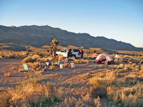 |
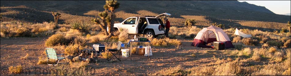
Overview Gass Peak Traditional Campsite 2 is located on the north side of Gass Peak, about 8 miles out the Gass Peak Road. A short spur road leads to the campsite, so it is conveniently off the main road. This is a nice "wilderness" campsite with grand views all around and a big sky for stargazing, but no sights or sounds of civilization. The site is only big enough for one group, and it makes a nice place for a Leave-No-Trace camping experience way out in the desert (but not too far from home). The campsite is near Gass Spring, a small water hole on the northeast flanks of Gass Peak, making this is a good area to find desert birds, bighorn sheep, and even bats as they come to drink. Link to map. |
 |
Watch Out Other than the standard warnings about hiking in the desert, ...this is a fairly safe place to camp. Depending on road conditions, camp might be accessible with a 2WD-HC vehicle, but inquire locally or use a 4WD just to be sure. While camping, please respect the land and the other people out there, and try to Leave No Trace of your passage. Also, be sure to have the 10 Essentials in your vehicle. This is a wildlife refuge, so pay extra attention to respecting the land. For general information on camping, regulations, other issues, and the natural history of the Wildlife Refuge, see the Desert National Wildlife Refuge -- Area Overview page. |
 |
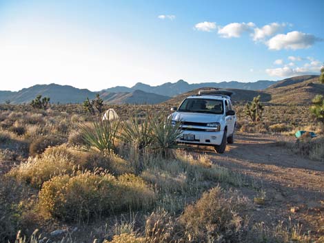
Getting to Camp This campsite is located on the Desert National Wildlife Refuge, about 2.5 hours north of town. From town, drive out to Corn Creek Field Station and continue east 100 yards to a T-intersection with a large directional sign. Turn right onto Mormon Well Road, driving south and then east up the bajada for 4.35 miles to Gass Peak Road. Gass Peak Road branches to the south (right) just before Mormon Well Road gets to the mountains. Turn right onto Gass Peak Road and follow it south and then east for 8.0 miles to a spur road to the right (Table 1, Site 1010). Turn right onto the spur road and drive south about 200 feet to the end of the road (Site 1011). This is it, park on the road and camp here. |
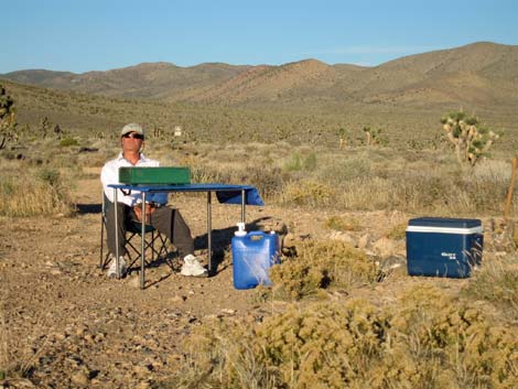 |
Gass Peak Traditional Campsite 2 is a nice "wilderness" campsite with no sights or sounds of civilization. There are no amenities, so bring your water, table, firewood (conditions permitting), and everything. Pitch tents on the edge of the road or in patches of bare dirt so as not to damage the vegetation, and be sure to use the big established fire ring rather than making a new one. There is no shade, so this is a 3-season campsite. While in the area, consider hiking out to Quail Spring or Gass Spring, or even Gass Peak or Quartzite Peak. |
Table 1. Highway Coordinates Based on GPS Data (NAD27; UTM Zone 11S). Download Highway GPS Waypoints (*.gpx) file.
| Site # | Location | Latitude (N) | Longitude (W) | UTM Easting | UTM Northing | Elevation (ft) | Verified |
|---|---|---|---|---|---|---|---|
| 1010 | Gass Peak Rd Camp 2 turnoff | 36.43682 | 115.16024 | 664906 | 4033771 | 4,954 | GPS |
| 1011 | Gass Peak Rd Camp 2 | 36.43646 | 115.16075 | 664862 | 4033731 | 4,943 | GPS |
Happy Hiking! All distances, elevations, and other facts are approximate.
![]() ; Last updated 240324
; Last updated 240324
| Hiking Around DNWR | Birding Around DNWR | Glossary | Copyright, Conditions, Disclaimer | Home |