Southern Nevada Wilderness Areas, Birding Avi Kwa Ame
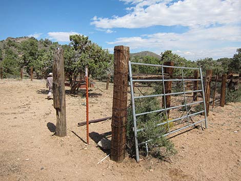
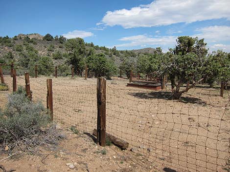 Railroad-tie fence posts and wire fencing (Sep 2012; view NE) |
Overview Pine Spring is a place to bird because it has water, and in this parched desert environment, anywhere with water will have birds. Keep an eye out for Turkey Vulture, Red-tailed Hawk, Northern Flicker, Say's Phoebe, Woodhouse's Scrub-Jay, Juniper Titmouse, Red-breasted Nuthatch, Townsend's Solitaire, Hermit Thrush, Western Bluebird, Cedar Waxwing, Phainopepla, Chipping Sparrow, Black-headed Grosbeak, and even the odd Acorn Woodpecker, and Red Crossbill. Pine Spring is a point of interest just outside the southeast corner of the South McCullough Wilderness Area that demonstrates a bit of the ranching history of this area. While the grazing allotment has been closed down, the site remains an interesting historic site, the troughs still hold water, and feral cows still roam the area. This site is not the best birding destination; it's a long way out, and the drive is a bit rough. Rather, this site complements a day birding Wee Thump and enjoying a bit of wild solitude, grand scenery, and perhaps see a few songbirds. |
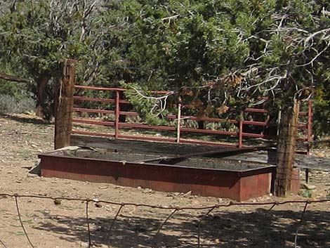
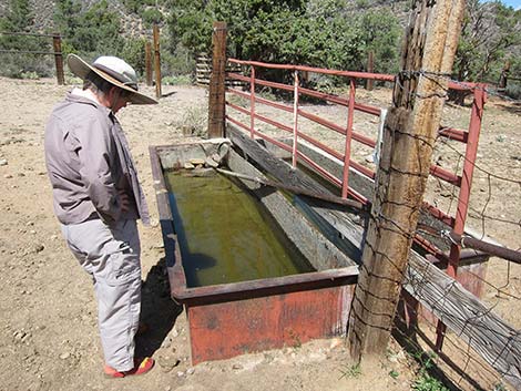 Metal trough with water (Sep 2012; view N) |
Getting to the Site Link to area map. Pine Spring is located up in the McCullough Range, about 1.5 hours southeast of Las Vegas, between Searchlight and Primm. Under the best of conditions, the access road does not require 4WD. I drove the sandy washes in 2WD, but with the comfort of knowing that I could shift into 4WD at any time. From town, drive south on Highway 95 to Searchlight (Table 1, Site 0927). In downtown Searchlight, turn right onto Highway 164 (Joshua Tree Highway) and drive west for 8.2 miles to Wee Thump East Road (Site 1299). |
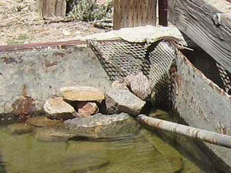 Trough with escape route so small animals don't drown |
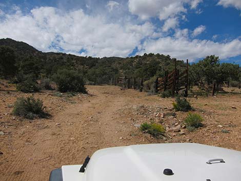
In at least a 2WD-HC vehicle, drive north on Wee Thump East Road for 4.5 miles to Wee Thump North Road (Site 1300). Turn left onto Wee Thump North Road and drive west for 1.1 miles to Wee Thump West Road (Site 1301). Pine Spring Road continues straight across the intersection to the west. Drive west on Pine Spring Road for 1.5 miles to a fork (Site 1302). Stay right on Pine Spring Road and follow it to Pine Spring (Site 1304) at the end of the road. For most people, parking at the corral and walking the last 0.1 miles to the end of the road will be good enough. |
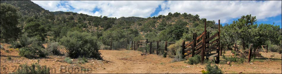
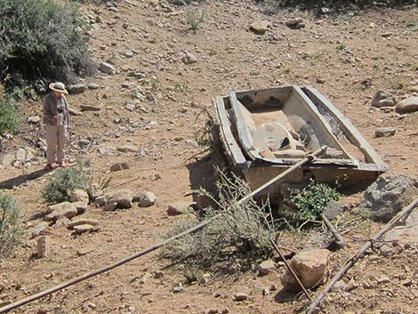
 All that is left of Pine Spring (view W) |
The Site When driving up the road, visitors will pass the historic corral, and then 0.1 miles farther up the road, the spring and associated structures. The corral was built largely using used railroad ties for fence posts. The ties probably were gathered after small railroads that served mining districts in the area went bankrupt or moved on (the railroads would take the metal rails, but leave the wooden cross ties). Old railroad ties are a common construction material used throughout the region, as seen at the Wee Thump Corral, corrals at the Walking Box Ranch, and even a ranch house at Corn Creek. The corrals area includes fencing, gates, a loading chute, water pipes, and a metal watering trough that still holds water. |
 Metal trough with water (Sep 2012; view NE) |
At the end of the road, the spring site includes broken water pipes, an empty water tank, and a metal watering trough that does not hold water. Up the gully above the water tank, a pipe drips a bit of water. Farther up the gully, an adit appears to have been dug, perhaps in an attempt to develop the spring, but it is mostly filled in now. Feral cattle still come to the site, evidenced by the environmental damage caused to the spring site and surrounding vegetation. This area is at the transition between the Mojave Desert Scrub and Pinyon-Juniper Woodland habitat types (Upper Sonoran Life Zones). The area is thick with blackbrush, buckhorn cholla, pricklypear cactus, banana yucca, Joshua trees, singleleaf pinyon pine, and Utah juniper, a mix of lower- and higher-elevation species. |
 Loading chute along Pine Spring Road (Sep 2012; view W) |
 Gate at entrance to the corral (Sep 2012; view NE) |
 Dry watering trough at Pine Spring (view S) |
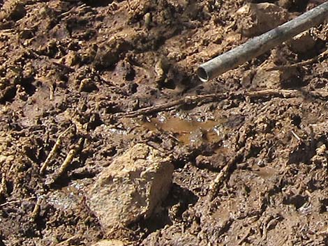
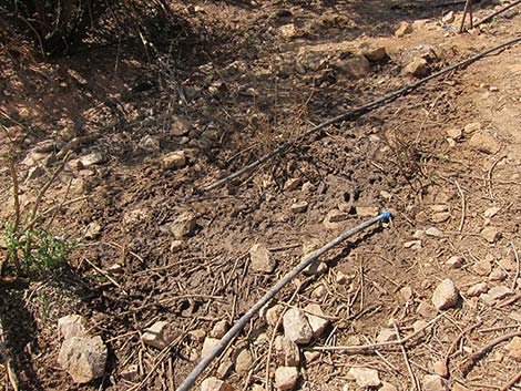 Dripping pipe at Pine Spring (view W) |
Table 1. Highway Coordinates Based on GPS Data (NAD27; UTM Zone 11S). Download Highway GPS Waypoints (*.gpx) file.
| Site | Location | UTM Easting | UTM Northing | Latitude (N) | Longitude (W) | Elevation (ft) | Verified |
|---|---|---|---|---|---|---|---|
| 0927 | Hwy 95 at Hwy 164, Searchlight | 688813 | 3926424 | 35.46519 | 114.91921 | 3,500 | Yes |
| 1299 | Hwy 164 at Wee Thump East Rd | 676340 | 3930808 | 35.50699 | 115.05564 | 3,960 | GPS |
| 1300 | Wee Thump East Rd at Wee Thump North Rd | 674061 | 3937257 | 35.56551 | 115.07937 | 4,375 | GPS |
| 1301 | Wee Thump West Rd at Wee Thump North Rd | 672453 | 3937265 | 35.56586 | 115.09710 | 4,560 | GPS |
| 1302 | Pine Spring Rd at Fork | 670165 | 3937004 | 35.56391 | 115.12239 | 4,913 | GPS |
| 1304 | Pine Spring | 667173 | 3937981 | 35.57322 | 115.15519 | 5,429 | GPS |
Happy Hiking! All distances, elevations, and other facts are approximate.
![]() ; Last updated 240323
; Last updated 240323
| Birding Around Avi Kwa Ame | Southern Nevada Birds | Copyright, Conditions, Disclaimer | Home |