Hiking Southern Nevada Wilderness Areas, Backroads
 March 5, 2020: worst spot on Wee Thump East Road |
Current Conditions March 5, 2020. Sebastian writes: Wee Thump East is in great condition. We got our 37' Class A motorhome to the campsite half a mile north of 164 with careful driving. North from there in our Grand Cherokee, the whole of East looked okay for a passenger car. The washes didn't have deep sand. The worst part of the road requires caution to straddle a bit of washout. |
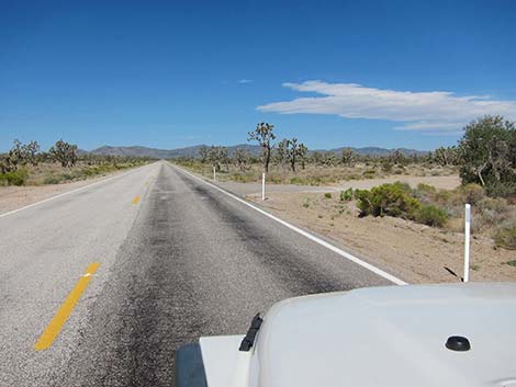 Hwy 164 at Wee Thump East Road (view NW) |
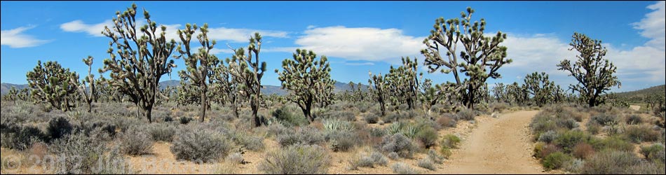
Overview Wee Thump East Road is a dirt road off Highway 164 near Searchlight, Nevada, that runs north from the pavement along the east side of the Wee Thump Joshua Tree Wilderness Area. The road provides sightseeing, camping, and hunting opportunities, plus hiker access to the Heart of the Wee Thump route, the El Dorado Wagon Road route, and several other hiking routes. The road is in fairly good condition overall, but it gets a bit rougher farther out. The road is fine for low-clearance vehicles (e.g., sedans) to a washout about 2.4 miles out, but sedan drivers should stop at an intersection 1.6 miles out. Beyond there, the road is suitable for 2-wheel-drive high-clearance (2WD-HC) vehicles in good weather. Link to map. |
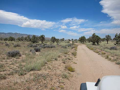
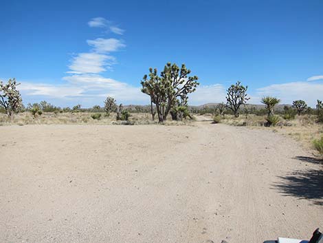 Start of road, just off the pavement (view N) |
Watch Out Other than the standard warnings about the desert ... Wee Thump East Road generally is a good dirt road, but it runs out into wild and remote country. There are no services or developments of any kind. Cell phones might work, but don't count on it. Bring water and food, a good spare tire, a shovel, tools, a tow rope, bailing wire, and anything you might need to survive a night stuck out in the desert. While hiking, please respect the land and the other people out there, and try to Leave No Trace of your passage. This road runs along Wilderness, so pay particular attention to respecting the land. Be sure to bring the 10 Essentials. For ATVs, spark arresters are required on roads in this area. |
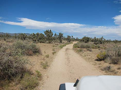
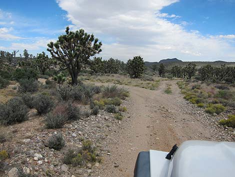
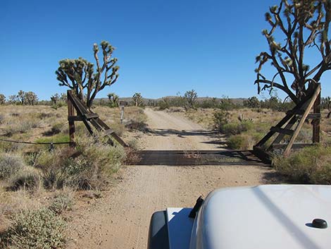 Approaching the cattle guard to start the road |
Getting to the Roadhead This road is located adjacent to the Wee Thump Joshua Tree Wilderness Area, about 1 hour south of Las Vegas, just west of Searchlight. From town, drive south on Highway 95 to Searchlight (Table 1, Site 0927). In downtown Searchlight, turn right onto Highway 164 (Joshua Tree Highway) and drive west for 8.2 miles to a large pullout on the right (north) side of the highway (Site 1007). The road starts in the corner of the pullout. Alternatively, from town, drive south on Interstate-15 for about 53 miles to Nipton Road (Site 1008) in California. Exit the Interstate and drive east, through Nipton, and back into Nevada. From the Nevada state line, continue east another 10.4 miles to a large pullout on the left (north) side of the highway (Site 1007). |
 |
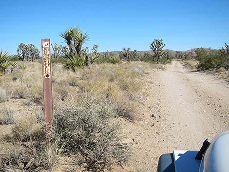
The Road Wee Thump East Road runs north out the northeast corner of the large pullout. The road was marked with a large wilderness area sign, but it has been torn down. Nonetheless, pass the highway fence at a cattle guard and continue north past information and designated route signs. Keep an eye out to the west for carsonite signs about 200-feet out that mark the edge of the actual Wilderness Area. At about 0.2 miles out, the road passes an historic corral with fencing, a windmill, water tank, and watering trough, all of which are aging poorly. Although there is no water here, a few cows still roam this area. |
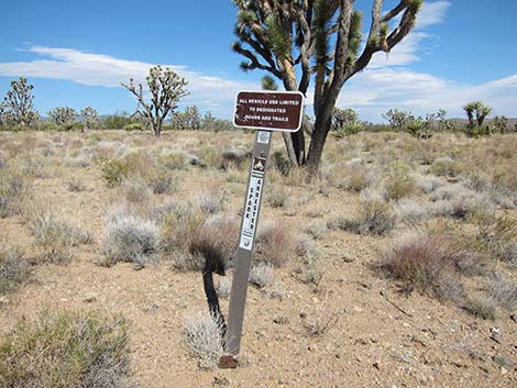
 Designated Road sign |
At about 0.5 miles out, the road passes a large campsite on the left. This is a good campsite for RVs and low-clearance vehicles, and it is also the east trailhead for the El Dorado Wagon Road trail. The road continues north, passing one campsite on the right, to arrive at a T-intersection (Site 0946) 1.6 miles out where the Piute Valley Road runs to the right. There is a small campsite about 0.1 miles down Piute Valley Road, a couple of quail guzzlers farther along, and the pavement at Hwy 164 about 3.0 miles distant. In good weather, Piute Valley Road is a good, 2WD road that probably could be navigated in a carefully driven sedan. The T-intersection (Site 0946) is a convenient trailhead for the Heart of the Wee Thump Loop Route. |
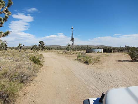 Historic corral with windmill |
Continuing northwest another 0.4 miles, Wee Thump East Road crosses a wash, and in a few yards arrives at another T-intersection (2.0 miles out). The wash is the end of the Heart of the Wee Thump Loop route. The spur road to the right leads about 0.1 miles to a gamebird guzzler, and another 0.1 miles to a turnabout. I found no reason to drive past the guzzler. Continuing yet another 0.4 miles, Wee Thump East Road arrives at a washout that blocks passage for low-clearance vehicles. At this point, a driver would have to back out a long way before turning a sedan around without risking getting stuck on the shoulder of the road. In fall 2012, this was the worst spot on the road. Shortly past the washout, the road passes another campsite, and at 3.0 miles out, arrives at a large campsite on the right. This is the most convenient trailhead parking for the Heart of the Wee Thump Direct Route. |
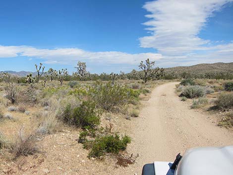
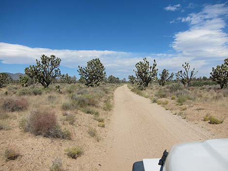
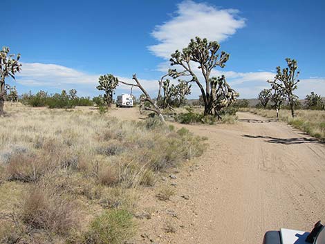 Wee Thump East Road at 0.5-Mile Campsite (left) and road (right) |
Beyond this camp, the road continues to deteriorate, but remains fine for 2WD-HC vehicles. At about 3.6 miles out, the road passes an earthen dam on the right designed to capture rainwater for cattle. During wet years, look for birds and tadpole shrimp in the pond, and the tracks of coyote, bobcat, and other animals in the mud. Just beyond the dam, a road forks right at a T-intersection. The road provides access to the dam pond, a campsite 0.1 miles out, a guzzler 0.9 miles out, and continues about 2 miles total (I did not drive past the campsite). |
 |
Continuing, the road gets into slightly hilly country and becomes more rocky, but still is a fine 2WD-HC road. On a low rise about 4.4 miles out, Wee Thump North Road can be seen ahead to the left, and shortly thereafter (4.5 miles out) it arrives at a T-intersection with that road (Site 1300). I've not driven farther, but maps and aerial photos show the road continuing north then curving left to connect with a powerline road some 2.6 miles distant. To continue the loop around Wee Thump Joshua Tree Wilderness Area, turn left onto Wee Thump North Road and drive east. For details of the rest of the loop, see the Wee Thump North Road and Wee Thump West Road webpages. |
 |
 |
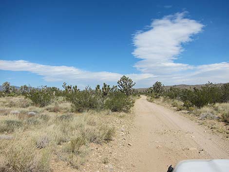
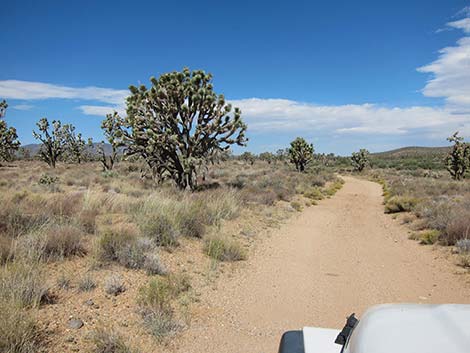
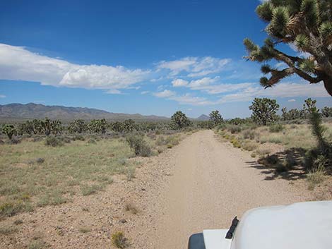
 Smooth road and easy driving |
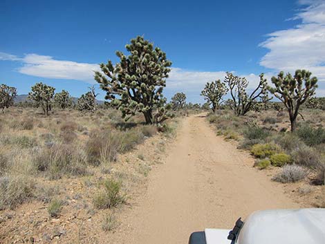
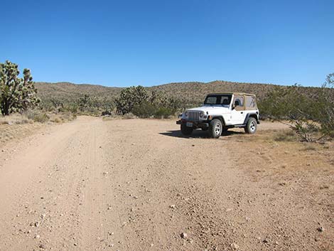 T-intersection 1.6 miles out; trailhead parking |
 |
 |
 |
 |
 |
 |
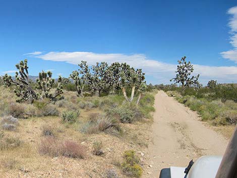
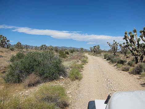
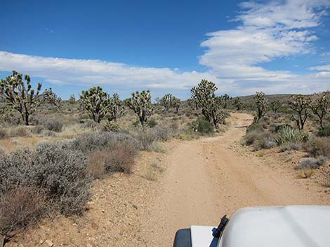
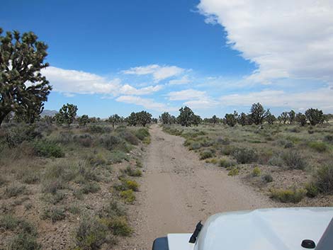
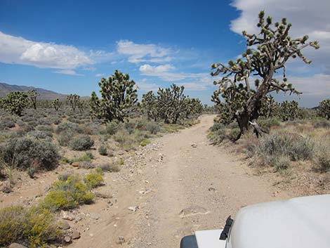
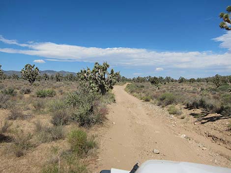 Road is getting rougher |
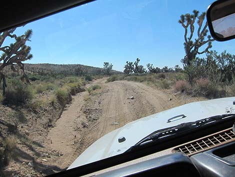 Driving through the washout (view coming back out; south) |
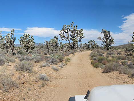
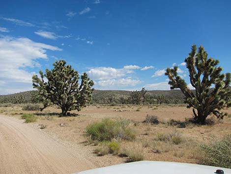 Large campsite 3.0 miles out; trailhead parking |
 Large campsite 3.0 miles out; trailhead parking |
 |
 |
 |
 |
 |
 |
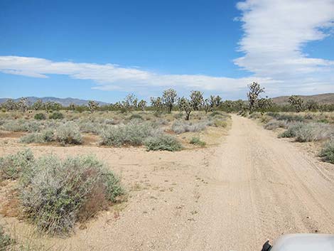
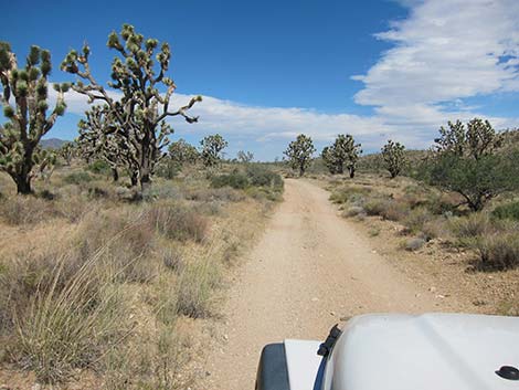
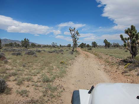
 Somewhat hilly, more rocky road |
 Wee Thump North Road; ahead to the left (view NW) |
 Wee Thump North Road on the left |
 More to come ... |
Table 1. Highway Coordinates Based on GPS Data (NAD27; UTM Zone 11S). Download Highway GPS Waypoints (*.gpx) file.
| Site | Location | UTM Easting | UTM Northing | Latitude (N) | Longitude (W) | Elevation (ft) | Verified |
|---|---|---|---|---|---|---|---|
| 0946 | WT East Rd at Piute Valley Rd | 675896 | 3933190 | 35.52853 | 115.06002 | 4,242 | Yes |
| 1299 | Hwy 164 at Wee Thump East Rd | 676352 | 3930785 | 35.50678 | 115.05551 | 3,960 | GPS |
| 1300 | Wee Thump East Rd at Wee Thump North Rd | 674061 | 3937257 | 35.56551 | 115.07937 | 4,375 | GPS |
| 1301 | Wee Thump West Rd at Wee Thump North Rd | 672453 | 3937265 | 35.56586 | 115.09710 | 4,560 | GPS |
| 1305 | Hwy 164 at Wee Thump West Rd | 668839 | 3930740 | 35.50768 | 115.13832 | 4,795 | GPS |
| 1306 | Wee Thump West Rd at Powerline Rd | 668681 | 3932106 | 35.52002 | 115.13978 | 5,013 | GPS |
| 1342 | Wee Thump W Rd at Cattle Guard | 668844 | 3931418 | 35.51379 | 115.13812 | 4,880 | GPS |
| 1349 | Wee Thump W Rd at Campsite | 674901 | 3935063 | 35.54559 | 115.07058 | 4,327 | GPS |
Happy Hiking! All distances, elevations, and other facts are approximate.
![]() ; Last updated 240330
; Last updated 240330
| Hiking Around Wilderness Areas | Hiking Around Las Vegas | Glossary | Copyright, Conditions, Disclaimer | Home |