Hiking Southern Nevada Wilderness Areas, Backroads

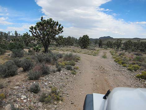 |
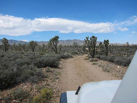
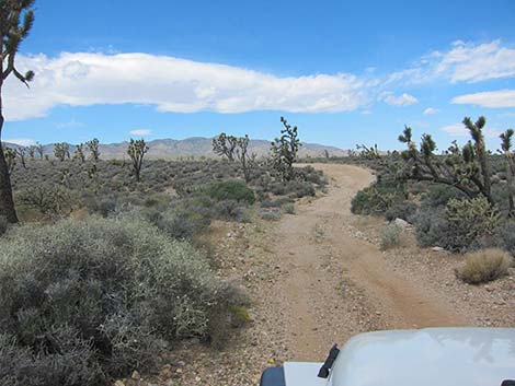
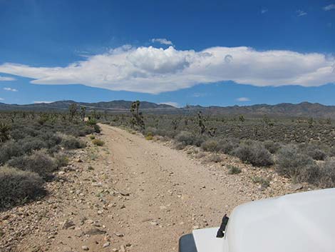
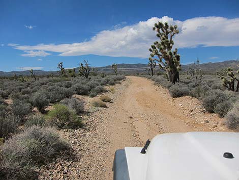
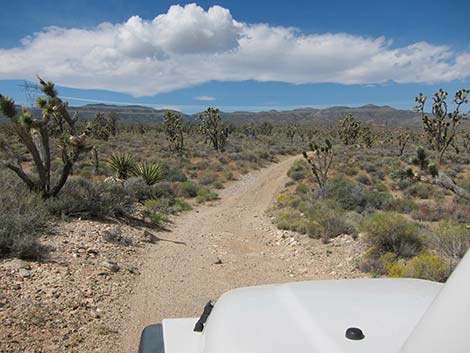
Current Conditions: March 5, 2020. Sebastian writes: Wee Thump North Road is slightly rougher than Wee Thump East, but it seemed okay for a passenger car. Overview Wee Thump North Road is a 1.1-mile dirt road that runs along the north side of the Wee Thump Joshua Tree Wilderness Area and connects Wee Thump East Road with Wee Thump West Road. Wee Thump North Road provides sightseeing and hunting opportunities, and the opportunity to circumnavigate the wilderness area. Some of the best examples in southern Nevada of the Joshua tree - blackbrush vegetation association can be seen along this road. The road is in fairly good condition overall, but it can be a bit rough in several places where it crosses gullies. Assuming good weather, the road is fine for 2-wheel-drive high-clearance (2WD-HC) vehicles. Link to map. |
 |
Watch Out Other than the standard warnings about the desert ... Wee Thump North Road generally is a good dirt road, but it runs out into wild and remote country. There are no services or developments of any kind. Cell phones might work, but don't count on it. Bring water and food, a good spare tire, a shovel, tools, a tow rope, bailing wire, and anything you might need to survive a night stuck out in the desert. While hiking, please respect the land and the other people out there, and try to Leave No Trace of your passage. This road runs along Wilderness, so pay particular attention to respecting the land. Be sure to bring the 10 Essentials. For ATVs, spark arresters are required on roads in this area. |
 |
Getting to the Roadhead This road is located adjacent to the Wee Thump Joshua Tree Wilderness Area, about 1-1/2 hours south of Las Vegas, just west of Searchlight. From town, drive south on Highway 95 to Searchlight (Table 1, Site 0927). In downtown Searchlight, turn right onto Highway 164 (Joshua Tree Highway) and drive west for 8.2 miles to Wee Thump East Road (Site 1007). In a 2WD-HC vehicle, drive north on Wee Thump East Road for 4.5 miles to Wee Thump North Road (Site 1300). Alternatively, from town, drive south on Interstate-15 for about 53 miles to Nipton Road (Site 1008) in California. Exit the Interstate and drive east, through Nipton, and back into Nevada. From the Nevada state line, continue east another 5.4 miles to Wee Thump West Road (Site 1305). In a 2WD-HC vehicle, drive north on Wee Thump West Road for 5 miles to Wee Thump North Road (Site 1301). |
 |
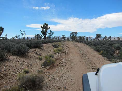
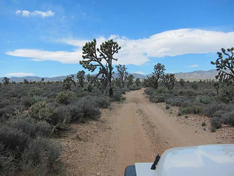
The Road Wee Thump North Road runs west from Wee Thump East Road (Site 1300) across low hills and gullies. The road drops into and climbs out of several washes, but it always is passable in a 2WD-HC vehicle. There are no side roads or campsites. Running west across the hills, the road parallels the north edge of the Wee Thump Joshua Tree Wilderness Area: watch for carsonite signs some 200 feet from the road that mark the actual wilderness boundary. |
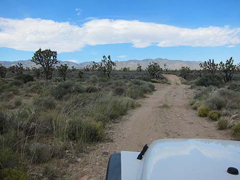 |
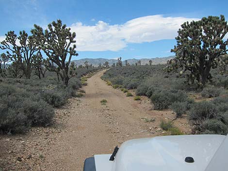
Along the east end of this road, the vegetation is a diverse mix of Mojave Desert Scrub Species, including Joshua trees, creosote bush, Mojave yucca, banana yucca, bunchgrasses, globemallow, matchweed, desert almond, and many other species. Farther out, the vegetation becomes less diverse, and the landscape is dominated by Joshua trees and blackbrush, with a scattering of buckhorn cholla. Eventually, after about 1.1 miles, Wee Thump North Road reaches a 4-way intersection. To the left is the Wee Thump West Road and the pavement, to the right is a powerline road, and straight ahead is Pine Spring Road, which provides access to the South McCullough Wilderness Area. |
 |
 |
 |
 |
 |
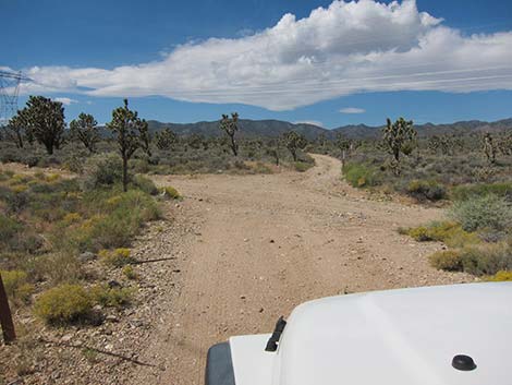 |
Table 1. Highway Coordinates Based on GPS Data (NAD27; UTM Zone 11S). Download Highway GPS Waypoints (*.gpx) file.
| Site | Location | UTM Easting | UTM Northing | Latitude (N) | Longitude (W) | Elevation (ft) | Verified |
|---|---|---|---|---|---|---|---|
| 0946 | WT East Rd at Paiute Valley Rd | 675896 | 3933190 | 35.52853 | 115.06002 | 4,242 | Yes |
| 1299 | Hwy 164 at Wee Thump East Rd | 676352 | 3930785 | 35.50678 | 115.05551 | 3,960 | GPS |
| 1300 | Wee Thump East Rd at Wee Thump North Rd | 674061 | 3937257 | 35.56551 | 115.07937 | 4,375 | GPS |
| 1301 | Wee Thump West Rd at Wee Thump North Rd | 672453 | 3937265 | 35.56586 | 115.09710 | 4,560 | GPS |
| 1305 | Hwy 164 at Wee Thump West Rd | 668839 | 3930740 | 35.50768 | 115.13832 | 4,795 | GPS |
| 1306 | Wee Thump West Rd at Powerline Rd | 668681 | 3932106 | 35.52002 | 115.13978 | 5,013 | GPS |
| 1342 | Wee Thump W Rd at Cattle Guard | 668844 | 3931418 | 35.51379 | 115.13812 | 4,880 | GPS |
| 1349 | Wee Thump W Rd at Campsite | 674901 | 3935063 | 35.54559 | 115.07058 | 4,327 | GPS |
Happy Hiking! All distances, elevations, and other facts are approximate.
![]() ; Last updated 240330
; Last updated 240330
| Hiking Around Wilderness Areas | Hiking Around Las Vegas | Glossary | Copyright, Conditions, Disclaimer | Home |