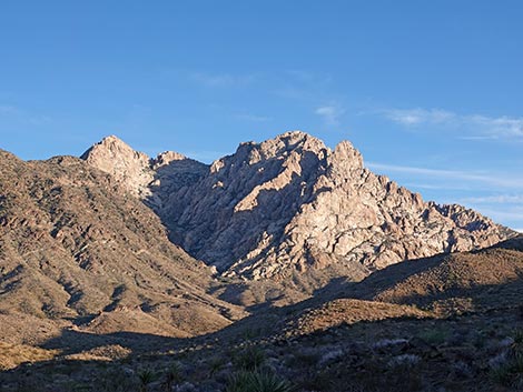
 Northwest face of Spirit Mountain in late-afternoon light (view SE) |
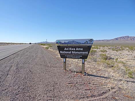
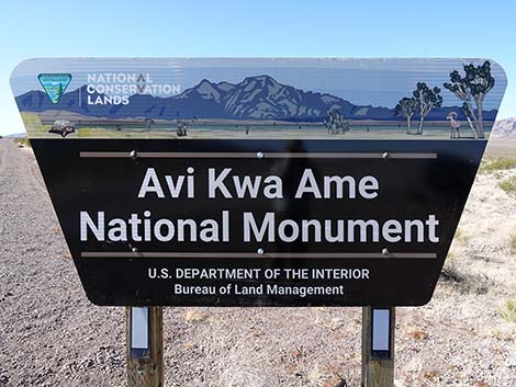
OVERVIEW Avi Kwa Ame (Ah-VEEK-waa-meh), which translates to “Spirit Mountain” in English, includes some 506,814 acres of land at the southern tip of Nevada that was designated as a national monument by President Biden in March 2023. The designation was a win for tribes and other advocates who for years sought protections to the area because it is the sacred center of creation for several tribes living along the lower Colorado River. These tribes, plus other Yuman-speaking peoples (totaling 10 tribes), as well as the Hopi, Southern Paiute, and Chemehuevi Paiute people, consider the area important in maintaining their cultural identity, as, for example, it features in Salt Song Trail songs and end of life rituals. In 1999, Spirit Mountain and 48,000 acres surrounding the peak were listed on the National Register of Historic Places as a Traditional Cultural Property (or PDF here) in recognition of the religious and cultural importance of the area. The national monument includes the western flanks of Spirit Mountain and almost everything that can be seen to the west from the mountain. Now, national monument status expands the area of protection from the Traditional Cultural Property (i.e., the ground of Spirit Mountain, proper) to the views from the mountain. Views to the east already are mostly protected. |
 West face of Spirit Mountain (view E from Wee Thump Wilderness) |
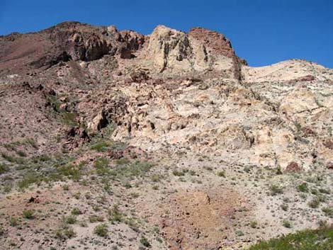
Important cultural resources exist throughout Avi Kwa Ame, including prehistoric lithic scatters, pot shards, rock shelters, petroglyphs, and quarry sites. Archeological evidence suggests that humans have used the area for some 10 to 12,000 years, although most of the activity has been in the last few thousand years. The area also is important in recent history. The Rock Springs Land and Cattle Company began grazing the Paiute Valley in the early 1900s, using the Walking Box Ranch as their base of operations. After changing hands several times, including ownership by Rex Bell and Clara Bow, the Bureau of Land Management acquired the ranch in 2004. The property is listed on the National Register of Historic Places and is open for guided tours. |
 Northwest face of Spirit Mountain (view SE) |
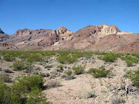
In the southern part of Avi Kwa Ame, a section of the historic Mojave Trail runs from the Colorado River to the California state line. This trail was originally used by Mojave and other Native Americans to transport trade goods between the desert southwest and coastal areas, trading with, for example, the Chumash people. The trail became the Mojave Road, which served civilian and military transport and mail carriers between the Arizona Territory and California. The ruins of Fort Paiute, just outside the monument in California, stand in silent testament to conflicts between Native people trying to protect their land and European immigrants trying to move in. While the creation of Avi Kwa Ame National Monument safeguards the cultural interests of Tribal nations, it also protects an area rich in plants, wildlife, and natural beauty. The region is designated as an Important Birding Area due to a unique and diverse assemblage of birds, including Gilded Flickers, Harris’ Hawks, Curved-billed Thrashers, and the highest densities of Golden Eagles in Nevada. The area is also home to Desert Tortoise, Gila Monsters, and the only Diamondback Rattlesnakes in Nevada. |
 West edge of Spirit Mountain (view S) |
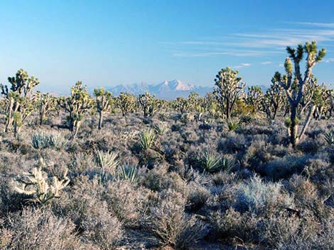
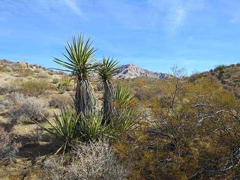
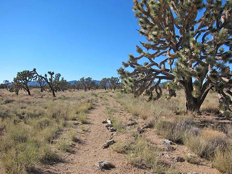
Avi Kwa Ame harbors great botanical diversity, including a dense forest of Eastern Joshua Trees with some of the oldest and largest Joshua trees in existence — some nearly 1,000 years old. Upland areas in the western portion contain a unique arid grassland community that includes 28 species of native grasses, about half of which are rare. In the eastern portion of Avi Kwa Ame, granitic mountains provide habitat for the only California Juniper and Bigelow's Nolina in Nevada. Importantly, the area fills a wide gap in conservation lands that can now provide a migration corridor extending from the deserts of southern California to the Rocky Mountains. This migration corridor forms a contiguous block of habitat of sufficient size and quality to promote the survival, growth, reproduction, and maintenance of viable populations of Mojave Desert flora and fauna. As climate conditions change, species like Joshua Trees, which are dying out in the southern portions of their range, will more easily expand northward over time. Similarly, populations of Desert Bighorn Sheep will be able to more easily migrate back and forth across the desert, facilitating overall population health. |
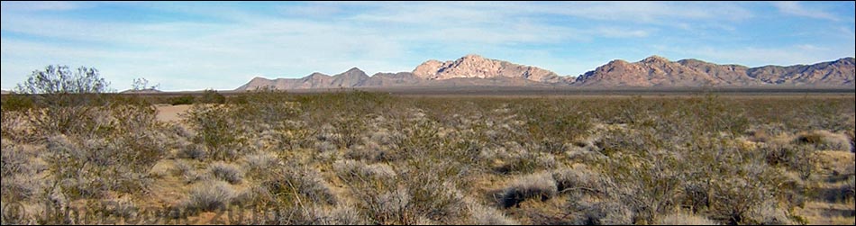
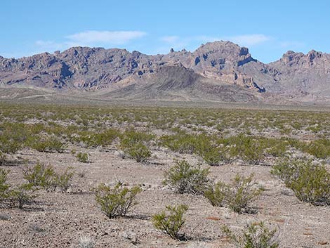
 Highland Range (view N) |
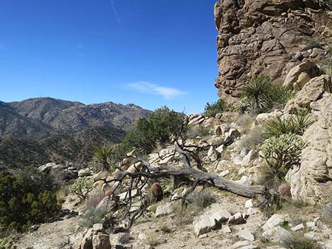
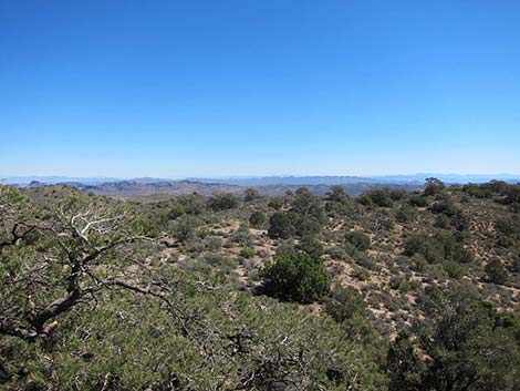
Avi Kwa Ame also protects a variety of recreational experiences and opportunities for the public to explore and enjoy, including sightseeing, hiking, backpacking, wildlife viewing, nature photography, scenic driving on designated roads, hunting, and horseback riding, as well as opportunities for solitude, dark night sky viewing, painting, and personal discovery. The remote nature of the area protects our ability to enjoy the increasingly rare natural quiet, starry nights, and solitude. Historical reenactments are sometimes done by volunteers at Walking Box Ranch. Stretching from the Eldorado, Newberry, and Dead mountains in the east to the New York, South McCullough, Lucy Gray, Castle, and Paiute mountains in the west, the Dead Mountains in the south, and including the more centrally located Highland Range and lowlands of Paiute and Eldorado valleys in the middle, these lands feature dramatic peaks, scenic canyons, natural springs, sloping bajadas covered with ancient Joshua tree forests, unique grasslands, and a rich history of rock art and other cultural sites. Two entire wilderness areas (South McCullough and Wee Thump Joshua Tree) and parts of others (Ireteba Peaks and Spirit Mountain) are included inside Avi Kwa Ame National Monument. |
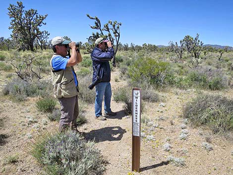 Birdwatching in Wee Thump Wilderness |
Getting To Avi Kwa Ame Avi Kwa Ame is located south of Las Vegas, but it stretches some 45 air-miles from north to south. As such, from Las Vegas, drivers head south on Highway 93/95/515/Interstate 11. After leaving the Las Vegas Valley south of Henderson, drivers take Highway 95 south towards Searchlight. At about 19.3 miles south of Interstate 11, drivers enter Avi Kwa Ame. Continuing south, drivers stay inside Avi Kwa Ame for about 13 miles, then exit Avi Kwa Ame into the Searchlight area, an area of 28,000 acres excluded from the national monument. In 2.6 miles, drivers arrive in downtown Searchlight. In Searchlight, turning west onto Highway 164, drivers exit the Searchlight zone in 2 miles and continue another 17 miles inside Avi Kwa Ame to the California state line. Turning east in Searchlight, drivers exit the Searchlight zone after 6 miles and continue another 2 miles inside Avi Kwa Ame to the boundary of Lake Mead National Recreation Area. |
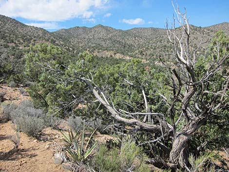 Junipers in the South McCullough Mountains (view NW) |
Continuing south from downtown Searchlight on Highway 95, drivers exit the Searchlight zone in another 3.6 miles and reenter Avi Kwa Ame. Farther south, there are small exclusion zones for Cal-Nev-Ari (1.5 miles long) and the intersection with Highway 163 (1.0 miles long). Continuing south on Highway 95, Avi Kwa Ame extends to the state line. Turning east on Highway 164 towards Laughlin, Avi Kwa Ame continues for another 11 highway miles. |
 Pinyon and junipers in the South McCullough Mountains (view E) |
HOURS Avi Kwa Ame is always open for visitors and dispersed camping, although Walking Box Ranch is only open for tours. There are a variety of businesses (e.g., gas, grocery stores, restaurants, hotels) in Searchlight. Most are open during regular business hours or longer. Gas and snacks are available at the intersection of Highway 95 and Highway 163. ENTRANCE FEES None. CAMPING Camping in Avi Kwa Ame is wide open and free. You should, however, choose an existing site and practice Leave-No-Trace skills. |
 Foot trail in Wee Thump Wilderness (view W) |
WATCH OUT Other than the standard cautions about hiking in the desert, ...this is a pretty safe place, but there are a few hazardous mine sites. People hunt and target shoot in the area, so always use caution when gunfire is heard. Much of this land is wild and remote, and even under the best of circumstances, help would be long in coming. Given that, exercise extra caution when hiking and give yourself a little wider margin of safety. Don't push it. In case of emergency, call the sheriff at 911, or call the federal inter-agency 24-hour emergency number at (702) 293-8932. Cell phones work in most parts of Avi Kwa Ame. |
 Highland Range (view N) |
SOME RULES AND REGULATIONS This is a National Monument, which is almost like a National Park. One obvious difference is that hunting is allowed here. Other than that, act as if you were in a National Park. Don't collect or otherwise disturb plants, rocks, fossils, or artifacts, and do not disturb the wildlife (except during hunting season with the proper license). Pack it in, pack it out. Drive only on designated roads. Driving in washes is illegal in all of Clark County. Pets are allowed virtually everywhere, but with coyotes becoming so aggressive these days, it is best to keep them on a leash. This prevents a lone coyote from tricking your dog into a chase where the rest of the pack can suddenly appear and attack. Never leave pets or kids in a closed vehicle because temperatures inside a car parked in the sun can exceed 120 degrees in just a few minutes, quickly cooking them, even during winter. For more information, see the Honor Avi Kwa Ame webpage. |
 Highway 95 at northern boundary of Avi Kwa Ame (view S) |
 Highway 95 at northern boundary of Avi Kwa Ame (view S) |
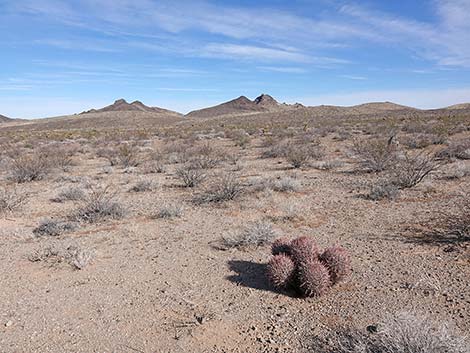 Cottontop Cactus on desert flats in Paiute Vally (view NE) |
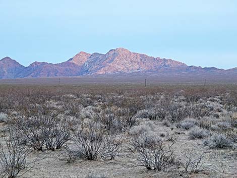
 Eldorado Valley and the Highland Range in northern Avi Kwa Ame |
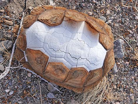 Lots of Desert Tortoise in the area, but the cycle of life continues |
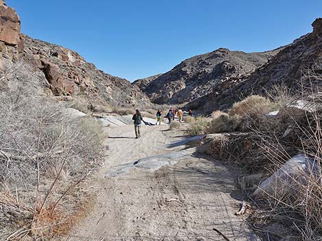 Hikers in Hiko Canyon, southern-most Avi Kwa Ame |
 Spirit Mountain in late evening light |
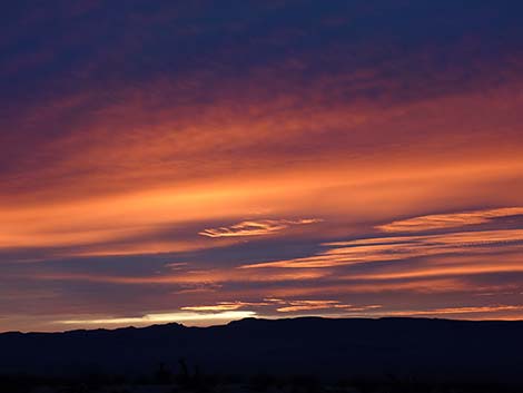 Winter sunset over Paiute Valley |
Happy hiking! All distances, elevations, and other facts are approximate.
![]() ; Last updated 240322
; Last updated 240322
| Birding Around Las Vegas | Hiking Around Las Vegas | Glossary | Copyright, Conditions, Disclaimer | Home |