Backroads Around Las Vegas
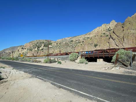
 Highway 93 approaching Highway 317 (view E) |
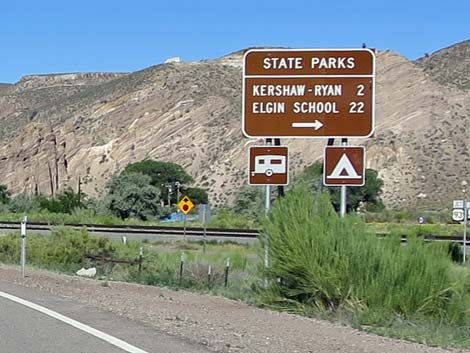
Overview Nevada Highway 317 isn't a "backroad," but it isn't a main road either, and it provides access to places and backroads we love. Running 22 miles through Rainbow Canyon along the mostly dry Meadow Valley Wash, the highway passes through a beautiful middle-elevation canyon with twisting narrows lined with tall cottonwood trees and towering mountains along both sides. Highway 317 connects U.S. Highway 93 to the north with Kane Springs Road to the south. Highway 317 winds down the canyon with limited speeds in most places (signed 35 mph). Gas, food, and supplies are available only in Caliente. Highway 317 provides access to the Rainbow Canyon Archeological sites, Kershaw-Ryan State Park, OHV trails, campsites, and backroad adventures. Excellent birding opportunities can be found along the wash where beaver create cattail ponds. Near the south end of the road, the historic Elgin Schoolhouse sits silently across the wash. Link to map. |
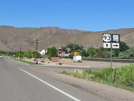 Highway 93 at Highway 317 (view E) |
Watch Out Other than the standard warnings about being in the desert, ...this road is pretty safe, but it winds about and parts of the pavement are missing. The road is subject to washout and may have mud on the road. I wasn't in a hurry and drove the road at 25-35 mph. Be sure that your vehicle is in good working condition, carry plenty of water, and pack a few snacks. Always drive carefully. If continuing south on Kane Springs Road, be prepared for 37 miles of gravel road with no services and very little traffic. While out, please respect the land and the other people out there, and try to Leave No Trace of your passage. This road goes into remote areas, so be sure to bring the 10 Essentials. Cell phones don't work. |
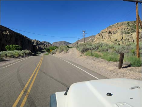
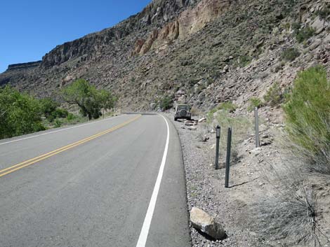
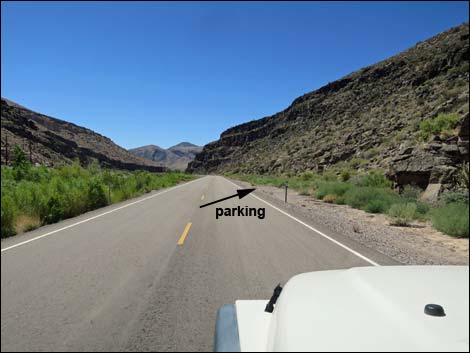
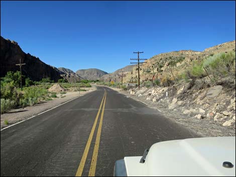 Highway 317 approaching Rock Art Site #1 parking (view S) |
Getting to the Road Highway 317 southbound begins in Caliente where it turns south from Highway 93 on the west end of town. From Las Vegas, drive north on Interstate-15 to Highway 93. Drive north 128 miles, passing Alamo (last full-service town) and Ash Springs (last gas). Consider picking up some Alien Jerky at the intersection of Highway 93 and Highway 318 for snacks during the drive north. When descending the scenic Newman Canyon into Caliente, watch for highway signs indicating state parks to the right and Highway 317 signs. |
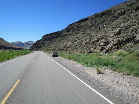
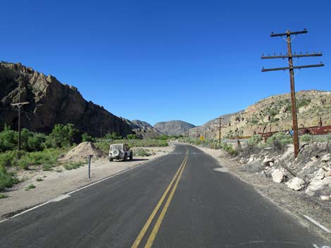 Highway 317 at Rock Art Site #1 parking (view S) |
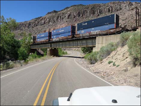
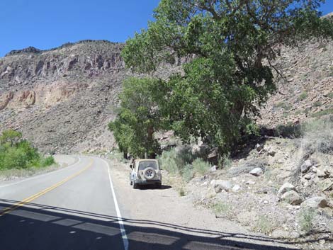
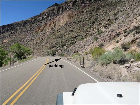
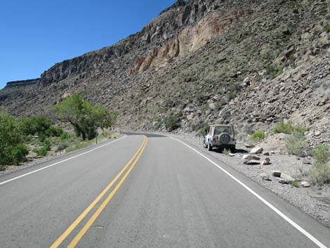
The Road Beginning from Highway 93 (Table 1, Site 1098), Highway 317 bends back to the right and for a short distance runs pinched between Highway 93 and railroad tracks. Soon, Highway 93 bends away to go back up Newman Canyon and Highway 317 bends left to pass under the first of four railroad bridges. The road bends around a big farm field, passes the sewage treatment plant across the wash to the west, and at about 2 miles out reaches the turnoff to Kershaw-Ryan State Park (Site 1830) where camping is available. Continuing south, the road winds down the canyon between the wash and the railway. At 5.0 miles out, the road passes a wide spot on the left and a low railroad bridge on the right. This is the trailhead parking for Rainbow Canyon Rock Art Site #1 (Tan Cliff Site and Etna Cave Site). The route starts by going under the low railroad bridge and following the wash on the other side of the tracks. Visitors can park closer, but it is considered trespassing to walk across the railroad tracks. |
 Rock Art Site #1 parking (view SW) |
Continuing down the winding canyon, the road passes under a second railroad bridge (11.4 miles out) and then the third railroad bridge (14.7 miles out). Just past the third bridge, there is a wide spot on the left side of the road (Site 1832; 14.8 miles out) with two roads leading out. The left road goes a short distance into a gravel pit (campsite) and the right goes about 0.6 miles to Rainbow Canyon Rock Art Site #2 (Grapevine Canyon Site) and a nice campsite (Site 1833) at the trailhead for the short Hummingbird Spring Trail. Continuing south, Highway 317 winds down the narrow canyon. At 17.5 miles out, the highway runs under the fourth (last) railroad bridge. A wide spot on the right (Site 1834), almost still in the shade of the railroad bridge, provides parking for Rainbow Canyon Rock Art Site #3 (Tunnel No. 5 Site). The official parking spot is 150 yards farther down the highway, but that pullout is narrower, and visitors have to walk back the 150 yards, but then it is on an old dirt road rather than clambering up the hillside and through the bushes. |
 Spur road to Etna Siding (view SW) |
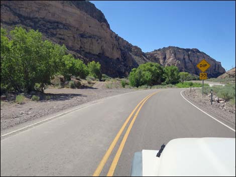
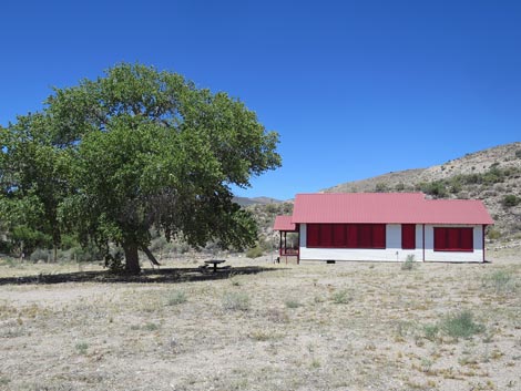
Continuing south, the canyon walls remain, but begin to lay back, opening the views up and down the canyon. On a nondescript straight section of roadway, a wide spot on the right (Site 1835; 19.6 miles out) serves as parking for Rainbow Canyon Rock Art Site #4 (Petroglyph Boulder Site). The boulder is visible from the roadway. Beyond the Petroglyph Boulder Site, the last of the rock art sites, the canyon continues to widen, and at about 20 miles out, the road effectively exits the canyon. The highway passes an old orchard on the right, then at 21.0 miles out arrives at a well-used graded road to the left (Site 1836). This road crosses the canyon, including crossing the wash on a concrete slab, to Elgin Schoolhouse State Historic Site (Site 1867), which is open by appointment only. Visitors can stay outside the fence and photograph the schoolhouse. Highway 317 continues south for another 0.5 miles (21.5 miles total) to the end of the pavement (Site 1868), a point that is convenient to consider the end of Highway 317 and the start of Kane Spring Road. |
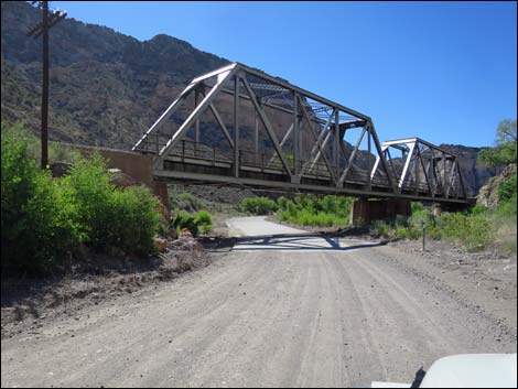 Washed out pavement and third railroad bridge (view S) |
 Highway 318 at side road to Rock Art Site #2 (view S) |
 Fourth railroad bridge (view S) |
 In shadow of fourth railroad bridge Rock Art Site #3 parking (view S) |
 Proper Rock Art Site #3 parking (view S) |
 Proper Rock Art Site #3 parking (view S) |
 Use-trail to Rock Art Site #3 (view S) |
 Rock Art Site #4 parking (view S) |
 Rock Art Site #4 parking (view S) |
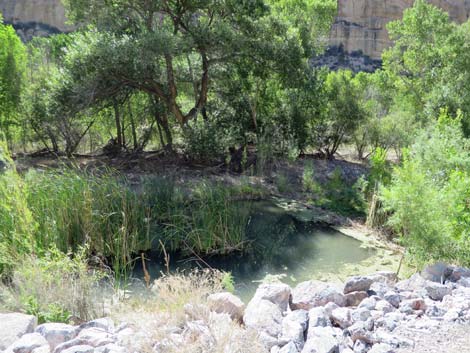 Beaver pond (view SE) |
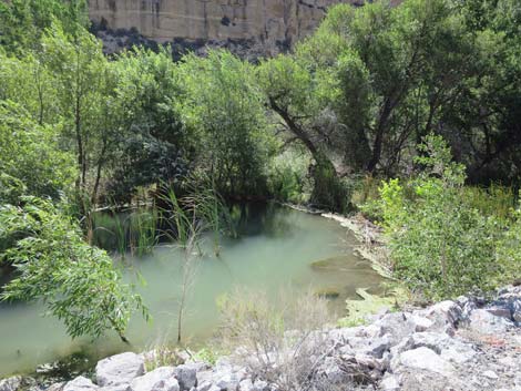 Beaver pond (view SE) |
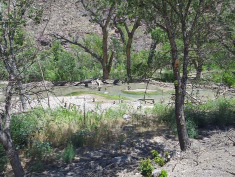 Beaver pond (view SE) |
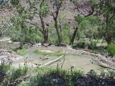 Beaver pond (view E) |
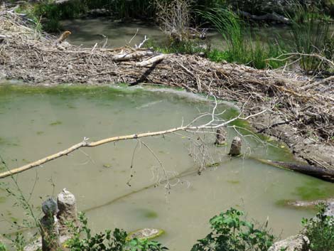 Beaver pond (view E) |
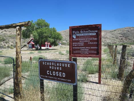 Elgin Schoolhouse signs (view NE) |
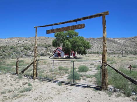 Elgin Schoolhouse ranch gate (view NE) |
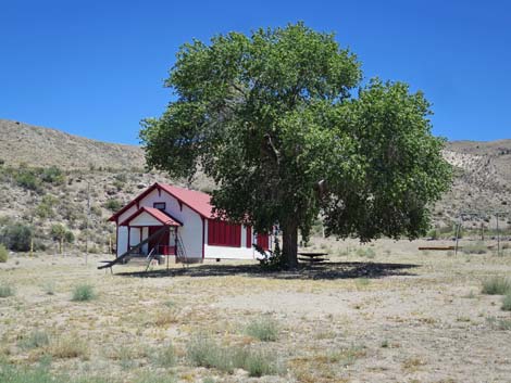 Elgin Schoolhouse (view E) |
 Elgin Schoolhouse (view E) |
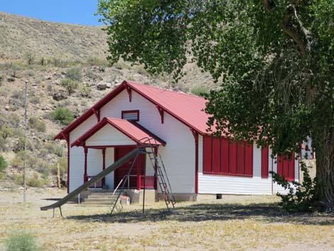
 Elgin Schoolhouse (view N) |
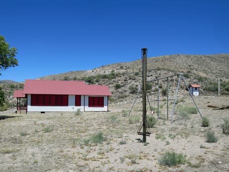 Elgin Schoolhouse (view N) |
Table 1. Highway Coordinates based on GPS Data (NAD27; UTM Zone 11S). Download Highway GPS waypoints (gpx) file.
| Site | Location | UTM Easting | UTM Northing | Latitude (N) | Longitude (W) | Elevation (ft) |
|---|---|---|---|---|---|---|
| 1098 | Highway 93 at Highway 317 | 718813 | 4165237 | 37.61006 | 114.52108 | 4,359 |
| 1830 | Highway 317 at Kershaw-Ryan State Park Road | 717711 | 4162676 | 37.58726 | 114.53432 | 4,339 |
| 1831 | Highway 317 at Rainbow Rock Art Site 1 Parking | 714736 | 4159207 | 37.55672 | 114.56899 | 4,206 |
| 1832 | Highway 317 at Road to Rainbow Rock Art Site 2 | 715758 | 4145050 | 37.42899 | 114.56159 | 3,763 |
| 1833 | Spur Road at Rainbow Rock Art Site 2 Parking | 716264 | 4144263 | 37.42178 | 114.55610 | 3,816 |
| 1834 | Highway 317 at Rainbow Rock Art Site 3 Parking | 716237 | 4141106 | 37.39336 | 114.55733 | 3,555 |
| 1835 | Highway 317 at Rainbow Rock Art Site 4 Parking | 717243 | 4138186 | 37.36682 | 114.54683 | 3,439 |
| 1836 | Highway 317 at Carp-Elgin Road | 718223 | 4136250 | 37.34916 | 114.53635 | 3,404 |
| 1837 | Elgin Schoolhouse Parking | 718434 | 4136556 | 37.35187 | 114.53387 | 3,413 |
| 1838 | Highway 317 at Kane Springs Road | 718853 | 4135692 | 37.34398 | 114.52941 | 3,403 |
Happy Hiking! All distances, elevations, and other facts are approximate.
![]() ; Last updated 240331
; Last updated 240331
| Backroads | Hiking Around Las Vegas | Glossary | Copyright, Conditions, Disclaimer | Home |