Tunnel No. 5 Site
Rock art is a precious resource. Please help protect and preserve these sites.
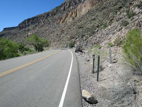
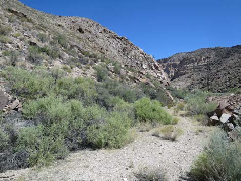
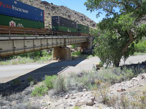
 Trailhead parking (view S) |
Overview Rainbow Canyon Archeological Site #3, the Tunnel No. 5 Site, is a volcanic area of desert canyons and cliffs along Meadow Valley Wash where water flows all year in places. Water and habitation sites brought ancient peoples to this area starting about 10,000 years ago. Several cultures have come and gone, including nomadic hunter-gathers, ancient farmers, and railroad men. Visiting this site is a 0.6-mile round-trip hike with a bit of a rocky scramble up the hillside at the end. The BLM and Lincoln County opened this area to the public, and Lincoln County printed a brochure with information about the site (including GPS coordinates) as part of their Get Primitive tourism campaign. Download the brochure from Lincoln County or snatch a copy here. |
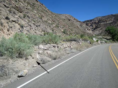
 Walk in the roadway to here ... (view S) |
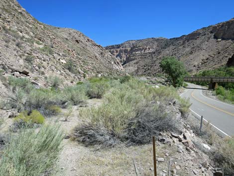
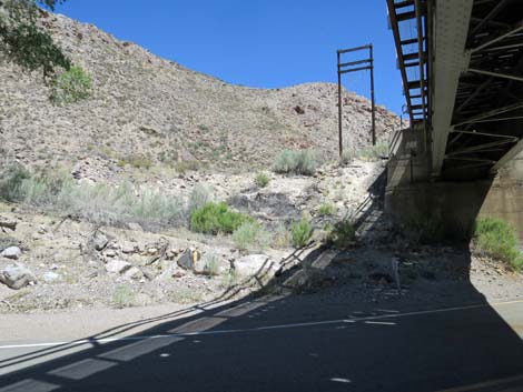
Getting to the Trailhead The Rainbow Canyon Archeological Sites are located just south of Caliente (Lincoln County) about 150 miles (2-1/2 hours) north of Las Vegas on Highway 93. From town, drive north on Interstate 15 to US Highway 93. Exit onto Highway 93 and drive north past Alamo and Ash Springs to the intersection of Highway 93 and Highway 318. Continue on Highway 93 for about 128 miles to Caliente. On the west edge of Caliente, turn right onto Highway 317 and drive south for 17.6 miles to Rainbow Canyon Archeological Site #3. Park in a wide spot on the right (west) side of the road. Alternative parking is about 150 yards back up the road almost in the shadow of the railroad bridge, but while this is closer, it requires a steep scramble up the hillside through bushes (watch for snakes!). |
 ... then cut up to the old road (view N) |
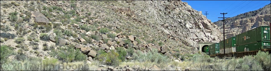
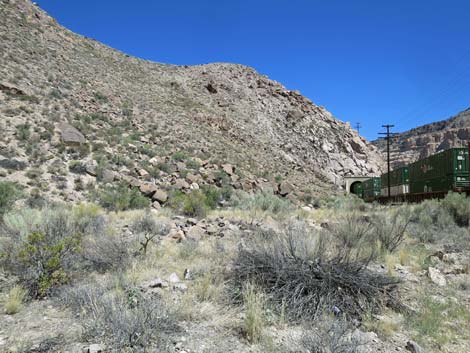
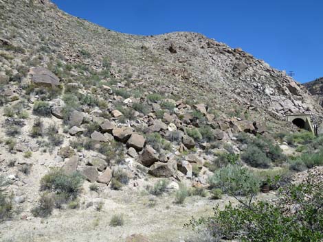
The Hike From the trailhead (Table 1, Waypoint Site#3-01), the route (no established trail) runs north back up the old highway grade. Recent rock falls, however, make it easier to start out walking on the pavement before cutting up onto the old road. About 200 yards out from the trailhead (Wpt. Site#3-02), hikers arrive at a point below boulders on the hillside above that are marked with petroglyphs (and a white sign post). Hikers can get a pretty good view from below, but scrambling up the rocky hillside brings one face to face with stories written on the stones by the ancients (Wpt. Site#3-03). If a train goes by while visiting this site, the name will become clear as it emerges from or disappears into Railroad Tunnel No. 5. For hikers using the alternative trailhead (Wpt. Site#3-04), the route runs up the steep hillside and heads northwest to the base of the hillside below the petroglyph marked boulders. |
 Starting down the old road (view N) |
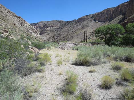
 The old road (view N) |
 Entering a wide spot on the old road (view N) |
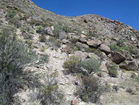 The rocky hillside is visible just ahead (view NW) |
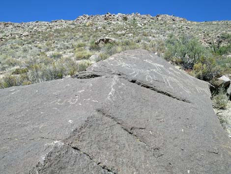
 A white marker indicates the petroglyph area (view NW) |
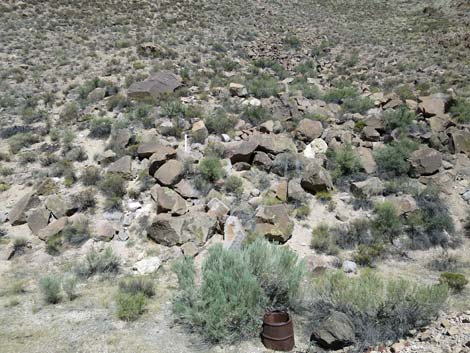
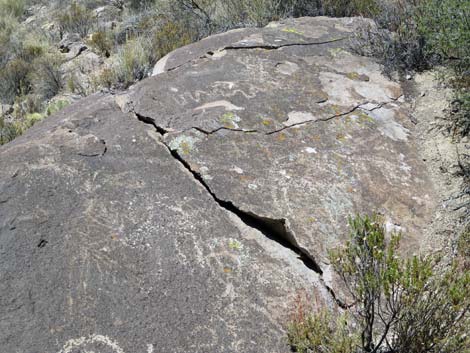
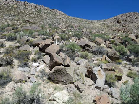 Petroglyph area (view NW) |
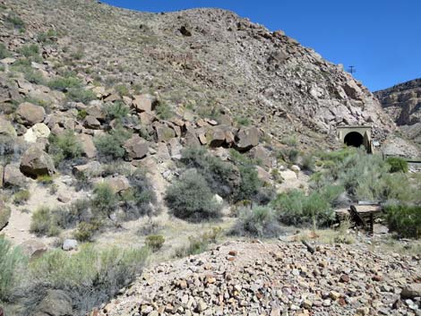 The railroad tunnel is farther up, but no petroglyphs |
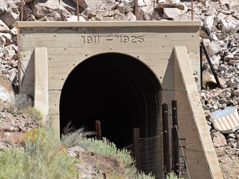 Tunnel No. 5 with dates: 1911-1925 (view N, telephoto) |
 Climbing towards the petroglyphs (view NW) |
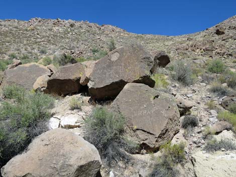
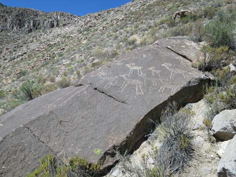
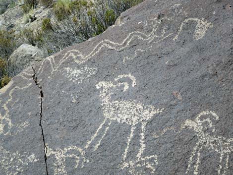
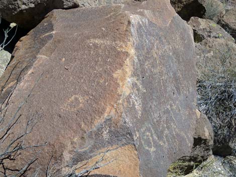 Lower petroglyphs |
 |
 |
 |
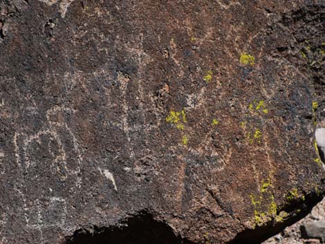 |
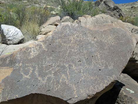
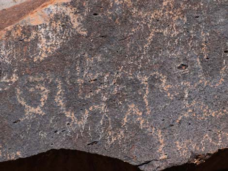
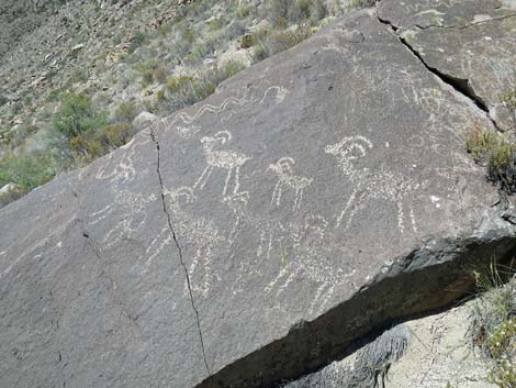
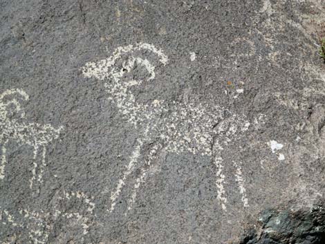
 Upper petroglyphs |
 Upper petroglyphs |
 |
 |
 |
 |
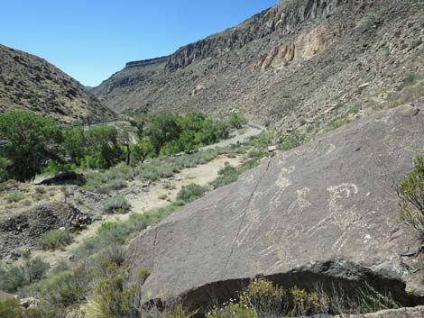 Grand scenery down the canyon (view S) |
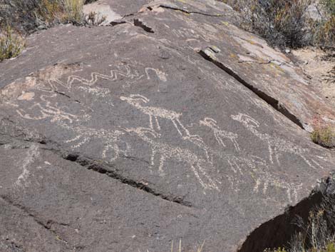 Lots of bighorn sheep |
Alternative Parking and Trailhead
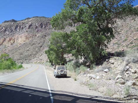 Alternative Parking under cottonwood tree (view S) |
 Route runs up this hillside (view NW) Route runs up this hillside (view NW) |
 Then cuts through this area (view NW) |
 Arriving at the wide spot on the old road (view NW) |
 Train going by while descending to the alternative trailhead (view SE) |
 More to come ... |
Table 1. Hiking Coordinates based on GPS data (NAD27; UTM Zone 11S). Download Hiking GPS Waypoints (*.gpx) file.
| Wpt. | Location | UTM Easting | UTM Northing | Elevation (ft) | Point-to-Point Distance (mi) | Cumulative Distance (mi) |
|---|---|---|---|---|---|---|
| Site#3-01 | Tunnel 5 Trailhead | 716164 | 4140976 | 3,562 | 0.00 | 0.00 |
| Site#3-02 | Base of Tunnel 5 Hillside | 716207 | 4141142 | 3,570 | 0.11 | 0.11 |
| Site#3-03 | Tunnel 5 Petroglyph Site | 716191 | 4141157 | 3,602 | 0.03 | 0.14 |
| Site#3-01 | Tunnel 5 Trailhead | 716164 | 4140976 | 3,562 | 0.14 | 0.28 |
| . | . | . | . | . | . | . |
| Site#3-04 | Alternative Tunnel 5 Trailhead | 716240 | 4141104 | 3,553 | 0.00 | 0.00 |
| Site#3-02 | Base of Tunnel 5 Hillside | 716207 | 4141142 | 3,570 | 0.04 | 0.04 |
| Site#3-03 | Tunnel 5 Petroglyph Site | 716191 | 4141157 | 3,602 | 0.02 | 0.06 |
| Site#3-04 | Alternative Tunnel 5 Trailhead | 716240 | 4141104 | 3,553 | 0.06 | 0.12 |
Happy Hiking! All distances, elevations, and other facts are approximate.
![]() ; Last updated 240323
; Last updated 240323
| Rock Art | Glossary | Copyright, Conditions, Disclaimer | Home |