Backroads Around Las Vegas, Red Rock Canyon National Conservation Area
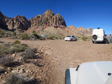
 Late Night Parking (view NE) |
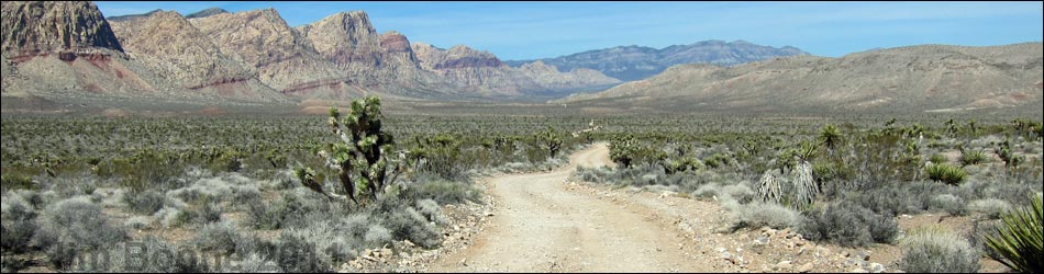
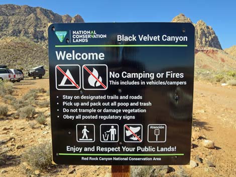
Overview Black Velvet Road is an occasionally maintained backcountry road that runs north from Highway 160 (the road to Pahrump) into the wild backcountry of Red Rock Canyon National Conservation Area and the base of the Red Rock escarpment. The road provides access to hikes along the base of the escarpment and climbing in the Black Velvet Canyon area. The road is rocky, and a bit rough were it crosses washes, but most of the rocks are rounded rather than sharp. People are driving sedans to within 50 yards of the trailhead (but they probably are rentals). Black Velvet Road is 2.6 miles long, and runs along the east edge of the Rainbow Mountain Wilderness Area. Camping is not permitted along the road. Link to map. |
 Edge of the pavement on Black Velvet Road (view NE) |
Watch Out Other than the standard warnings about driving in the desert, ...this is a slow and rocky, but fairly easy drive. The road is maintained, but the exact condition depends on the time since grading and the history of rain and flooding, but it should be suitable for a carefully driven sedans. Sometimes the road is washed out and requires 2WD-HC vehicle. While out, please respect the land and the other people out there, and try to Leave No Trace of your passage. Also, even though this road is short, be sure to bring what you need of the 10 Essentials. |
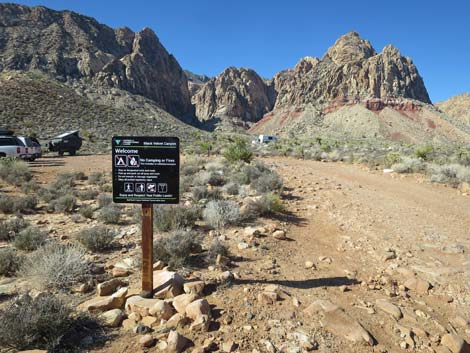
 Designated Route sign |
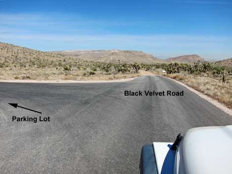
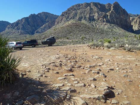
Getting to the Roadhead From town, drive out to Red Rocks. From West Charleston at the entrance to the Scenic Loop Road (Table 1, Site 0519), continue west on Charleston Blvd (Hwy 159) all the way past Blue Diamond town to Highway 160 (Site 0848). Turn right onto Highway 160, towards Pahrump, and drive west for 4.7 miles. Watch for a sign and a paved, right turn lane with the parking area off to the right. Turn right onto the Late Night Access Road (Site 1076) and drive towards the paved parking area. Stay to the right (straight) and continue past the parking areas and the vault toilet (Site 1072) to the far end of the paved parking area. The edge of the pavement marks the start of Black Velvet Road. |
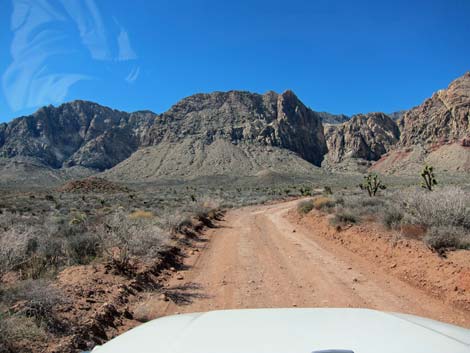
 The road crosses a wash about 0.2 miles out (view N) |
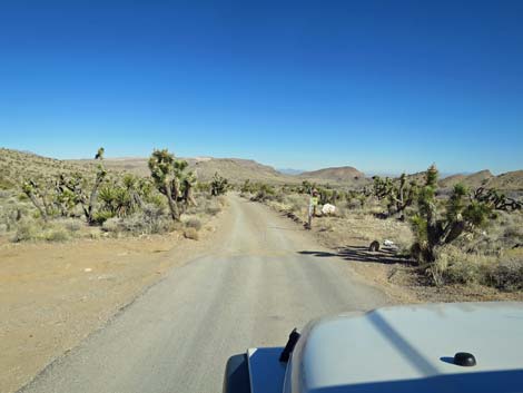
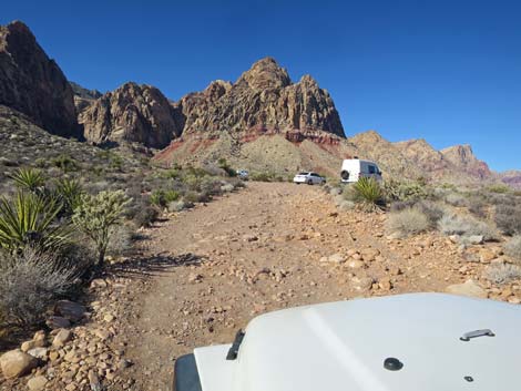
The Road In the far east edge of the paved area (Site 1081), the graded dirt Black Velvet Road runs out into the desert generally heading northeast. Watch for carsonite "designated route" signs. The road parallels the Mustang Loop Trail, and often bike riders can be seen on the left. At about 0.2 miles out, the road crosses a wash where the far side is getting steeper and more divoted as drivers in 2WD vehicles spin their tires. At about 0.45 miles out, the road bends left around the toe of Mustang Hill and passes Mustang Trailhead parking, on the left. Watch for the Mustang Loop sign. This is trailhead parking for Rubber Ducky Trail. |
 Bank on the far side of the wash is steep and divoted (view N) |
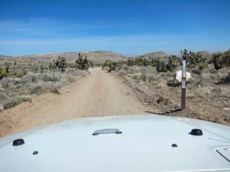
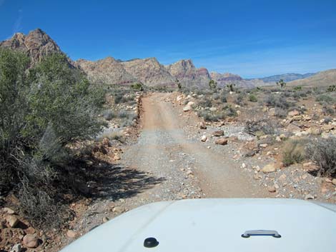
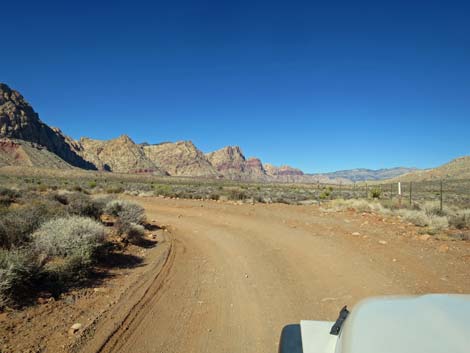
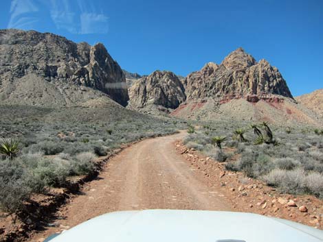
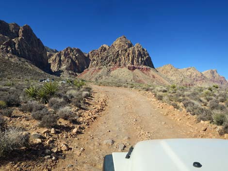
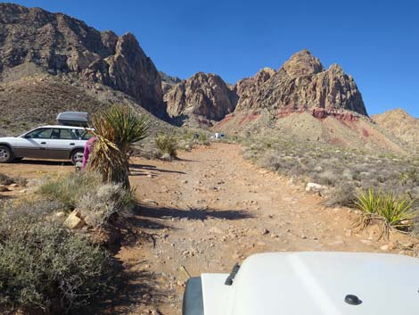
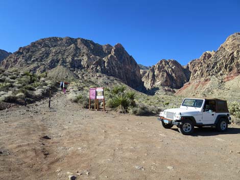
Past the trailhead, the road bends and runs to the northwest as it passes around Mustang Hill. At 1.30 miles (Site 1082) and 1.34 miles out (Site 1083), the Black Velvet Road passes two side roads to the left. These two roads converge to become Lone Grapevine Road, which runs out to the Mud Spring #2 Trailhead and the Lone Grapevine Spring Trailhead. Continuing northwest past the Lone Grapevine Roads, the Black Velvet Road crosses a wash, and in my experience gets rougher. The road continues to the northwest, then at 1.8 miles out, bends hard to the left and runs more to the west, parallel to a wire fence. The road continues to get more and more rocky, then at about 2.5 miles from the pavement, the road passes the first of several parking spots. The road continues for another 0.1 miles, but only the most hardy drivers (and those in rental vehicles) will drive to the very end of the road (Site 1074). Park in any of the parking areas; this is the trailhead. |
 Most of the road is in good condition (view N) |
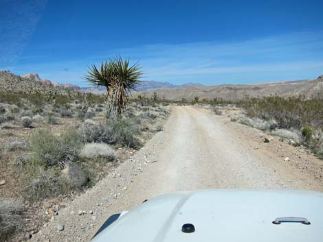
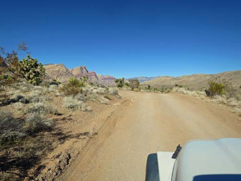
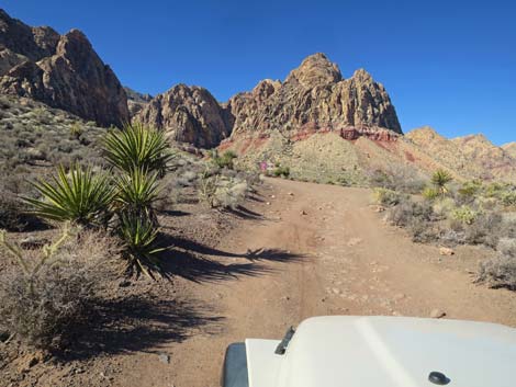
 Black Velvet Road provides grand views (view N) |
 Approaching Mustang Trailhead parking (view N) |
 Mustang Loop Trail sign (view W) |
 Mustang Loop Trail sign serves as trailhead sign (view W) |
 There is space for several vehicles at the Mustang Loop trailhead |
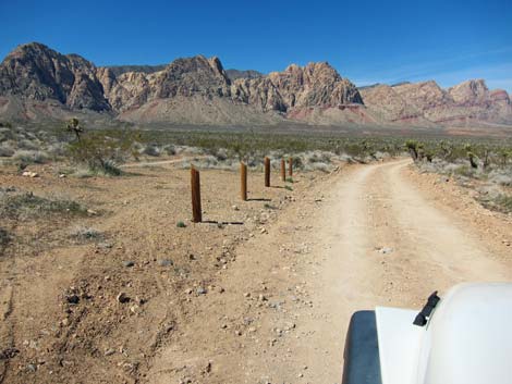 Black Velvet Road has several "no parking" areas (view NW) |
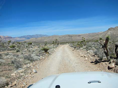
 The road seems to run into the distance (view N) |
 Black Velvet Road approaching Lone Grapevine Road, South (view N) |
 Black Velvet Road at Lone Grapevine Road, South (view N) |
 Lone Grapevine Road, South (view W from Black Velvet Road) |
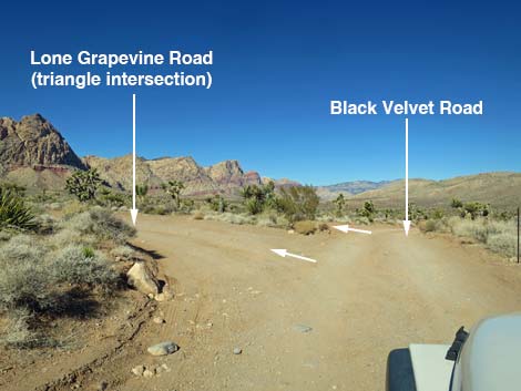
 Black Velvet Road approaching Lone Grapevine Road, North (view N) |
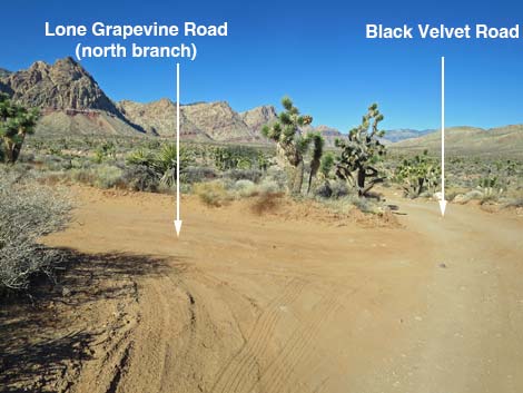 Black Velvet Road at Lone Grapevine Road, North (view N) |
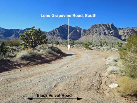
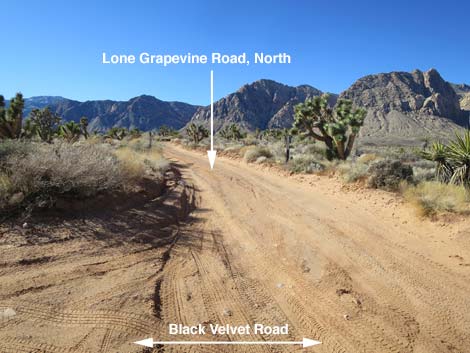 Lone Grapevine Road, North (view W from Black Velvet Road) |
 Black Velvet Road crossing a major wash (view NW) |
 Black Velvet Road bends hard to the left at a fenceline (view NW) |
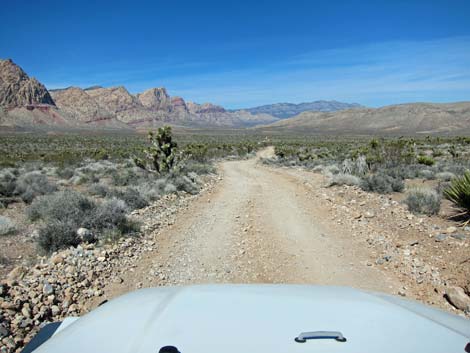
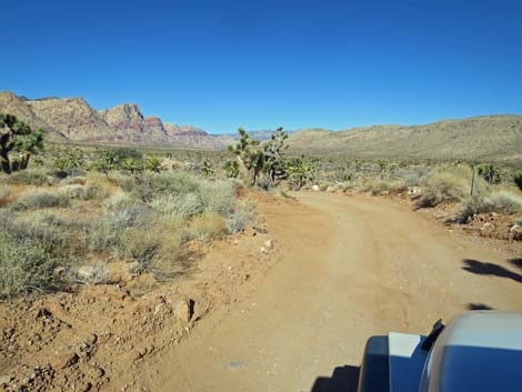
 Heading west (view W) |
 Smooth road (view W) |
 Rocky road (view W) |
 More rocky road leading to first parking area (view W) |
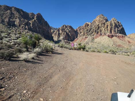
 Black Velvet Canyon information sign (view W) |
 Black Velvet Canyon information sign (view W) |
 Very rocky patch before 3rd parking area |
 Rocky road before 4th parking area |
 4th parking area |
 Road to 5th parking area |
 Arriving at the end of Black Velvet (view NW) |
 Last (5th) parking area along Black Velvet (view W) |
Table 1. Backroad Coordinates (NAD27; UTM Zone 11S). Download Roadway GPS Waypoints (*.gpx) file.
| Site | Location | Easting | Northing | Elevation | Latitude | Longitude |
|---|---|---|---|---|---|---|
| 0519 | Charleston Blvd at Scenic Loop Entrance | 642120 | 3999525 | 3,681 | 36.13183 | 115.42059 |
| 0848 | Hwy 160 at Blue Diamond Rd | 647933 | 3988875 | 3,169 | 36.03498 | 115.35801 |
| 1072 | Late Night Parking | 641416 | 3986150 | 3,930 | 36.01139 | 115.43080 |
| 1074 | Black Velvet Parking | 639758 | 3988689 | 3,862 | 36.03451 | 115.44875 |
| 1081 | Late Night Parking at Black Velvet Rd | 641548 | 3986183 | 3,938 | 36.01167 | 115.42934 |
| 1082 | Black Velvet Rd at Lone Grapevine Rd-1 | 641294 | 3988096 | 3,718 | 36.02895 | 115.43182 |
| 1083 | Black Velvet Rd at Lone Grapevine Rd-2 | 641296 | 3988152 | 3,717 | 36.02945 | 115.43179 |
Happy Hiking! All distances, elevations, and other facts are approximate.
![]() ; Last updated 250308
; Last updated 250308
| Backroads | Hiking Around Las Vegas | Glossary | Copyright, Conditions, Disclaimer | Home |