Backroads Around Las Vegas, Lake Mead National Recreation Area
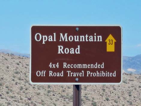 |
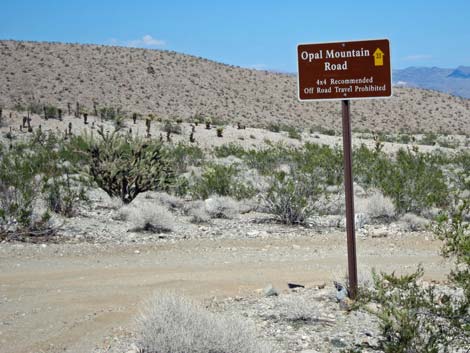
Overview Opal Mountain Road (NPS Road 33) is an occasionally graded dirt road that runs 5.8 miles from Rockefeller Mine Road to the western shore of Lake Mojave, following along the south edge of the Ireteba Peaks Wilderness Area. The road provides sightseeing, hiking, hunting, and camping opportunities in this wild and remote part of Lake Mead National Recreation Area, plus hiking and hunting opportunities inside the wilderness area. The road is in fairly good condition (upper half graded in Sept. 2012), but rough in places. Assuming good weather, the road is suitable for experienced drivers of 2WD high-clearance vehicles, but soft patches can be found, so 4WD would be safer. Link to map. |
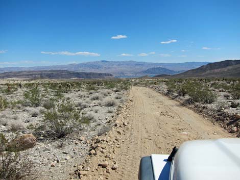
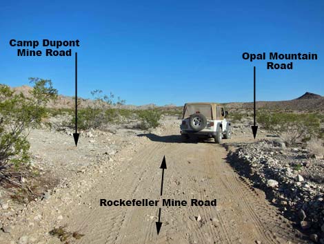 4-way intersection (view NW) |
Watch Out Other than the standard warnings about the desert ... Opal Mountain Road generally is a good road, but it runs out into wild and remote country. There are no services or developments of any kind. Cell phones don't work. Bring water and food, a good spare tire, a shovel, tools, a tow rope, bailing wire, and anything you might need to survive a night stuck out in the desert. While out and about, please respect the land and the other people out there, and try to Leave No Trace of your passage. This road runs along the edge of Wilderness, so pay particular attention to respecting the land. Be sure to bring the 10 Essentials. All motor vehicles, including ATVs, must be street legal. Getting to the Roadhead This road is located in Lake Mead National Recreation Area, about 1-1/2 hours south of Las Vegas and just east of Searchlight. |
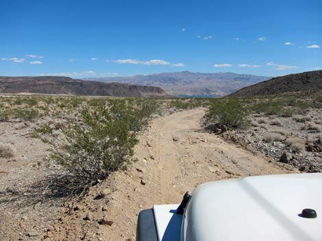
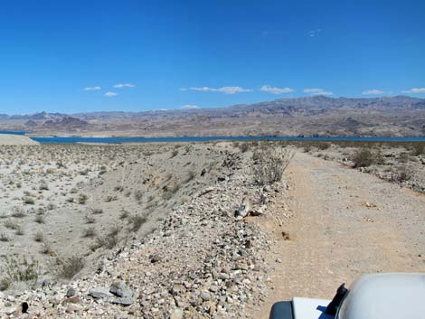
 Rockefeller Mine Rd at Opal Mountain Rd (view NE) |
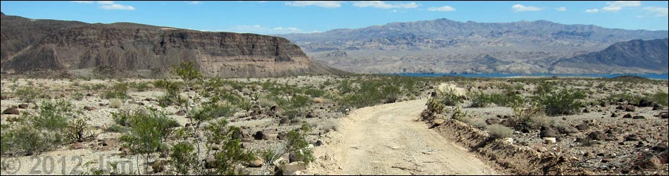
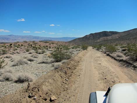
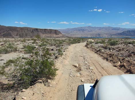
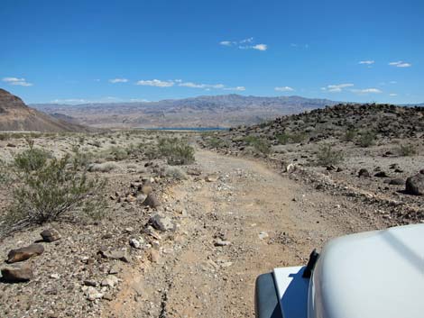
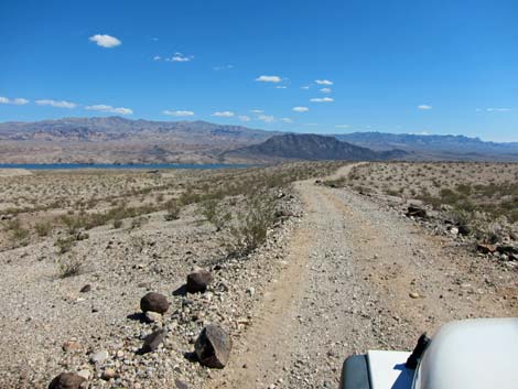
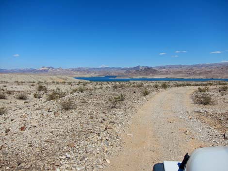
From town, drive south on Highway 95 to Searchlight (Table 1, Site 0927). In downtown Searchlight, turn left onto Cottonwood Cove Road and drive east for 7.8 miles) to Rockefeller Mine Road (Site 1320) on the left. Drive generally northward on Rockefeller Mine Road for 9.7 miles to Opal Mountain Road (Site 1323). The Road Opal Mountain Road (Site 1323) turns right and runs east and downhill towards Lake Mojave, which can't be seen from this point, but all of the land north of the road is the Ireteba Peaks Wilderness Area. The road is in reasonably good shape, but flaws in the grading will surprise drivers who have been lulled into a false sense of tranquility by the generally smooth roadway. There are no side roads or major points of interest along the road, but the drive is quite scenic. There are nice patches of teddybear cholla, pleasing hillsides, and broad washes off to the side of the road. |
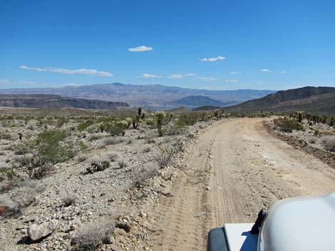
 Opal Mountain Rd (view E) |
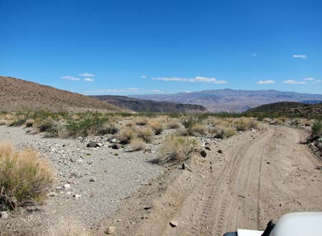
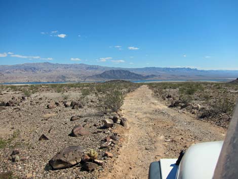
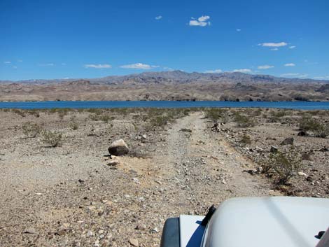
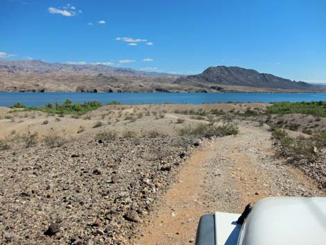
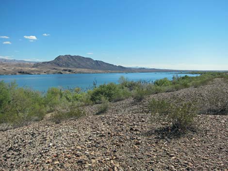
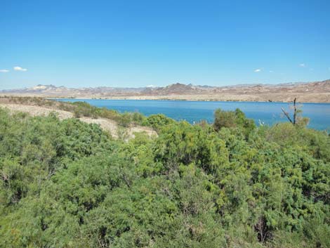
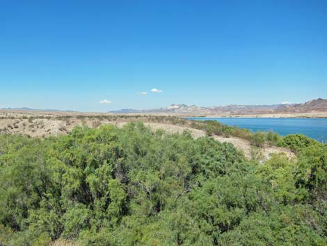
Farther out, Opal Mountain, a large ridge of dark volcanic rock, dominates the landscape ahead and left of the road, and the deep blue waters of Lake Mojave dominate the view straight ahead. The road winds around towards the end and eventually reaches a flat area overlooking the lake with a campfire ring. This is the end of the road (Site 1363). A track continues along a ridgeline as if it were the road leading to the water, but the ridge pinches out and drivers are forced to back up the narrow ridge without falling off either side. It is safer to park at the campsite and walk the few yards to the lake. |
 |
 |
 |
 |
 Teddybear cholla lining the road |
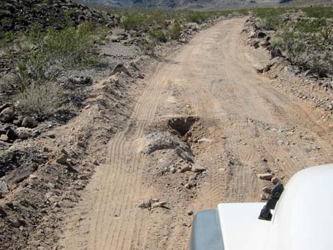 Grading flaw |
 Grading flaw |
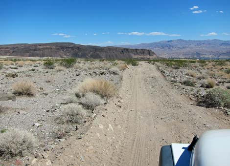 Opal Mountain ahead on left |
 Opal Mountain (left) and Lake Mojave (right) |
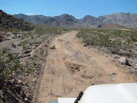
 More grading flaws |
 |
 |
 |
 |
 |
 |
 Winding down to the edge of Lake Mojave |
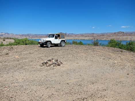 Campsite at the end of the road |
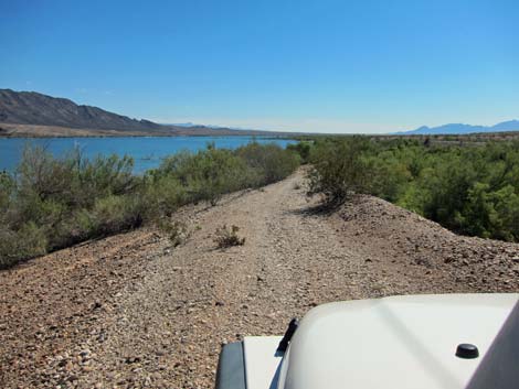 Narrow track -- best not to drive down there |
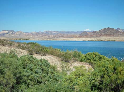 Lake Mojave |
 |
 |
 |
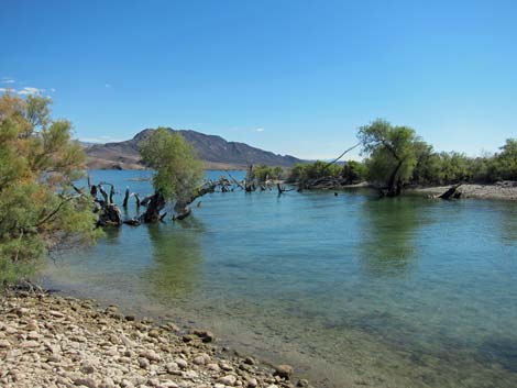 |
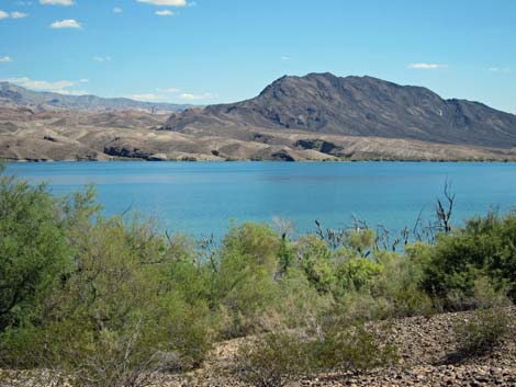
 Opal Mountain (view N from campsite at Lake Mojave) |
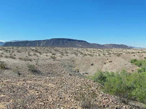
 Desert landscape (view N from campsite at Lake Mojave) |
Table 1. Highway Coordinates Based on GPS Data (NAD27; UTM Zone 11S). Download Highway GPS Waypoints (*.gpx) file.
| Site | Location | UTM Easting | UTM Northing | Latitude (N) | Longitude (W) | Elevation (ft) | Verified |
|---|---|---|---|---|---|---|---|
| 0927 | Hwy 95 at Hwy 164, Searchlight | 688813 | 3926424 | 35.46519 | 114.91921 | 3,500 | Yes |
| 1320 | Cottonwood Cove Rd at Rockefeller Mine Road | 701103 | 3928204 | 35.47882 | 114.78341 | 1,982 | GPS |
| 1323 | Rockefeller Mine Road at Opal Mtn Rd | 702755 | 3937877 | 35.56564 | 114.76280 | 1,768 | GPS |
| 1363 | Opal Mtn Rd at Lake Mojave | 711146 | 3937839 | 35.56355 | 114.67029 | 706 | GPS |
Happy Hiking! All distances, elevations, and other facts are approximate.
![]() ; Last updated 240326
; Last updated 240326
| Hiking Around Lake Mead | Backroads | Glossary | Copyright, Conditions, Disclaimer | Home |