Backroads Around Las Vegas, Lake Mead National Recreation Area
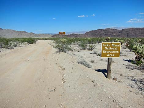
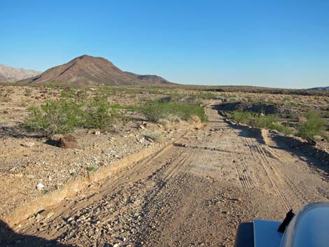
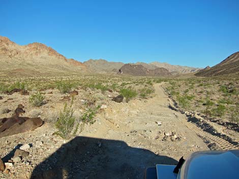
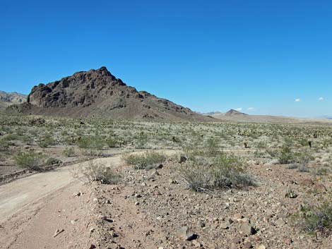
 Cottonwood Cove Rd at Rockefeller Mine Rd (view E) |
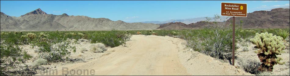
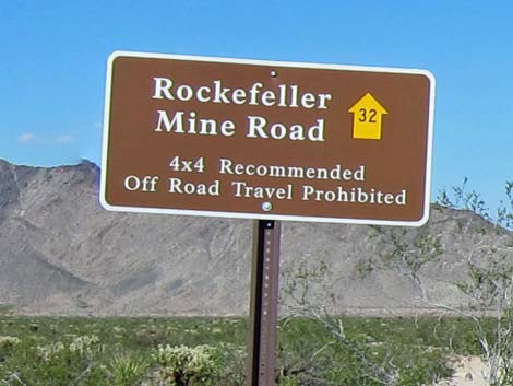
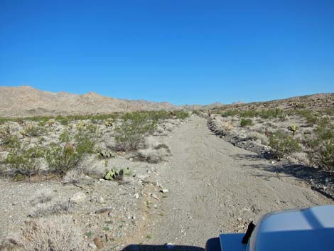
Overview Rockefeller Mine Road is an occasionally graded dirt road that runs 10.6 miles from the paved Cottonwood Cove Road to the south edge of the Ireteba Peaks Wilderness Area. The road provides sightseeing, hunting, hiking, camping opportunities, and even access to historic mining sites in this wild and remote part of Lake Mead National Recreation Area. In addition, the road provides access hiking and hunting inside the wilderness area. The road generally is in fair condition overall, but it is rough in places. Assuming good weather, the road is suitable for experienced drivers of 2WD high-clearance (2WD-HC) vehicles, but soft sand can be found, so 4WD would be safer. Link to map. |
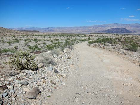
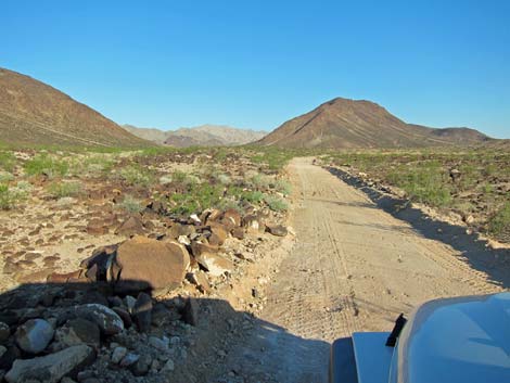
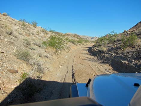
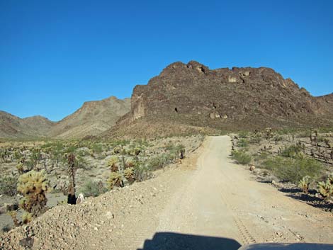
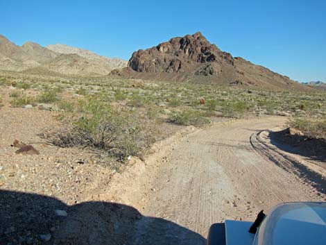
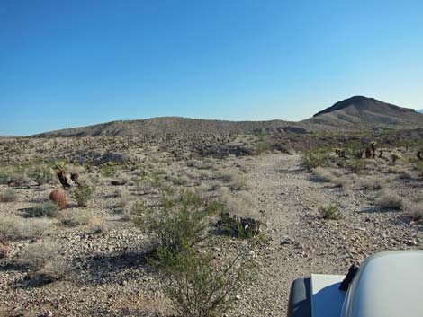
 Start of Rockefeller Mine Rd (view NE) |
Watch Out Other than the standard warnings about the desert ... Rockefeller Mine Road generally is a good road, but it runs out into wild and remote country. There are no services or developments of any kind. Cell phones don't work. Bring water and food, a good spare tire, a shovel, tools, a tow rope, bailing wire, and anything you might need to survive a night stuck out in the desert. Old mines are never safe. While out and about, please respect the land and the other people out there, and try to Leave No Trace of your passage. This road runs out to the edge of Wilderness, so pay particular attention to respecting the land. Be sure to bring the 10 Essentials. All motor vehicles, including ATVs, must be street legal. |
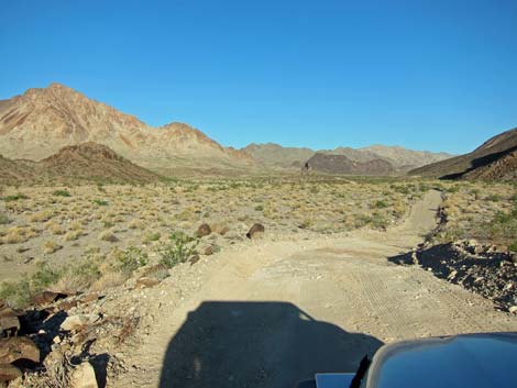
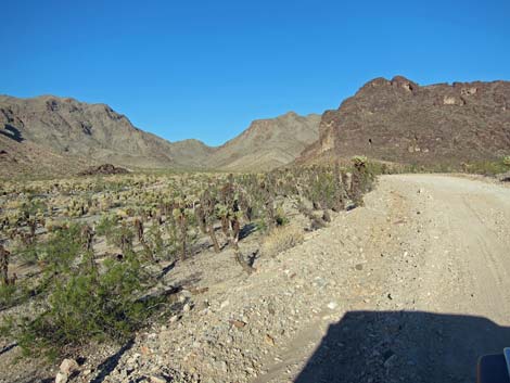
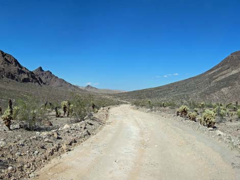
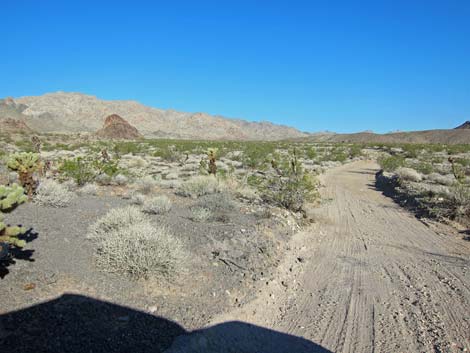
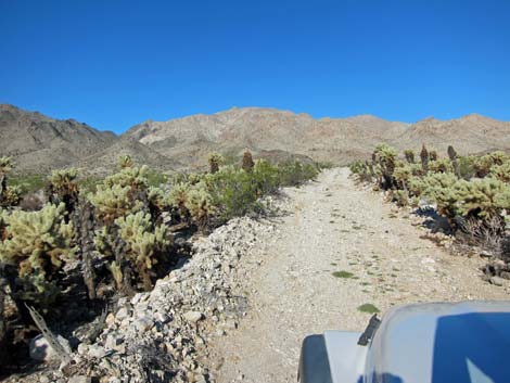
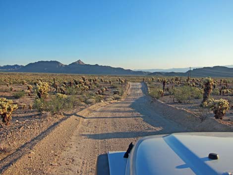 Lots of Teddybear Cholla out here (view NE) |
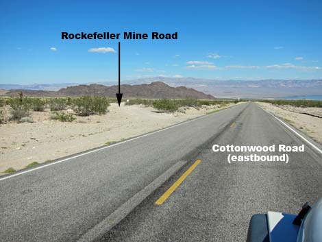
Getting to the Roadhead This road is located in Lake Mead National Recreation Area, about 1 hour south of Las Vegas and just east of Searchlight. From town, drive south on Highway 95 to Searchlight (Table 1, Site 0927). In downtown Searchlight, turn left onto Cottonwood Cove Road (this road is the eastern extension of Highway 164, which technically only runs west from Searchlight). Drive east on Cottonwood Cove Road for 6.8 miles to the Lake Mead Entrance Station. Pay the entrance fee, then continue 1.0 miles (total of 7.8 miles) to an unmarked side road to the left that angles away from the pavement. This is Rockefeller Mine Road (Site 1320). |
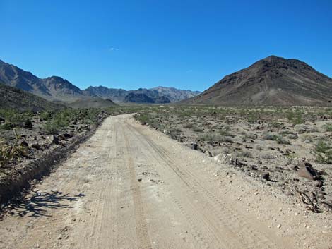
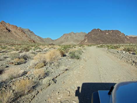
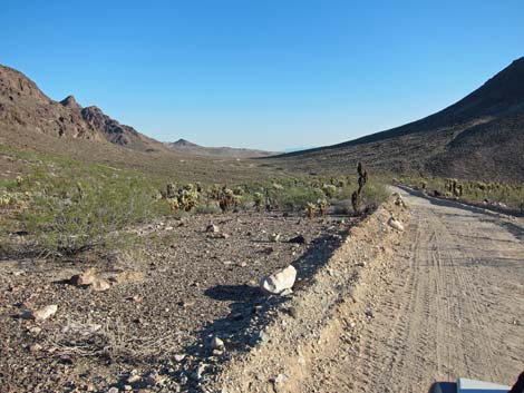
 Lake Mead NRA boundary (view NE) |
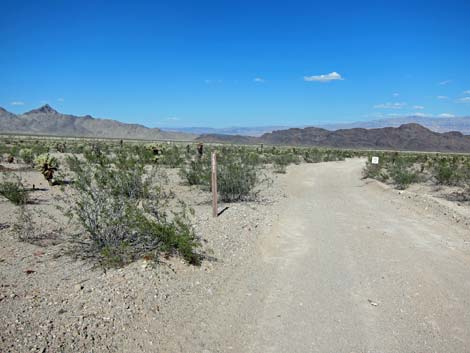
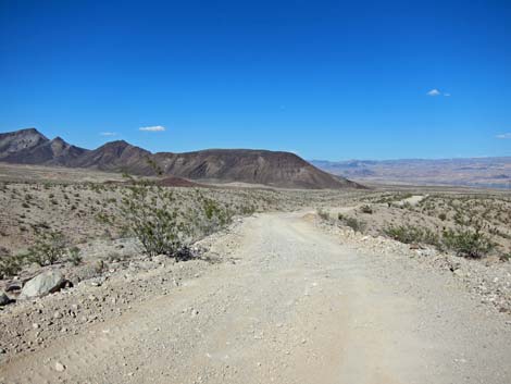
The Road Rockefeller Mine Road (Site 1320) angles away from the pavement heading east-northeast, then bends to run more to the northeast. In about 0.8 miles (Site 1321), signs announce the boundary of Lake Mead National Recreation Area, and this is where the first Rockefeller Mine Road sign appear. The road continues northeast to pass dark, rocky ridge, then curves hard to the right and runs to the east. The road winds down a hill to cross a broad wash, the passes Solicitor Mine Road (Site 1353; 2.55 miles out) to the left. The road climbs out of the wash, winds around a bit more, and passes Indigo Road (Site 1354; 2.94 miles out) to the left. |
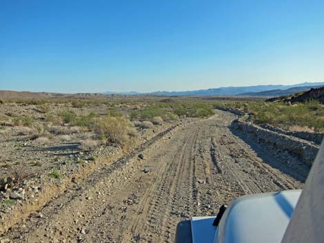
 Rockefeller Mine Road (view N) |
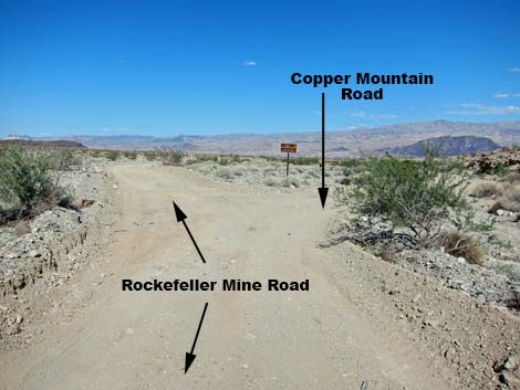
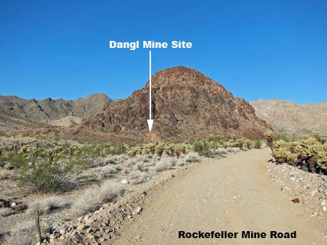
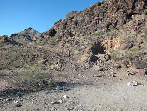
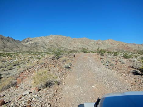
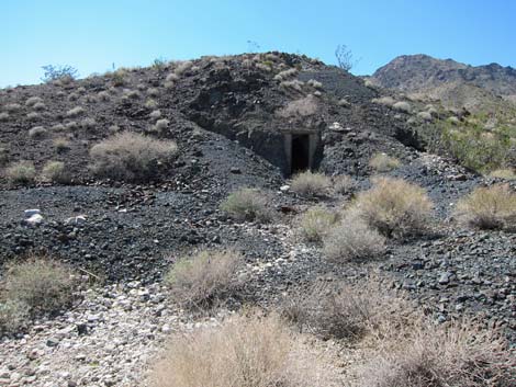
The road runs down ridgelines to the northeast, eventually arriving at Copper Mountain Road (Site 1322; 4.86 miles out). Copper Mountain Road continues down the wash to the shores of Lake Mojave, while Rockefeller Mine Road curves to the left and runs up the wash. Rockefeller Mine Road runs northwest climbing gradually toward the mountains. At the base of a rocky mountain, the road bends hard to the right (Site 1355; 7.70 miles out). Closed road to the left invite hikers into the wildness and an old mining district. The road runs north, over a saddle, and down the other side, eventually curving gradually to the left and running uphill. At the base of a small hill, the Dangl Mine Road (Site 1356; 9.55 miles out), now closed to vehicles, forks to the left. The Dangl Mine Site is a point of interest where miners left an adit, now collapsed, and an old road that invites further investigation. |
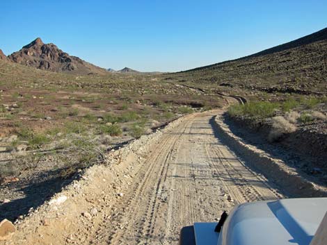
 Just past 2-mile curve (view E) |
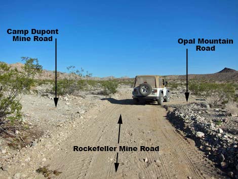
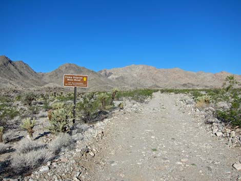
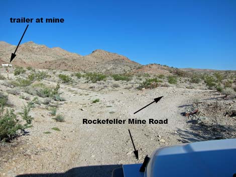
Rockefeller Mine Road runs northwest a short distance to a 4-way intersection (Site 1323; 9.66 miles out). Rockefeller Mine Road continues straight northwest. To the left, Camp Dupont Mine Road runs west-northwest to a mining district, and to the right, Opal Mountain Road runs east towards Lake Mojave. Continuing on Rockefeller Mine Road, the road eventually bends to left, running more to the west. At the base of a small hill, a played-out adit was used by miners as living quarters (Site 1357; 10.37 miles out). There are several adits and an 8-ft-deep pit in the area, so be careful walking around. About this time, an old travel trailer can be seen ahead on a hill. At a fork in the road (Site 1358; 10.47 miles out), the road to the left runs through a fence and past a "no trespassing" sign to the trailer, while the Rockefeller Mine Road curves hard to the right. The road ends shortly at barricades in the bottom of a wash (Site 1360; 10.61 miles out) at the edge of the Ireteba Peaks Wilderness Area. From this point, the Ireteba Wash Hike runs north into the wilderness area. |
 Beginning to cross wash (view NE) |
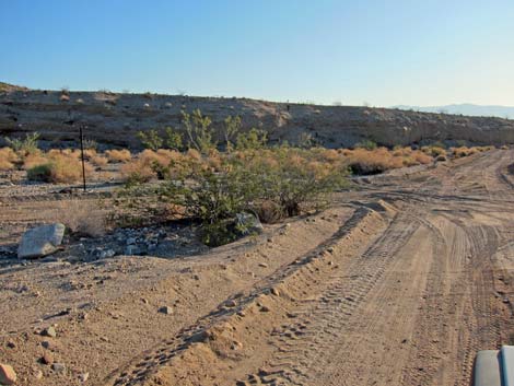 Approaching Solicitor Mine Road (view NE) |
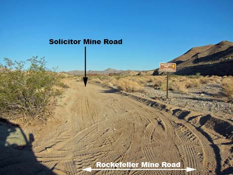 Solicitor Mine Road (view NW) |
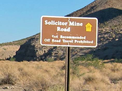 Sign: Solicitor Mine Road (view NW) |
 Above the wash (view E) |
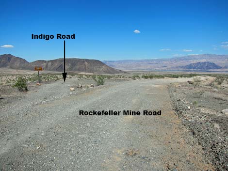 Approaching Indigo Road (view ENE) |
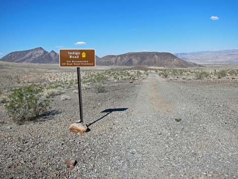 Indigo Road (view NNE) |
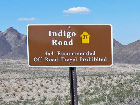 Sign: Indigo Road (view NNE) |
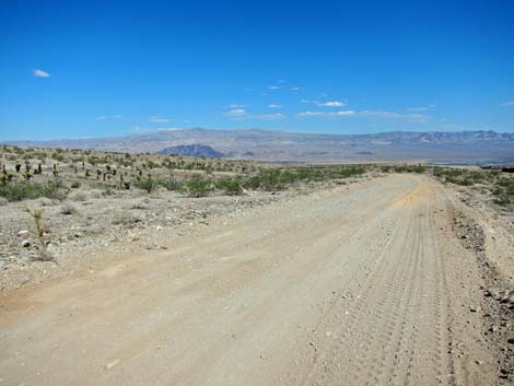
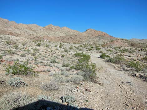
 Running down long ridgeline (view NE) |
 Running down long ridgeline (view NE) |
 Approaching Copper Mountain Road (view NE) |
 Copper Mountain Road (view NE) |
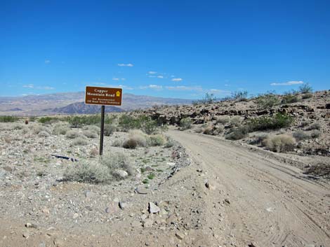
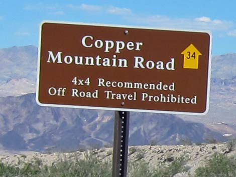 Sign: Copper Mountain Road |
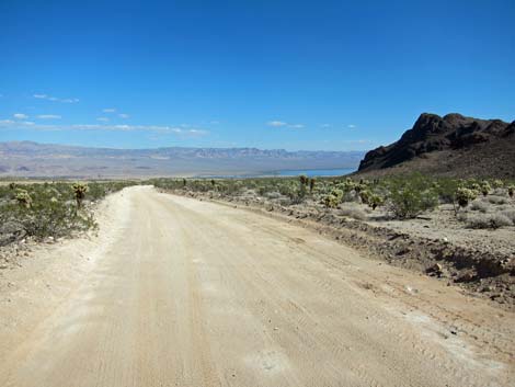
 Rockefeller Mine Road (view N) |
 |
 |
 |
 |
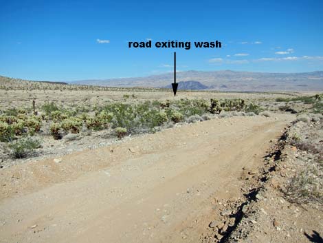
 Climbing out of a wash |
 Climbing towards the mountains (view NW) |
 Approaching hard bend to the right (view NW) |
 Approaching bend to the right (view W) |
 Past bend to the right (view N) |
 Starting towards a saddle (view N) |
 Climbing towards a saddle (view N) |
 Past saddle (view N) |
 Past saddle (view N) |
 Long, smooth road |
 Climbing towards the hills again (view NW) |
 Climbing towards the hills again (view NW) |
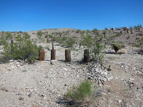
 Dangl Mine Rd and collapsed adit (view SW) |
 4-way intersection (view NW) |
 Camp Dupont Mine Road (view WNW) |
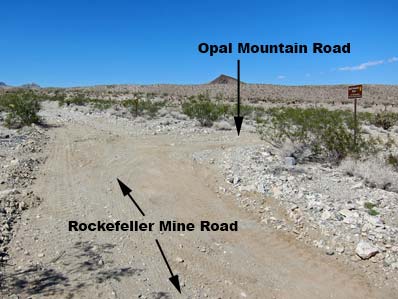 Rockefeller Mine Rd at Opal Mountain Road (view NE) |
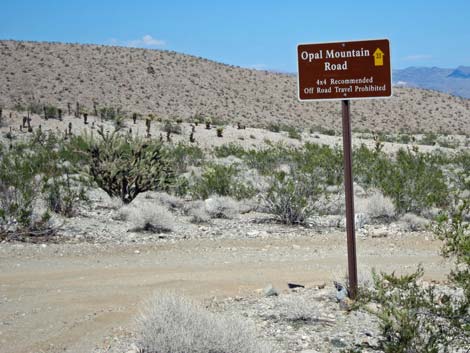 Opal Mountain Road (view NE) |
 Rockefeller Mine Road (view N) |
 Rockefeller Mine Road (view NW) |
 Rockefeller Mine Road (view WNW) |
 Rockefeller Miner's Living Quarters (view SW) |
 Approaching fork in the road (view NW) |
 Side road to Rockefeller Mine trailer (view NW) |
 Rockefeller Mine Road dropping towards wash (view NE) |
 End of road at Ireteba Wilderness and Ireteba Wash Hike (view N) |
 More to come ... |
Table 1. Highway Coordinates Based on GPS Data (NAD27; UTM Zone 11S). Download Highway GPS Waypoints (*.gpx) file.
| Site | Location | UTM Easting | UTM Northing | Latitude (N) | Longitude (W) | Elevation (ft) | Verified |
|---|---|---|---|---|---|---|---|
| 0927 | Hwy 95 at Hwy 164, Searchlight | 688813 | 3926424 | 35.46519 | 114.91921 | 3,500 | Yes |
| 1320 | Cottonwood Cove Rd at Rockefeller Mine Road | 701103 | 3928204 | 35.47882 | 114.78341 | 1,982 | GPS |
| 1321 | Rockefeller Mine Road at NPS Bndry | 701793 | 3929277 | 35.48835 | 114.77554 | 1,896 | GPS |
| 1322 | Rockefeller Mine Road at Copper Mtn Rd | 706344 | 3932940 | 35.52041 | 114.72448 | 1,161 | GPS |
| 1323 | Rockefeller Mine Road at Opal Mtn Rd | 702755 | 3937877 | 35.56564 | 114.76280 | 1,768 | GPS |
| 1353 | Rockefeller Mine Road at Solicitor Mine Rd | 703517 | 3931017 | 35.50368 | 114.75612 | 1,651 | GPS |
| 1354 | Rockefeller Mine Road at Indigo Road | 703917 | 3931197 | 35.50521 | 114.75167 | 1,648 | GPS |
| 1355 | Rockefeller Mine Road at Mine Rd | 703005 | 3935464 | 35.54384 | 114.76065 | 1,702 | GPS |
| 1356 | Rockefeller Mine Road at Dangl Mine Rd | 702852 | 3937748 | 35.56446 | 114.76177 | 1,711 | GPS |
| 1357 | Rockefeller Mine Road at Miner's Quarters | 701986 | 3938594 | 35.57226 | 114.77110 | 1,924 | GPS |
| 1358 | Rockefeller Mine Road at Side Road | 701894 | 3938733 | 35.57352 | 114.77208 | 1,896 | GPS |
| 1359 | Rockefeller Mine Road at End of Road | 701659 | 3938710 | 35.57337 | 114.77468 | 2,009 | GPS |
| 1360 | Ireteba Wash Trailhead Parking | 702075 | 3938802 | 35.57411 | 114.77007 | 1,857 | GPS |
| 1361 | Camp Dupont Mine Road at Wash | 701700 | 3938148 | 35.56830 | 114.77437 | 1,956 | GPS |
| 1362 | Camp Dupont Mine Road at Dupont Mine | 701307 | 3938280 | 35.56957 | 114.77867 | 2,031 | GPS |
| 1363 | Opal Mtn Rd at Lake Mojave | 711146 | 3937839 | 35.56355 | 114.67029 | 706 | GPS |
Happy Hiking! All distances, elevations, and other facts are approximate.
![]() ; Last updated 240326
; Last updated 240326
| Hiking Around Lake Mead | Backroads | Glossary | Copyright, Conditions, Disclaimer | Home |