Backroads Around Las Vegas, Death Valley National Park
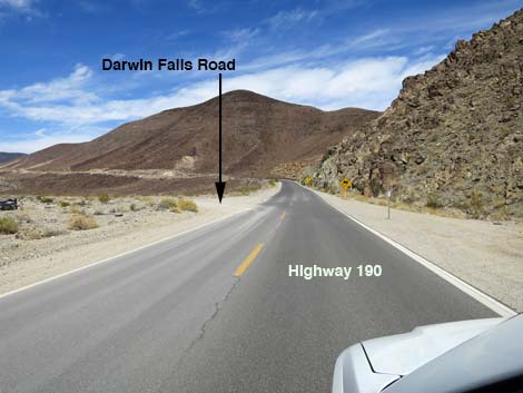
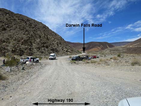
 Highway 190 approaching Darwin Falls Road (view N) |
Overview Darwin Falls Road runs from Highway 190 to the town of Darwin, passing through a sparely vegetated desert area where the geology is laid bare. Following the edge of Darwin Wash for 2.4 miles, the road arrives at the Darwin Falls Trailhead parking area. Past this trailhead, the road climbs steeply into the mountains and conditions deteriorate to the point that often a 4WD vehicle is necessary. Both sides of the road are inside the Death Valley Wilderness Area to 1.7 miles past the trailhead, so this is as close as it gets to driving in a designated wilderness area. After this point, the road leaves Death Valley National Park and the Wilderness Area. Darwin Falls Road provides access to various hiking destinations, primarily the Darwin Falls Trail, but also off-trail hikes to places such as Zinc Hill on BLM land in the Argus Range. Link to map. |
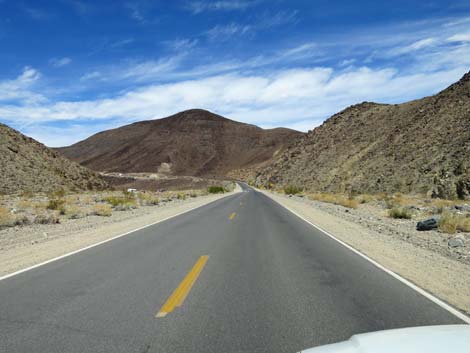
 Highway 190 approaching Darwin Falls Road (view N) |
Watch Out Other than the standard warnings about driving in the desert, ... Darwin Falls Road is entirely safe in appropriate vehicles. The road is graded dirt with a firm base that normally is passable in sedans to Darwin Falls Trailhead, but conditions change over time and a 2WD-HC vehicle would be better to this point. The road is rockier and bumpier than it looks, so drive slowly and carefully watching for sharp rocks. Past Darwin Falls Trailhead, the road may require a 4WD vehicle. Be sure that your vehicle is in good working condition, carry plenty of water (radiator and drinking), pack a lunch, and drive slowly and carefully. Time changes road conditions, so always use your own good judgment. While out, please respect the land and the other people out there, and try to Leave No Trace of your passage. This road goes into remote areas, so be sure to bring the 10 Essentials. |
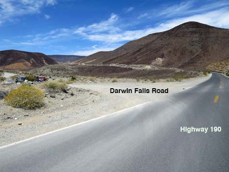 Highway 190 at Darwin Falls Road (view NW) |
Getting to Darwin Falls Road Darwin Falls Road is located in the western part of Death Valley National Park, about 3 hours northwest of Las Vegas. From town, drive out to Death Valley. From the Furnace Creek Visitor Center, drive north and then west on Highway 190 for 55 miles, past Stovepipe Wells and over the mountains to Panamint Springs Resort. From Panamint Springs, continue west on Highway 190 for 1.0 miles to an unmarked gravel road on the left. This is Darwin Falls Road, as announced on a sign about 110 yards up the road. |
 Darwin Falls Road crosses Darwin Wash (view W from Highway 190) |
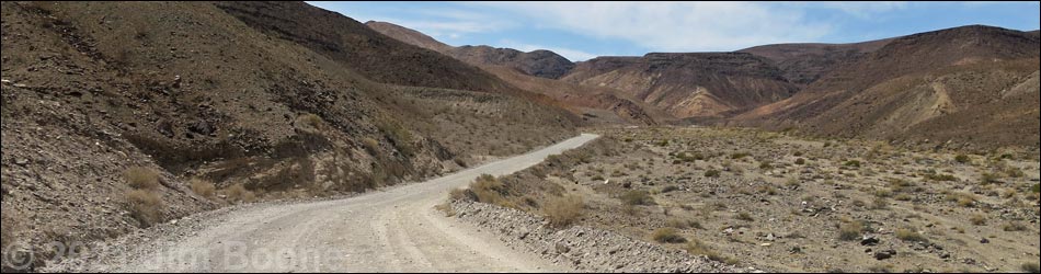
The Road From the pavement (Table 1; Site 0977), Darwin Falls Road runs west across Darwin Wash. If these first few yards of the road are passable, then the rest of the road probably is passable too. Across the wash, the road stays against the base of the mountains and out of the wash. The road winds along the base of the hills for about 1.2 miles, then bends southwest. The road becomes more straight, but it stays along the base of the hills for another 0.8 miles to a hard turn left and a short spur road right. The spur road is trailhead parking for the Darwin Falls Trail. Past the trailhead, the road narrows, climbs steeply, and winds into the mountains. The road passes an historical mine area and climbs onto a high point on a ridge. The road then winds steeply down into a large wash and bends sharply to the right (northwest) near the Zinc Hill trailhead (Site 0766). The road continues climbing over the mountains and eventually drops into the town of Darwin. |
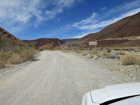 Darwin Falls Road approaching road sign (view NW) |
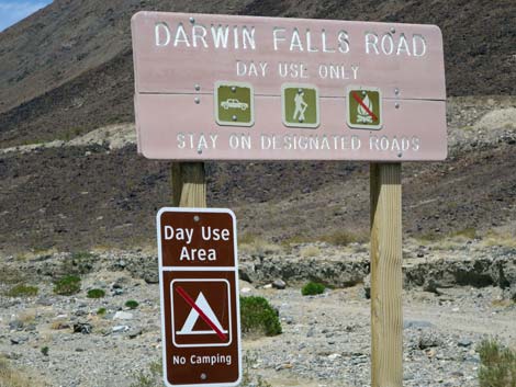 Darwin Falls Road road sign (view N) |
 Darwin Falls Road is more bumpy than it looks (view W) |
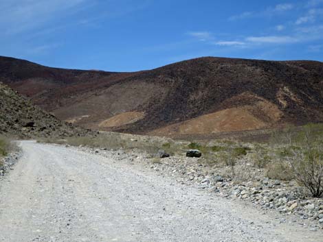
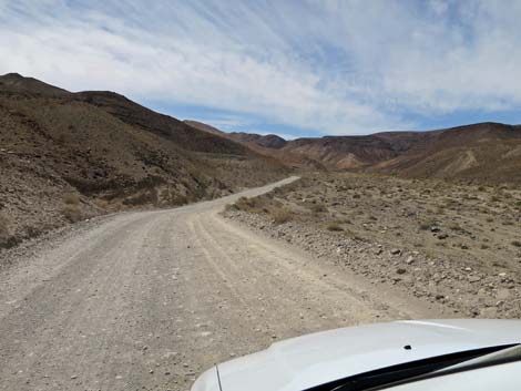
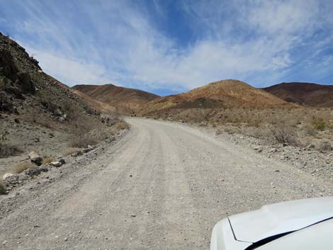 Darwin Falls Road winds along the base of the mountains (view W) |
 |
 |
 |
 |
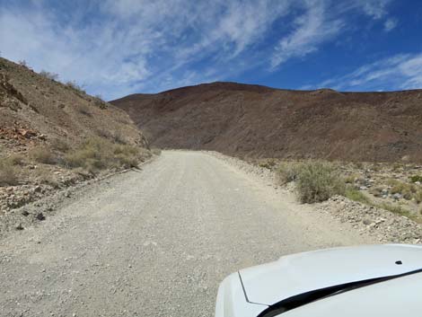
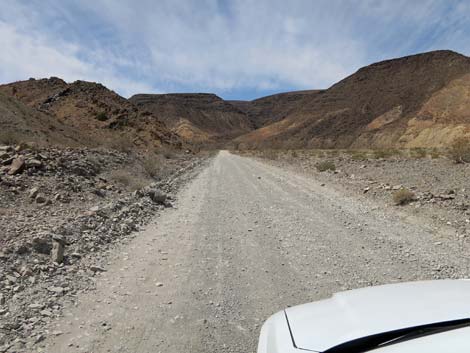 Farther out, Darwin Falls Road runs more straight (view SW) |
 Farther out, Darwin Falls Road runs more straight (view SW) |
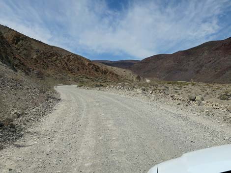
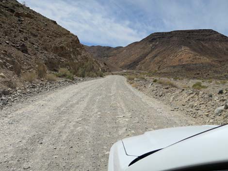
 Farther out, Darwin Falls Road approaching a turn left (view SW) |
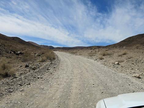
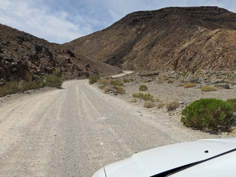
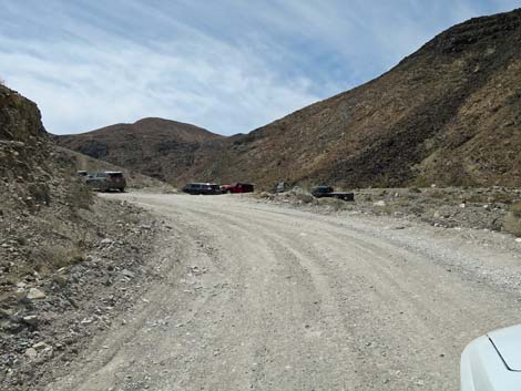 At the left turn, Darwin Falls Road approaching trailhead (view SW) |
 Darwin Falls Road approaching trailhead (view SW) |
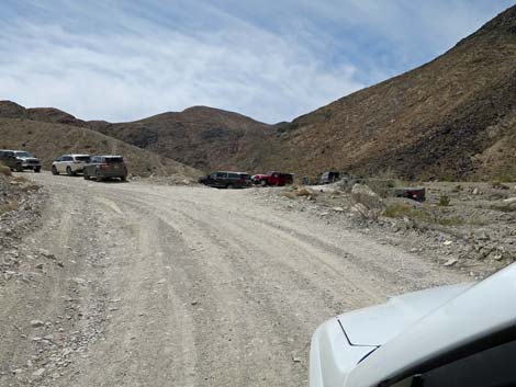
 Darwin Falls Road at Darwin Falls Trailhead spur road (view SW) |
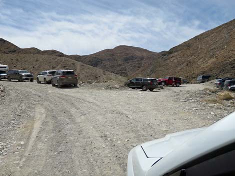
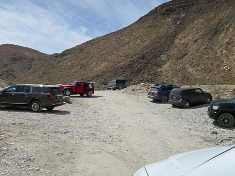 Darwin Falls Trailhead spur road (view SW) |
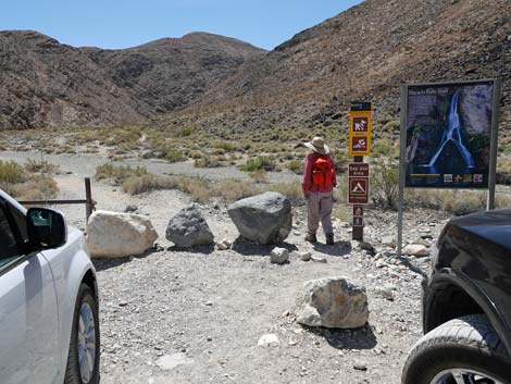 Hiker departing Darwin Falls Trailhead (view S) |
Table 1. Highway Coordinates Based on GPS Data (NAD27; UTM Zone 11S). Download Highway GPS Waypoints (*.gpx) file.
| Site # | Location | Latitude (N) | Longitude (W) | Easting | Northing | Elevation (ft) |
|---|---|---|---|---|---|---|
| 0766 | Zinc Hill Parking | 36.29672 | 117.51731 | 453550 | 4016783 | 3,683 |
| 0977 | Hwy 190 at Darwin Canyon Rd | 36.34005 | 117.47924 | 456992 | 4021571 | 2,100 |
| 0978 | Darwin Canyon Rd at Darwin Falls Rd | 36.32805 | 117.51352 | 453909 | 4020256 | 2,543 |
Happy Hiking! All distances, elevations, and other facts are approximate.
![]() ; Last updated 240324
; Last updated 240324
| Hiking Death Valley | Backroads | Hiking Around Las Vegas | Glossary | Copyright, Conditions, Disclaimer | Home |