Backroads Around Las Vegas, Basin and Range National Monument

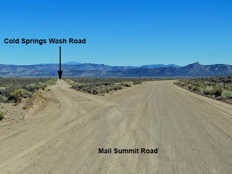 Mail Summit Road at Cold Springs Road (view E) |
Overview Cold Springs Road is a well-maintained dirt road that normally is suitable for 2WD vehicles. The road starts from Mail Summit Road near Murphy Gap (where Mail Summit Road runs through a gap in the Golden Gate Range) and runs northeast along Cold Springs Wash to Coal Valley West Road in the bottom of Coal Valley. This road provides access to the southwestern corner of Coal Valley, but primarily serves as a connector road between Mail Summit Road and Coal Valley West Road. |
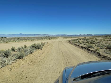 Cold Springs Road crossing a spur of Mail Summit Road (view NE) |
Watch Out Other than the standard warnings about driving in the desert, ...this road is pretty safe, but be sure that your vehicle is in good working condition, carry plenty of water (radiator and drinking), and pack a lunch. Always drive carefully; even though the road is well maintained, there are occasional hazards such as errant boulders in the roadway and mud after heavy rains. While out, please respect the land and the other people out there, and try to Leave No Trace of your passage. This road goes into remote areas, so be sure to bring the 10 Essentials. Cell phones don't work. |
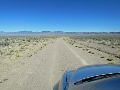
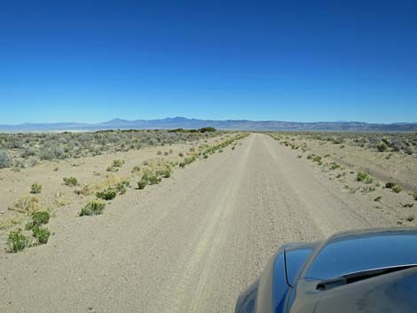 Cold Springs Road (view NE) |
Getting to the Road Cold Springs Road is located in the central part of Basin and Range National Monument, about 2.5 hours (135 miles) northeast of Las Vegas. From Las Vegas, drive north on Interstate-15 21 miles to Highway 93. Turn left onto Great Basin Highway (Hwy 93) and drive north past the towns of Alamo (95 miles from Las Vegas) and Ash Springs (102 miles) to the intersection of Highway 93 and Highway 318 (107 miles). Gasoline is available in Alamo, Ash Springs, Rachael, and Lund. Turn left onto Highway 318 and drive west then north for 9.4 miles to Mail Summit Road on the left. On Mail Summit Road, drive northwest 17.3 miles to a fork in the road where a side road Ys in from the right. Turn hard to the right onto Cold Springs Road. |
 |
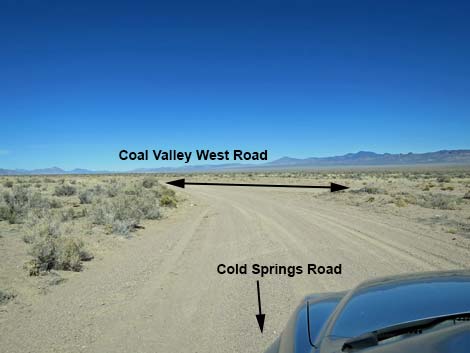
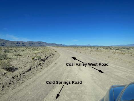
The Road From Mail Summit Road near Murphy Gap, Cold Springs Road (Table 1, Site 1570) runs northeast parallel to Cold Springs Wash down towards the bottom of Coal Valley. At about 4.8 miles out, Cold Springs Road merges with Coal Valley West Road (Site 1912), which merges from the right. |
 |
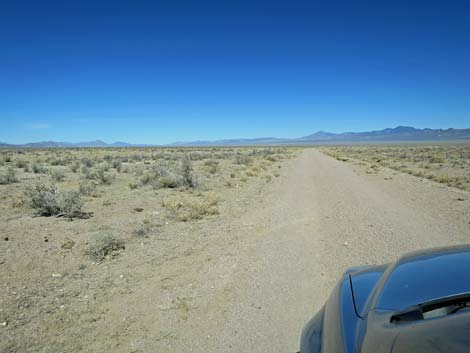 |
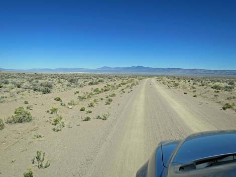
 Cold Springs Road approaching Coal Valley West Road (view NE) |
 Cold Springs Road approaching Coal Valley West Road (view NE) |
Table 1. Highway Coordinates and Distances based on GPS Data (NAD27). Download Highway GPS Waypoints (gpx) file.
| Wpt. | Location | Latitude (N) | Longitude (W) | Elevation (ft) | Point-to-Point Distance (mi) | Cumulative Distance (mi) |
|---|---|---|---|---|---|---|
| 1912 | Coal Valley Wt Rd at Cold Spr Rd | 37.82105 | 115.34238 | 5,099 | 0.00 | 0.00 |
| 1570 | Mail Summit Rd at Coal Valley W Rd | 37.79089 | 115.42029 | 5,733 | 4.83 | 4.83 |
Happy Hiking! All distances, elevations, and other facts are approximate.
![]() ; Last updated 240324
; Last updated 240324
| Basin and Range | Backroads | Hiking Around Las Vegas | Glossary | Copyright, Conditions, Disclaimer | Home |