Hiking Around Las Vegas, Sloan Canyon NCA
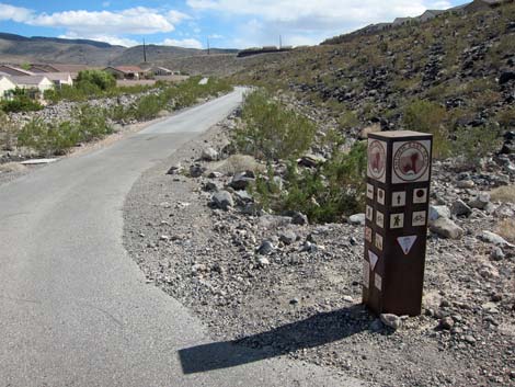 Shadow Canyon Trailhead; paved East Anthem Trail |
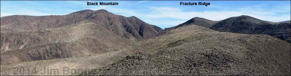
Overview The Fracture Ridge Route is a fairly strenuous hike in the Sloan Canyon National Conservation Area that climbs onto the crest of the North McCullough Range and provides grand views of the Las Vegas Valley and out over vast wildlands of southern Nevada and western Arizona. Paved access to the trailhead makes this an easy getaway from town into the black, volcanic mountains that rim the south edge of Las Vegas. These mountains seem to catch a lot of rain, making the Mojave Desert Scrub vegetation fairly robust and diverse. Link to map. |
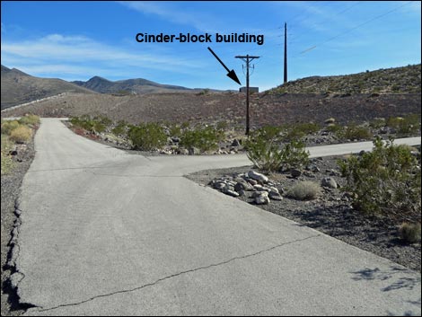 On paved East Anthem Trail, aim for small cinder-block building |
Watch Out Other than the standard warnings about hiking in the desert, ...this hike is fairly safe with no unusual hazards. Be careful at the summit, as the eastern scarp is quite steep. While hiking, please respect the land and the other people out there, and try to Leave No Trace of your passage. Also, even though this hike is short, be sure to bring what you need of the 10 Essentials. |
 Passing the small cinder-block building |
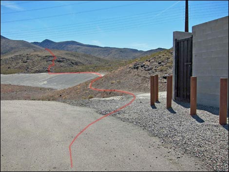
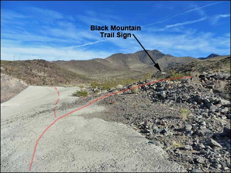
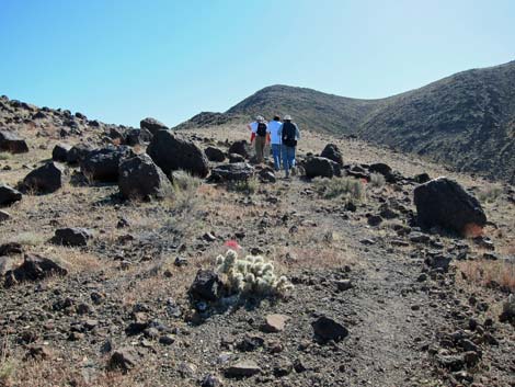
Getting to the Trailhead This hike is located in Sloan Canyon NCA, but it is accessed from urban neighborhoods in the Anthem area of Henderson, as described for the Shadow Canyon Trailhead. The Hike From the Shadow Canyon Trailhead (Table 1, Waypoint 01), the hike starts running southeast on the paved Anthem East Trail in a well landscaped gully bordered by houses. At a small cinder-block building atop a retention dam (Wpt. 04), the hike follows the Black Mountain Trail (BLM 404) on a dirt foot path around the back of the retention basin. |
 Atop the retention basin |
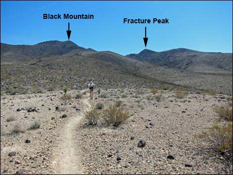
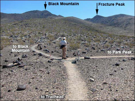
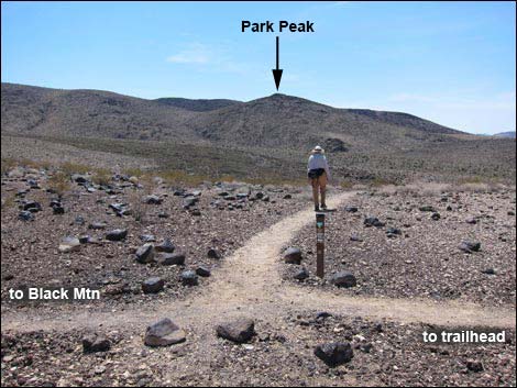
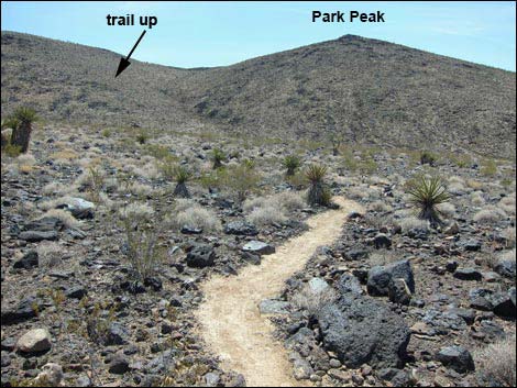
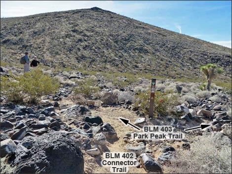
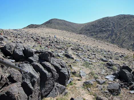
At about the middle of the top edge of the retention basin (Wpt. 06), the Black Mountain Trail turns right and heads into the wildlands. The trail climbs onto a low ridge and follows the ridgeline up to the southeast. Eventually the grade eases and the trail drops gradually into a broad saddle and a trail junction (Wpt. 07). Here, the Black Mountain Trail continues east up the ridgeline, while the Connector Trail (BLM 402) turns southwest and drops off the south side of the ridge. The hike follows the Connector Trail south across a broad valley to another trail junction (Wpt 08), this time with the Park Peak Loop Trail (BLM 403). The hike now follows the Park Peak Loop Trail to a saddle (Wpt. 09) atop the ridgeline to the south. For details of getting to this point, follow the links to descriptions of the Connector (BLM 402), Park Peak Loop (BLM 403), and Black Mountain (BLM 404) trails. |
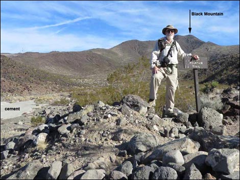 Black Mountain Trail sign |
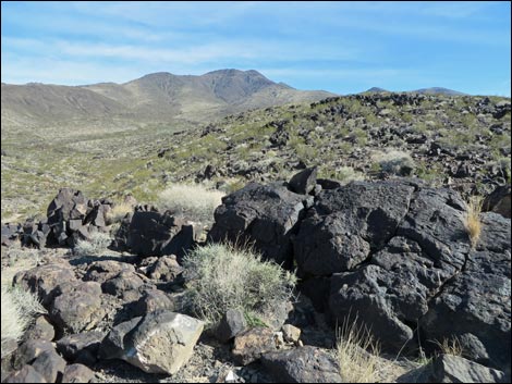
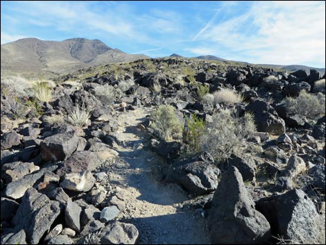
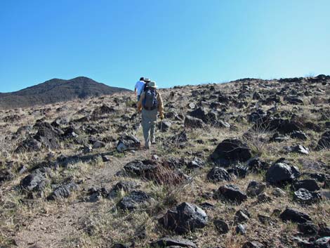
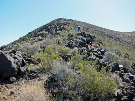
From the saddle on the ridgeline just east of Park Peak (Wpt. 09), this hike becomes a use-trail as it turns east to climb Fracture Ridge. There is no formal trail from the saddle, but hikers will find the use-trail. When coming back down, please stay on the ridgeline all the way back to this saddle (Wpt. 09) rather than shortcutting straight down the hillside. Continuing up, the ridge eventually narrows and steepens (Wpt. 33). Here the use-trail disappears and reappears among black boulders on the ridgeline (Class 2), but a plethora of cairns keep hikers on the narrow ridge. Eventually the use-trail crests onto the summit, and a faint use-trail (Wpt. 35) leads tantalizingly south along the crest of the range. A few more steps eastward lead to the summit (Wpt. 38). |
 Heading towards initial steep section |
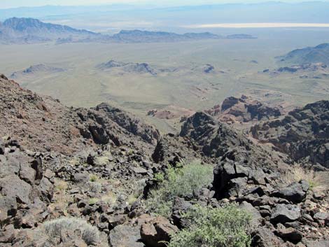
Views from the summit are grand and sweeping. Mt. Charleston and Red Rock Canyon can be seen in the distance beyond the urban Las Vegas area. The steep summit slopes of Black Mountain beg an off-trail assault on that summit, and the broad ridge to the south draws hikers on a faint trail (Wpt. 35) leading along the crest of the McCullough Range. To the east, the Eldorado Valley and mountains that stretch forever into Arizona. When ready, return to the trailhead by following your footprints in the dust back to the saddle (Wpt. 09) near Park Peak. Descend the Park Peak Trail to the trail junction at the bottom of the ridge (Wpt. 08), then as an alternative ending, consider using the Park Peak Loop Trail that runs along a broad ridge and reconnects with the main trail at the cinder-block building (Wpt. 04) atop the retention basin dam. |
 Trail passes through a boulder field |
 Hikers on gentle, open trail |
 Black Mountain Trail (BLM 404) at Park Peak Connector Trail (BLM 402) |
 Hiker turning right onto the Connector Trail (view SW) |
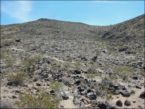
 Connector Trail crosses a broad valley (view south) |
 Connector Trail ends at the Park Peak Trail (BLM 403; view S) |
 Park Peak Trail starts up hillside (view SE) |
 One of several switchbacks on hillside (view E) |
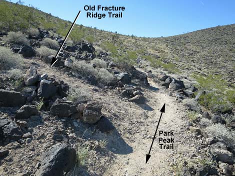 Park Peak Trail at Old Fracture Ridge (view SW). Don't go this way. |
 Old Fracture Ridge (view E from Park Peak Trail). Don't go this way. |
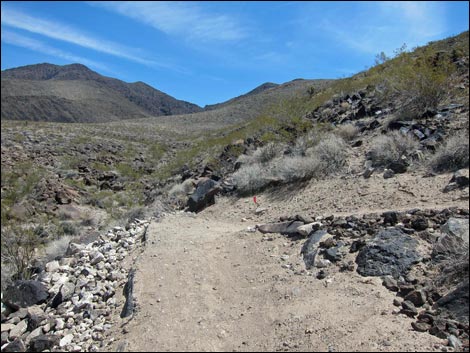
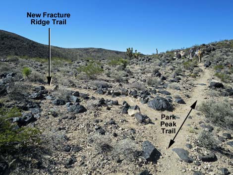
 Park Peak Trail at New Fracture Ridge (view SW) |
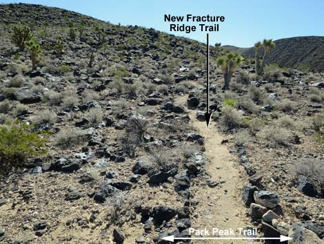
 Park Peak Trail at New Fracture Ridge (view SW) |
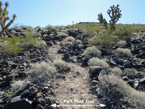
 Fracture Ridge (view E from Park Peak Trail) |
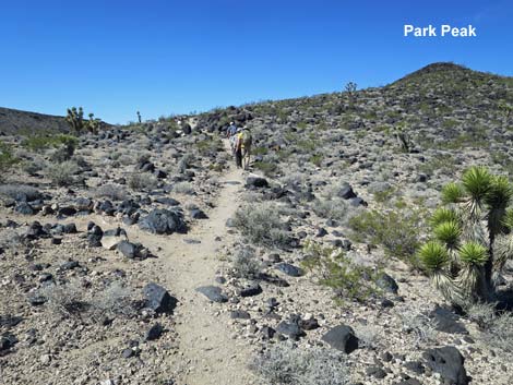
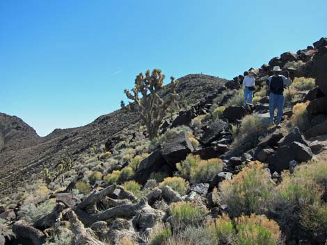
 Hikers on Fracture Ridge Trail (view E) |
 Open, gentle slopes |
 Open, rock-strewn slopes |
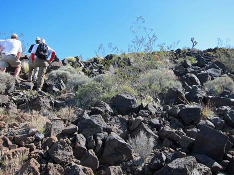
 Starting up the steep, rocky ridge |
 Hikers on steep, rocky ridge |
 Hikers on steep, rocky side of the ridge |
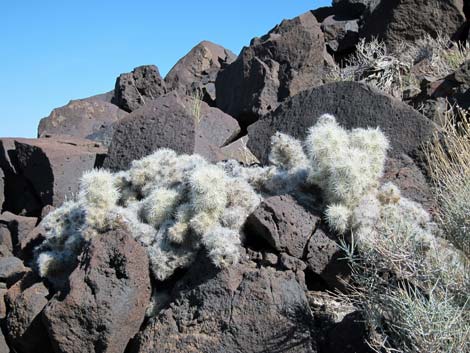 Blue Diamond Cholla on steep, rocky ridge |
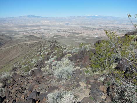 Mt. Charleston and Las Vegas (view NW from steep, rocky ridge) |
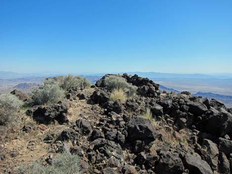 Summit (view E) |
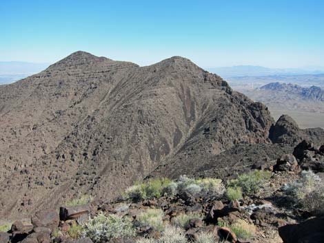 Black Mountain (view N from summit) |
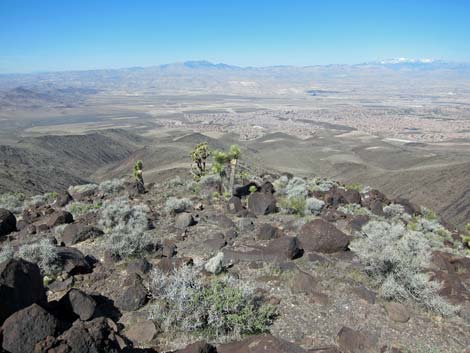 Mt. Charleston and Las Vegas (view NW from summit) |
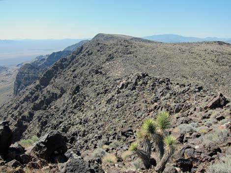 North McCullough Range (view S from summit) |
 Eldorado Valley and Arizona (view E from summit) |
 Cliffs below summit and Eldorado Valley (view E from summit) |
 Summit register |
Table 1. Hiking Coordinates and Distances based on GPS Data (NAD27; UTM Zone 11S). Download Hiking GPS Waypoints (*.gpx) file.
| Wpt. | Location | UTM Easting | UTM Northing | Elevation (ft) | Point-to-Point Distance (mi) | Cumulative Distance (mi) | Verified |
|---|---|---|---|---|---|---|---|
| 01 | Trailhead | 673133 | 3979357 | 2,966 | 0.00 | 0.00 | Yes |
| 02 | Trail Junction | 673277 | 3979000 | 2,976 | 0.26 | 0.26 | GPS |
| 03 | Trail Junction | 673415 | 3978839 | 3,021 | 0.14 | 0.40 | GPS |
| 04 | Trail Junction | 673476 | 3978746 | 3,052 | 0.10 | 0.50 | GPS |
| 05 | Trail Junction | 673582 | 3978631 | 3,086 | 0.10 | 0.60 | GPS |
| 06 | Top of Retention Basin | 673680 | 3978654 | 3,055 | 0.07 | 0.67 | GPS |
| 07 | Trail Junction | 674316 | 3978158 | 3,398 | 0.68 | 1.35 | GPS |
| 08 | Trail Junction | 674396 | 3977485 | 3,419 | 0.58 | 1.93 | GPS |
| 09 | Saddle | 674494 | 3977047 | 3,677 | 0.62 | 2.55 | GPS |
| 33 | Rocky Ridge Line | 675917 | 3976960 | 4,438 | 0.98 | 3.53 | GPS |
| 35 | Trail Junction | 676485 | 3976882 | 4,891 | 0.40 | 3.93 | GPS |
| 38 | Summit | 676505 | 3976890 | 4,907 | 0.02 | 3.95 | GPS |
| 01 | Trailhead | 673133 | 3979357 | 2,966 | 3.95 | 7.90 | Yes |
Happy Hiking! All distances, elevations, and other facts are approximate.
![]() ; Last updated 240330
; Last updated 240330
| Hiking Around Sloan Canyon | Hiking Around Las Vegas | Glossary | Copyright, Conditions, Disclaimer | Home |