World's Tallest Mojave Yucca
Hiking Around Las Vegas, Mojave National Preserve
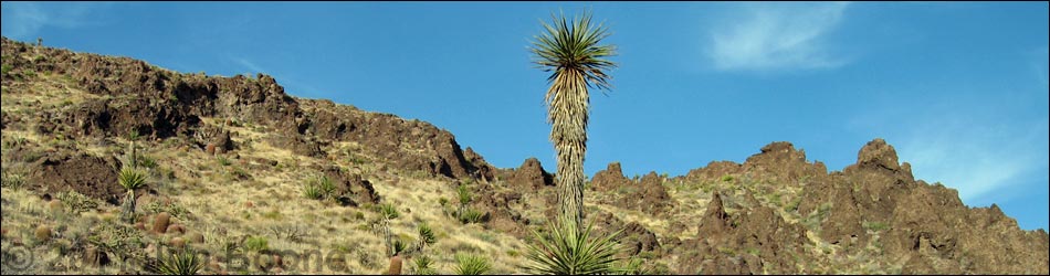
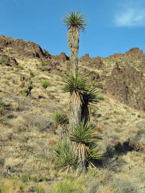
 Tallest yucca before it fell over (June 2006) |
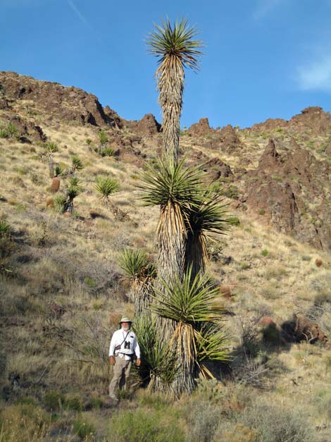
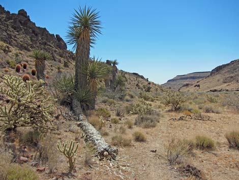
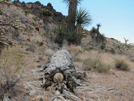
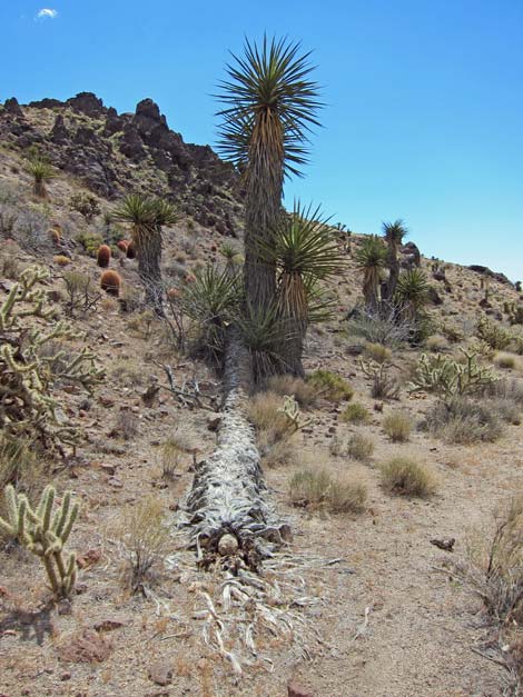
Overview Unfortunately, the World's Tallest Mojave Yucca fell over during the summer of 2008, so it now holds the record of bring the World's Longest Yucca. Although the tallest is gone, it is worth the walk to see the remaining unusually tall Mojave Yucca in the area. This easy route starts along Wild Horse Road near the Hole-in-the-Wall Visitor Center, runs north along the Barber Peak Loop Trail, drops into a broad wash, and follows the wash upstream for a total of 1 mile to the tall Mojave Yuccas. You can't miss them, but if you do, the wash runs up against cliffs and several high pour-overs just past the yuccas. For a somewhat longer hike, visit the tall yuccas as a detour from the Barber Peak Loop Trail or the Hole-in-the-Wall to Mid Hills Trail. Link to map. Watch Out Other than the standard warnings about hiking in the desert, ... this is a pretty safe hike, but watch for cactus and yuccas hiding along the route just waiting to surprise you. The route in the wash follows game trails, so be sure to watch for snakes in the bushes. While hiking, please respect the land and the other people out there, and try to Leave No Trace of your passage. Also, even though this is a short hike, be sure to bring what you need of the 10 Essentials. |
 Tallest yucca before it fell over (June 2006) |
Getting to the Trailhead This hike is located in the Mojave National Preserve, about 2 hours south of Las Vegas. From town, drive out to Hole-in-the-Wall Visitor Center, which is about 85 miles south of Las Vegas. From the Visitor Center Road, drive back out to Black Canyon Road, turn right and drive south for 0.25 miles to Wild Horse Road. Turn right onto the graded Wild Horse Road and drive west for almost 1.1 miles to the Wild Horse Trailhead parking area, which is on the north side of the road. Park here; this is the trailhead. |
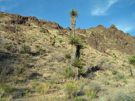
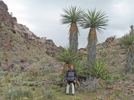
 World's Tallest Yucca (view S) |
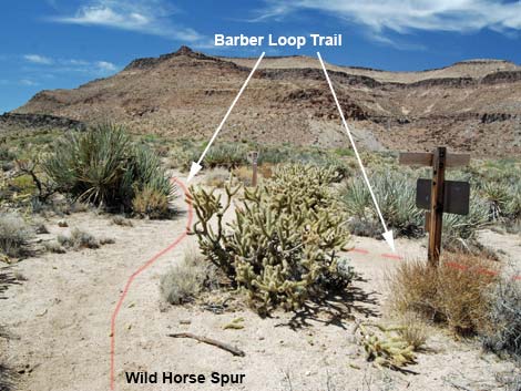
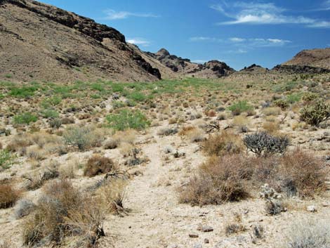
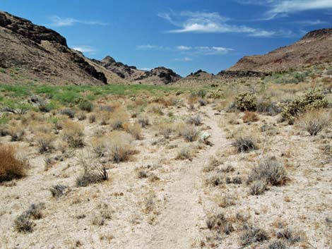
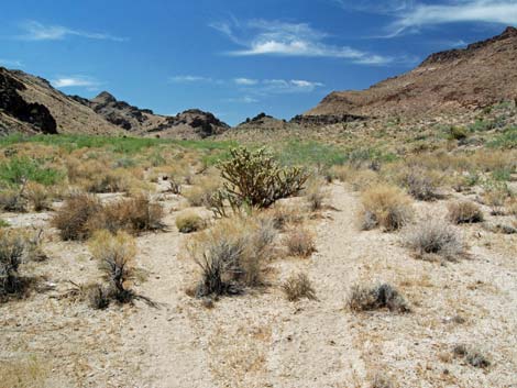
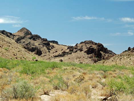
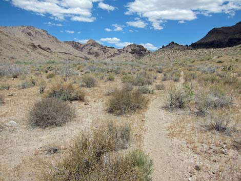
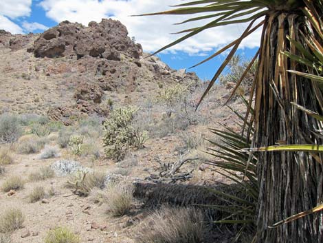
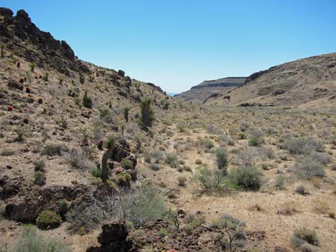
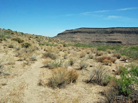
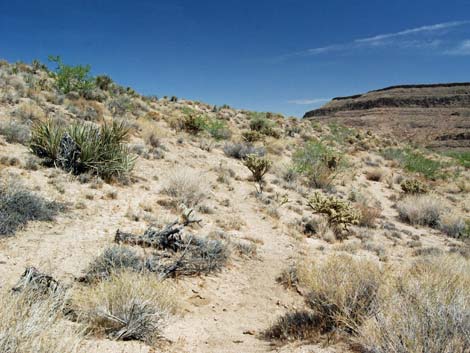
The Hike From the trailhead (Table 1, Waypoint 01), the trail runs northwest and up the gentle bajada heading for what appears to be a pass on the horizon. Vegetation on the flats is low-growing Mojave Desert Scrub with lots of tall Mojave Yucca, Buckhorn Cholla, and Silver Cholla. A fire burned the entire mountain across the wash to the west, which makes for an interesting comparison with this side. The trail runs north for 0.30 miles to a trail junction (Wpt. 02) where the trail meets the Barber Peak Loop Trail at a T-intersection. For details of the hike to this point, see the Wild Horse Spur Trail. From the trail junction, the Barber Peak Loop Trail runs north on a bench overlooking a broad sandy wash to the west. However, a few paces beyond the trail sign, there is a carsonite trail marker with a nature trail symbol sign and the number five. At this point, the Tall Yuccas Route turns left and heads over the edge of the hill following a cow trail, contouring across the hillside into the wash (Wpt. 03). |
 Tallest yucca after it fell over (left of hiker) |
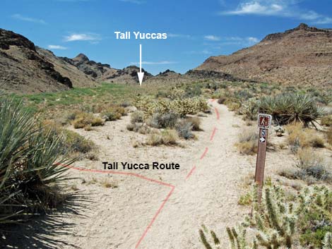
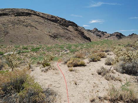
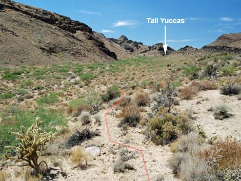
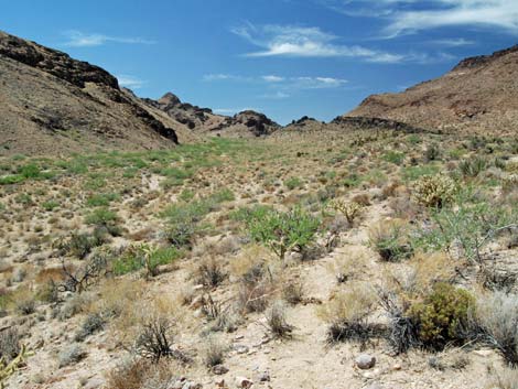
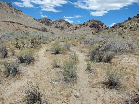
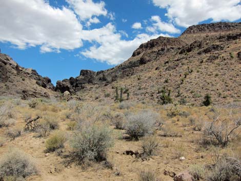
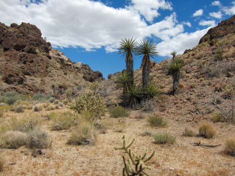
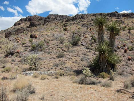
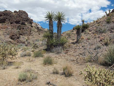
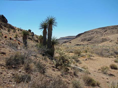
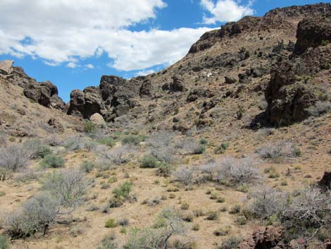
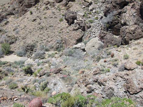
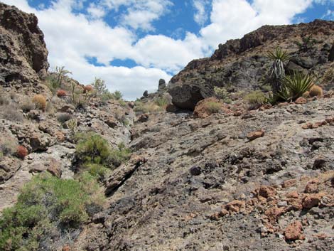
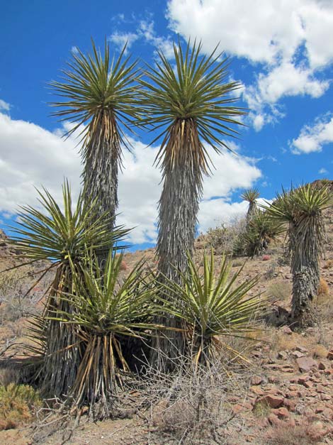
In the wash, the route runs upstream following cow trails and open sandy areas. When the canyon forks, look for the tall yuccas (Wpt. 04) against the hillside on the right side of the right fork. I have no idea why these specimens grew so tall. I've seen plenty of Mojave Yucca growing to about 15 feet tall, but these are extraordinary. Even the short yuccas here are extremely tall - they just look short in comparison to the taller specimens. The World's Tallest, ... well World's Longest, lies on the ground next to its comrades. For hikers continuing north on the Barber Peak Loop Trail, hike up the canyon to a high pour-over (Wpt. 05), then turn uphill and hike up the steep hillside to the east until reaching the Loop Trail (Wpt. 06). Otherwise, hikers should follow their footprints in the sand back to the trailhead. |
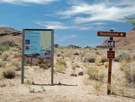 Wild Horse Trailhead signs (view N) |
 Arriving at Barber Peak Loop Trail (view N) |
 Route departs Barber Peak Loop just past intersection (view NW) |
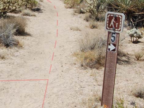 Route departs Barber Peak Loop at this sign (view NW) |
 Route starts over edge towards wash (view NW) |
 Route drops into wash (view NW) |
 |
 |
 Route follows cow trails (view NW) |
 Route follows cow trails (view NW) |
 |
 |
 Route follows cow trails (view NW) |
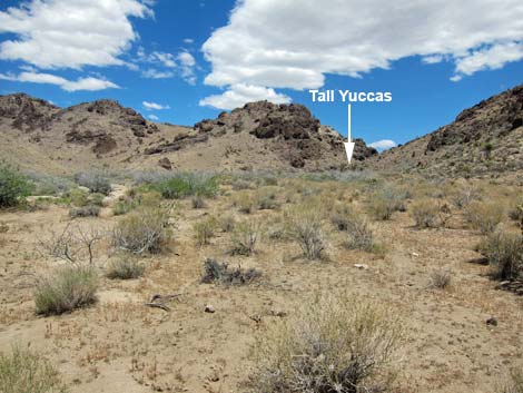 Tall yuccas are in a side canyon on right (view N) |
 Approaching tall yuccas (view NE) |
 Approaching tall yuccas (view NE) |
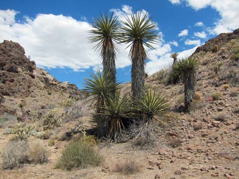 Tall yuccas (view NE) |
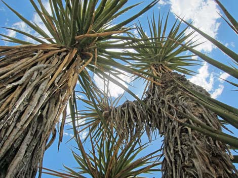
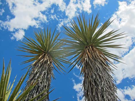 Tall yuccas (view up) |
 Longest yucca lies on the ground |
 Longest yucca lies on the ground |
 Longest yucca lies on the ground |
 Longest yucca lies on the ground |
 Tall yuccas (view NE) |
 Tall yuccas (view S) |
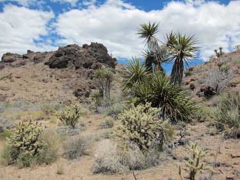 Neighbors of the Tall yuccas (view NE) |
 Neighbors of the Tall yuccas (view S) |
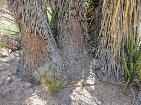 Hefty trunks of the Neighbors (view SE) |
 The neighbors are trying to keep up (view S) |
Tallest Yucca. Reconnecting with Barber Loop Trail Northbound
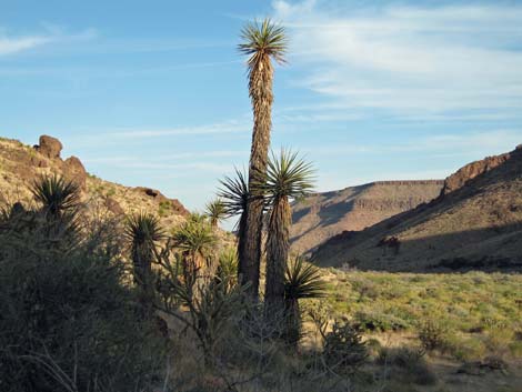
 Tall yuccas (view S from atop a crag in the wash) |
 Approaching narrows (view NE; note exit route on hillside) |
 Hillside above narrows (view down; it isn't as bad as it looks) |
 Hillside above narrows (view up; it isn't as bad as it looks) |
World's Tallest Yucca
 Tallest Yucca (2006) |
 Tallest Yucca (2006) |
 Longest and very tall Yuccas (2013) |
 Remaining very tall Yuccas (2013) |
Tallest Yucca. Returning to the Barber Loop Trail Southbound
 Cow trail begins to angle up across hillside (view SE) |
 Cow trail contours up across hillside (view SE) |
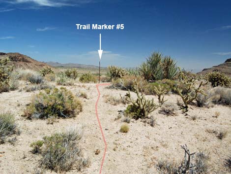 Cow trail arrives at Barber Loop Trail by Marker #5 (view SE) |
 More to come ... |
Table 1. Hiking Coordinates Based on GPS Data (NAD27; UTM Zone 11S). Download Hiking GPS Waypoints (*.gpx) file.
| Wpt. | Location | UTM Easting | UTM Northing | Elevation (ft) | Point-to-Point Distance (mi) | Cumulative Distance (mi) | Verified |
|---|---|---|---|---|---|---|---|
| 01 | Wild Horse Trailhead | 645309 | 3878101 | 4,199 | 0.00 | 0.00 | GPS |
| 02 | Barber Trail Junction | 645032 | 3878461 | 4,270 | 0.30 | 0.30 | GPS |
| 03 | Base of Hillside | 644915 | 3878563 | 4,274 | 0.10 | 0.40 | GPS |
| 04 | Tall Yuccas | 644300 | 3879256 | 4,367 | 0.63 | 1.03 | GPS |
| 05 | Base of Hillside - northbound | 644268 | 3879421 | 4,415 | . | . | GPS |
| 06 | Join Barber Trail - northbound | 644330 | 3879441 | 4,514 | . | . | GPS |
| 01 | Wild Horse Trailhead | 645309 | 3878101 | 4,199 | 1.03 | 2.06 | GPS |
Happy Hiking! All distances, elevations, and other facts are approximate.
![]() ; Last updated 240329
; Last updated 240329
| Hiking Around Mojave Preserve | Hiking Around Las Vegas | Glossary | Copyright, Conditions, Disclaimer | Home |