
 |
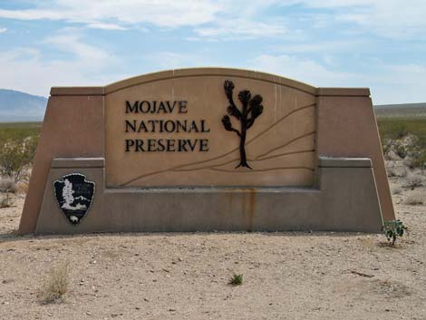
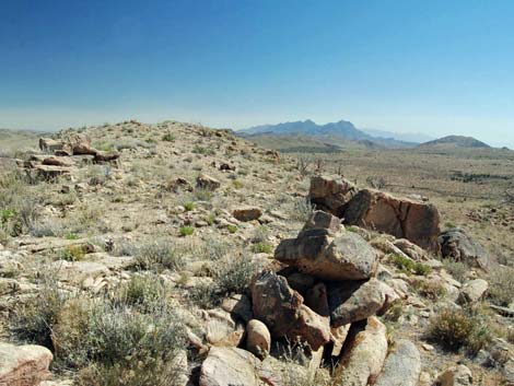
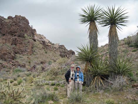
OVERVIEW Mojave National Preserve, established in 1994 and administered by the U.S. National Park Service, is located in California, due south of Las Vegas. The primary feature of the park is the 1.6 million acres of grand desert vistas and the solitude. The preserve includes 800,000 acres of designated wilderness (50% of the preserve!), three major mountain ranges, 600-foot-high sand dunes, jumbled piles of rocks, volcanic cinder cones with lava flows, dry lakes, wildflowers, and history. Activities in the preserve primarily are orientated around sightseeing (nature and history), camping, day hiking, and off-highway driving (not off-road driving). People also backpack, picnic, ride horses and bikes, and hunt in the preserve. Guided tours are available of Mitchell Caverns, a California State Park within the preserve. Mojave National Preserve is located in the Mojave Desert, with biotic influences from the Great Basin Desert (at higher elevations) and Sonoran Desert (at lower elevations in the eastern portion of the preserve). Elevations range from about 800 feet on the western dry lakebeds to about 8,000 feet in the northern mountains. |
 |
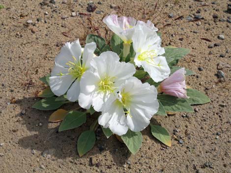
The lower-elevation desert-scrub areas are dominated by scattered Creosote Bush, White Bursage, a few lizards, Jack Rabbits, and Desert Tortoises; the middle elevations are floristically diverse with many species of shrubs, forbs, cacti, and lots of Eastern Joshua Trees; and the higher-elevation areas are dominated by Pinyon-Juniper Woodlands with Big Sagebrush, Mule Deer, and Bighorn Sheep. The variation in topography and soils makes for a mix of habitats and a diverse flora and fauna. Bugs unique to Mitchell Caverns add an interesting flavor to the biotic diversity. Temperatures in lower-elevation areas are similar to those in Las Vegas: daytime summer temps exceed 100 degrees, while daytime winter temps can stay below freezing. Higher-elevation areas are cooler than lower-elevation areas, but summer temps still exceed 90 degrees, and they get snowed-in during winter. Because of the high summer temps, hiking generally is best during October through May. Afternoon thunderstorms are common during July and August, creating flash flood and lightning hazards. Inside Mitchell Caverns it remains about 65 degrees all year. Services inside the preserve are limited. This is wild country, so bring what you need. Outside the preserve, Baker, Searchlight, Fenner, and a few other small towns provide the usual small-town services, including gasoline. The Cima Store, used to provide groceries, snacks, and drinks, but it seems to be permanently closed. |
 |
GETTING TO MOJAVE NATIONAL PRESERVE Link to map. Mojave National Preserve is located about 2 hours south of Las Vegas. From Las Vegas, drive south on Interstate-15 into California. About 25 miles past the California-Nevada state line, exit the interstate onto Cima Road (Table 1, Site 0830). Top off your gas tank here, then drive south for 17.6 miles to T-intersection with Cima-Kelso Road. Turn right onto Cima-Kelso Road and drive west for about 0.1 miles to Cima (Site 0831), which is in the center of Mojave National Preserve. Cima town used to have a phone, a post office, and the Cima Store, but it seems to be a ghost town now. From the T-intersection in Cima, continue south on the Cima-Kelso Road for 18.7 miles to the Kelso Depot Visitor Center (Site 1269). |
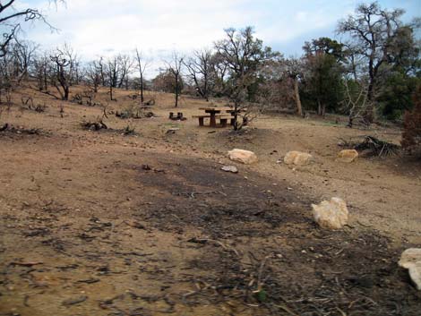
 Cima Dome from Mid Hills Campground after the fire (view NW) |
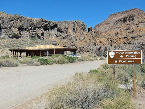
Along the Cima-Kelso Road, 4.6 miles south of Cima, note the paved Cedar Canyon Road turnoff (Site 0832). This is the road to Mid Hills, Hole-in-the-Wall, and Mitchell Caverns. Turn left onto Cedar Canyon Road (which becomes graded dirt) and drive east for 6.3 miles to Black Canyon Road (Site 0833). Turn right onto Black Canyon Road and drive south on the graded dirt road, passing the Mid Hills turnoff, for 9.5 miles to the Hole-in-the-Wall Visitor Center Road (Site 0836), which is just beyond Hole-in-the-Wall Campground. Turn right onto the Visitor Center Road and drive west for 0.3 miles to the Visitor Center (Site 0502). This is about 80 miles from Las Vegas. For Mitchell Caverns, continue south on Black Canyon Road from the Hole-in-the-Wall turnoff for 9.7 miles to at T-intersection with Essex Road (0845). Turn right and drive west on Essex Road for 6.1 miles to the end of the road (Site 0503). |
 |
HOURS The preserve is always open. The Kelso Depot Visitor Center is open 9 AM to 5 PM, Friday to Tuesday [closed Wednesday and Thursday due to federal sequester cuts; May 2013]. The Hole-in-the-Wall Visitor Center is open seasonally when park staff or volunteers are available (i.e., when not on patrol or responding to emergencies) [Saturday 9-4; May 2013]. The Mitchell Caverns Visitor Center is Friday, Saturday, and Sunday (plus holiday Mondays). ENTRANCE FEES Mojave National Preserve has no entrance fees. Mitchell Caverns has a day-use fee of $10/vehicle, and cave tours cost $10 for adults; kids (16 and younger) and seniors cost $5. |
 Mid Hills Campground |
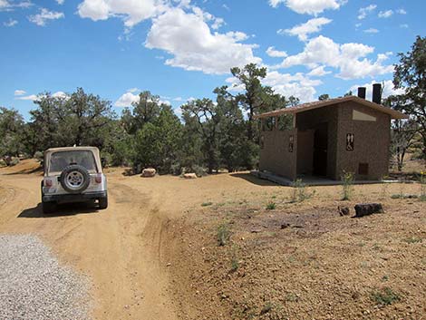
CAMPING Car camping is permitted in three developed campgrounds and in some 300 traditionally used campsites located throughout the Preserve. The three campgrounds (Hole-in-the-Wall, Mid Hills, and Mitchell Caverns) are located in the central portion of the preserve. Hole-in-the-Wall Campground (35 sites) is located at 4,400 feet in open desert with no shade, but with expansive views of the desert and sculptured volcanic mountains. Mid Hills Campground (26 sites) is located at 5,600 feet in a pinyon-juniper forest that gets snowed-in during winter. Mid Hills Campground burned during the Hackberry Fire in June, 2005. Most of the trees burned, but several patches of trees remain that provide shade and shelter from the wind. There are a few sites with grand vistas to the northwest. Mitchell Caverns (6 sites) is located high on the side of a steep ridge (4,300 feet elevation) with no shade, but with fantastic views of the desert to the east. There are no RV hookups in the preserve. |
 Same Mid Hills campsite after Hackberry Fire (April 2006) |
Traditionally used, dispersed campsites are undeveloped spots along backroads where people have camped for years (i.e., these have, at the least, a bare-dirt parking area and a fire ring). Dispersed camping is allowed at some 300 campsites throughout the preserve, but not along paved roads, not in day-use areas, not within 0.25 miles of water sources, and not in Mitchell Caverns State Park. There are no facilities (i.e., no water, restrooms, or picnic tables) and no camping fees at the dispersed campsites. Do not drive over bushes, expand the parking areas, or make new campsites. The park has inventoried more than 300 traditional campsites, so if you try to make a new one, they will know about it. People use dispersed campsites to get away from it all, so given a choice, always be considerate and camp away from other campers; this preserves everyone's tranquility and solitude. Backcountry camping is basically unregulated. Backpackers can camp anywhere in designated backcountry, which is defined as any land more than 0.5 miles from a road (except no camping within 0.25 miles water sources). Backcountry permits are not required. Don't camp in washes if flash floods are possible. No wood fires. Practice Leave-No-Trace techniques. |
 Kelso Depot Visitor Center |
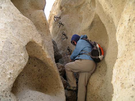
HIKING PERMITS None. HISTORY Native Americans. Native Americans lived in the area for thousands of years, and evidence of their use can be found throughout the preserve (all archeological resources are protected). Mojave Road. This Native American trade route was used by settlers during the westward expansion. During the 1860s, the U.S. Army established forts along the road to protect travelers on what had become an important route across the desert, and remnants of the outposts can still be found. The Mojave Road crosses the preserve from Paiute Springs in the east to Soda Lake in the west, but most of it requires a 4WD vehicle. The graded Cedar Canyon Road runs on part of this historical route. |
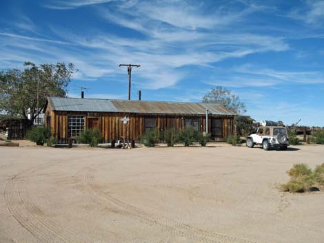 Cima Store |
Kelso Depot. This once-fancy railroad depot was built by the Union Pacific Railroad in 1924 to service steam locomotives. This is now one of only two remaining railroad depots built with Spanish-style architecture. The Park Service has restored the depot building for a Visitor Center, and a concession operates the cafe. Hole-in-the-Wall. This geologically interesting volcanic area is said to have been used as an outlaw hideout during the late 1800s. The name, they say, comes from a resemblance to Butch Cassidy's Hole-in-the-Wall hideout in Wyoming. The area now includes a campground and a visitor center. |
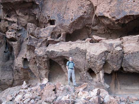
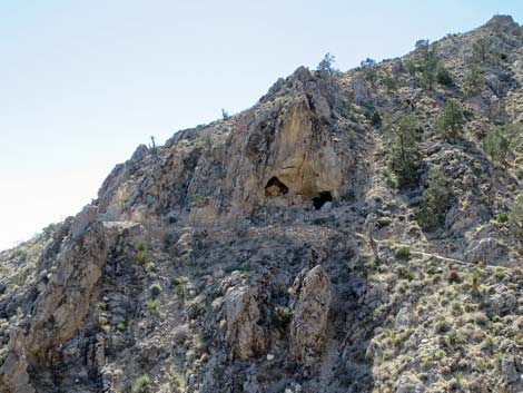 Mitchell Caverns: entrance to the cave. |
MITCHELL CAVERNS Mitchell Caverns is a California State Park established to protect limestone caves. The caves are elaborately decorated with familiar cave formations (e.g., stalactites, stalagmites, columns, and flowstone), plus some unusual formations (e.g., shields and straws). The caves are closed except for guided tours led by park staff. Tour fees are based on age: Adults $10, Seniors $5, kids $5. Tours are limited to 15 people. The tours are about 1.5 miles long and last for about 1.5 hours. Tours are not strenuous, but the ground is uneven and not fully accessible due to stairs and narrow passages inside the cave. The caverns are open all year, but only three days per week (Friday, Saturday, and Sunday, plus holiday Mondays). Tours fill early, so make reservations in advance. Visit the Mitchell Caverns website for details and current information. Mitchell Caverns has 6, campsites available through the Reserve California website. The camp has running water and flush toilets. No RV hookups. There are two short, above-ground hiking trails near the campground. |
 |
WATCH OUT Other than the standard warning about hiking in the desert, ...this is a pretty safe place to hike. However, there are many old mines, and while mines are inherently interesting, it is never safe to enter old mines. Ranchers still run cattle in the preserve, so stay clear of the bulls. The preserve is open for hunting. It is always open season for something, but be especially careful during the later-half of October when rifle-hunters are looking for deer. Park rangers recommend that hikers stay out of the woods during rifle season. |
 |
During July and August, afternoon thunderstorms are common and create lightning hazards in exposed places and on ridges. Afternoon thunderstorms also cause flash floods. Summer temperatures can exceed 115 degrees, and there is little (if any) shade, so mid-day hiking should be avoided. In case of emergency, contact any ranger or call 911. Cell phones work in some parts of park, but don't count on it. Without cell service, it might be best to drive out of the preserve to get service along I-15 or I-40. People still live in the preserve, so you might knock on someone's door if it is a true life-and-death emergency; otherwise, don't bother them. If you can cell service, call the Interagency Communications Center at (909) 383-5651, which is a centralized dispatch center. |
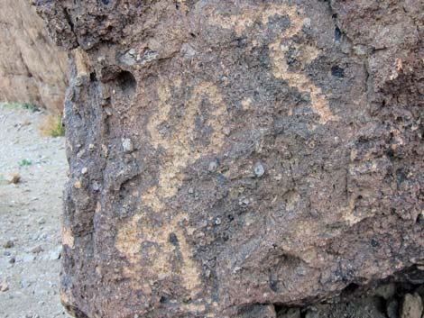 Mojave Preserve petroglyphs |
SOME RULES AND REGULATIONS Resource Protection. The preserve is regulated like a National Park. Do not collect or otherwise disturb plants, rocks, fossils, historical objects, or artifacts, and do not feed or disturb the wildlife. Collecting wood for campfires, including dead and down wood, is prohibited. Pets. Unlike most Park Service areas, pets are allowed in the preserve, including backcountry trails. Pets must be on a leash (six-foot maximum) and under physical control at all times, even in the campground. Never leave a pet or child in a vehicle because temperatures inside a car parked in the sun can exceed 120 degrees in just a few minutes, quickly cooking them. |
 |
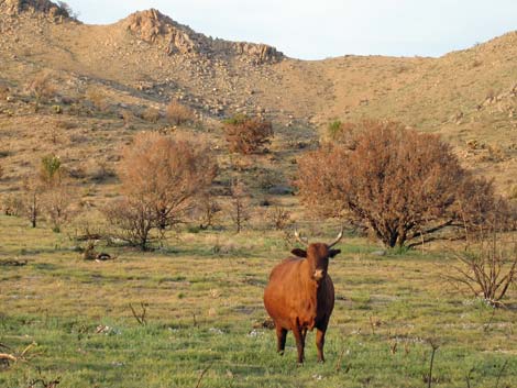
Vehicles and Bicycles. Motor vehicles must stay on designated roads. Bicycles can be used on roads and on trails that once were roads (i.e., closed roads), but not on other trails. No driving or biking in wilderness areas. All motorized vehicles must be street legal. Private Property. Private inholdings are scattered throughout the preserve. Please respect property rights and get permission before entering private property. Ranchers use preserve lands to graze cattle, but these lands are still open to the public (don't disturb cattle, fences, or water tanks). Leave gates the way you found them (either open or closed). |
 |
Hunting. The California Department of Fish and Game regulates hunting in the preserve. A state license is required. Shooting is only allowed while legally hunting; plinking and target practice are illegal. Weapons must be unloaded before entering campgrounds. Discharging weapons within 150 yards of any structure or campground is illegal. MORE INFORMATION For more information on these topics, visit the Mojave National Preserve website. Park maps are available online. |
 |
 |
 Hole in the Wall Visitor Center |
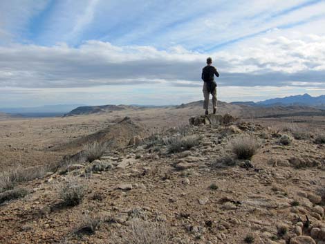 Grand vistas |
 Cima Dome |
 Cave formation inside Mitchell Caverns |
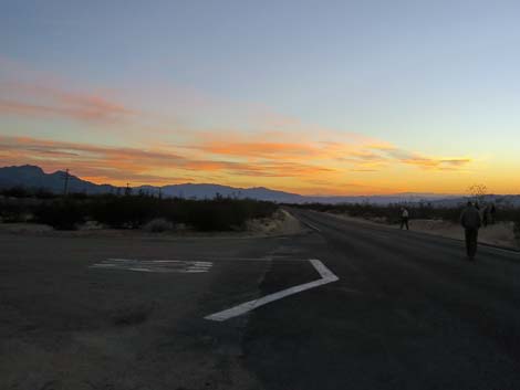 Sunset over Mojave National Preserve (view SW) |
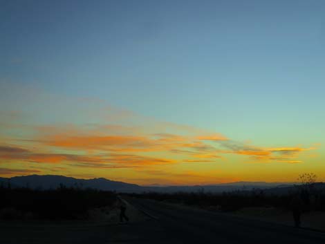 Sunset over Mojave National Preserve (view SW) |
Table 1. Highway Coordinates (NAD27; UTM Zone 11S). Download Highway GPS Waypoints (*.gpx) file.
| Site # | Location | UTM Easting | UTM Northing | Latitude (°N) | Longitude (°W) | Elevation (feet) |
|---|---|---|---|---|---|---|
| 0121 | Kelso Dunes Parking | 618950 | 3861679 | 34.89233 | 115.69824 | 2,789 |
| 0502 | Hole-in-the-Wall VC Parking | 646417 | 3878715 | 35.04231 | 115.39474 | 4,260 |
| 0503 | Mitchell Caverns parking | 635906 | 3867560 | 34.94322 | 115.51176 | 4,314 |
| 0537 | Mid Hills Campground | 642635 | 3888357 | 35.12976 | 115.43453 | 5,585 |
| 0830 | Hwy I-15 at Cima Rd | 620348 | 3922872 | 35.44382 | 115.67401 | 3,727 |
| 0831 | Kelso-Cima Rd at Cima | 636506 | 3900100 | 35.23647 | 115.49983 | 4,176 |
| 0832 | Cima-Kelso Rd at Cedar Cyn Rd | 635862 | 3893399 | 35.17615 | 115.50802 | 3,727 |
| 0833 | Cedar Cyn Rd at Black Cyn Rd | 644718 | 3893322 | 35.17422 | 115.41081 | 5,007 |
| 0840 | I-15 at Baker | 584386 | 3902446 | 35.26336 | 116.07229 | 951 |
| 0842 | Aiken Mine Rd at Lava Tube Park | 613562 | 3897252 | 35.21365 | 115.75232 | 3,560 |
| 0845 | Black Canyon Rd at Essex Rd | 644029 | 3863839 | 34.90855 | 115.42348 | 2,887 |
| 0847 | Cima Rd at Teutonia Peak TH | 631660 | 3908878 | 35.31625 | 115.55167 | 5,043 |
| 1008 | I-15 at Nipton Rd | 640822 | 3926437 | 35.47327 | 115.44788 | 3,432 |
| 1260 | NY Mts Rd at Caruthers Rd | 655000 | 3898274 | 35.21732 | 115.29701 | 5,397 |
| 1264 | Nipton Rd at Ivanpah Rd | 646206 | 3924856 | 35.45824 | 115.38885 | 2,747 |
| 1265 | Ivanpah Rd at Morning Star Rd | 647345 | 3919904 | 35.41344 | 115.37719 | 2,837 |
| 1269 | Kelso Visitor Center | 623051 | 3875074 | 35.01260 | 115.65139 | 2,133 |
| 1470 | Cedar Cyn Rd at Ivanpah Rd | 665583 | 3888405 | 35.12668 | 115.18277 | 4,083 |
| 1474 | Essex Road at I-40 | 653704 | 3852069 | 34.80104 | 115.31978 | 2,044 |
| 1475 | Ivanpah Rd at Mojave Road | 665257 | 3889716 | 35.13855 | 115.18608 | 4,104 |
| 1476 | Kelso-Cima Rd at Macedonia Cyn | 632168 | 3885015 | 35.10107 | 115.54991 | 3,103 |
| 1477 | I-40 at Kelbaker Road | 621084 | 3842709 | 34.72106 | 115.67762 | 2,953 |
Happy hiking! All distances, elevations, and other facts are approximate.
![]() ; Last updated 241129
; Last updated 241129
| Birding Around Las Vegas | Hiking Around Las Vegas | Glossary | Copyright, Conditions, Disclaimer | Home |