Hiking Around Las Vegas, Mojave National Preserve, Providence Mountains State Park
 Hiking out to the caverns (view S) |
Overview The hike into Mitchell Caverns is a great 2-hour ranger-guided nature walk. The trail runs out an easy 0.5 miles from the Mitchell Caverns Visitor Center to the entrance to the caves. The tour then goes underground for about an hour to see and learn about the interesting, unusual, and well-preserved cave formations. The park is open all year, but only on Fridays, Saturday, and Sundays (plus holiday Mondays) The park is closed weekly Monday through Thursday, plus Christmas and New Year's Day. Tour fees are based on age, ranging up to $10 per adult. Tours are twice per day and limited to 15 people. For information on reservations, visit the Providence Mountains State Park website. For more information, download the Providence Mountains brochure (1.2mb PDF). |
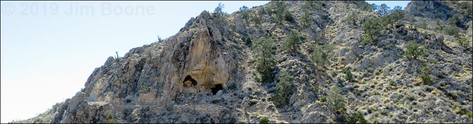
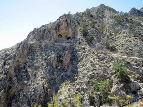
 The eyes of the mountain (view S) |
Watch Out Other than the standard warnings about hiking in the desert, ...this is a pretty safe hike, but be careful on the trail and watch your head in the cave. There are stairs and tight places inside the cave. While hiking, please respect the land and the other people out there, and try to Leave No Trace of your passage. Also, this is a short, guided hike, so just bring what you need of the 10 Essentials. |
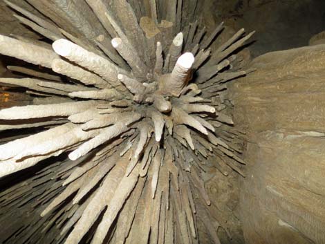
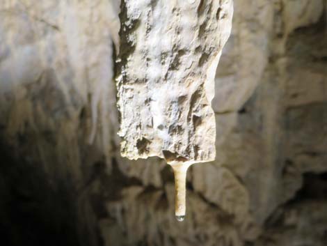
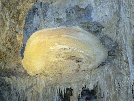
 Cave shield and stalactites |
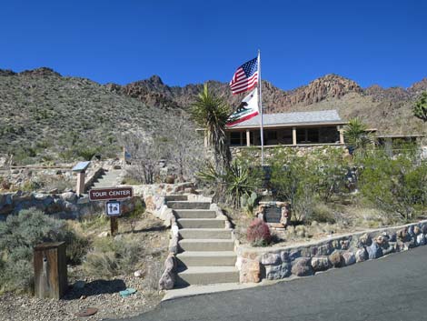
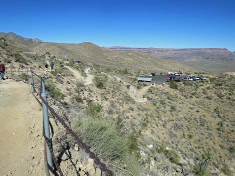
Getting to the Trailhead This hike is located in Mojave National Preserve, about 2.5 hours south of Las Vegas. From town, drive out to Mojave National Preserve and then to the Hole-in-the-Wall Visitor Center (Table 1, Site 0502), which is about 85 miles from Las Vegas. From the Visitor Center turnoff on Black Canyon Road, drive south for 9.7 miles to a T-intersection with the paved Essex Road (Site 0845). Turn right and drive west for 6.1 miles to the end of the road (Site 0503). Park in the large parking area by the campground or the small parking area by the Mitchell Caverns Visitor Center. Park here; this is the trailhead. |
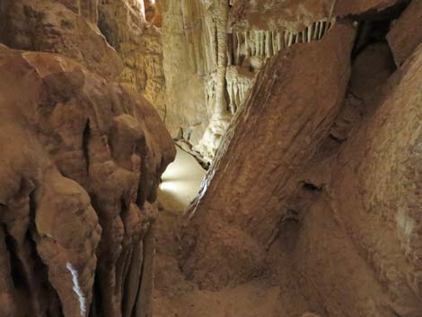
 A tight spot |
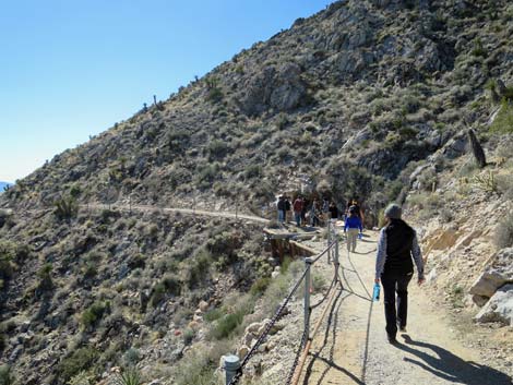
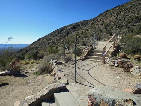
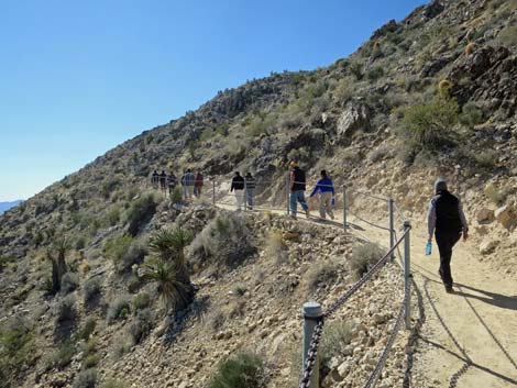
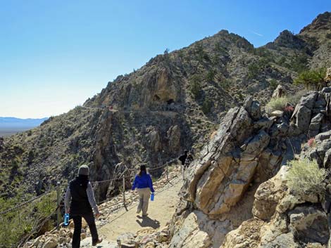
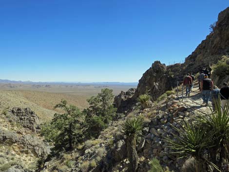
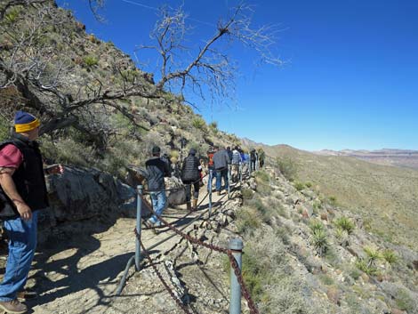
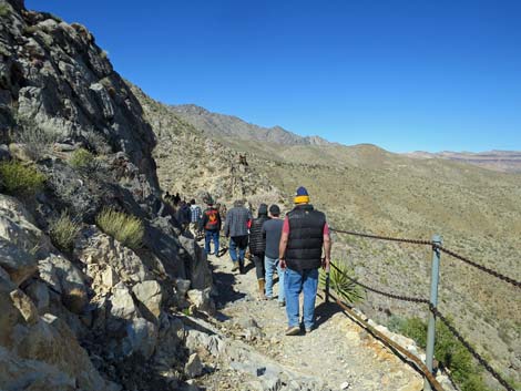
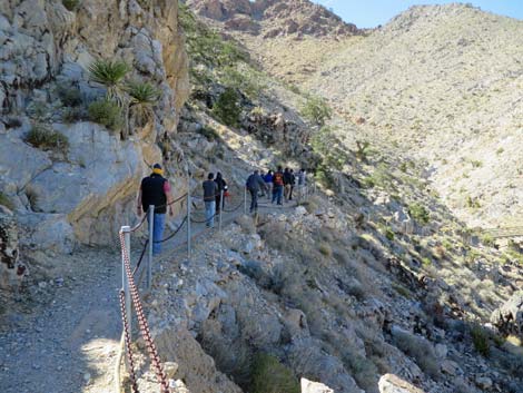
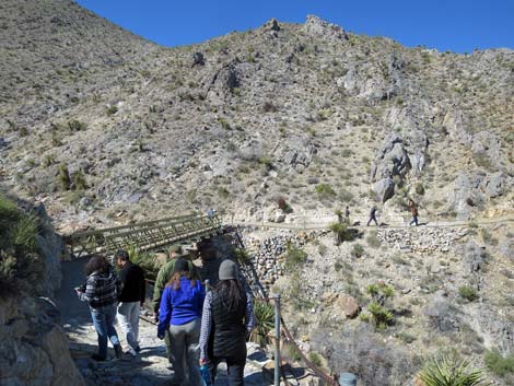
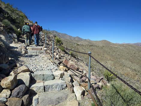
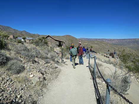
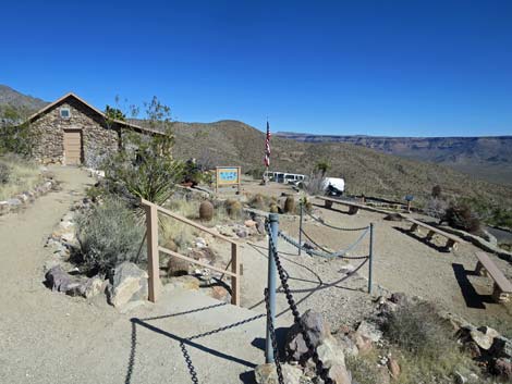
The Hike Join the tour on the outside patio of the Mitchell Caverns Visitor Center (Table 2, Waypoint 1) by the flagpole. The ranger will give an orientation talk explaining the geologic history of the area and how the caves formed, explaining that there are actually two limestone caves (El Pakiva and Tecopa) that are now linked with a man-made tunnel. They talk about human history and use of the cave, including use by prehistoric, historic, and modern peoples. Rangers also talk about the wildlife (including unique species) in and around the caves. After the talk, the ranger leads the group south on the well-maintained trail across the hillside towards the caverns. |
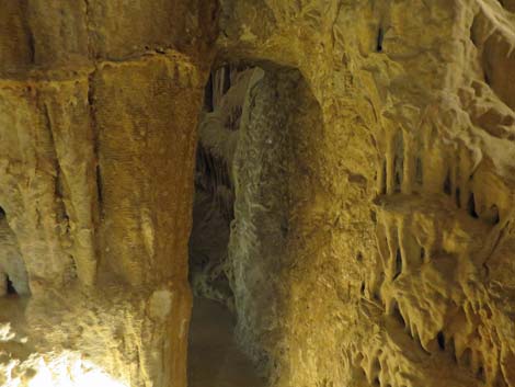
 Don't bump your head! |
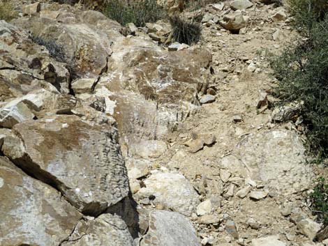
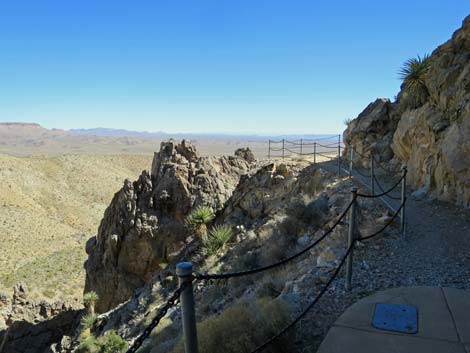
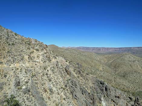
The vegetation along the trail is relatively lush, higher-elevation Mojave Desert Scrub with creosote bush, Mojave Yucca, cactus, and other species. The elevation is high enough that Juniper trees survive in the canyon at the mouth of the cave. The rocks along the trail are limestone and dolomite, but higher up, the rocks are volcanic. The limestone generally was laid down as flat layers of deep-ocean sediment, but a volcano pushed up through the layers, melting and tilting the limestone. The dark-colored peaks above the trail are the remains of the volcano. There are good views of the contact between these two types of rock along the trail. The rangers will fill in details of the geologic history. |
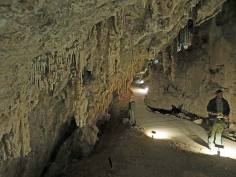
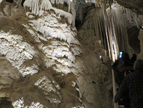
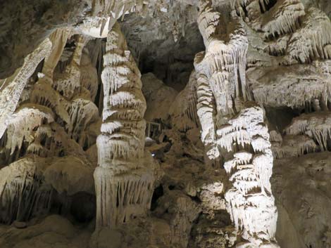 Large columns |
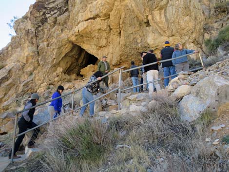
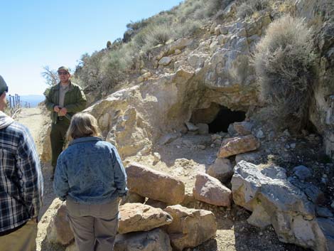
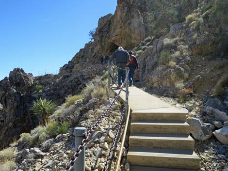
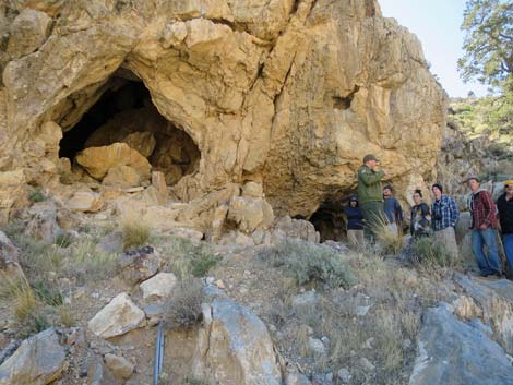
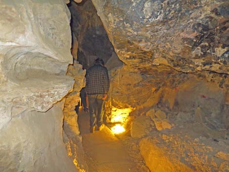
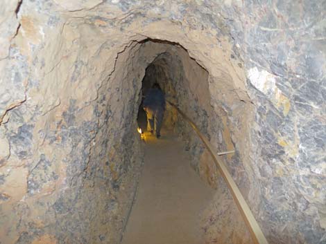
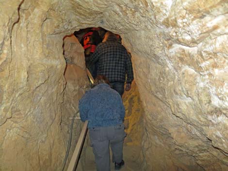
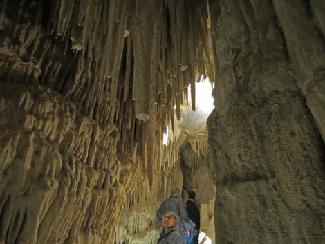
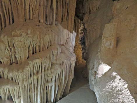
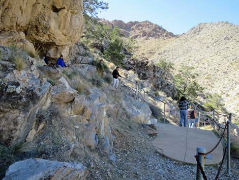
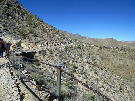
Just before getting to the cave, the trail rounds a little ridge where there is a great view of "the eyes of the mountain," the double opening of El Pakiva cave. Just a few steps beyond the curve, visitors can see the remains of an old cave on the uphill side of the trail. This cave might have been part of El Pakiva cave, but here the roof collapsed, and the walls completely eroded away. All that remain are formations that made up the floor, including the concentric rings of several columns and some flowstone. With the orientation talk and several brief stops along the way, it took our group about 1 hour to get from the ranger station to the cave entrance (Wpt. 2). Inside the cave, the trail is paved and easy, but there are some stairs and narrow parts, so watch your head; the trail is not fully accessible. |
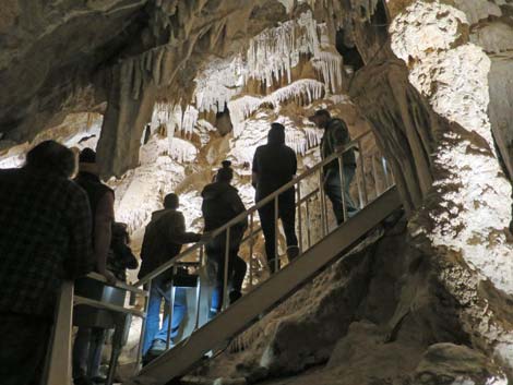 |
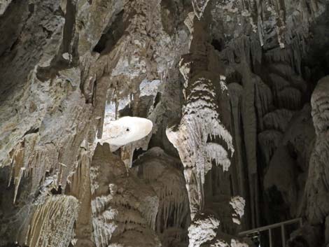
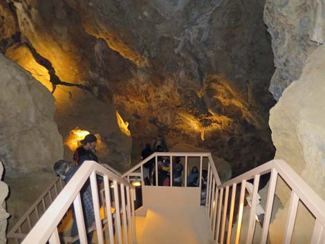
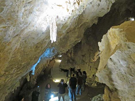
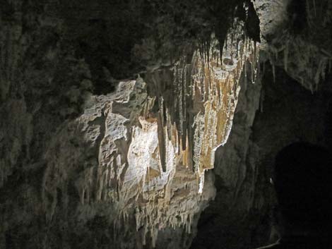
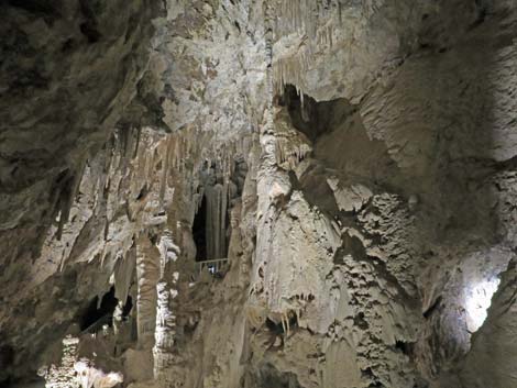
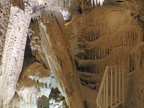
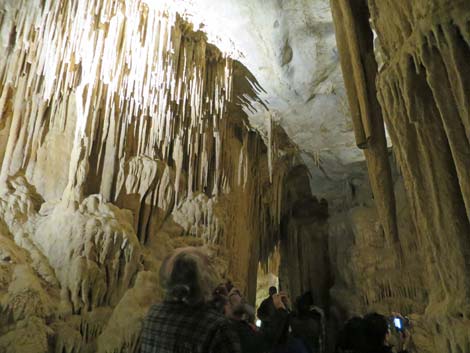
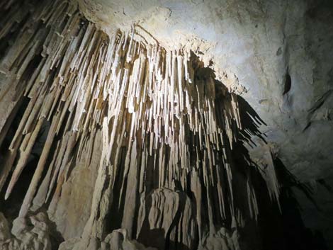
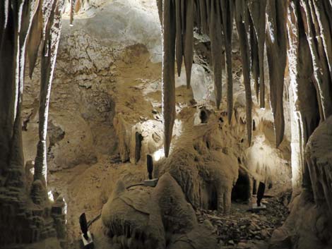
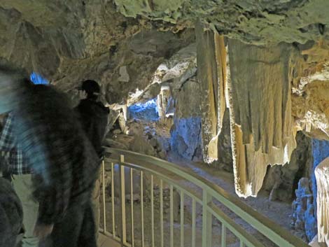
The cave formations are spectacular with many stalactites, stalagmites, and columns as would be expected, but there are also many "erratic" formations including cave shields, straws, popcorn, and other formations that grow against gravity. The rangers use lighting to spotlight and highlight various formations. Interesting animals live inside this cave and nowhere else on earth. Unique animals include the cave stinkbug and cave pseudoscorpion. Many other creatures use the cave too, including Townsend's Big-eared Bats (a species of concern). These cute little bats have ears that are about 1 inch long (on a 4-inch body), and they can roll up their ears to keep them warm while sleeping. |
The Hike
 Approaching the Ranger Station; trail on stairs left (view W) |
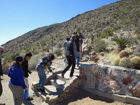
 Stairs to begin the trail to the cave (view S) |
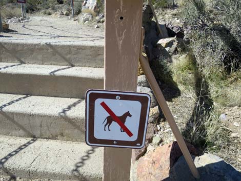 Note: no dogs on trail or in the cave) |
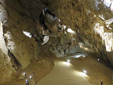
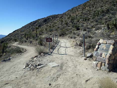 Trail to the cave is not open for general hiking (view S) |
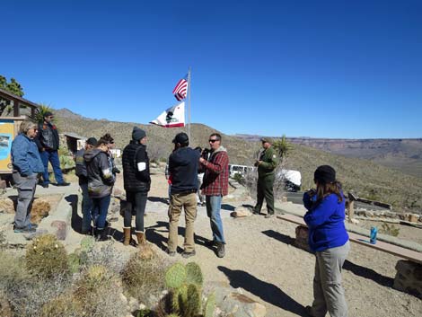 Hikers gather up outside the Ranger Station (view N) |
 Hikers starting on the trail to the cave (view S) |
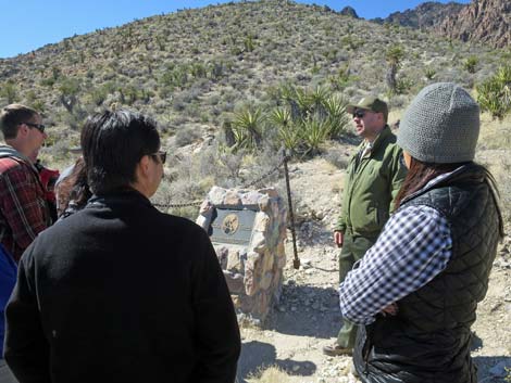 First stop along the tour: info about Jack and Ida Mitchell (view SW) |
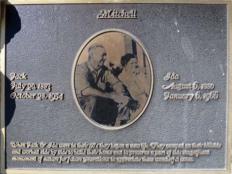 Plaque honoring the memory of Jack and Ida Mitchell (view SW) |
 Trail to the cave is fairly level (view S) |
Trail to the cave (view S) |
 Ranger speaking about an old mine (view S) |
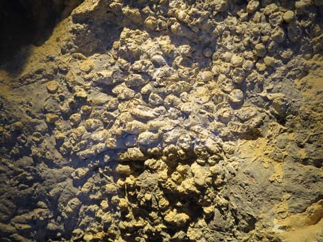
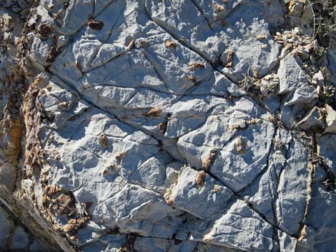 Fossils in the limestone rock |
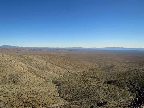 Grand scenery from the trail (view E) |
 First view of the cave entrance from the trail (view S) |
 Eyes in the mountain |
 Ranger speaking again about trail-side geology (view SW) |
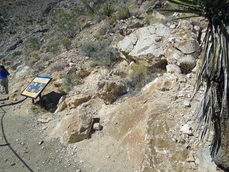 Outcrop along trail is an old cave (view W) |
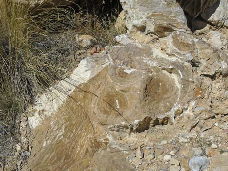 Old cave formations exposed along the trail (view N) |
 Old cave formations exposed along the trail (view N) |
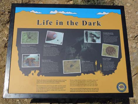 Information sign about creatures living in the cave (view N) |
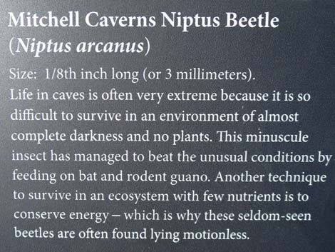 Mitchell Caverns Niptus Beetle (Niptus arcanus) |
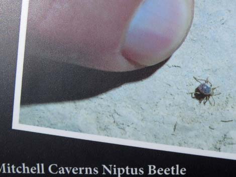 Mitchell Caverns Niptus Beetle (Niptus arcanus) |
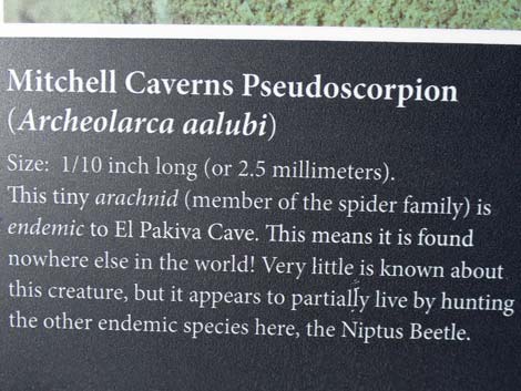 Mitchell Caverns Pseudoscorpion (Archeolarca aalbui) |
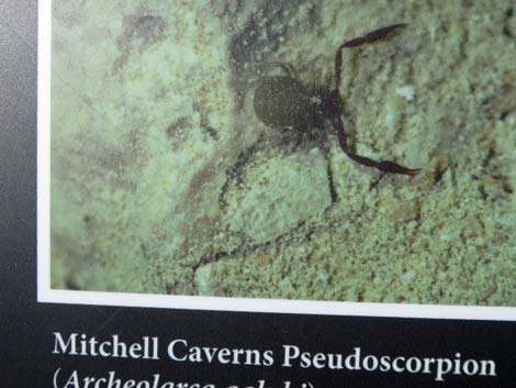 Mitchell Caverns Pseudoscorpion (Archeolarca aalbui) |
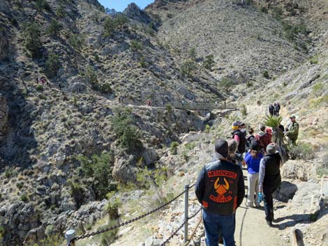
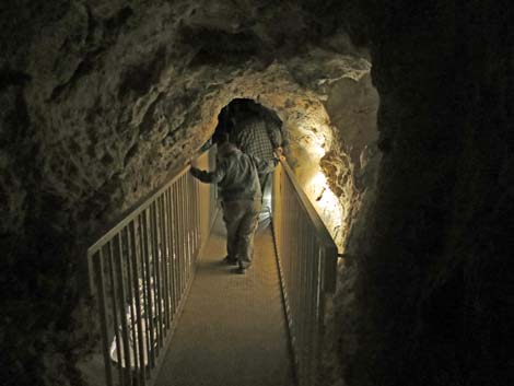
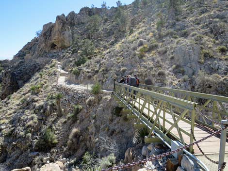 Bridge across chasm leads towards the cave (view S) |
 Grand scenery and some pinyon pines (view SE) |
 Stairs lead up towards cave entrance (view S) |
 Fork in trail: straight is the return from cave exit (view S) |
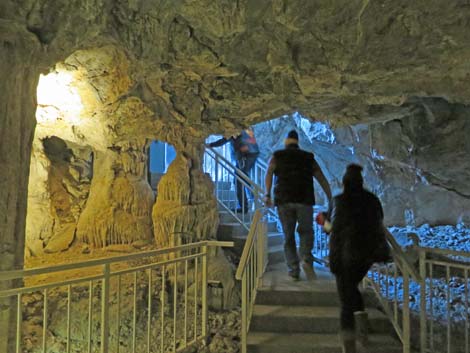
Stairs into the cave (view SW) |
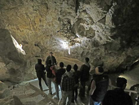
 Ranger giving final instructions before entering cave (view W) |
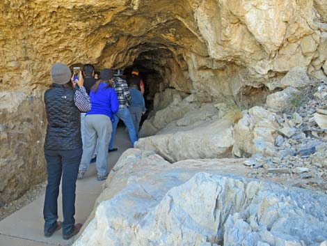 Hikers finally entering the cave (view W) |
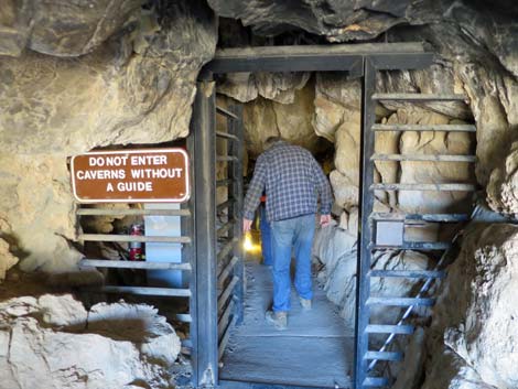 The cave has a gate to keep vandals out (view W) |
 |
 |
 |
 |
 |
 |
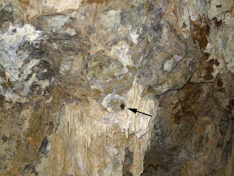 Small bat sleeping inside the cave |
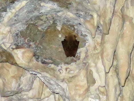 Small bat sleeping inside the cave |
 |
 |
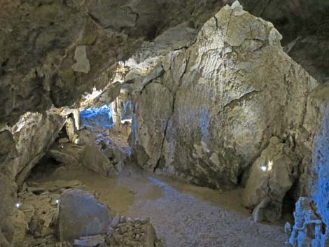
 The cave is wet and still growing |
 The cave is wet and still growing |
|
 |
|
|
 |
 |
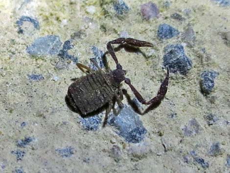 A live Mitchell Caverns Pseudoscorpion (Archeolarca aalbui) |
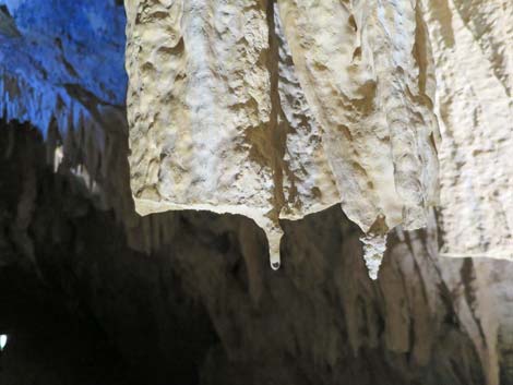
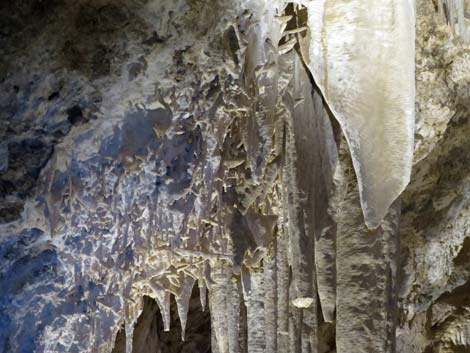 Cave bacon and other formations |
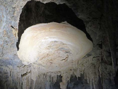 Cave shield |
 Cave shield |
 Cave popcorn |
 Bridge over the "bottomless pit" |
 The bottom of the "bottomless pit" |
 Tunnel that was dug to connect the two caves |
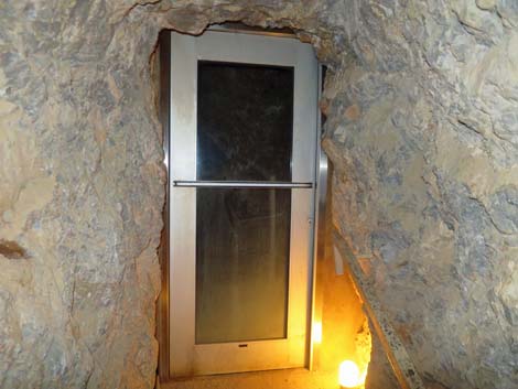 Door that forms an air-lock between the two caves |
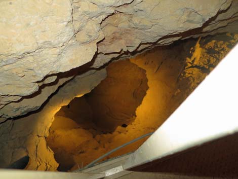
 End of the tunnel |
 |
 |
 |
 |
 Cave formations |
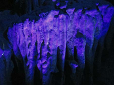 Cave formations under black light |
 |
 |
I hope they don't break off and fall while I'm here! |
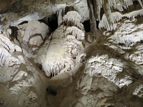
 Cave formations |
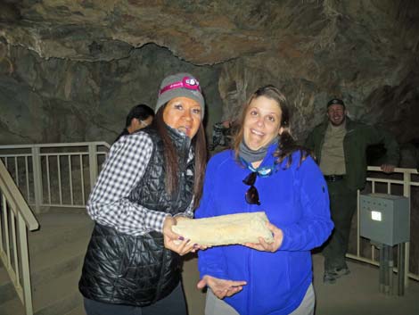 Passing around a piece of a broken cave formation |
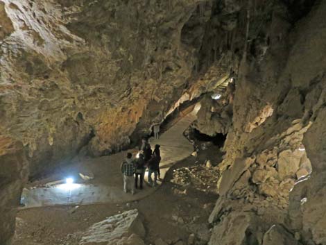
 Natural exit from the cave in the distance |
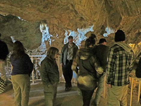 Final chat from the Ranger while inside the cave |
 Natural exit from the cave |
 Hikers on stairs that lead to the exit gate |
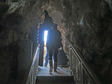 Hikers passing through the exit gate |
 Above ground, hikers return towards the cave entrance (view N) |
 Hikers returning towards the cave entrance (view N) |
 Hikers approaching the cave entrance (view NW) |
 Hikers collecting items left at the cave entrance (view NW) |
 From the cave, it looks like a long way back (view N) |
 Returning to the bridge (view N) |
 Climbing stone stairs (view N) |
 The Ranger Station is getting closer (view N) |
 The Ranger Station is getting closer (view N) |
 Hikers returning to the Ranger Station (view N) |
 Returning to the trailhead (view N) |
 More to come ... |
Table 1. Highway Coordinates (NAD27; UTM Zone 11S). Download Highway GPS Waypoints (*.gpx) file.
| Site | Location | Latitude (°N) | Longitude (°W) | UTM Easting | UTM Northing | Elevation (feet) | Verified |
|---|---|---|---|---|---|---|---|
| 0502 | Hole-in-the-Wall Visitor Center | 35.04221 | 115.39490 | 646403 | 3878704 | 4,260 | Yes |
| 0503 | Mitchell Caverns parking area | 34.94341 | 115.51171 | 635911 | 3867581 | 4,314 | Yes |
| 0836 | Black Cyn Rd at Hole-in-the-Wall Rd | 35.04185 | 115.38989 | 646860 | 3878671 | 4,213 | Yes |
| 0845 | Essex Rd at Black Canyon Rd | 34.90858 | 115.42343 | 644034 | 3863842 | 2,887 | Yes |
Table 2. Hiking Coordinates Based on GPS Data (NAD27; UTM Zone 11S). Download Hiking GPS Waypoints (*.gpx) file.
| Wpt. | Location | Easting | Northing | Elevation (ft) | Verified |
|---|---|---|---|---|---|
| 01 | Ranger station Trailhead | 635837 | 3867590 | 4,300 | GPS |
| 02 | Cave entrance | 635890 | 3867100 | 4,300 | GPS |
Happy Hiking! All distances, elevations, and other facts are approximate.
![]() ; Last updated 240329
; Last updated 240329
| Hiking Around Mojave Preserve | Hiking Around Las Vegas | Glossary | Copyright, Conditions, Disclaimer | Home |