Hiking Around Las Vegas, Gold Butte National Monument
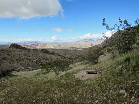
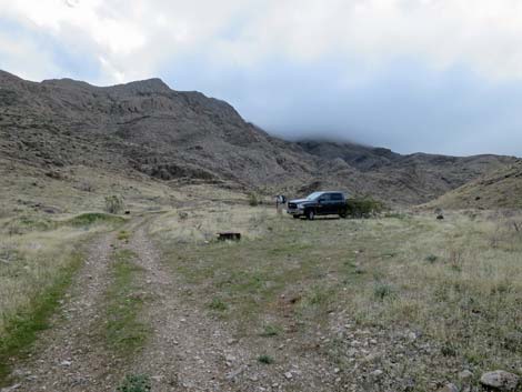 Trailhead parking for regular vehicles (view SE) Trailhead parking for regular vehicles (view SE) |
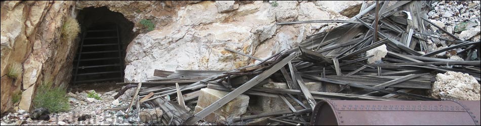
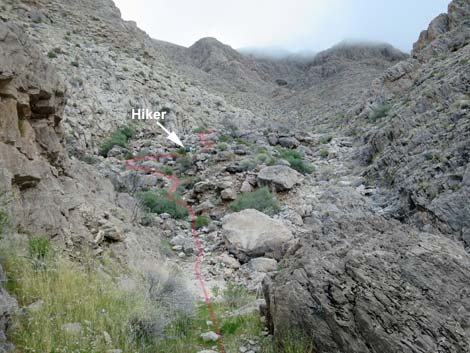
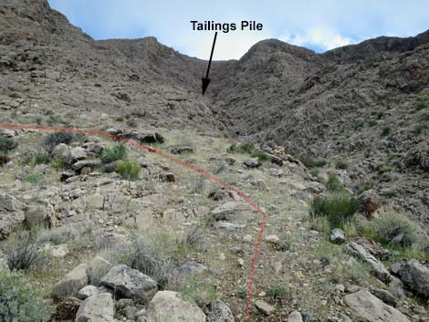
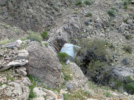
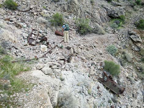
Overview Tramp was one of the major copper mines in the Gold Butte region, but little seems to be known about it. A 1916 mineral report says that a small carload of ore was removed and assayed at 24% copper, but the size of the mine and the amount of material removed suggests that much more ore was collected. Another account mentions that mules hauled water up to the mine and ore back down. Recorded copper production in the district (three mines) was about 75 tons, mostly taken before 1932 (probably mostly before 1918), with mining ending in 1956. Interesting mining debris remain in the area, but the mine entrance was grated in 2019. The 1-mile hike to Tramp Mine starts at the last good place to park regular high-clearance vehicles. The mine road is followed to the site of a mine camp at the end of the road (0.4 miles out). From there, a steep mining trail runs up the canyon until switchbacking steeply up the hillside to the base of the tailings pile in a gully. The mining trail crosses the gully and climbs steeply along cliffs to the mine entrance, a rather stout 0.9 miles out. Mine debris remain at the trailhead and along the trail, outside the mine, and inside the mine. Link to hiking map. |
 Metal and wooden mining debris at the trailhead (view SE) |
Watch Out Other than the standard warnings about hiking in the desert, ... this hike is pretty safe, but it is steep and always be careful when high enough to fall and get hurt. The mine openings have been grated, so don't plan on going deep. This is a wild and remote area without services of any kind (no restrooms, no water, no gas, no food). Bring what you need to survive. Be prepared and be self-reliant. BLM rangers occasionally patrol the area. Someone will find you eventually if you stay on a main road, but be prepared to survive alone for a day or two. Cell phones work sporadically in the area. While out, please respect the land and the other people out there, and try to Leave No Trace of your passage. Also, this is a remote area, so be sure to bring the 10 Essentials. Be sure to leave mining debris and other things as you find them -- future generations of hikers will thank you. |
 Hiker starting up the mine road (view SE) |
Getting to the Trailhead This hike is located out in Gold Butte National Monument at the northeast end of Lake Mead, about 3 hours northeast of Las Vegas in a wild, remote, and scenic area. From town, drive out to Gold Butte National Monument. From Whitney Pocket, continue south on the unpaved Gold Butte Road for 3.9 miles to Mud Wash North Road on the right. Turn onto Mud Wash North Road and drive southwest 3.2 miles to Mud Wash Road. Turn left onto Mud Wash Road and drive southeast (up and out of the wash) for 0.4 miles to a fork. When the main road bends left, stay straight onto Tramp Mine Road. Continue south on Tramp Mine Road for 3.9 or 4.3 miles, depending on the type of vehicle being driven. Tramp Mine Road can also be accessed from unpaved Gold Butte Road and Mud Wash Road when driving down past Devils Throat, in which case Tramp Mine Road is about 2.1 miles west of Devils Throat. |
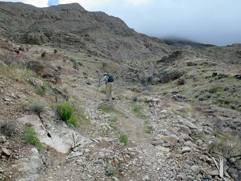
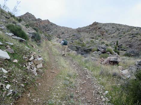
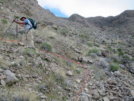
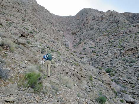
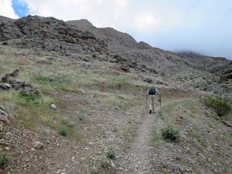 Hiker passing last place to turn around a small vehicle (view SE) |
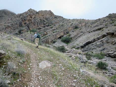
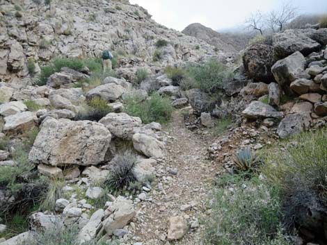
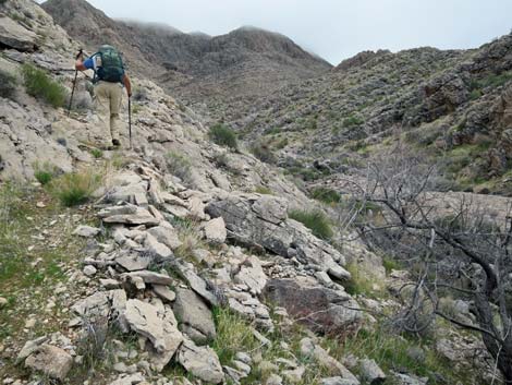
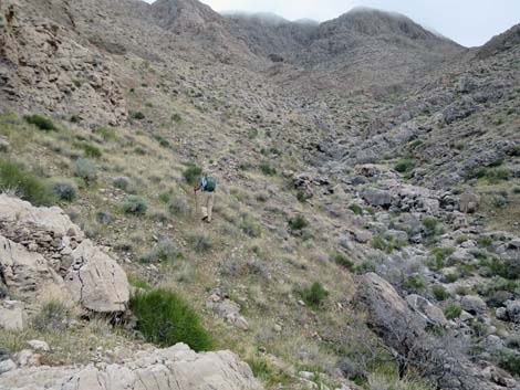
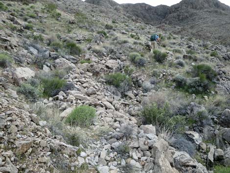
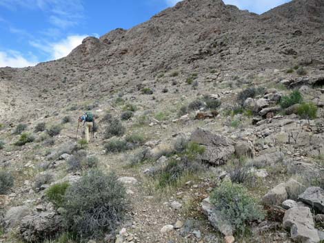
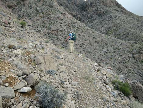
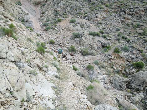
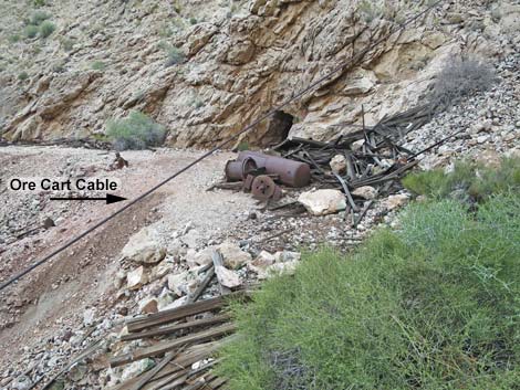
The Hike From the trailhead parking for regular vehicles (Table 1, Waypoint 01), the hike continues up Tramp Mine Road. In about 280 yards, hikers can see why it is useful to park back on open, flat terrain. Speaking from experience, this is a difficult place to turn around a stock jeep. Continuing, the steep, narrow, and rocky road runs along the hillside above a rocky canyon bottom. Hikers eventually arrive at the end of the road (Wpt. 02), which apparently was a camp of some sort, or at least a place for machinery; perhaps this was the bottom of the cable-car line (cable remains up near the mine). From the end of the road (Wpt. 02), the trail follows along the north edge of the rocky canyon bottom. The trail winds through boulders and eventually climbs onto the north side of the canyon to avoid the rocks and washouts. |
 End of the road for regular vehicles (view SE) |
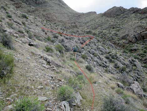
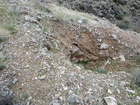
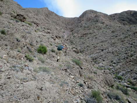
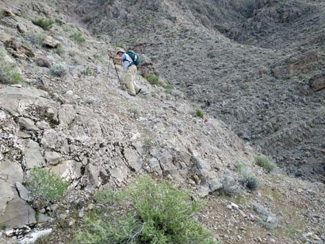
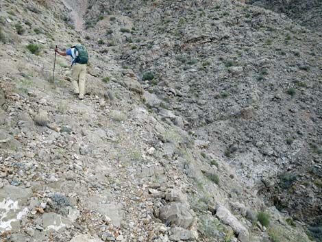
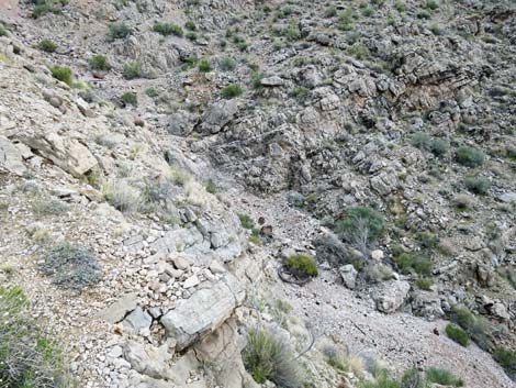
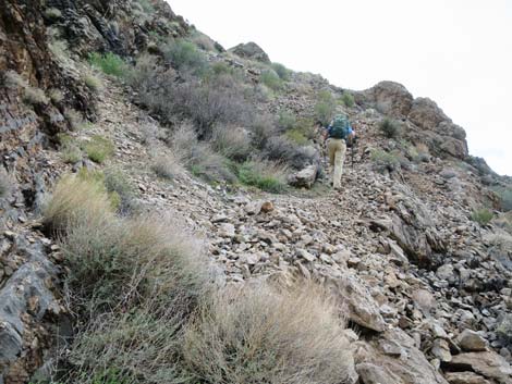
On the hillside, the trail reaches the first switchback (Wpt 03) and cuts back up to the left gaining some elevation on the hillside. After switching back to the right, the trail climbs up along the hillside for some distance. When the trail hits a cliff overlooking the rocky canyon bottom again (Wpt 04), it switchbacks to the left and begins a long series of five steep switchbacks. Be careful to follow the switchbacks in this area because hikers have missed a few and are damaging the landscape and the historical nature of the trail. The trail eventually drops back into the rocky canyon bottom (Wpt. 05), although at this point it is just a steep gully. This is also the bottom of the tailings pile, and there are quite a few bits of metallic mining debris and colorful ore fragments here. Some hikers turn directly up the gully slogging up the loose tailings to the mine entrance above. However, the mining trail crosses the gully and makes a steep ascent along the base of the cliffs on the south side. For the sake of the landscape and historical nature of the site, it is better to stay on the trail. Be careful, however, when high enough to fall and get hurt. |
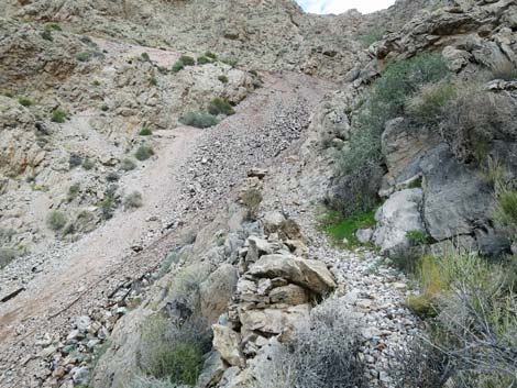
 The road gets pretty rocky (view S) |
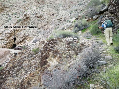
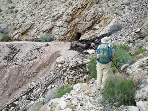
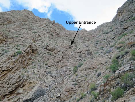
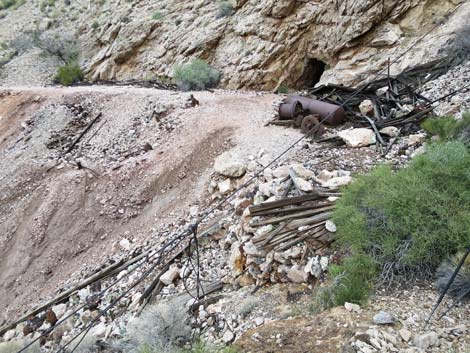
From the gully crossing (Wpt. 05), hikers can look to the top of the tailings pile and see the edge of the landing where the trail ends, although the mine opening is not visible from below. When hiking up along the base of the cliffs, hikers get to a point where they can look across the tailings pile just below the level of the mine. At this point, the trail unexpectedly turns away from the mine and climbs up around a rocky outcrop adorned near the top with a rusty drill bit. Following this trail is better than trying to cut across the top of the tailing pile to the mine. Climbing around the rocky face, hikers end up 5-10 feet above the level of the mine entrance. A short drop through bushes puts hikers on a 200-ft long landing covered with wooden and metal mining debris. The main mine entrance (Wpt. 06) is just ahead, but hikers can look up (following a cable) to see an upper entrance to the mine. The near end of the landing is covered with mining debris, then there is main mine entrance, more mining debris, and finally 150 feet of landing where miners moved tailings out before dumping them over the side. Return to the trailhead (Wpt. 01) using the mining trail and mine road. |
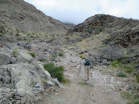
 Road runs above the rocky canyon bottom (view S) |
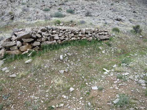
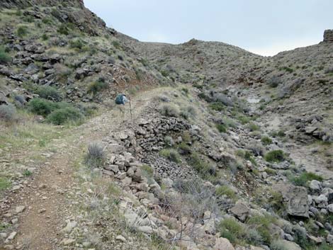 Note handmade stone wall holding up the road (view S) |
 Steep, narrow road (view SW) |
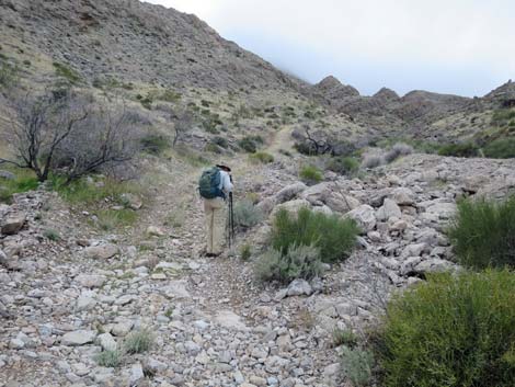
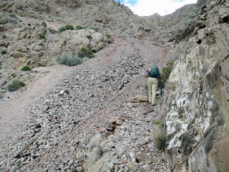
 Hiker approaching the end of the mine road (view S) |
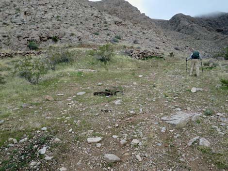 Hiker at the lower mine camp (view SE) |
 Opening for a root cellar? (more mine debris along the trail; view N) |
 Stone wall holding up a tent site (more mine debris along the trail) |
 Hiker passing the end of the road (view SE) |
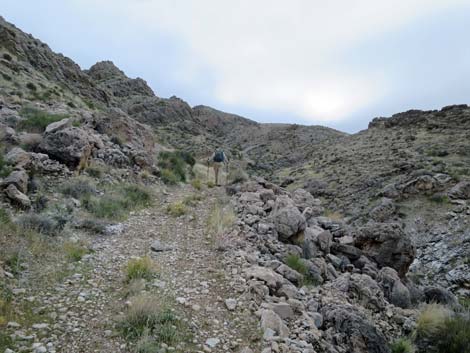
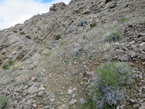
 From the end of the road, the mining trail hugs the canyon wall |
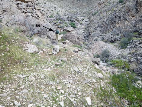
 mining trail drops into the rocky canyon bottom (view SE) |
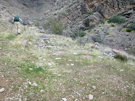
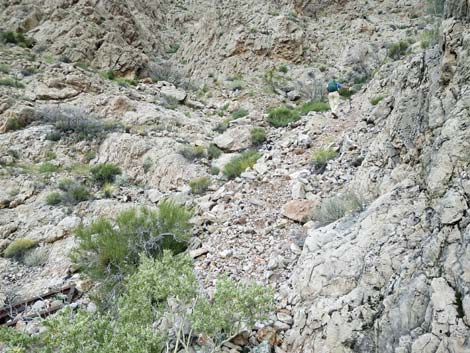
 Trail winds through boulders in the canyon bottom (view E) Trail winds through boulders in the canyon bottom (view E) |
 The trail climbs onto the north side of the canyon (view SE) |
 Hiker approaching the first switchback (view SE) |
 Hiker turning the first switchback (view SE) |
 Hiker turning the second switchback (back to the right; view NE) |
 Trail continues across the hillside (view SE) |
 Trail continues across the hillside (view SE) |
 Approaching the third switchback, tailings pile becomes visible |
 Hiker approaching the fourth switchback (view NE) |
 Small prospect along the fourth switchback (view SE) |
 Water tank rolled down the gully (more mine debris along the trail) |
 Hiker approaching the fifth switchback (view SE) |
 The trail winds past low cliffs (view SE) |
 Trail winding up through the cliffs (view SE) |
 There are some short spots of steep trail (view SE) |
 Trail traverses the cliffs towards the rocky gully (view SE) |
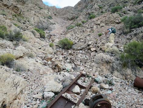
 More mining debris in the gully below the trail (view S) |
 Hiker arriving at the gully (view SE) |
 Hiker inspecting mining debris (more mine debris along the trail) |
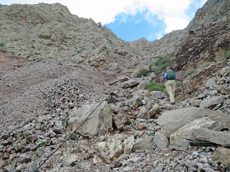
 Hiker on mining trail bypassing the tailings pile (view SE) |
 Hiker on mining trail bypassing the tailings pile (view E) |
 Hiker on mining trail bypassing the tailings pile (view E) |
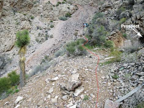
 Prospect on right edge of trail |
 Prospect is not so deep as it appears |
 The mining trail continues adjacent to the tailings pile (view E) |
 Hiker on mining trail at edge of tailings pile (view E) |
 Near the top, the trail is partially covered with tailings (view E) |
 The trail unexpectedly turns away from the tailings pile (view SE) |
 mining trail turning back towards the mine entrance (view NE) |
 Hiker at high point along the trail (view NE) |
 The upper mine entrance is visible from the high point (view E) |
 The mine site is also clearly visible from the high point (view NE) |
 The mining trail descends through the bushes (view NE) |
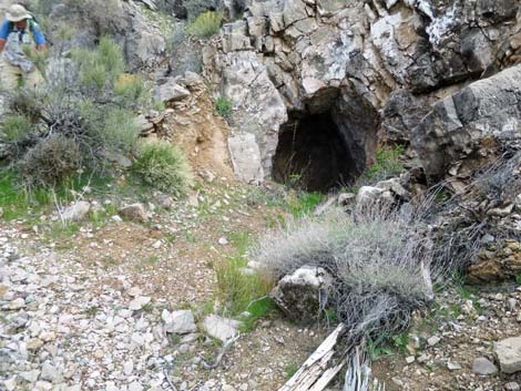
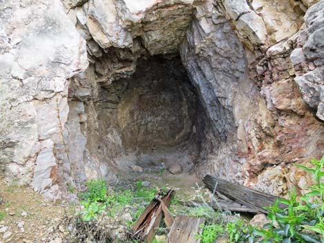
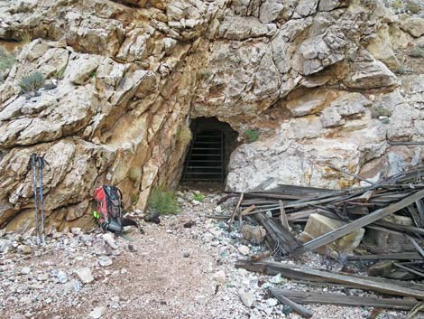 Tramp Mine entrance (see inside the mine; view E) |
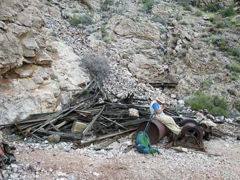 Old boiler makes convenient seat (more mine debris outside the mine) |
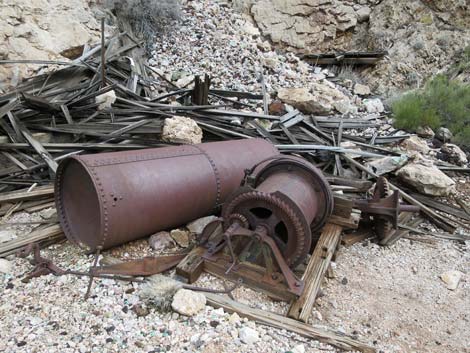 Mine debris outside the mine (view SE) |
Table 1. Hiking Coordinates and Distances based on GPS Data (NAD27; UTM Zone 11S). Download Hiking GPS Waypoints (gpx) file.
| Wpt. | Location | UTM Easting | UTM Northing | Elevation (ft) | Point-to-Point Distance (mi) | Cumulative Distance (mi) |
|---|---|---|---|---|---|---|
| 01 | Trailhead | 753599 | 4030618 | 2,953 | 0.00 | 0.00 |
| 02 | Mine Camp at End of Road | 753697 | 4030074 | 3,259 | 0.41 | 0.41 |
| 03 | First Switchback | 753800 | 4029962 | 3,360 | 0.11 | 0.52 |
| 04 | Base of Main Switchbacks | 753845 | 4029853 | 3,443 | 0.10 | 0.62 |
| 05 | Cross Wash below Tailings | 754012 | 4029815 | 3,612 | 0.19 | 0.81 |
| 06 | Tramp Mine | 754093 | 4029788 | 3,793 | 0.12 | 0.93 |
| 01 | Trailhead | 753599 | 4030618 | 2,953 | 0.93 | 1.86 |
Happy Hiking! All distances, elevations, and other facts are approximate.
![]() ; Last updated 240326
; Last updated 240326
| Backroads Around Las Vegas | Hiking Around Las Vegas | Glossary | Copyright, Conditions, Disclaimer | Home |