Hiking Around Las Vegas, Gold Butte National Monument
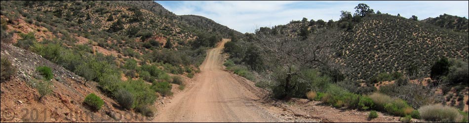
 End of the pavement at Whitney Pocket (view S) |
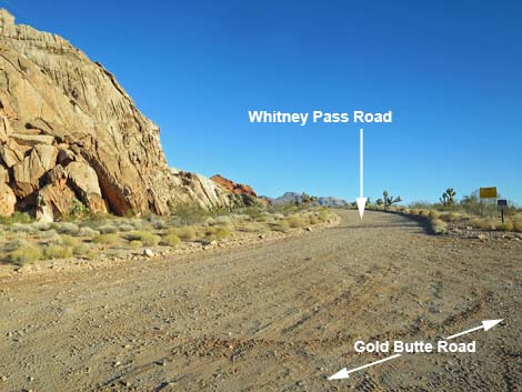
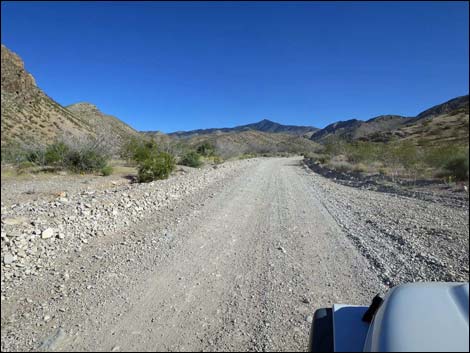
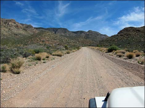
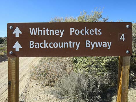
October 2022: the road is in fairly good condition. Overview Whitney Pass Road (also called Nay Ranch Road and Arizona Road) runs east from Whitney Pocket into Arizona, climbing some 2,000 feet in 4.3 miles to Whitney Pass. Along the way, the road passes through a number of vegetation zones where different species of desert and montane species can be found. The road normally is suitable for sedans, but it is steep and narrow, and it gets washboarded. From Whitney Pass, the road descends towards Arizona and ends at a fork in the road at 5.1 miles out. From the fork, drivers can turn left and take the "scenic" road back to Mesquite, or turn right and continue into Arizona and the wilds of Grand Canyon-Parashant National Monument. For information on driving Whitney Pass Road westbound, see Whitney Pass Road -- Westbound. This road provides access to the Whitney Pocket camp area, hikes to Virgin Peak and Billy Goat Peak, Aravada Springs Ranch, and Grand Canyon - Parashant National Monument over in Arizona. Link to map. |
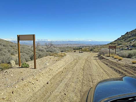
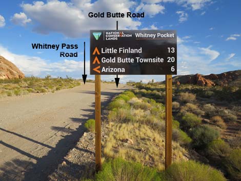 Gold Butte Road at "road to Arizona" directional sign (view S) |
Watch Out Other than the standard warnings about driving in the desert, ... this road is narrow, winding, and fairly steep, but there are no unusual hazards. Do be extra careful on blind curves: there are no vehicles out here, so everyone assumes nobody will be coming around the curve. This is a wild and remote area without services of any kind (no restrooms, no water, no gas, no food). Bring what you need to survive. Be prepared and be self-reliant. Someone will find you eventually if you stay on a main road, but be prepared to survive alone for a day or two. Cell phones only work along parts of the paved road. While visiting the area, please respect the land and the other people out there, and try to Leave No Trace of your passage. Also, this is a remote area, so be sure to bring the 10 Essentials. |
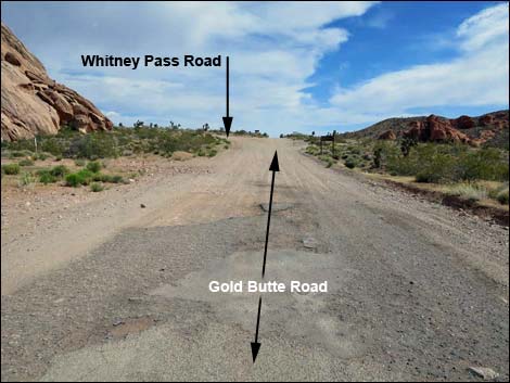
 Gold Butte Road at Whitney Pass Road (view S) |
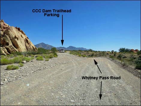
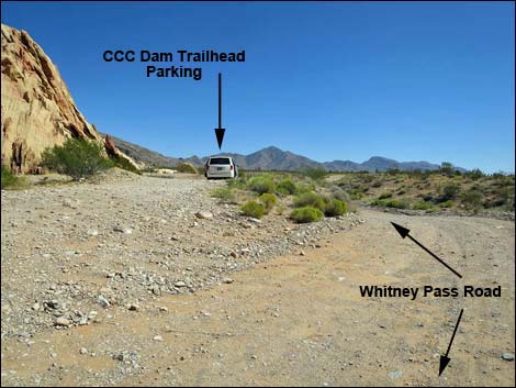
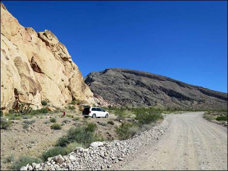
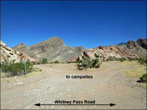
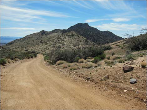
Getting to Whitney Pass Road Whitney Pass Road is located about 2 hours east of Las Vegas, in the wild, remote, and scenic Gold Butte region south of the town of Mesquite. From Las Vegas, drive out to Gold Butte National Monument. Drive south on the paved Gold Butte Road for 21 miles to Whitney Pocket. The unpaved Gold Butte Road continues south, and in only 100 yards, Whitney Pass Road forks off to the left (towards Arizona) heading east and uphill alongside red-and-white sandstone crags. |
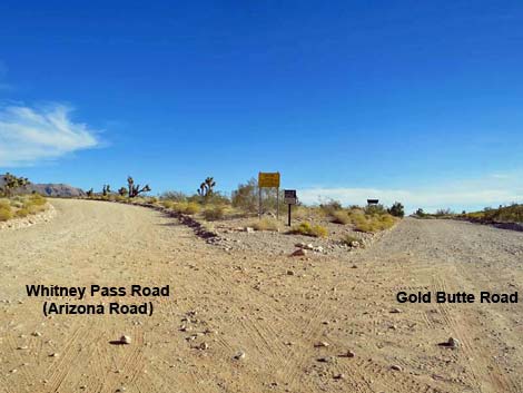
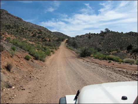
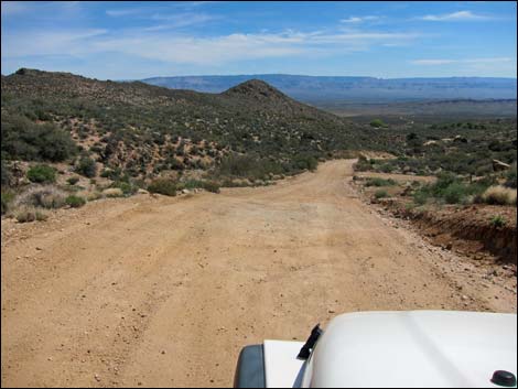
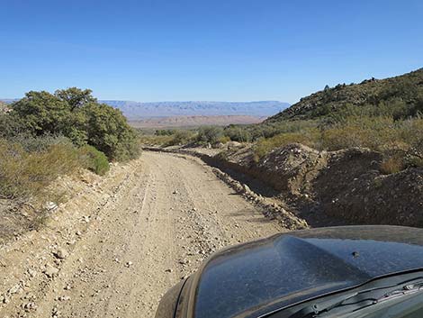
 Whitney Pass Road (view SE from Gold Butte Road) |
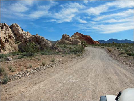
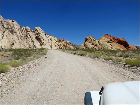
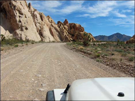
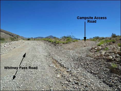
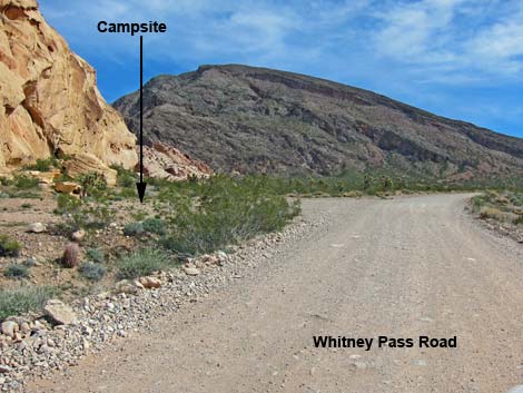
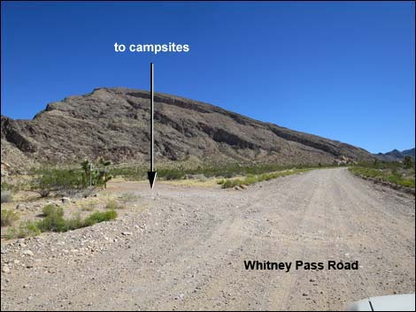
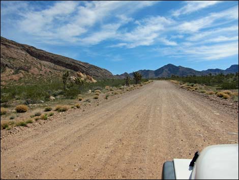
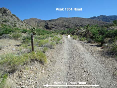
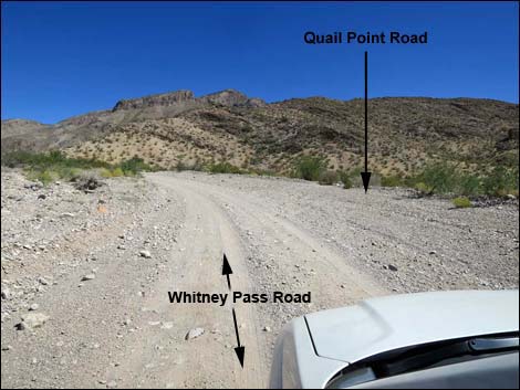
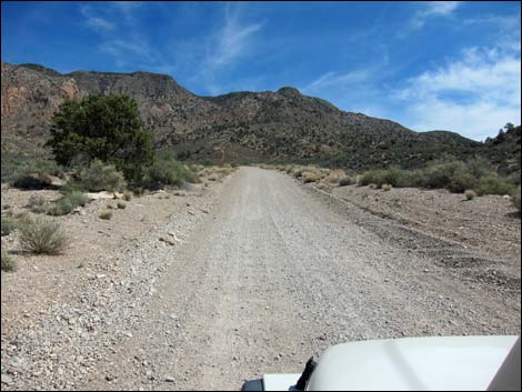
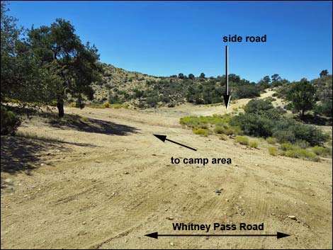
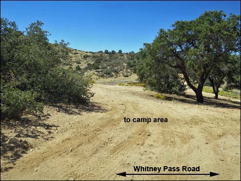
The Road From the unpaved Gold Butte Road (Table 1, Site 0462), Whitney Pass Road runs east along the south edge of the Whitney Pocket crags. Several camping areas are scattered along these crags, and there is an historic dam (Site 1658) and an historic storage shed built by the Civilian Conservation Corps (CCC) during the Great Depression in the 1930s in this area. After about 0.4 miles, the road passes beyond Whitney Pocket and begins climbing the bajada, passing additional camp areas along the way. At about 1.5 miles out (Site 1884), Whitney Pass Road passes an obscure road on the left, Peak 1354 Road. This "road" looks like a wash, and indeed, for some distance the road runs up the sandy wash. The road dead ends in the wash about 0.9 miles out. At about 2.0 miles out (Site 1886), Whitney Pass Road passes Quail Point Road, on the right. There is a nice campsite a few yards down the road. The road runs about 1.6 miles and dead ends at another campsite. |
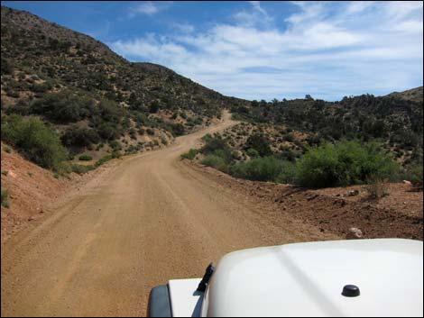
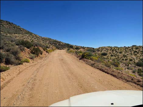
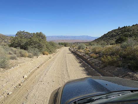
 Whitney Pass Road (view E from near Gold Butte Road) |
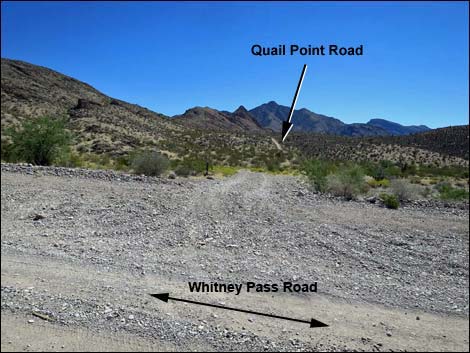
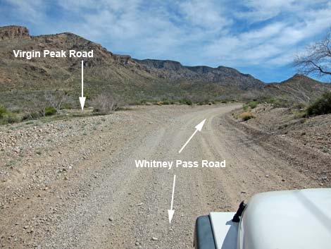
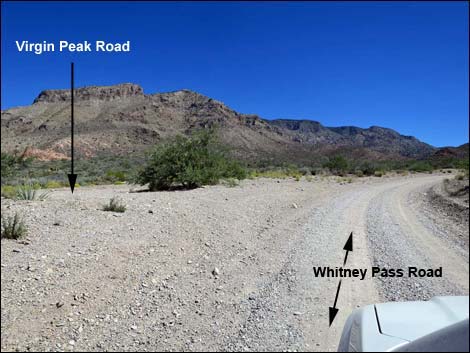
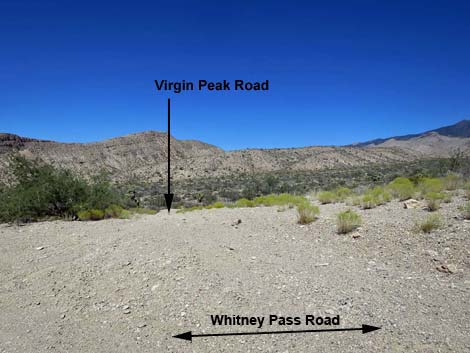
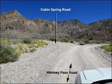
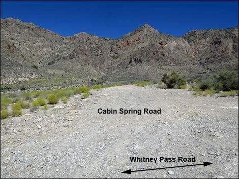
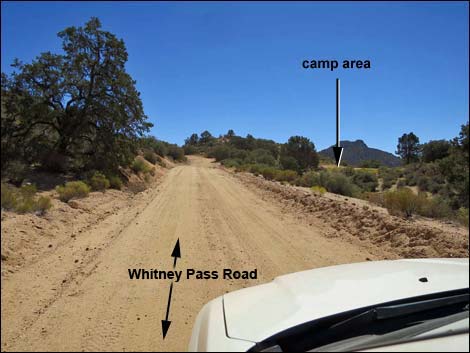
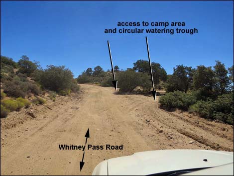
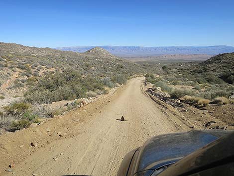
At about 2.1 miles out, Whitney Pass Road passes Quail Point at a narrow gap between rocky ridges. Shortly, Whitney Pass Road pass Virgin Peak Road (Site 0937), on the left. Virgin Peak Road runs north to the Virgin Peak trailhead. Beyond Virgin Peak Road, Whitney Pass Road begins climbing into the mountains in earnest. At about 3.4 miles out, the road bends right at the point where Cabin Spring Road (Site 1660) forks to the left. The spring went dry years ago, and the road is a bit rough, but the remains of a stone cabin continue to sit high in the canyon. Beyond Cabin Spring Road, Whitney Pass Road winds up into the mountains, and before long, Singleleaf Pinyon Pine dot the hillsides, evidence of how increasing altitude changes the environment in the desert. At about 4.2 miles out (Site 1887), the road passes a flat area on the right with an historic, circular cement watering trough. This area once was wet enough to support cattle, but now it makes a nice campsite. |
 Whitney Pass Road at Whitney Pocket (view E) |
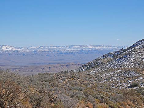
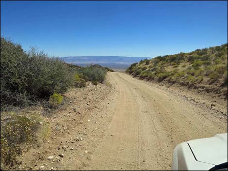
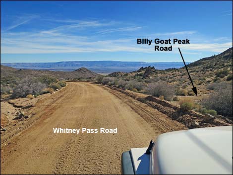
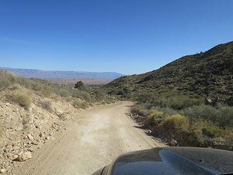
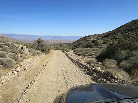
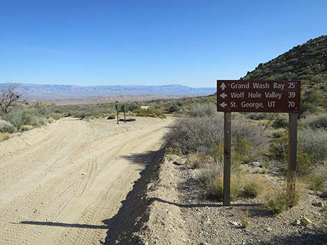
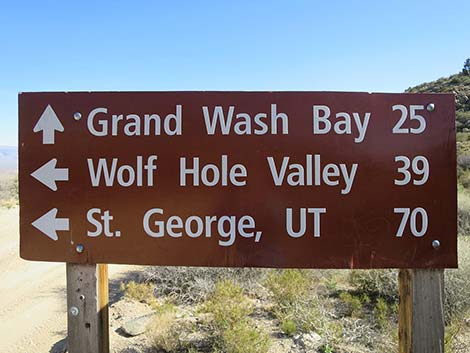
Shortly beyond the cement trough, Whitney Pass Road reaches the highpoint at Whitney Pass (Site 0688). This is a nice place to stop and enjoy the views in both directions: west across Nevada and east into Arizona. A forest fire some years ago killed off most of the trees, but it also opens up the view. Beyond Whitney Pass, Whitney Pass Road descends rapidly. At 4.6 miles out (Site 0969), the road passes Billy Goat Peak Road, on the right. This road runs south to the Billy Goat Peak trailhead. Beyond Billy Goat Peak Road, Whitney Pass Road continues steeply down to a major fork (Site 1659) that marks the end of Whitney Pass Road. To the left, Wolf Hole Valley Road runs north and connects with roads leading to Mesquite, while to the right (straight), Pakoon Road runs south towards Grand Wash Bay (almost all the way to the Colorado River). Staying right onto Pakoon Road, the road continues downhill heading southeast. Shortly, the Nay Ranch area comes into view with spring-fed trees, orchards, and buildings. A couple of families own land here, collectively known at the Nay Ranch area, but the road goes onto and crosses the Aravada Springs Ranch property. |
 Whitney Pass Road at Whitney Pocket (view NE) |
A ranch gate, which spans the road, announces Aravada Springs, and smaller signs remind visitors that this is private property and hunting is prohibited without an invitation. The road passes a small cemetery where some of the pioneer settlers were laid to rest, and then provides a broad view out across the area. Shortly, a big sign on the right announces a left turn into the Aravada Springs Adventure Resort. The ranch gate here still holds the historic name of the property: Nay Ranch. Passing under the Nay Ranch sign, campers with reservations (801-431-4950) enter Aravada Springs where hookup campsites, wall tents (glamour tents), and new cabins await. Campers are offered swimming, shooting, a zip-line, ATVs, and general relaxing on the historic property, but bring your own food. In spring and fall, this is a great place for glamping. Continuing, Pakoon Road head east across the Aravada Springs Property to the Arizona border where another Aravada Springs ranch gates spans the roadway. Pakoon Road continues south into Arizona. |
 Approaching CCC Dam trailhead parking (view SE) |
 Whitney Pass Road at CCC Dam trailhead parking (view SE) |
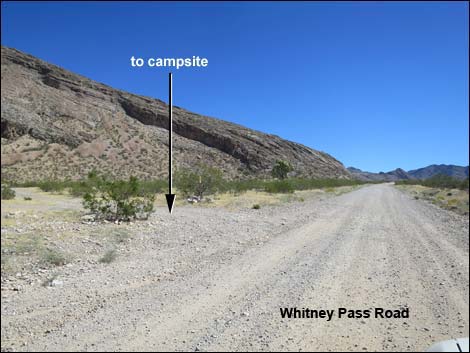
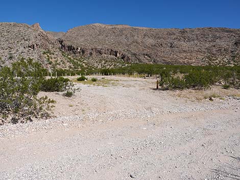
 Passing Whitney Pocket Campsite #5 access road (view E) |
 Approaching Whitney Pocket Campsite #6 (view NE) |
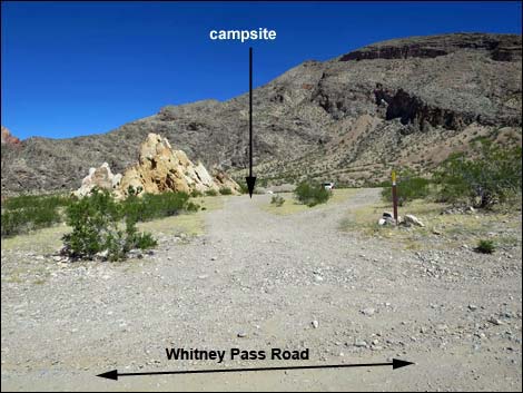
 Whitney Pass Road at WP Campsite #6 (view NE) |
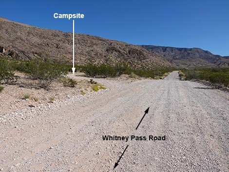
 Whitney Pass Road at WP Campsite #7 access road (view NE) |
 WP Campsite #7 access road (view N from Whitney Pass Road) |
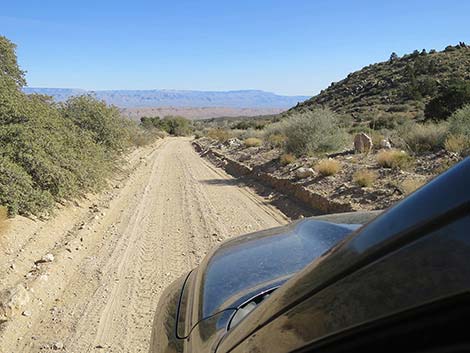
 Whitney Pass Road heading up the bajada (view E) |
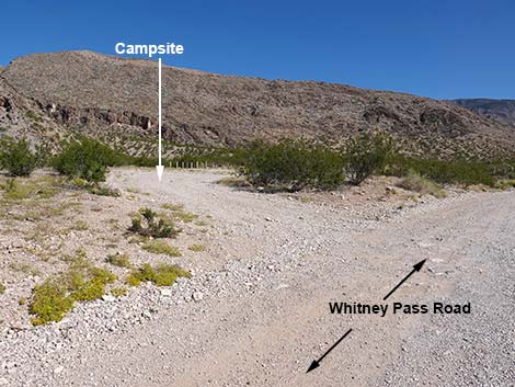
 Whitney Pass Road at WP Campsite #8 access road (view E) |
 WP Campsite #8 access road (view N from Whitney Pass Road) |
 Whitney Pass Road at Toe-of-the-Ridge Campsite (view NE) |
 Toe-of-the-Ridge Campsite, west access (view N) |
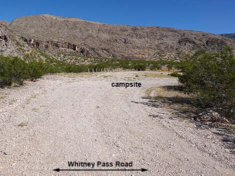 Toe-of-the-Ridge Campsite, east access (view N) |
 Whitney Pass Rd at exit from Toe-of-the-Ridge Campsite (view NE) |
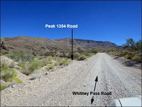 Whitney Pass Road approaching Peak 1354 Road (view NE) |
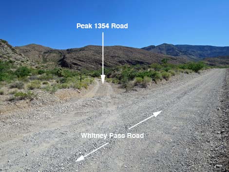 Whitney Pass Road at Peak 1354 Road (view NE) |
 Peak 1354 Road (view NE from Whitney Pass Road) |
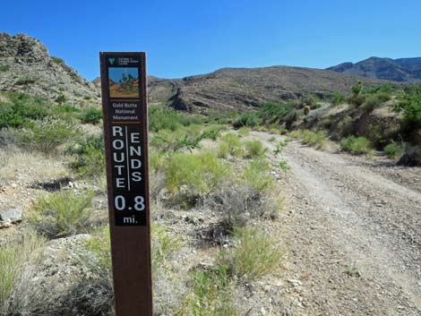 Sign: Peak 1354 Road ends at barricade 0.8 miles out (view NE) |
 Whitney Pass Road approaching Quail Point Road (view NE) |
 Quail Point Road (view SE from Whitney Pass Road) |
 Whitney Pass Road passing through Quail Point Gap (view N) |
 Whitney Pass Road approaching Virgin Peak Road (view NE) |
 Whitney Pass Road at Virgin Peak Road (view NE) |
 Virgin Peak Road (view NW from Whitney Pass Road) |
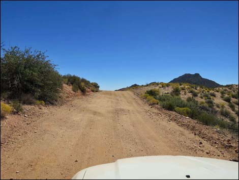
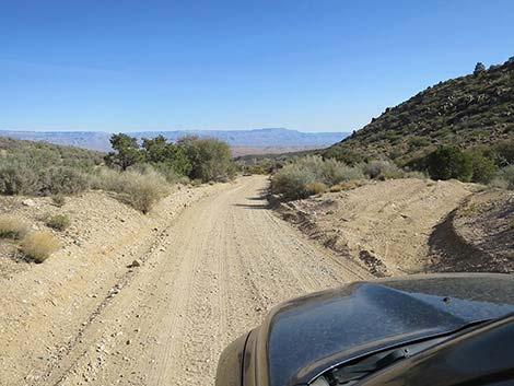
 Whitney Pass Road climbing into the mountains (view NE) |
 Whitney Pass Road climbing into the mountains (view NE) |
 Whitney Pass Road at Cabin Spring Road (view NE) |
 Cabin Spring Road (view N from Whitney Pass Road) |
 Whitney Pass Road climbing into the mountains (view SE) |
 Climbing into the mountains (view SE) |
 Whitney Pass Road approaching Whitney Pass Campsite (view SE) |
 WP Road at Whitney Pass Campsite access roads (view SE) |
 Whitney Pass Campsite west access road (view S) |
 Whitney Pass Campsite east access road (view SW) |
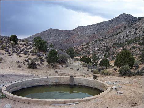 Cement watering trough (2002 with water; view NW) |
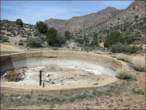 Cement watering trough (2013-18; view NW) |
 Climbing towards Whitney Pass (view E) |
 Whitney Pass Road approaching Whitney Pass (view SE) |
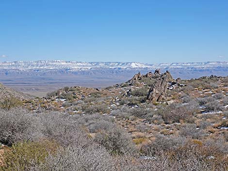
 Whitney Pass (view SE from Whitney Pass Road) |
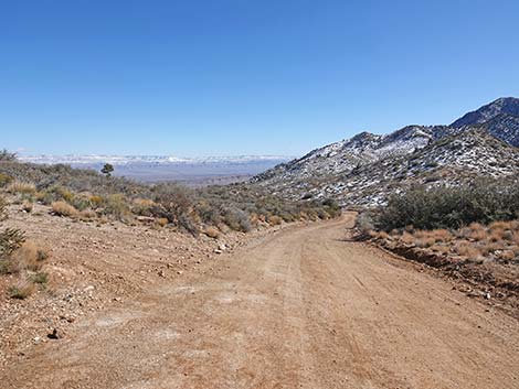 Whitney Pass after a spring snow storm (view SE) |
 Whitney Pass after a spring snow storm (view SE) |
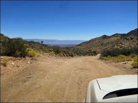
 Descending towards Billy Goat Peak (view SE) |
 WP Road with Grand Wash Cliffs in the distance (view SE) |
 Whitney Pass Road at Billy Goat Peak Road (view SE) |
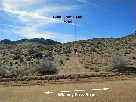 Billy Goat Peak Road (view S from Whitney Pass Road ) |
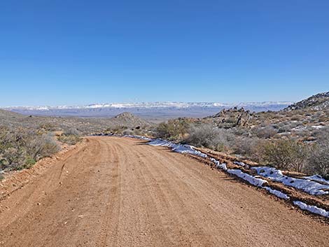 Whitney Pass Road after a spring snow storm (view SE) |
 Whitney Pass Road after a spring snow storm (view SE) |
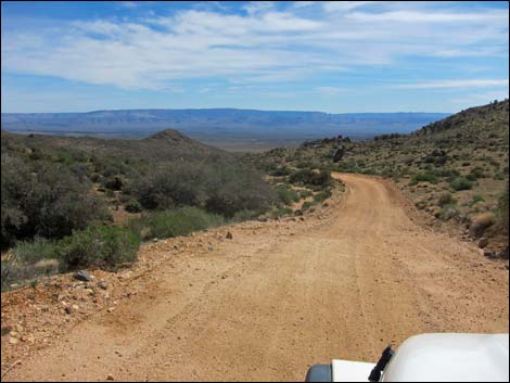 Whitney Pass Road with Grand Wash Cliffs in the distance (view SE) |
 Descending towards the Arizona State Line (view SE) |
 Always watch for errant rocks (view SE) |
 Whitney Pass Road winds down the canyon (view SE) |
 Whitney Pass Road winds down the canyon (view SE) |
 |
 |
 Whitney Pass Road winds down the canyon (view SE) |
 Approaching the end of Whitney Pass Road (view SE) |
 Whitney Pass Road approaching a fork in the road (view SE) |
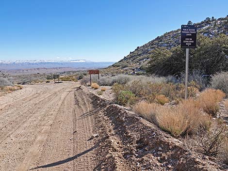 Whitney Pass Road at an information sign (view SE) |
 Whitney Pass Road at an information sign (view SE) |
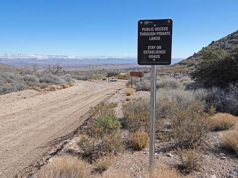
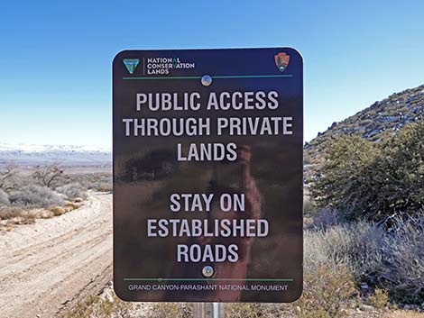 Public Access through private lands - stay on established roads |
 Approaching backside of directional sign (view SE) |
 Looking back: westbound directional sign (view NW) |
 Directional signs at fork in the road (view SE) |
 Directional sign (left to Mesquite too; view SE) |
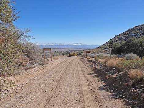
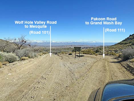 Whitney Pass Road ends at fork in the road (view SE) |
 More to come ... |
Table 1. Highway Coordinates Based on GPS Data (NAD27; UTM Zone 11S). Download Highway GPS Waypoints (*.gpx) file.
| Wpt. | Location | Latitude (N) | Longitude (W) | Elevation (ft) | Point-to-Point Distance (mi) | Cumulative Distance (mi) |
|---|---|---|---|---|---|---|
| 0462 | Whitney Pass Rd at Arizona Road | 36.52333 | 114.13919 | 3,013 | 0.00 | 0.00 |
| 1658 | Whitney Pass at CCC Dam Parking | 36.52326 | 114.13490 | 3,069 | 0.26 | 0.26 |
| 1884 | Whitney Pass Road at Peak-1354 Road | 36.52596 | 114.11355 | 3,538 | 1.24 | 1.50 |
| 1886 | Whitney Pass Road at Quail Point Road | 36.52927 | 114.10463 | 3,722 | 0.55 | 2.05 |
| 0937 | Whitney Pass Rd at Virgin Peak Rd | 36.53264 | 114.10125 | 3,856 | 0.32 | 2.37 |
| 1660 | Whitney Pass Rd at Cabin Spring Rd | 36.53630 | 114.08361 | 4,460 | 1.06 | 3.43 |
| 1887 | Whitney Pass Road at Water Tank | 36.53223 | 114.07158 | 4,819 | 0.75 | 4.18 |
| 0688 | Whitney Pass Rd at Whitney Pass | 36.53137 | 114.06904 | 4,875 | 0.17 | 4.35 |
| 0969 | Whitney Pass Rd at Billy Goat Peak Rd | 36.52908 | 114.06592 | 4,753 | 0.23 | 4.58 |
| 1659 | Whitney Pass Ends at Fork | 36.52592 | 114.05843 | 4,453 | 0.52 | 5.10 |
Happy Hiking! All distances, elevations, and other facts are approximate.
![]() ; Last updated 240326
; Last updated 240326
| Hiking Around Gold Butte | Hiking Around Las Vegas | Glossary | Copyright, Conditions, Disclaimer | Home |