Hiking Around Las Vegas, Gold Butte National Monument
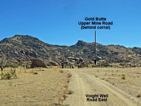 Approaching Voight Well Corral (view S) |
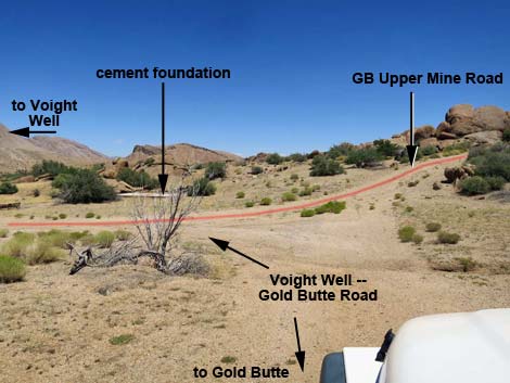
Overview Gold Butte Townsite Upper Mine is an interesting place to visit and commune with the mining history of this wild and rugged region. In 1905, gold was discovered on Gold Butte Peak, and when news got out, miners poured into the area. The town of Gold Butte was established in 1906 with a post office, and by 1908 there was a hotel, livery stable, saloon, mercantile, and some 2,000 residents. In 1909, the mines played out, the post office closed, and the town was abandoned. Art Coleman and Bill Garrett arrived at Gold Butte Townsite in 1916, after the town had been abandoned, and intermittently worked the mines and ran cattle until 1958 and 1961, respectively. Today the area is littered with evidence of mining, including mines, old equipment, the remains of old mills, can dumps, and cement foundations, but all of the buildings are gone. Link to map. |
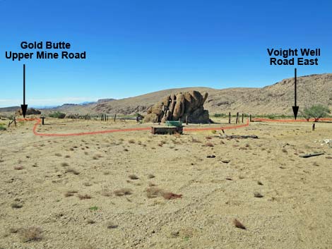
 Continuing around the left end of the corral (view SE) |
Watch Out Other than the standard warnings about hiking in the desert, ... this area is fairly safe if you stay out of the mines. Old holes in the ground are never safe to enter, and these were dug over 100 years ago into decomposed granite, which is a bit like stuck-together gravel that is coming apart. Most of the tunnels have already collapsed. Stay out; stay alive. The access road requires a 4WD vehicle, but it is short enough to walk. This is a wild and remote area without services of any kind (no restrooms, no water, no gas, no food). Bring what you need to survive. Be prepared and be self-reliant. Law enforcement occasionally patrols the area. Someone will find you eventually if you stay on a main road, but be prepared to survive alone for a day or two. Cell phones don't work in this area. While visiting, please respect the land and the other people out there, and try to Leave No Trace of your passage. Also, this is a remote hike, so be sure to bring the 10 Essentials. |
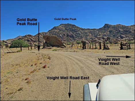
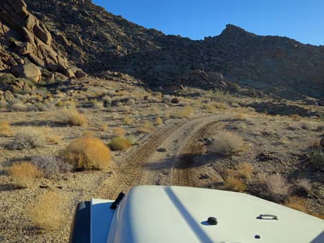
 Road passes around the corral (view W) |
Getting to the GB Townsite Upper Mine Gold Butte Townsite is located out in Gold Butte National Monument at the northeast end of Lake Mead, about 3 hours northeast of Las Vegas in a wild, remote, and scenic area. From town, drive out to Gold Butte, then drive south on the paved Gold Butte Road for 21 miles to Whitney Pocket where the pavement ends. Continue south on the scenic unpaved Gold Butte Road for 19.8 miles; a cattle guard that marks entry into the Gold Butte Townsite area. Just past the cattle guard, Voight Well Road East forks left into the Voight Well area (Table 1, Site 1698), a suburb of Gold Butte Town. Driving in, the old corral and the well are straight ahead. The road to the mine is straight ahead beyond the corral, so drive around either end of the corral and continue south. About 50 yards past the corral, the road forks. Stay left onto Gold Butte Upper Mine Road and drive 0.6 miles to the end (Site 1851). This is a rough road where a 4WD-SWB vehicle is better. |
 Fork: mine road stays left (view E from VW-GB Road) |
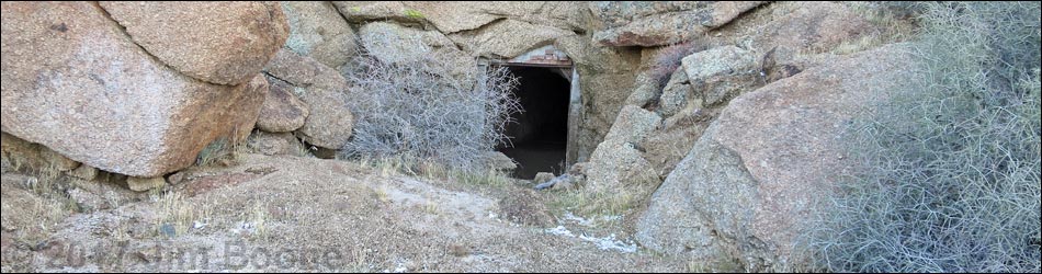
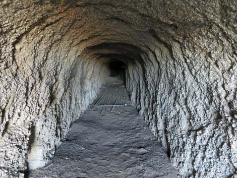
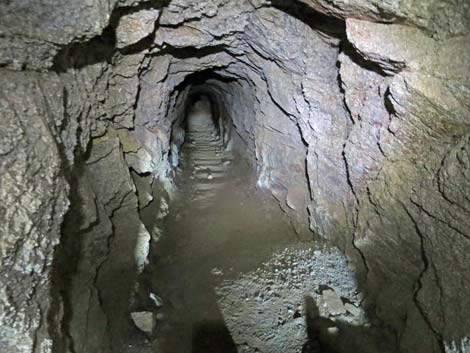
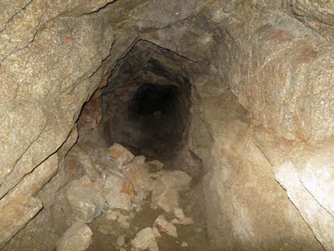
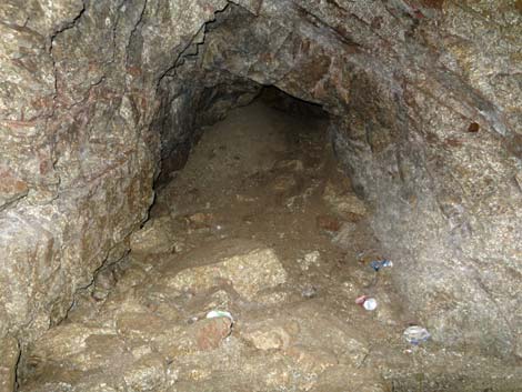
GB Townsite Upper Mine Gold Butte Upper Mine Road ends in a large, open area where a small fleet of trucks could be turned around, but most of this probably is just mine tailings filling the shallow canyon. The mine entrance once had a metal door set in a cement and brick frame, but the door is long gone. Rocks at the mine entrance look solid and safe, but farther in proves this assessment wrong. Inside the adit, which runs straight back, there is a cache of 1-inch PVC pipes on the floor. These could have been used to force fresh air into the back of the mine, but they post-date mining activity by Coleman and Garrett. Just past the pipes is a pile of soft dirt that fell from the roof. Plant roots hanging from the ceiling suggest fractured, rather than solid, rock. Farther back, a big pile of rocks on the floor also fell from the roof. The adit eventually bends left, more rocks grace the floor, and finally the adit ends at a cave-in. Enjoy these photos and stay out. |
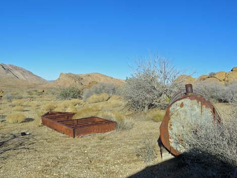 Mining debris along the road (view E) |
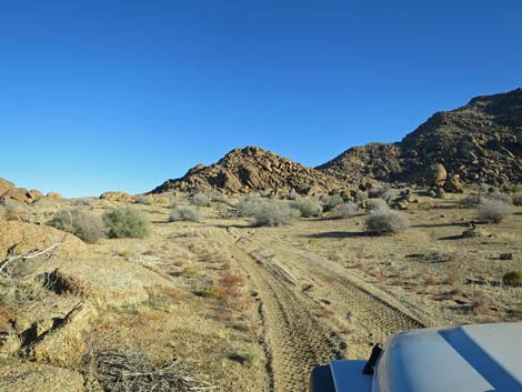 Winding into the hills (view SE) |
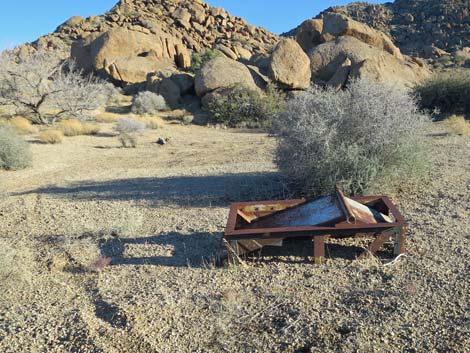 More mining debris (view SE) |
 Winding into the hills (view SW) |
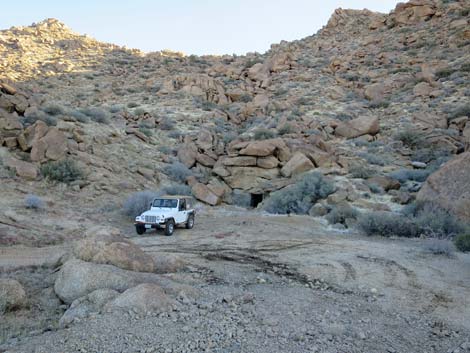 Parking at end of the road (view S from edge of tailings pile) |
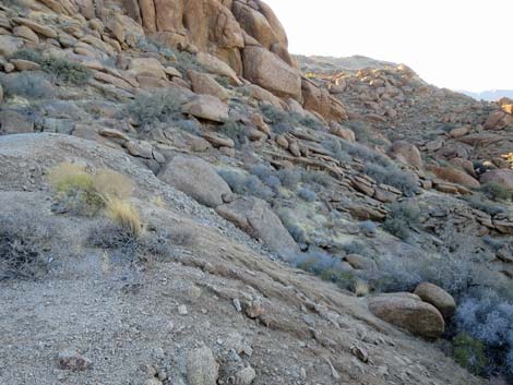 Edge of tailings pile (view W) |
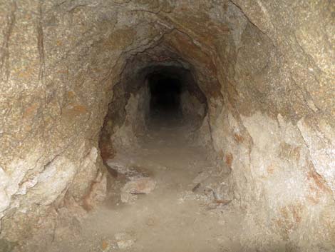
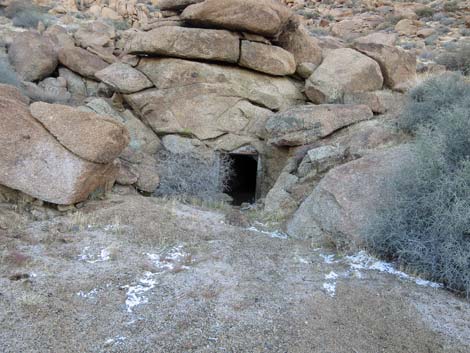 Mine entrance (view S) |
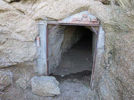 Mine entrance (view S) |
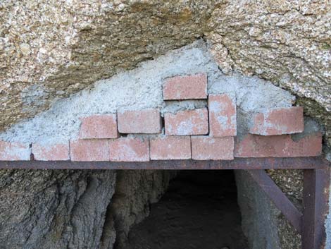 Mine entrance details of brick door frame (view S) |
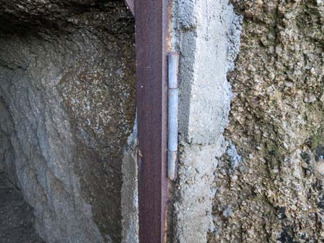 Mine entrance details of hinge and cement frame (view S) |
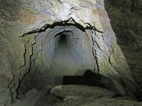
 Mine entrance (view S from outside) |
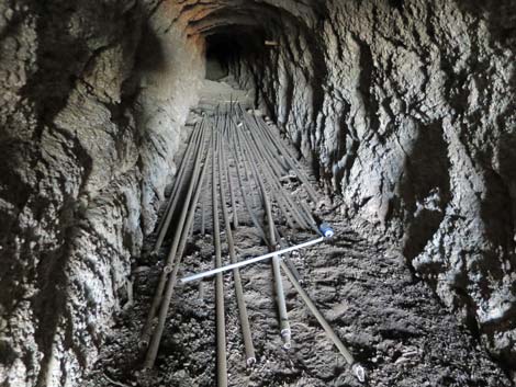 PVC pipes on the floor |
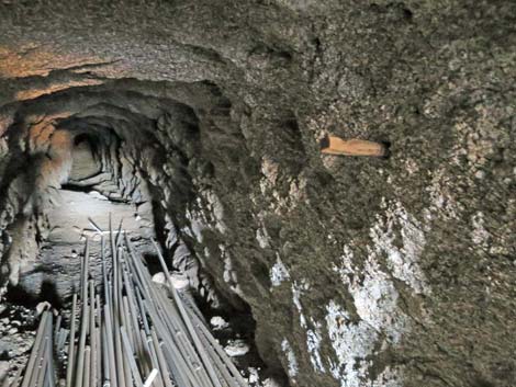 Wooden peg on wall (note pile of dirt on the floor) |
 Another pile of dirt on the floor |
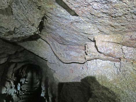 Plant roots and fractured rock on the ceiling |
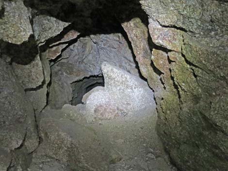 High pile of roof collapse debris |
 Beyond the roof collapse the air became stale |
 Wooden peg on wall |
 More rocks on the floor |
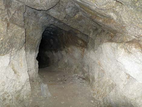 Tunnel bends left |
 More rocks on the floor |
 Rocks and total tunnel collapse |
Table 1. Highway Coordinates Based on GPS Data (NAD27; UTM Zone 11S). Download Highway GPS Waypoints (*.gpx) file.
| Site | Location | UTM Easting | UTM Northing | Latitude (N) | Longitude (W) | Elevation (ft) |
|---|---|---|---|---|---|---|
| 1698 | Voight Well Area | 752057 | 4018860 | 36.28362 | 114.19366 | 3,724 |
| 1851 | Gold Butte Upper Mine | 752253 | 4017960 | 36.27547 | 114.19176 | 4,031 |
Happy Hiking! All distances, elevations, and other facts are approximate.
![]() ; Last updated 240325
; Last updated 240325
| Hiking Around Gold Butte | Hiking Around Las Vegas | Glossary | Copyright, Conditions, Disclaimer | Home |