Hiking Around Las Vegas, Gold Butte National Monument
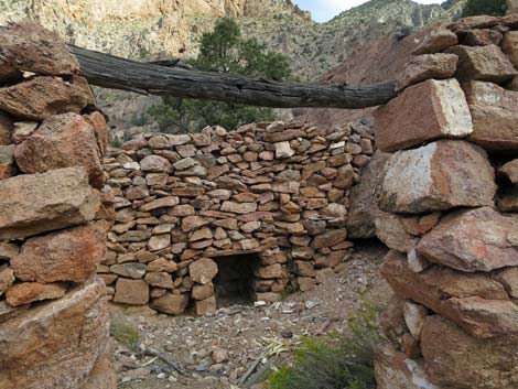
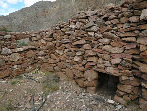
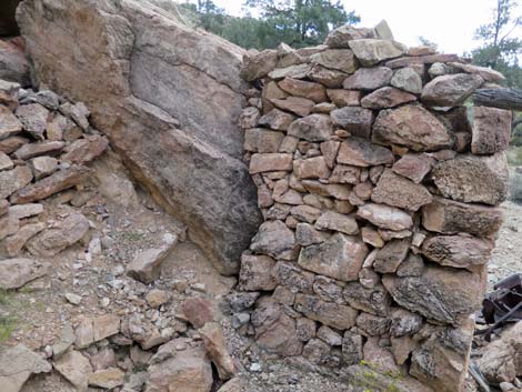
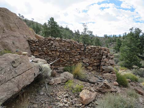
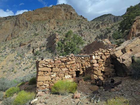 Cabin exterior, southern exposure (view N) |
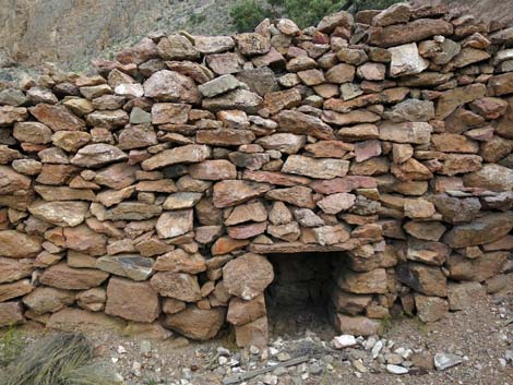
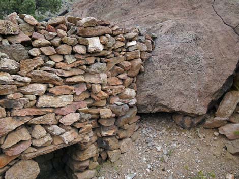
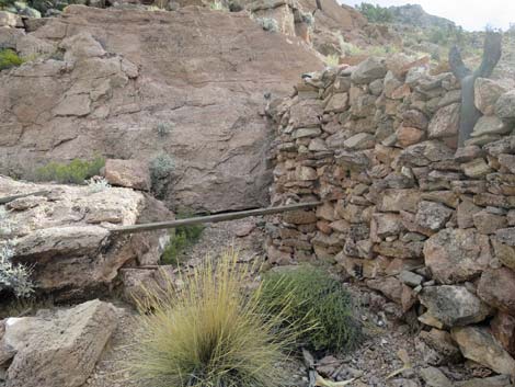
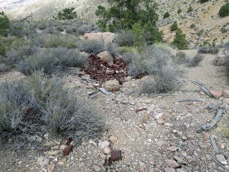
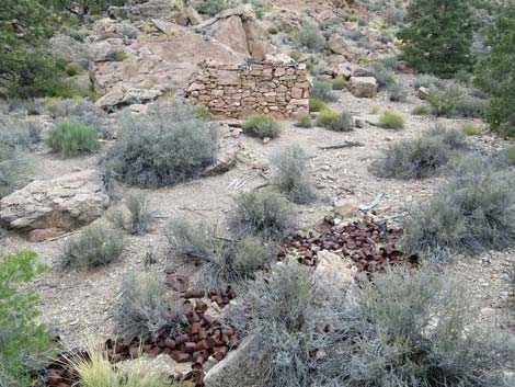
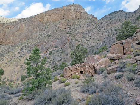
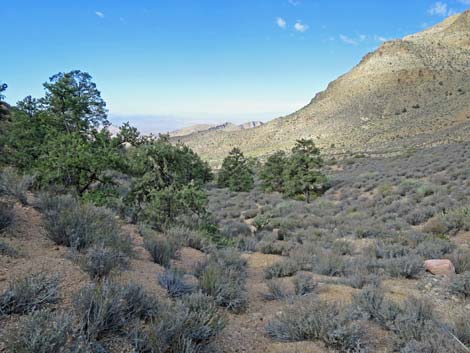
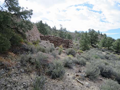
Overview The Rock Cabin in Cabin Spring Canyon is an historical site at the south end of the Virgin Mountains in Gold Butte National Monument where it appears that prospectors spent a fair bit of time and effort building a cabin and looking for mineral wealth. It is curious that the spring (now dry) was located below the cabin such that getting water would have been an arduous task. The nearby prospects seem to have been worthless. The cabin is made of stacked stones without mortar. There is no evidence for a roof, so perhaps the residents pulled a canvas tarp over the top. There is, however, a nice can dump with dozens of cans of different types, so the site can be dated. For me, this is an interesting place to spend a few minutes thinking about the people who made a home in these mountains, worked very hard, and then disappeared. The site also has spectacular views down the canyon. Link to hiking map. |
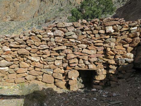
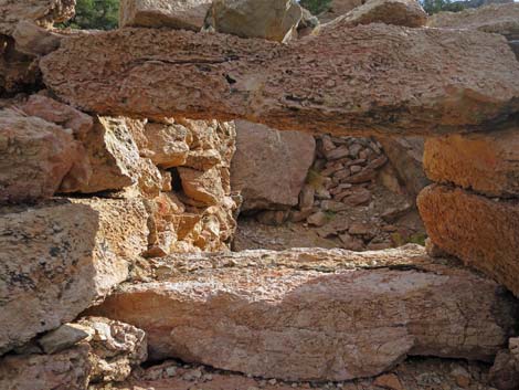
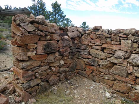 Cabin interior, (view SW) |
Watch Out Other than the standard warnings about hiking in the desert, ...this is a fairly safe hike in a wild and remote place. The route following the old road is moderately steep, but it is not bad. Do be careful out in this remote area because even a twisted ankle could be a serious problem with help so far away. Cabin Spring Canyon Road is not maintained and is pretty steep, so with a 2WD vehicle, consider parking near Whitney Pass Road and walking -- it is only 250 yards to the lower trailhead. This is a wild and remote area without services of any kind (no restrooms, no water, no gas, no food). Bring what you need to survive. Be prepared and be self-reliant. Someone will find you eventually if you stay on a main road, but be prepared to survive alone for a day or two. Cell phones only work along parts of the paved road. While hiking, please respect the land and the other people out there, and try to Leave No Trace of your passage. Also, this is a remote hike, so be sure to bring the 10 Essentials. |
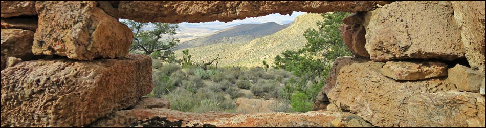
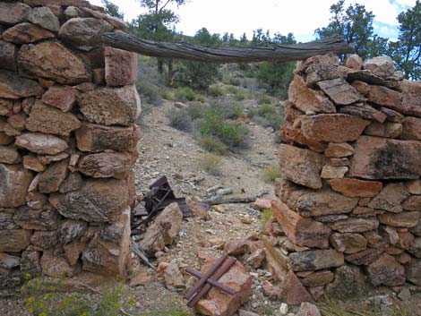
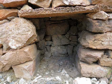
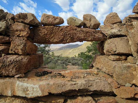 Cabin interior, window with down-canyon view (view W) |
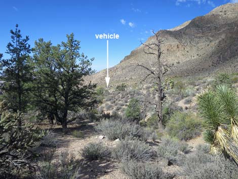
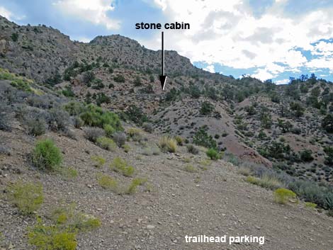
Getting to the Trailhead The Rock Cabin in Cabin Spring Canyon is located out in Gold Butte National Monument at the northeast end of Lake Mead, about 2.5 hours northeast of Las Vegas in a wild, remote, and scenic area. From town, drive out to Gold Butte National Monument. From the end of the pavement at Whitney Pocket, continue south 100 yards on the unpaved Gold Butte Road to Whitney Pass Road on the left. Turn onto Whitney Pass Road and drive east into the mountains. On Whitney Pass Road, drive 3.4 miles east to Cabin Spring Canyon Road, an unsigned road on the left. Turn left onto the steep road and drive up about 250 yards to the small trailhead on the right. Park here; this is the lower trailhead for the Old Road Route. In a 4WD vehicle, some people might want to drive to the end of the road and take the shorter, but much steeper, Hillside Route to the cabin. |
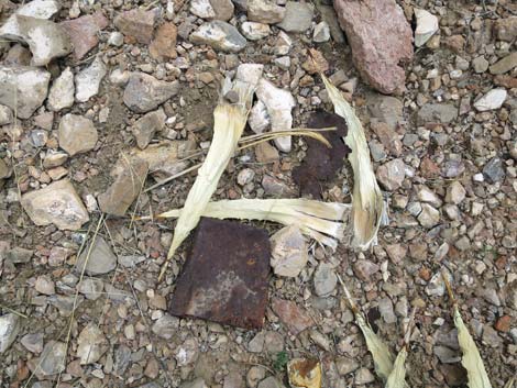
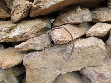
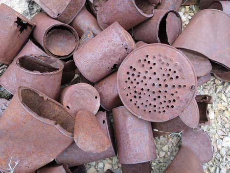 Can dump with strainer |
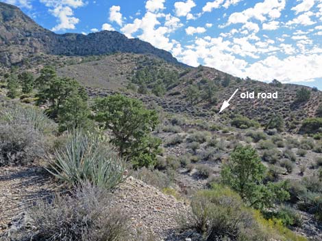
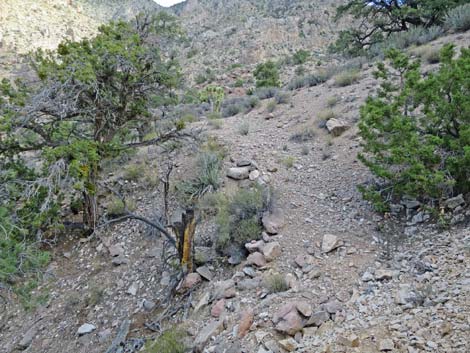
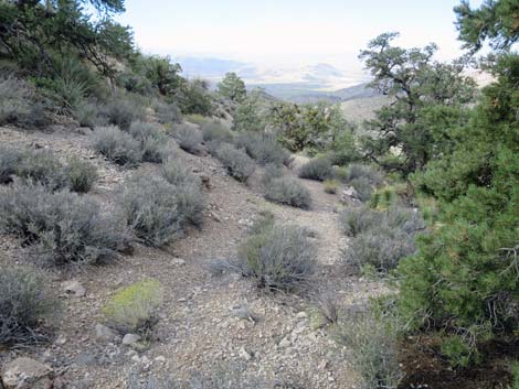
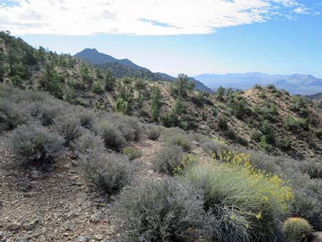
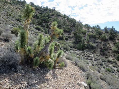
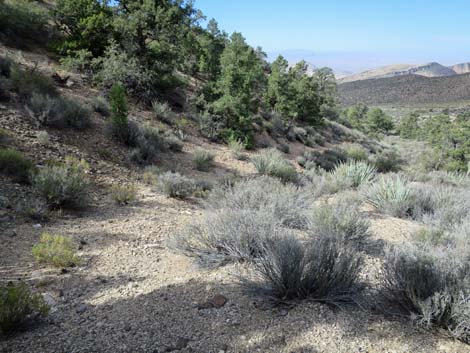
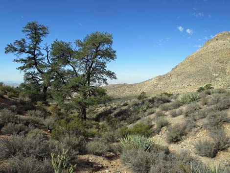
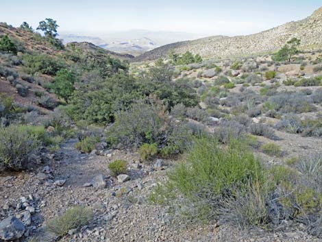
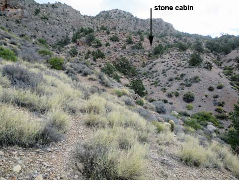
The Hike -- Old Road Route From the lower trailhead (Table 1, Waypoint 01), hikers can walk to the edge of the campsite, which is the top of the bank overlooking Cabin Canyon Wash. From there, look ESE towards the ridge across the wash and notice a bit of the old road as it exits the far side of the main wash and heads into a smaller side wash. The old road will stay below the pinyon and juniper trees that can be seen on the far hillside. The wash bank is steep, so find a good way down into the wash and pick a way across to the start of the old road (Wpt. 02); the route finding is easier from here on. Following the old road into the side wash, the road becomes washed out, but after passing through the lowest of the trees, the old road becomes more apparent and easier to follow. The old road runs up the edge of the wash, then switchbacks left up and across the blackbrush-covered hillside. Passing an odd clump of Joshua trees at the crest of the ridge, the road switchbacks right to follow the ridgeline up. Watch for stone walls holding up the downhill side of the road. |
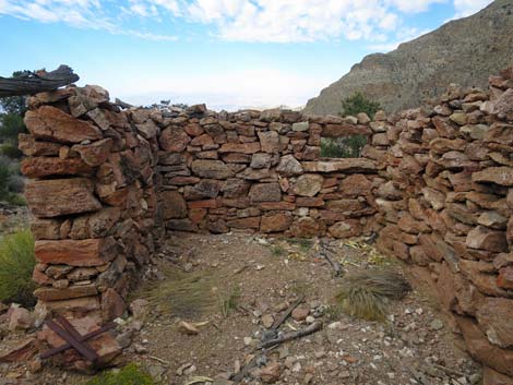
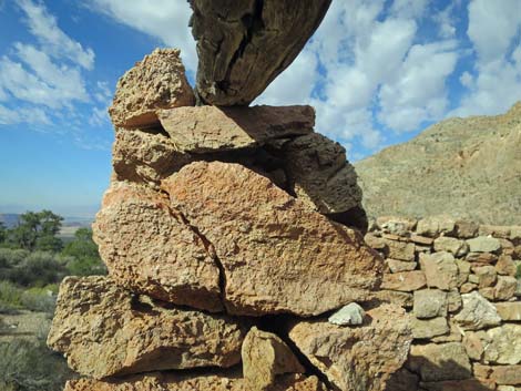
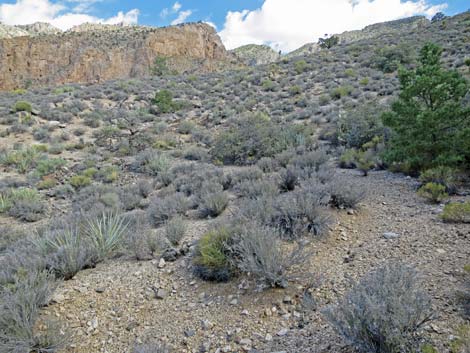
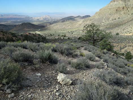 Grand view down the Cabin Spring Canyon (view SW) |
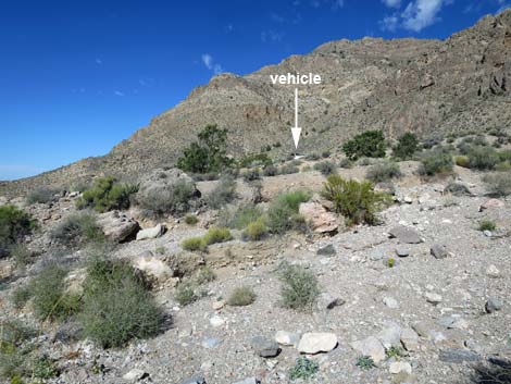
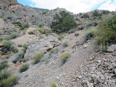
The old road climbs into an open basin, then disappears into the landscape at an area that might have been a mine works (Wpt. 03). The road is partially obscured by fallen trees and a washout area, but turning north, hikers can pick up the old road again across the wash (Wpt. 04), and from there, the cabin should be visible just ahead (Wpt. 05). From this side, hikers arrive approaching the front door of the cabin. The Hike -- Steep Hillsides I don't recommend this route, but it is shorter. From the end of Cabin Canyon Road (Wpt 07), hikers can see what appears to be a trail heading east towards the cabin, which is barely visible far above. The "trail" quickly runs out, but hikers can descend very steeply into the bottom of the canyon (Wpt. 06), then climb very steeply up the loose hillside to the cabin (Wpt. 05). From this direction, hikers arrive approaching the back of the cabin. |
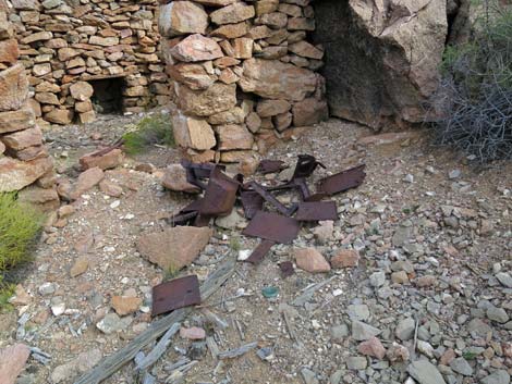
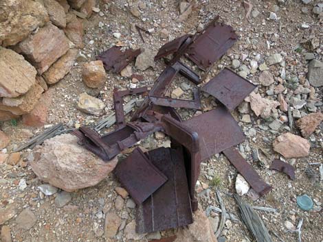
Rock Cabin
|
 |
 |
 |
 |
 |
|
 |
|
 |
 |
 |
 |
 |
 |
 |
 |
 |
 |
 |
 |
 |
 |
 |
 |
|
Route Following the Old Road
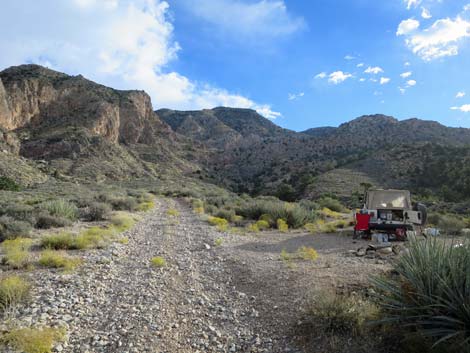 Lower (campsite) trailhead (view NE) |
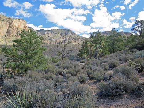
 Edge of campsite (view ESE towards start of old road) |
 Crossing Cabin Spring Canyon Wash (view ESE) |
 Across the wash, approaching start of old road (view ESE) |
 Old road is overgrown, but can be followed into trees (view ENE) |
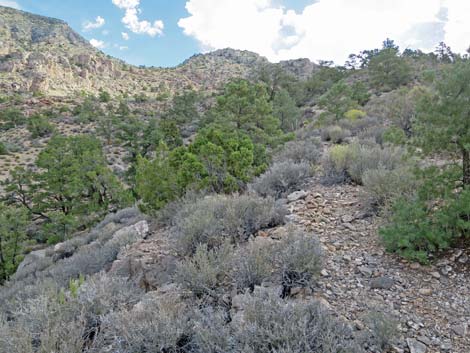
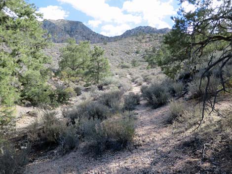 Old road passing through the trees (view ENE) |
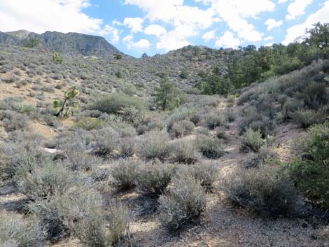 Beyond the trees, old road continues along the hillside (view E) |
 Old road bends left (view NE) |
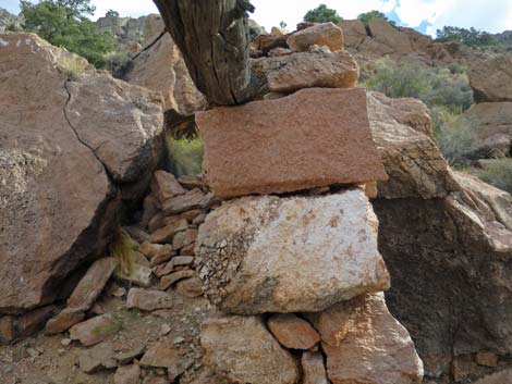
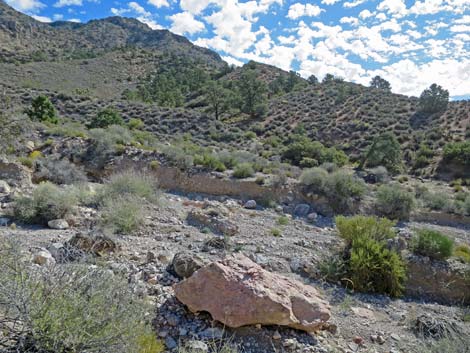
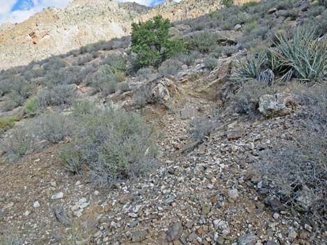 Minor prospect near the bend in the road (view N) |
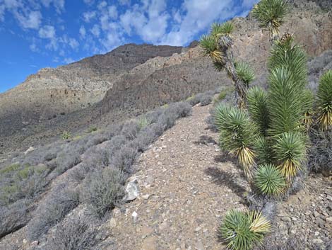 Odd clump of Joshua trees along the old road (view N) |
 Old road turns to run up ridgeline (view E) |
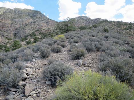
 Old road follows ridgeline (view E) |
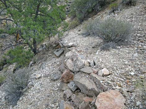 Old road held up by stone wall (view E) |
 Well defined old road crosses gully, then seems to end (view NE) |
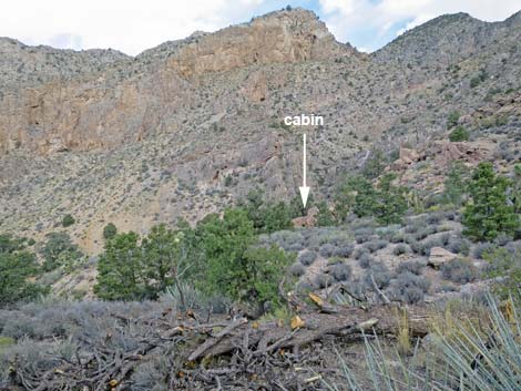 When old road seems to end, cabin is visible in distance (view N) |
 Approaching the cabin (view N) |
Route Returning Down the Old Road
 |
|
 |
 |
 |
 |
 |
 |
 |
 |
Route from End of Road
 Alternative route: end of road to cabin |
 Steep drop into canyon, then steep climb up hillsides (view SE) |
 Steep climb up loose hillside (view SE) |
 Approaching the cabin (view S) |
Table 1. Hiking Coordinates Based on GPS Data (NAD27; UTM Zone 11S). Download Hiking GPS Waypoints (*.gpx) file.
| Wpt. | Location | UTM Easting | UTM Northing | Elevation (ft) | Point-to-Point Distance (mi) | Cumulative Distance (mi) |
|---|---|---|---|---|---|---|
| 01 | Campsite Trailhead | 761227 | 4047368 | 4,614 | 0.00 | 0.00 |
| 02 | Start of Old Road | 761312 | 4047336 | 4,619 | 0.08 | 0.08 |
| 03 | Old Road Becomes Faint | 761640 | 4047473 | 4,906 | 0.29 | 0.37 |
| 04 | Old Road Becomes Apparent Again | 761640 | 4047528 | 4,888 | 0.05 | 0.42 |
| 05 | Rock Cabin | 761635 | 4047541 | 4,888 | 0.01 | 0.43 |
| 06 | Canyon Bottom | 761532 | 4047557 | 4,768 | 0.11 | 0.54 |
| 07 | End of Road Trailhead | 761482 | 4047590 | 4,799 | 0.05 | 0.59 |
| 01 | Campsite Trailhead | 761227 | 4047368 | 4,614 | 0.22 | 0.81 |
Note: All distances, elevations, and other facts are approximate.
![]() ; Last updated 240325
; Last updated 240325
| Hiking Around Gold Butte | Hiking Around Las Vegas | Glossary | Copyright, Conditions, Disclaimer | Home |