Travertine Canyon to Boucher Trail Junction
Hiking Around Las Vegas, Grand Canyon National Park
Overview | Previous Segment | Next Segment
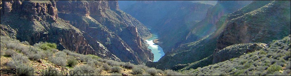
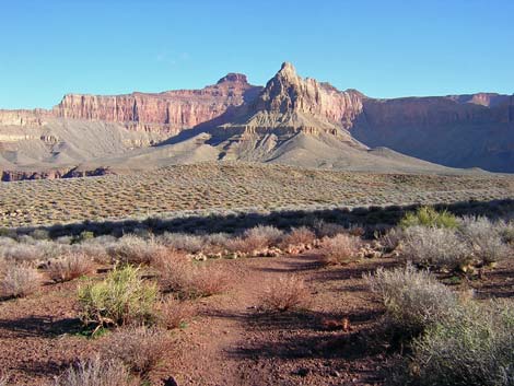
 Trail and Boucher Rapids (view NW) |
Overview This description of the Tonto West Trail is divided into two parts: (1) an overview of the entire trail, trailheads, and other general information, and (2) individual canyon-to-canyon segments. From the wash in Travertine Canyon, it is about 2.2 miles and 1.25 hours to the Tonto-Boucher trail junction. There is no water along this segment. This segment of the trail runs out the west side of Travertine Canyon, loops around White's Butte (ridge below Cocopa Point), and turns into the Boucher drainage system. The trail getting out of the Travertine drainage system is a bit rough, and there are some airy spots on steep sideslopes, but it is short. There are more airy (but more secure) spots overlooking the river before the trail turns into the Boucher drainage system, and then a delightful trail runs across the Tonto Platform to the Boucher Trail junction. This segment of trail runs through Backcountry Use Zone BN9, where camping is at large (you can camp anywhere). Link to map of this segment. |
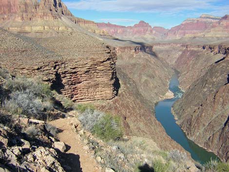
 Hiking along edge of Inner Gorge (view NW) |
Watch Out Other than the standard warnings about hiking in the desert, ...be sure to read the Watch Out section on the Tonto West Overview page, which discusses things such as cell phones and signal mirrors. While hiking, please respect the land and the other people out there, and please try to Leave No Trace of your passage. Getting to the Trailhead Trailhead information is presented on the Tonto West Overview page. |
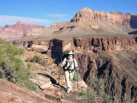
 Hiker on a saddle (view SE) |
The Hike 8. Travertine Canyon to Boucher Trail Junction -- 2.2 miles and 1.25 hours From the wash in Travertine Canyon (Table 8, Waypoint 023), the trail west out of Travertine Canyon runs down the wash and cuts out across steep hillsides to the west. Getting out of Travertine is quick but strenuous. The narrow trail runs across steep, rocky hillsides with cliffy spots, short but steep ups and downs, and some high steps; and there are many places to stumble and go over the edge into Travertine Canyon. The trail runs out to a saddle behind a large boulder pile (Wpt. 024), then quickly turns out of the Travertine drainage system at a rocky point (Wpt. 025) overlooking the Inner Gorge. |
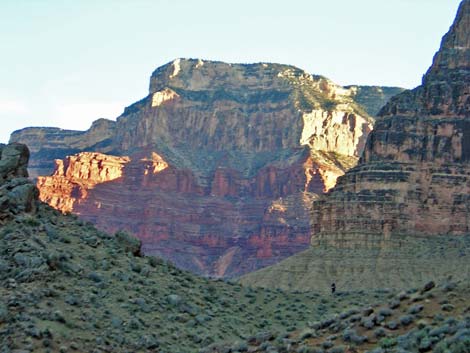
 Faint trail (view N) |
From the rocky point (Wpt. 025), the trail turns and runs downriver, crossing several saddles but mostly crossing steep, rocky side slopes overlooking the river, until turning onto the flats of the Tonto Platform near Boucher Canyon. Just west of the rocky point, there is a nice campsite on a bluff with a view to the north (Wpt. 026). From there, the trail runs out to a point and crosses a ridge with great views of the river (Wpt. 027). From the ridge, the trail runs across side slopes (with drop-offs to the river) to a saddle (Wpt. 028) with grand views of Boucher Rapids to the west and Hermit Rapids to the east. From this saddle, the trail runs across another steep side slope to a low saddle (Wpt. 029), and then on to another saddle at the northeast corner of Boucher Canyon (Wpt. 030) with a campsite. |
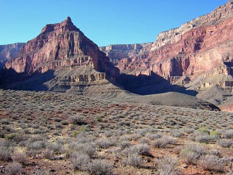 Boucher (left) and Topaz (right) canyons (view S) |
From the low saddle (Wpt. 030), the trail becomes easy as it turns west, hooks around the northwestern toe of Whites Butte (Wpt. 031), and then runs south into Boucher Canyon. The trail generally heads southwest until abruptly turning southeast. This abrupt turn is a bit confusing; watch for little cairns (this is where the current trail intersects an old trail, and it is easy to miss the turn when hiking east). The trail runs southeast across gentle flats, getting closer and closer to the edge of the Tapeats cliffs. Near the edge, the trail runs across a sideslope and contours into a large gully. Across the gully, the trail turns and runs down the hillside along the far side of the gully, quickly intersecting the Tonto-Boucher trail junction (Wpt. 032). The junction (Wpt. 032) is unmarked, but from the gentle flats, you can see the trail on the west side of White's Butte. The Boucher Trail switchbacks steeply up the side of White's Butte to the base of the Redwall, then cuts across the top of the slope beneath the limestone cliffs and disappears into the back of the canyon. Watch for several cairns and a big "B" scratched on a boulder at the trail junction. |
Table 8 Hiking Coordinates Based on GPS Data (NAD27; UTM Zone 12). Download Entire Route Waypoint (gpx) file.
| Wpt. | Location | Time | Easting | Northing | Elevation (ft) | Verified |
|---|---|---|---|---|---|---|
| 023 | Travertine Wash (106) | 1033 | 389779 | 3995124 | 3,237 | GPS |
| 024 | Ridge with large boulder pile, camps (105) | 1021 | 389977 | 3995472 | 3,226 | GPS |
| 025 | Turn out of Travertine drainage (104) | 1020 | 389979 | 3995513 | 3,196 | GPS |
| 026 | Ridge on sidehill, camps (103) | 1014 | 389906 | 3995693 | 3,175 | GPS |
| 027 | Saddle, camps (102) | 1009 | 389816 | 3995823 | 3,208 | GPS |
| 028 | Rocky point (101) | 1002 | 389719 | 3996035 | 3,158 | GPS |
| 029 | Saddle behind small rocky knob, camps (100) | 0930 | 389370 | 3996358 | 3,183 | GPS |
| 030 | Turn into Boucher canyon, camps (99) | 0920 | 388962 | 3996577 | 3,197 | GPS |
| 031 | Low ridge with nice campsites (98) | 0912 | 388719 | 3996497 | 3,181 | GPS |
| 032 | Tonto-Boucher trail junction (97) | 0853 | 388742 | 3996057 | 3,137 | GPS |
Happy Hiking! All distances, elevations, and other facts are approximate.
![]() ; Last updated 240326
; Last updated 240326
| Hiking Around Grand Canyon | Hiking Around Las Vegas | Glossary | Copyright, Conditions, Disclaimer | Home |