Hermit Creek to Travertine Canyon
Hiking Around Las Vegas, Grand Canyon National Park
Overview | Previous Segment | Next Segment
 Hermit Creek just above campground. Trail west goes out just above the cliffs (view N) |
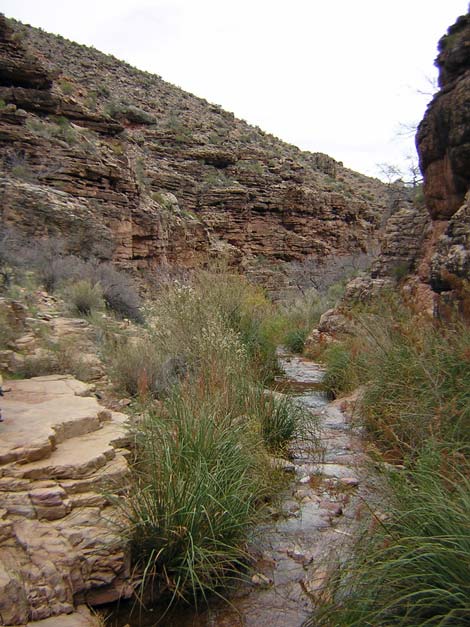
Overview This description of the Tonto West Trail is divided into two parts: (1) an overview of the entire trail, trailheads, and other general information, and (2) individual canyon-to-canyon segments. From Hermit Creek Campground, it is about 2.6 miles and 1.75 hrs to the wash in Travertine Canyon. Drinking water is available only in Hermit Creek. This segment of the trail runs from the back of Hermit Canyon out to a point overlooking Hermit Canyon and the Inner Gorge that boasts one of the most beautiful views on the entire Tonto West Trail. From there, the trail turns west to cross the north face of Yuma Point, which is a bit exhilarating because this is one of the few places along the entire Tonto West Trail where you really feel as though you might slip and fall into the river. From Yuma Point, the trail turns and runs up into Travertine Canyon, which is the second-hardest canyon to cross on the entire Tonto West Trail (Boucher is the hardest). Hermit Creek is in Backcountry Use Zone BM7 (camping only in the campground), and Travertine Canyon is in Zone BN9, where camping is at large (you can camp anywhere). Link to map of this segment. |
 Overlooking river; trail runs below cliffs past juniper tree (view NW) |
Watch Out Other than the standard warnings about hiking in the desert, ...be sure to read the Watch Out section on the Tonto West Overview page, which discusses things such as cell phones and signal mirrors. While hiking, please respect the land and the other people out there, and please try to Leave No Trace of your passage. Getting to the Trailhead Trailhead information is presented on the Tonto West Overview page. |
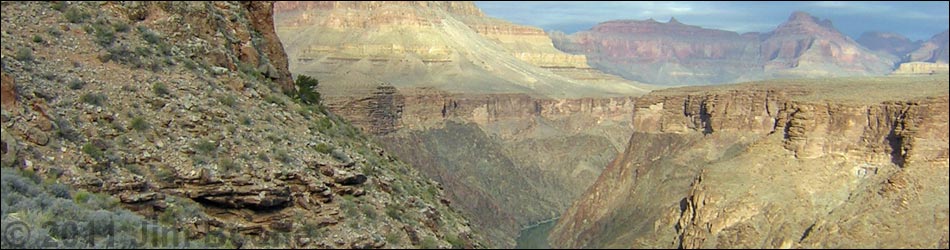
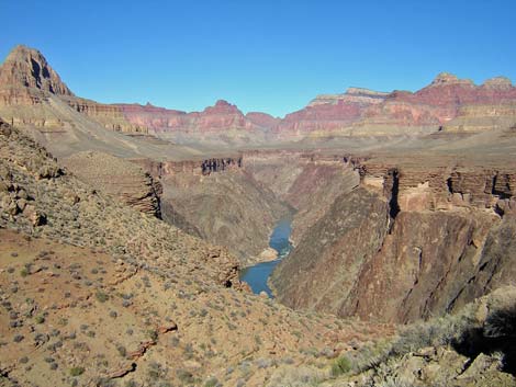
 Hermit Rapids from trail under toe of Yuma Point (view NE) |
The Hike 7. Hermit Creek to Travertine Canyon -- 2.6 miles and 1.75 hrs From the outhouse in Hermit Creek Campground (Table 7, Waypoint 018), the Tonto Trail runs upstream past the last campsite and drops into the bottom of the canyon. The trail crosses the creek and runs upstream for about 75 yards to where the canyon narrows (Wpt. 019). The trail then cuts steeply up the rocky slope through a break in the cliffs to get above the Tapeats Sandstone. The spot where the trail cuts up the hillside is obvious and marked with cairns. |
 |
Getting above the band of cliffs puts you back on the Tonto Platform. It doesn't look like it from the back of the canyon, but the trail stays more-or-less on the contour all the way out to a point overlooking the Colorado River. Getting out of the back of the canyon is a bit rough. The trail is narrow, it runs along a steep sideslope, there are many rocks in the trail, and there are many steep little spots as the trail runs across each gully; all of which makes for slow going. As the trail gets out of the back of the canyon (Wpt. 020), the Tonto Platform widens, the trail becomes more pleasant, and there are some nice illegal campsites. |
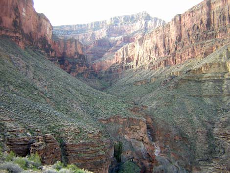 Travertine Canyon (view SW) |
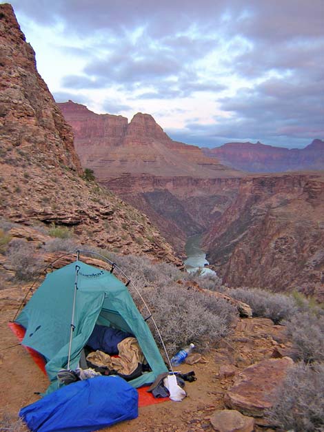
The trail winds around one large side canyon below Columbus Point, then runs northward across easy terrain to the point overlooking Hermit Canyon and the Inner Gorge (Wpt. 021). This point is a most spectacular place. Campsites on the point are just inside the Boucher at-large camping zone, which makes them legal with a Boucher permit. If you don't need to camp near water and an outhouse, this campsite is much nicer than Hermit Campground. |
 Travertine Canyon (view W) |
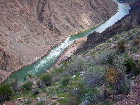
From the spectacular point (Wpt. 021), a quite narrow, rocky, and rather exhilarating trail turns northwest under the toe of Yuma Point. The trail runs across a steep dirt slope below a band of cliffs with a shear slide-off into the river. This place has stunning views down to the river, and you get the feeling that if you fell, you would fall straight into Hermit Rapids. After passing the toe of Yuma Point, the trail turns southwest and runs up into Travertine Canyon (Wpt. 022). Crossing Travertine is fairly tough, as there are many steep up, steep down, and rocky parts. This trail goes far back into the canyon, climbs higher onto the steep rocky hillsides below the Redwall, and it does so more quickly than in the other canyons. Of all the canyon crossings on the Tonto West Trail, only Boucher Canyon is harder to cross. When the trail crosses Travertine Wash (Wpt. 023), it runs up to the edge of a cliff, then cuts steeply, straight down the cliff for 25 feet or so to the wash below. From the spot where the trail jumps off the cliff, it is easier to take a sheep-trail that runs south and more gently down across a sideslope, hitting the wash some 30 yards upstream from where the regular trail hits the wash. The only place to camp here is the creek bed. |
Table 7. Hiking Coordinates Based on GPS Data (NAD27; UTM Zone 12). Download Entire Route Waypoint (gpx) file.
| Wpt. | Location | Time | Easting | Northing | Elevation (ft) | Verified |
|---|---|---|---|---|---|---|
| 018 | Hermit Camp Outhouse (112) | 1211 | 390878 | 3993501 | 2,904 | GPS |
| 019 | Hermit Creek Crossing (111) | 1209 | 390842 | 3993436 | 2,923 | GPS |
| 020 | Broad ridge with nice illegal campsites (110) | 1155 | 390850 | 3994099 | 3,036 | GPS |
| 021 | Turn out of Hermit drainage (108) | 1123-1105 | 390714 | 3995332 | 3,101 | GPS |
| 022 | Turn into Travertine drainage (107) | 1057 | 390475 | 3995481 | 3,118 | GPS |
| 023 | Travertine Wash (106) | 1033 | 389779 | 3995124 | 3,237 | GPS |
Happy Hiking! All distances, elevations, and other facts are approximate.
![]() ; Last updated 240326
; Last updated 240326
| Hiking Around Grand Canyon | Hiking Around Las Vegas | Glossary | Copyright, Conditions, Disclaimer | Home |