Lonetree Canyon to Cremation Canyon
Hiking Around Las Vegas, Grand Canyon National Park
Overview | Next Segment West | Next Segment East
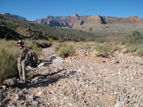
 Hiker just below the trail crossing in Lonetree Canyon (view S) |
Overview
I've organized my description of the Tonto East Trail into two parts: (1) an overview of the entire trail, trailheads, and other general information, and (2) individual canyon-to-canyon segments. From Lonetree Canyon, it is about 3.3 miles and 1.75 hours to Cremation Canyon. This segment of the trail runs out the west side of Boulder Canyon, loops around Pattie Butte, and then runs up into Cremation Canyon. Most of the trail is fast and easy. The first half runs on a gentle contour with a few rocky gullies, but the second half runs more line-of-sight (up over ridges and down through gullies). Views above and below the trail and out into the Inner Gorge are spectacular. Lonetree Canyon is in Camping Zone BJ9 (camping at-large), and Cremation Canyon is in Zone BJ9 (camping at-large). Link to map of this segment. |
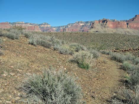
 Trail crosses Lonetree Canyon at a low band of cliffs (view SE) |
Watch Out Other than the standard warnings about hiking in the desert, ... This segment of the trail is fairly safe, but be sure to read the Watch Out section on the Tonto East Overview page, which discusses things such as cell phones and signal mirrors. While hiking, please respect the land and the other people out there, and please try to Leave No Trace of your passage. |
 Trail along lower Lonetree Canyon (view N) |
Getting to the Trailhead Trailhead information is presented on the Tonto East Overview page. This segment of the Tonto East Trail can only be accessed from other segments of the Tonto East Trail -- there is no rim access. |
 Trail west of Lonetree Canyon (view NW) |
The Hike 7. Lonetree Canyon to Cremation Canyon -- 3.3 miles and 1.75 hours From the wash crossing in Lonetree Canyon (Wpt. 52; 1133), the trail cuts steeply up the hillside, angling slightly upstream following an obscure trail with good cairns, to a cairn set atop a boulder that you can see from the wash crossing below. The trail then turns north and heads out on the contour. The trail passes a small side canyon, rounds a point, and turns into a larger side canyon on the contour. The trail climbs into the side canyon at a moderate grade, crosses the wash (Wpt. 53; 1150 hrs), and climbs out onto a low ridge (Wpt. 54; 1155 hrs) with marginal campsites. |
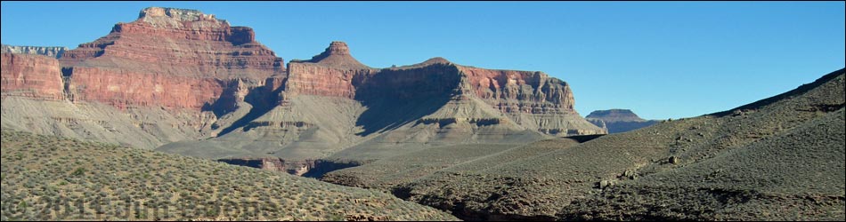
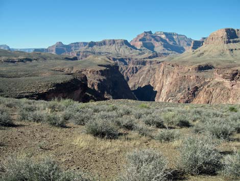 Mouth of Cremation Canyon (left); Inner Gorge (right) (view W) |
The trail runs up the ridge heading northwest to exit Lonetree Canyon (1203 hrs) on little ridges and points with views into the Inner Gorge. There are some marginal campsites among the pricklypear cactus on the ridge we named "Bug Butte" (Wpt. 55; 1204 hrs). The trail continues running northwest, crossing the back of a rocky side canyon (Wpt. 56; 1212 hrs), cresting a little rise (Wpt. 57; 1216 hrs) with nice campsites off the trail out towards the edge of the canyon, and finally crossing a low ridge with several tent campsites and grand views up into Cremation Canyon (Wpt. 58; 1222 hrs). This last bit of trail is unusual for the Tonto Trail because it does not run on the contour. Rather, it runs more-or-less straight across the landscape up over ridges and down into canyons following erosion gullies. |
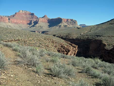
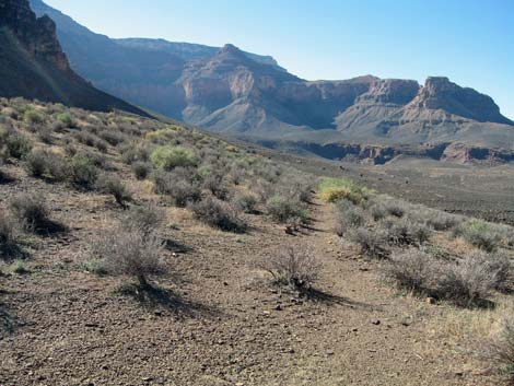 Trail turning into Cremation Canyon (view SW) |
From the low ridge, the trail contours down and around a hillside into a side canyon, which is crossed near a large boulder (Wpt. 59; 1233) with a campsite under the boulder. The trail then cuts straight down the hillside along the south side of the wash. The trail here is steep and rocky compared to the rest of the trail, but it eventually turns and cuts off across the hillside on the contour. After crossing a wash, the trail climbs at a good rate onto another low ridge (Wpt. 60; 1241) that marks the turn into Cremation Canyon. From there, the trail cuts off gently across hillsides towards the back of the canyon. |
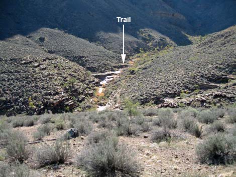
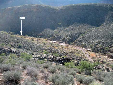 Trail crossing (arrow) in east fork of Cremation Canyon (view SW) |
The trail runs southwest across an undulating plane taking the line-of-sight over several low hills and through several little gullies. The trail eventually runs up onto a broad ridge (Wpt. 61; 1254) with nice campsites. This ridge provides the first good view into the east fork of Cremation Canyon. From the broad ridge, the trail angles down and across hillsides as it curves to the south heading into the back of Cremation Canyon. The trail eventually drops into the broad wash in the east fork of Cremation Canyon (Wpt. 62; 1306 hrs). The trail crosses the wash directly beneath cliffs on the west side of the wash. |
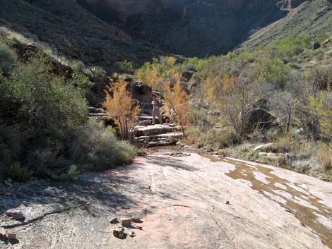
 Hiker at trail crossing in the east fork of Cremation Canyon (view N) |
At the crossing, there are campsites suitable for a couple of tents on the west bank of the wash. There is no water. The canyon here feels quite open and shallow, but that provides spectacular views up and down the canyon. In contrast to this crossing, most canyons are narrower and feel more confined with limited views. The vegetation is mostly desert species plus some Catclaw Acacia "trees," some Saltcedar, and lots of composite shrubs. |
Table 7. Hiking Coordinates Based on GPS Data (NAD27; UTM Zone 12). Download Entire Route Hiking GPS Waypoints (*.gpx) file.
| Wpt. | Location | Easting | Northing | Elevation | Point-to-Point Time (min) | Cumulative Time (min) | Point-to-Point Distance (mi) | Cumulative Distance (mi) | Total Tonto Distance (mi)* |
|---|---|---|---|---|---|---|---|---|---|
| 52 | Lonetree Wash | 405870 | 3992189 | 3,624 | 0:00 | 0:00 | 0.00 | 0.00 | 29.27 |
| 53 | Back of a side canyon | 406014 | 3992722 | 3,723 | 0:30 | 0:30 | 0.58 | 0.58 | 29.85 |
| 54 | Low ridge with marginal campsites | 406191 | 3992674 | 3,743 | 0:04 | 0:34 | 0.15 | 0.73 | 30.00 |
| 55 | Marginal campsites among cactus | 406045 | 3993101 | 3,766 | 0:07 | 0:42 | 0.32 | 1.05 | 30.32 |
| 56 | Crossing rocky side canyon | 405791 | 3993196 | 3,766 | 0:09 | 0:52 | 0.24 | 1.29 | 30.56 |
| 57 | Little rise with nice campsites | 405639 | 3993388 | 3,763 | 0:03 | 0:56 | 0.14 | 1.43 | 30.70 |
| 58 | Low ridge with campsites | 405406 | 3993570 | 3,791 | 0:05 | 1:02 | 0.27 | 1.70 | 30.97 |
| 59 | Marginal campsite | 405348 | 3993408 | 3,763 | 0:10 | 1:12 | 0.35 | 2.05 | 31.32 |
| 60 | Low ridge | 404975 | 3993560 | 3,725 | 0:08 | 1:21 | 0.21 | 2.26 | 31.53 |
| 61 | Broad ridge with nice campsites | 404193 | 3993378 | 3,690 | 0:12 | 1:34 | 0.59 | 2.85 | 32.12 |
| 62 | Cremation Canyon (east fork) crossing | 403855 | 3992891 | 3,612 | 0:11 | 1:45 | 0.46 | 3.31 | 32.58 |
Happy Hiking! All distances, elevations, and other facts are approximate.
![]() ; Last updated 240326
; Last updated 240326
| Hiking Around Grand Canyon | Hiking Around Las Vegas | Glossary | Copyright, Conditions, Disclaimer | Home |