Cremation Canyon to South Kaibab Trail (Tipoff)
Hiking Around Las Vegas, Grand Canyon National Park
Overview | Next Segment West | Next Segment East
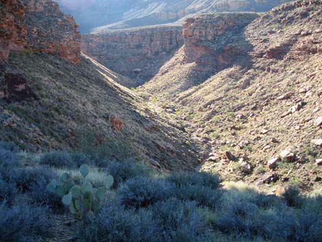
 Cremation Canyon (east fork) trail crossing (view up canyon, SE) |
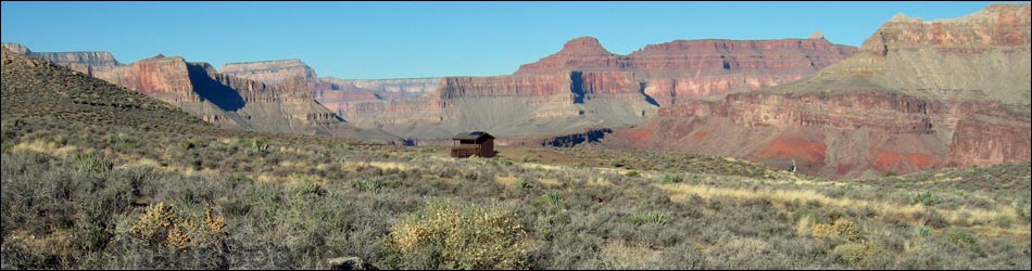
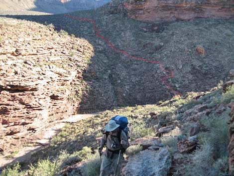
Overview I've organized my description of the Tonto East Trail into two parts: (1) an overview of the entire trail, trailheads, and other general information, and (2) individual canyon-to-canyon segments. From east fork of Cremation Canyon, it is about 3.0 miles and 2 hours to The Tipoff (South Kaibab Trail junction). This segment of the trail runs out the west side of Cremation Canyon, then climbs onto a ridge and the junction with the South Kaibab Trail at The Tipoff. This is one of the toughest parts of the entire Tonto Trail, but time wise, it is short. The first part crosses two deep, steep canyons, and the second part climbs a long, steep hillside. Views above and below the trail are spectacular. Cremation Canyon is in Camping Zone BJ9 (camping at-large), and The Tipoff is in a no camping zone. Link to map of this segment. |
 Looking back at trail dropping into E fork Cremation Canyon (view SE) |
Watch Out Other than the standard warnings about hiking in the desert, ...this segment is fairly safe, but be sure to read the Watch Out section on the Tonto East Overview page, which discusses things such as cell phones and signal mirrors. While hiking, please respect the land and the other people out there, and please try to Leave No Trace of your passage. |
 Cremation Cyn (middle fork) trail crossing (view SW from top of cliffs) |
Getting to the Trailhead Trailhead information is presented on the Tonto East Overview page. The west end of this segment of the Tonto East Trail can be accessed from the South Kaibab Trail. The other end can only be accessed from other segments of the Tonto East Trail. |
 Cremation Canyon (middle fork) (view NE towards exit route) |
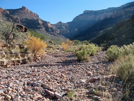
The Hike 8. Cremation Canyon to South Kaibab Trail (Tipoff) -- 2.4 miles From the wash crossing in the east fork of Cremation Canyon (Wpt. 62; 1321 hrs), the trail crosses the gravel wash more-or-less on the same line that it came in on. Across the wash, the trail climbs the hillside and passes a band of cliffs on the upstream side. The trail runs straight up the hillside to above the cliffs, then angles out and up on the contour. The trail runs northwest along the base of steep hillsides to a ridge with cliffs overlooking the middle fork of Cremation Canyon (1331 hrs); there are no campsites here. The trail then turns abruptly to the southwest and drops straight down a dirt cliff into the bottom of the canyon (Wpt. 63; 1337 hrs). There are campsites for one or two tents at the crossing (for those heading east who can't face climbing the dirt cliff at the end of a long day). |
 Cremation Canyon (west fork; view E) |
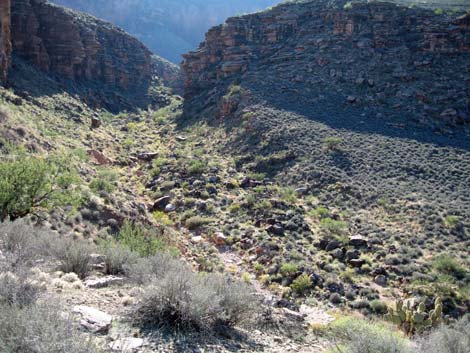
The trail crosses the wash and immediately turns and runs down the bottom of the canyon on the west side of the wash. The trail follows the wash, then starts (1343 hrs) climbing out of the canyon on a very steep trail that leads to a saddle (Wpt. 64; 1348 hrs) with marginal campsites. From the saddle, the trail continues northwest to the top of the cliffs overlooking the west fork of Cremation Canyon. Again, the trail turns abruptly to the southwest and drops off a very steep rock and dirt hillside into the bottom of the canyon (Wpt. 65; 1400 hrs). There are campsites here, but only in the wash. |
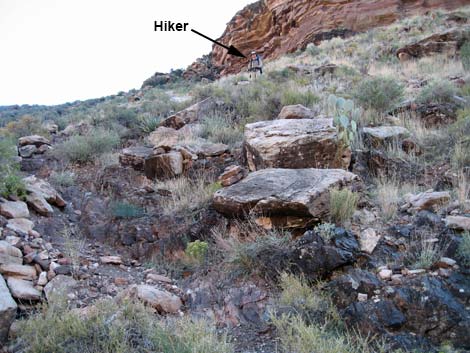 Hiker descending into W fork of Cremation Canyon (view SE) |
In the bottom of the canyon (1405 hrs), the trail turns down the streambed, crosses under an enormous boulder, and then starts (1406 hrs) climbing the steep, rocky hillside on the west side of the wash. On the flats at the top of the gorge (Wpt. 66; 1412 hrs), the trail continues northwest across, in comparison, gentle flats. The trail passes a large campsite (Wpt. 67; 1422 hrs) that has space for several tents on a flat pad and a big rock shelter overhang with a stone wall in case of rain. Note: we stopped here for the night. My journal that evening was: "A lot of the trail today was stony with lots of little rocks that hurt my feet. ... and the guy on the Internet was right: crossing Cremation after a long day is hard. So far on the Tonto east, crossing Cremation Canyon was by far the hardest." |
 Hiker on trail exiting west fork of Cremation Canyon (view SE) |
From the large campsite (Wpt. 67; 0740 hrs), the trail continues northwest along the base of steep hillsides and cliffs contouring, more or less, in and out of little side canyons. The trail passes a pair of very large (3-4 ft high) cairns (Wpt. 68; 0752 hrs). One of the cairns is knocked down, and there are campsites for 3 tents towards the wash from here. The cairns are important because the Park Service marked the edge of the Tipoff no-camping zone with cairns. However, these are not the boundary cairns, the boundary is farther up the trail (this is 1.3 miles from The Tipoff. |
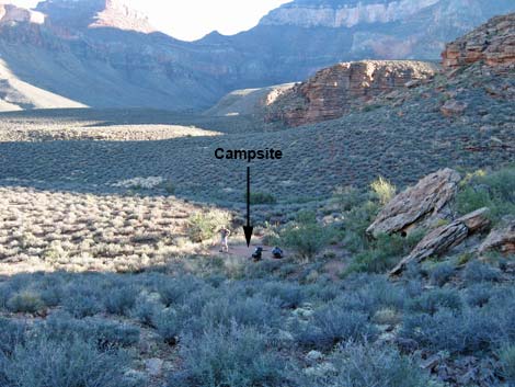 Big campsite on flats W of Cremation Cyn wash crossings (view SE) |
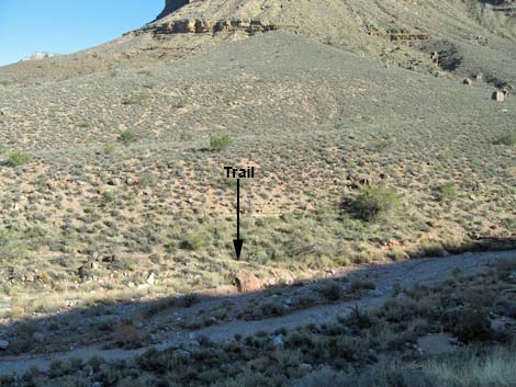
The trail continues northwest along the base of steep hillsides, then turns (Wpt. 69; 0757 hrs) and runs straight up a rocky ridge that merges into a rocky hillside. This is the start of the climb to The Tipoff, and there are big sites on the flats at the base of the hill below the trail. Climbing steeply, the trail passes a pair or large cairns (Wpt. 70; 0805 hrs) that mark the edge of the no-camping zone (1 mile from The Tipoff). These cairns are on a steep hillside with no campsites nearby. The trail continues steeply, then eases a bit as it turns and runs up and across the hillside (0809 hrs). |
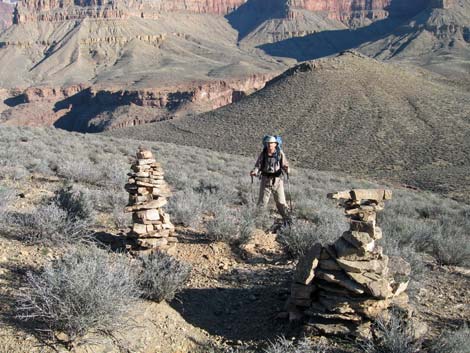 Large cairns mark no camping zone boundary (view N) |
As the trail climbs onto a ridgeline (Wpt. 71; 0811 hrs), it passes several illegal campsites, and 30-seconds up the ridge, it passes several more. As the grade eases, the trail contours into a wash in a side canyon (Wpt. 72; 0819 hrs). The trail drops into the wash and runs -- down -- the wash 20 yards before turning out. Despite the number of people who must hike here, the trail is not obvious here. |
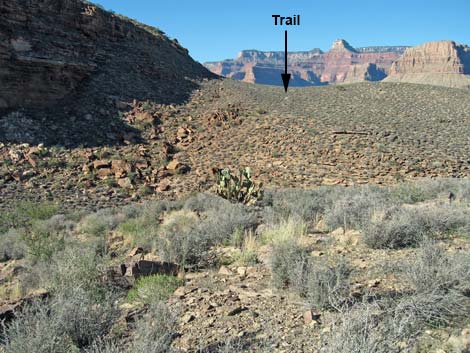
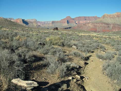 Trail into The Tipoff (view NW towards outhouse) |
The trail contours into another side canyon heading upstream, crosses the wash (0822 hrs), and continues up the canyon onto a ridge (Wpt. 73; 0826 hrs). At the top of the ridge, there are enough illegal tent sites to bivouac a troop of Boy Scouts. From the ridge, the trail runs gently down across Blackbrush-covered flats to The Tipoff outhouse (Wpt. 74; 0832 hrs), a nice 3-seater composting toilet, hitching posts for mules, and the junction with the South Kaibab Trail (Wpt. 75; 0833 hrs). The junction is marked with a "Tonto-Trail East" sign. Although not on the Tonto Trail, it is worth the few minutes it takes to walk down to "the actual tipoff," the point on the edge of the Inner Gorge where the trail seems to "tip off" the edge of the world. There are great views of the Colorado River and the Phantom Ranch area. |
Table 8 Hiking Coordinates Based on GPS Data (NAD27; UTM Zone 12). Download Entire Route Hiking GPS Waypoints (*.gpx) file.
| Wpt. | Location | Easting | Northing | Elevation | Point-to-Point Time (min) | Cumulative Time (min) | Point-to-Point Distance (mi) | Cumulative Distance (mi) | Total Tonto Distance (mi)* |
|---|---|---|---|---|---|---|---|---|---|
| 62 | Cremation Canyon (east fork) crossing | 403855 | 3992891 | 3,612 | 0:00 | 0:00 | 0.00 | 0.00 | 32.58 |
| 63 | Cremation Canyon (middle fork) crossing | 403510 | 3993180 | 3,596 | 0:20 | 0:20 | 0.52 | 0.52 | 33.10 |
| 64 | Saddle | 403452 | 3993468 | 3,676 | 0:11 | 0:32 | 0.25 | 0.77 | 33.35 |
| 65 | Cremation Canyon (west fork) crossing | 403302 | 3993585 | 3,536 | 0:12 | 0:44 | 0.28 | 1.05 | 33.63 |
| 66 | Up on the flats | 403288 | 3993769 | 3,653 | 0:12 | 0:56 | 0.20 | 1.25 | 33.83 |
| 67 | Large campsite | 403236 | 3993940 | 3,647 | 0:08 | 1:05 | 0.15 | 1.40 | 33.98 |
| 68 | Possible boundary cairns | 403156 | 3994218 | 3,676 | 0:13 | 1:19 | 0.31 | 1.71 | 34.29 |
| 69 | Climbing out of Cremation Canyon | 403084 | 3994352 | 3,719 | 0:05 | 1:24 | 0.13 | 1.84 | 34.42 |
| 70 | Pair or large cairns | 402904 | 3994348 | 3,895 | 0:07 | 1:32 | 0.22 | 2.06 | 34.64 |
| 71 | Ridge with campsites | 402799 | 3994234 | 3,966 | 0:05 | 1:37 | 0.13 | 2.19 | 34.77 |
| 72 | Crossing a side canyon | 402541 | 3994037 | 3,981 | 0:08 | 1:46 | 0.26 | 2.45 | 35.03 |
| 73 | Ridge with many campsites | 402332 | 3994168 | 4,053 | 0:07 | 1:53 | 0.22 | 2.67 | 35.25 |
| 74 | Tipoff outhouse | 402093 | 3994315 | 4,009 | 0:05 | 1:58 | 0.21 | 2.85 | 35.46 |
| 75 | South Kaibab Trail junction | 402030 | 3994312 | 4,013 | 0:00 | 1:59 | 0.04 | 2.88 | 35.50 |
Happy Hiking! All distances, elevations, and other facts are approximate.
![]() ; Last updated 240326
; Last updated 240326
| Hiking Around Grand Canyon | Hiking Around Las Vegas | Glossary | Copyright, Conditions, Disclaimer | Home |