Hiking Around Las Vegas, Death Valley National Park
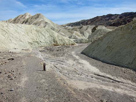
 Golden Canyon Trailhead (view NE) |
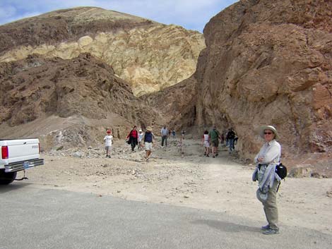
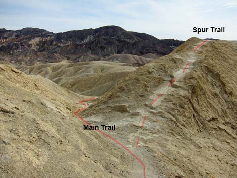
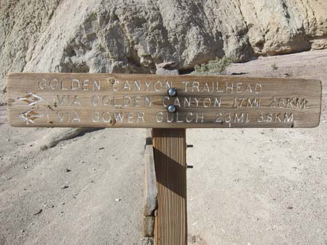
Overview This moderately strenuous, 4.3-mile loop involves a 1-mile walk up Golden Canyon, (a picturesque, narrow, and geologically interesting canyon), a steep 1.0-mile hike up and over badland mud hills to Gower Gulch, and a pleasant 2.0-mile hike down Gower Gulch through mud hills and towering conglomerate cliffs, returning back to the Golden Canyon Trailhead. There is a short, 3rd-class pour-over near the bottom of Gower Gulch to downclimb. This hike starts on the Golden Canyon Nature Trail. There are a few of the 10 numbered posts in Golden Canyon, so be sure to pick up a brochure at the Visitor Center or the trailhead so you can read about the local geology while hiking up the canyon. Link to map. |
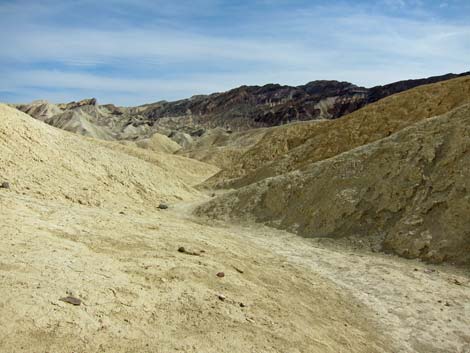
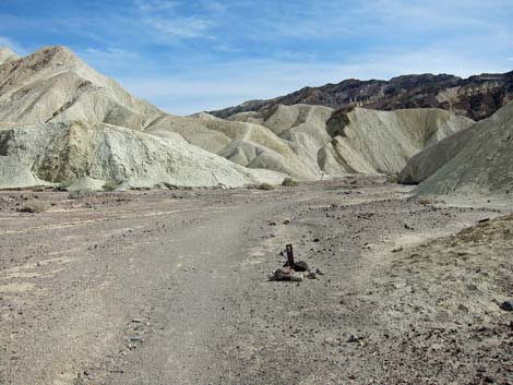
 Golden Canyon (view NE) |
Watch Out Other than the standard warnings about hiking in the desert, ...this hike is pretty safe, but stay out of the canyon (and off the mudhills) if it is raining or threatens to rain because of flash flood dangers. There is a pour-over in the lower end of Gower Gulch that is an easy 3rd-class downclimb, but the rock is water-polished and slick, plus it is covered with dust and gravel, so there is greater than usual risk of slipping. During warm weather, bring plenty of water and take advantage of shade as you find it. The higher-elevation traverse below Manly Beacon will be full sun, so find shade in Cathedral Canyon before hiking over the highlands into Gower Gulch Canyon. Similarly, after dropping out of Gower Gulch Canyon, there is no shade before the trailhead, so relax in the shade at the end of the canyon before descending onto the flats. |
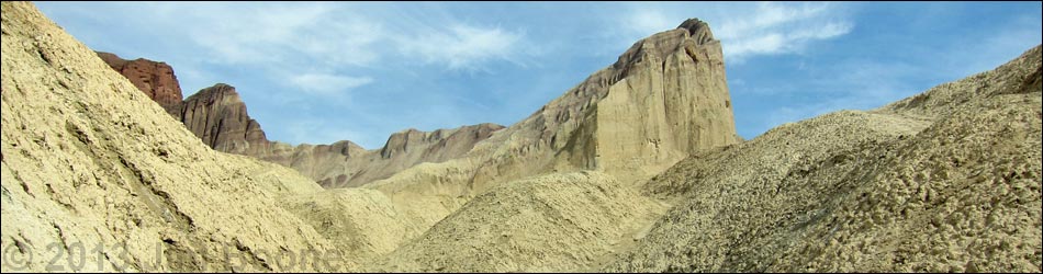
 Golden Canyon and Red Cathedral Cliffs (view NE) |
While hiking, please respect the land and the other people out there, and please try to Leave No Trace of your passage. Also, this is a fairly long hike, so be sure to bring the 10 Essentials. Getting to the Trailhead This hike is located along Badwater Road in Death Valley National Park, about 2 hours northwest of Las Vegas. From town, drive out to Death Valley, pay the entrance fee, and then drive to the Golden Canyon Trailhead. Park here; this is the trailhead. For a change of scenery, consider starting the hike at the Zabriskie Point Trailhead. |
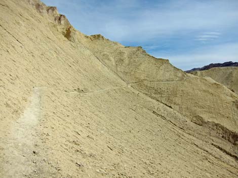
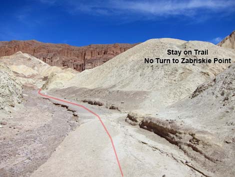 Wrong turn; stay on main trail (view NE) |
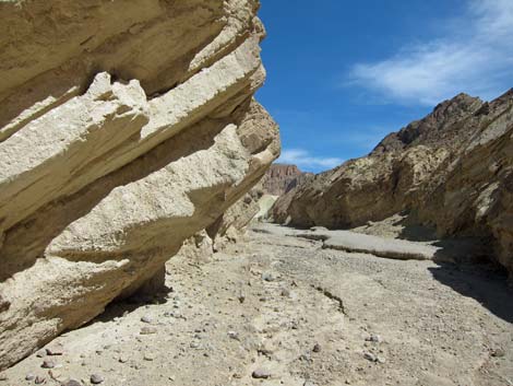
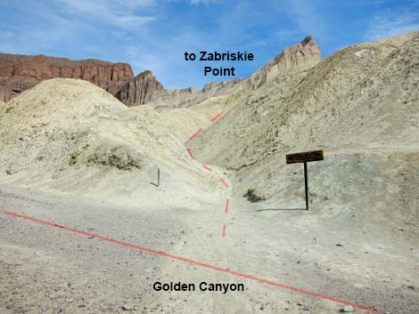
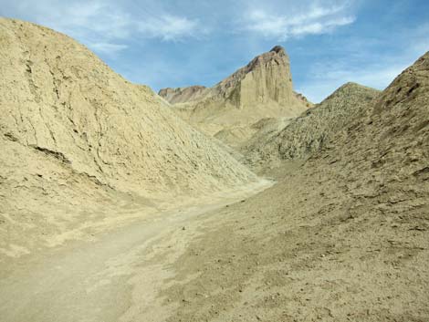
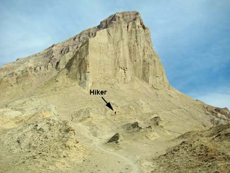
The Hike From the Golden Canyon Trailhead (Table 1, Waypoint 01), the trail immediately enters and ascends a narrow canyon with colorful walls, ripple marks in the rocks, and other evidence of wetter conditions in the past. The loop follows the Golden Canyon Nature Trail for 1.0 miles (about 30 minutes) to a trail junction at Trail Marker #10 (Wpt. 02). For details on this section of the hike, see the description of the Golden Canyon Trail. At the trail junction, a sign indicates that Red Cathedral is to the northeast (left; straight up the main canyon) and that Zabriskie Point and Gower Gulch are to the southeast (right; up a side canyon). The loop runs southeast and follows the narrow trail up into the eroded mudhills. Markers along this section of trail indicate which gullies to follow. The trail runs steeply and more or less directly towards the northwest corner of Manly Beacon, and there are some great views of the Red Cathedral cliffs. The trail then cuts southward under the sheer west face of Manly Beacon and runs out to a saddle on the southwest flank of the beacon (Wpt. 04). |
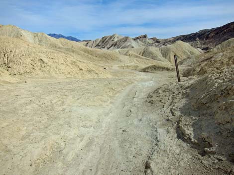
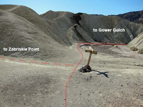
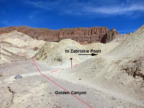 Golden Canyon - Zabriskie Trail junction (view NE) |
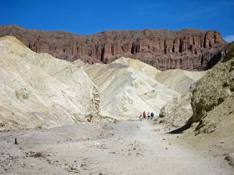
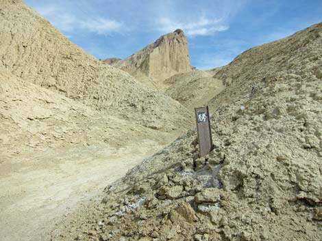
This saddle, 0.4 miles from Golden Canyon, marks the high point on the route. From the saddle, there are spectacular views of the badlands and mesquite flats in floor of Death Valley to the north and of badlands and mountains to the south. Even without shade, this is a great place to stop for lunch. From the saddle, the trail drops steeply through the mudhills heading southeast. Along this section of the trail, which gets well beyond Manly Beacon, hikers can look back to see that the brick-red Red Cathedral cliffs continue behind Manly Beacon and off towards Zabriskie Point. After about 0.3 miles, the trail arrives at another signed trail junction (Wpt. 05). The trail to the east (left; uphill) runs up to Zabriskie Point, while the trail to the southwest (right; downhill) runs down to Gower Gulch. Taking the trail towards Gower Gulch, the trail follows a little canyon with a firm base as it runs downhill through low mud hills. This canyon has no trail markings, but it stays in the main canyon. In the lower part of this little canyon, the hard gravel wash surface has eroded to form a tiny slot canyon (3 inches wide and 10 inches deep); it looks like a new slot canyon getting started in the old canyon. |
 |
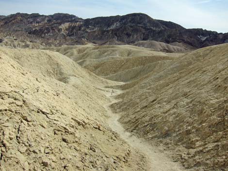
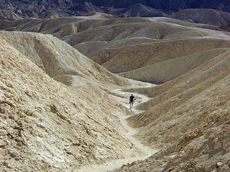
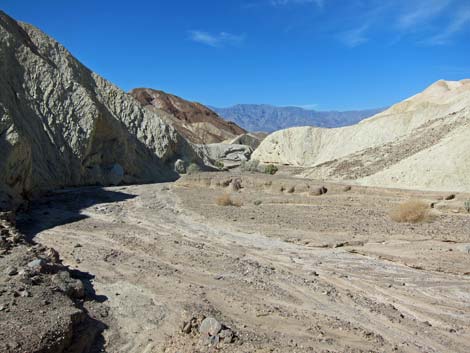
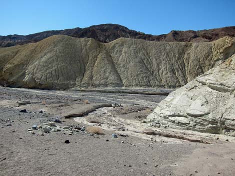
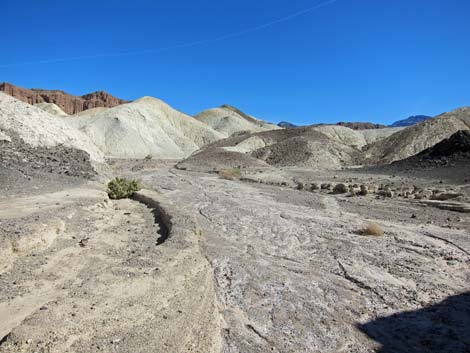
After about 0.3 miles, the little canyon ends at the edge of Gower Gulch with another signed trail junction (Wpt. 06); upstream leads to Zabriskie Point, while downstream leads back to the Golden Canyon Trailhead. From this junction, the route turns west (right) and down Gower Gulch. The gray gravel in the wash contrasts nicely with the pale-yellow badlands, and there is enough dirt mixed in the gravel to make the surface hard and easy to walk on. The vegetation in the wash is sparse, mostly desert holly and prickly penstemon, but it is lush compared to the mudhills. Hiking down Gower Gulch, there are places where water eroded the edges of the mudhills revealing the underlying sedimentary layers. It seems that the surface erodes and covers the hills with mud, making them look soft and rounded. There also seems to be places where a volcanic conglomerate or pyroclastic rubble is mixed into the mud; makes you wonder if volcanic rocks were blasted into an ancient lake. The mudhills survived the eons because they were capped by basalt flows, and in places the remains of the basalt cap can be seen on ridges south of the gulch. |
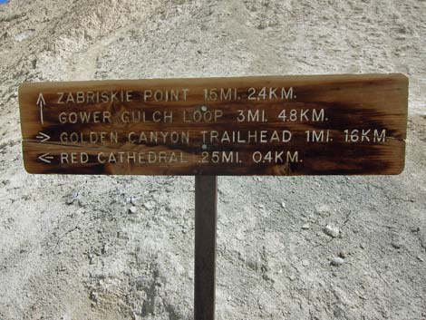 Sign at trail junction (view E) Distance to Red Cathedral is actually 0.47 miles |
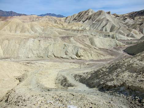
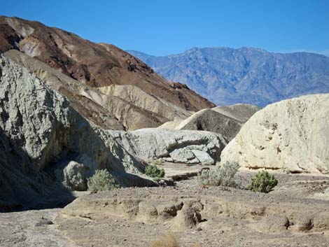
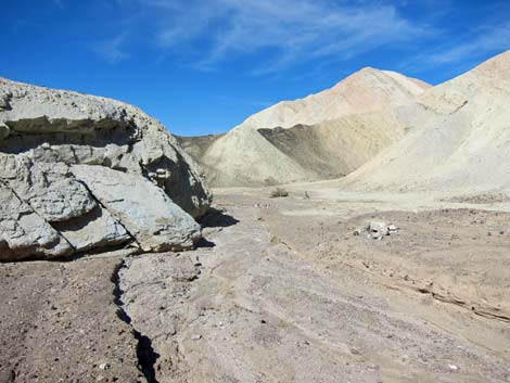
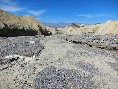
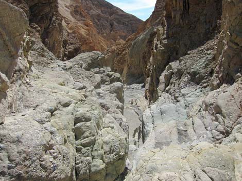
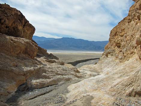
After another 0.6 miles, the canyon drops below the mud hills and gets into conglomerate rocks that form the lower portion of Gower Gulch and Golden Canyon (there are some sedimentary layers here too). This is also the borax mining area (Wpt. 07) where several mines penetrate the sides of the canyon and an old trail runs up the hillside north of the wash. There appear to be no mining structures in the area. Just downstream from the mining area, the canyon walls are formed of polished conglomerate rocks and green cliffs, and there are ripple marks in some red rocks along the canyon wall. About 0.3 miles below the mining area, the route arrives at the Gower Gulch pour-overs (Wpt. 08). There are several short scramble-downs and an easy 10-ft 3rd-class pour-over. About 0.3 miles downstream from the pour-over, the route arrives at the mouth of Gower Gulch, which opens suddenly onto the floor of Death Valley from atop a 25-ft-high pour-over (Wpt. 9). When first arriving at the edge of the pour-over, there appears to be no way to get down, but a trail cuts across ledges off to the north (right). This is a spectacular end to the canyon that would be nice to see with flowing water. |
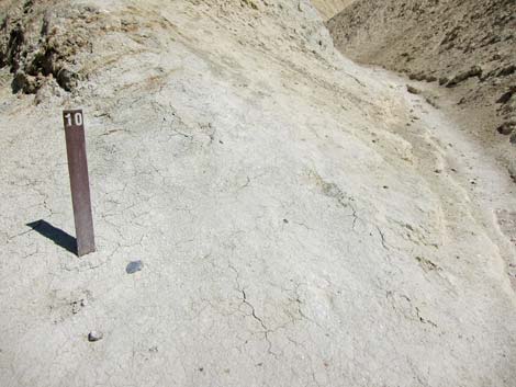 Marker #10 at junction (view E) |
Below the final pour-over, there is a fairly new erosion channel cut into the old alluvial fan with great contrast between new (bright gray) and old (dark and desert varnished) alluvium. The new channel has 6- to 10-ft high sidewalls that keep the newer flows tightly concentrated and flowing all the way out into bottom of the valley. After taking in the view, the route runs northward across ledges until reaching gentle slopes on the floor of Death Valley. From there, the route wanders north across the tops of several little alluvial fans to the Golden Canyon trailhead (Wpt. 01), which is about 0.8 miles north of the final pour-over. |
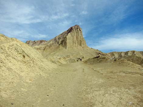
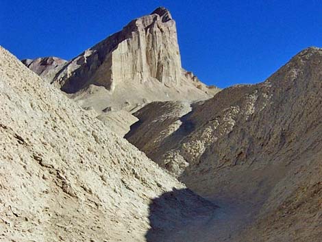 Manly Beacon (view E from trail marker #10) |
 |
 Watch for scattered trail markers (view E) |
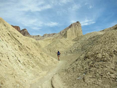 Human on trail heading for Manley Beacon (view E) |
 |
 |
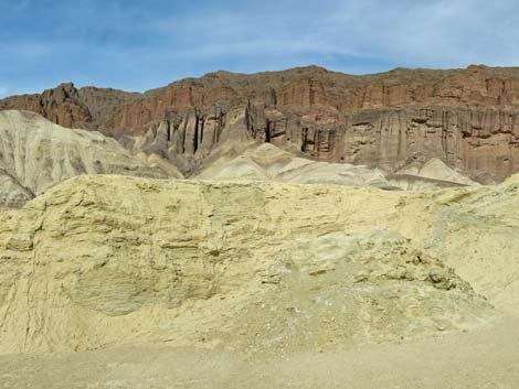 Passing Red Cathedral Cliffs (view NE) |
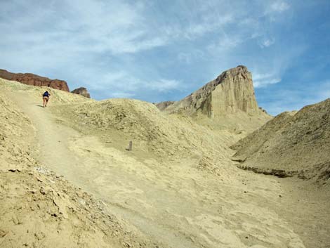
 Human on trail below Manley Beacon (view SE) |
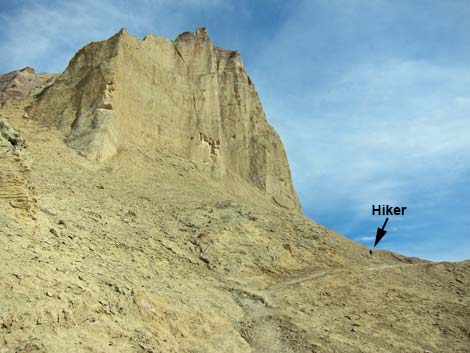 Human on trail below Manley Beacon (view SE) |
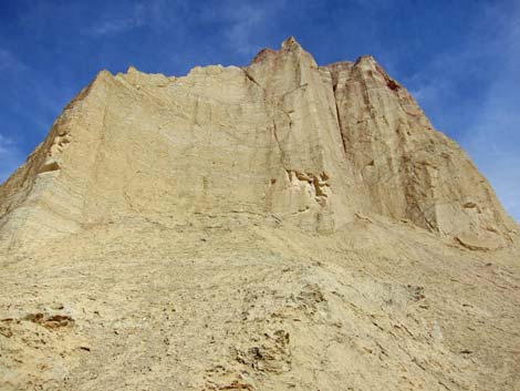 Manley Beacon (view NE) |
 Trail below Manley Beacon (view SE) |
 Trail below Manley Beacon (view SE) |
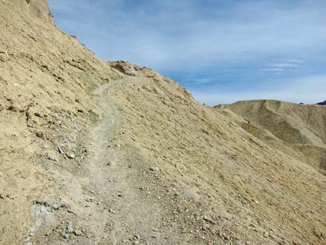
 Crest of ridge beyond Manley Beacon (view SE) |
 Trail follows canyon beyond Manley Beacon crest (view SE) |
 |
 Trail south of Manly Beacon (view S) |
 Trail marker along wash |
 Trail climbs over mud ridge (view SE) |
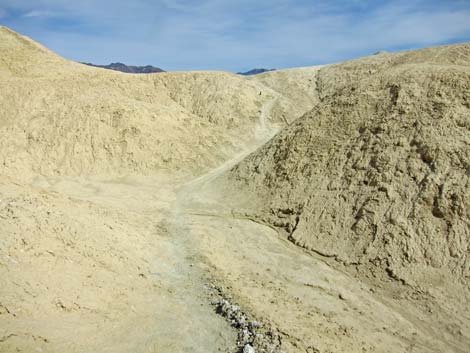
 Trail drops into next canyon (view SE) |
 Trail marker along wash (view S) |
 Trail marker along wash (view S) |
 Gower Loop - Zabriskie Point trail junction (view S) |
 Gower Loop - Zabriskie Point trail junction signs (view W) |
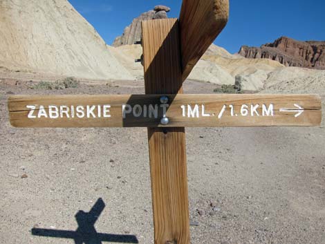 Gower Loop - Zabriskie Point trail junction signs (view N) |
 |
 |
 |
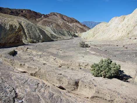 |
 Arriving at Gower Gulch, proper (view S) |
 Turning down into Gower Gulch, proper (view SW) |
 Could turn upstream and go to Zabriskie Point (view SE) |
 Hiking down into Gower Gulch, proper (view W) |
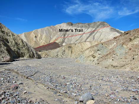 Miner's trail on hillside (view NW) |
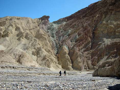 Hikers below colorful cliffs (view S) |
 Looking down pour-over (view SW) |
 Approaching sudden end of Gower Gulch (view west) |
 Hikers on pour-over bypass trail (view NW) |
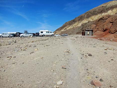 Arriving at Golden Canyon Trailhead (view N) |
Table 1. Hiking Coordinates Based on GPS Data (NAD27, UTM Zone 11S). Download Hiking GPS Waypoints (*.gpx) file.
| Wpt. | Location | UTM Easting | UTM Northing | Elevation (ft) | Point-to-Point Distance (mi) | Cumulative Distance (mi) | Verified |
|---|---|---|---|---|---|---|---|
| 01 | Golden Canyon Trailhead | 513808 | 4030411 | -167 | 0.00 | 0.00 | GPS |
| 02 | Trail Marker #10 | 515143 | 4030862 | 131 | 1.01 | 1.01 | GPS |
| 04 | SW Flank, Manly Beacon | 515636 | 4030620 | 500 | 0.43 | 1.44 | GPS |
| 05 | Signed Trail Junction | 516003 | 4030270 | 379 | 0.37 | 1.81 | GPS |
| 06 | Gower Gulch Wash, Edge | 515705 | 4030003 | 303 | 0.31 | 2.12 | GPS |
| 07 | Borax Mining Area | 514813 | 4029954 | 179 | 0.65 | 2.77 | GPS |
| 08 | Gower Gulch Pour-Over | 514499 | 4029706 | 86 | 0.41 | 3.18 | GPS |
| 09 | 25-ft Pour-Over | 514407 | 4029354 | -46 | 0.29 | 3.47 | GPS |
| 01 | Golden Canyon Trailhead | 513808 | 4030411 | -167 | 0.83 | 4.30 | GPS |
Happy Hiking! All distances, elevations, and other facts are approximate.
![]() ; Last updated 240324
; Last updated 240324
| Death Valley | Hiking Around Las Vegas | Glossary | Copyright, Conditions, Disclaimer | Home |