Backroads Around Las Vegas, Basin and Range National Monument
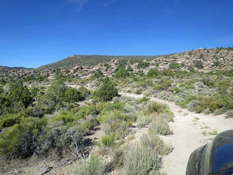
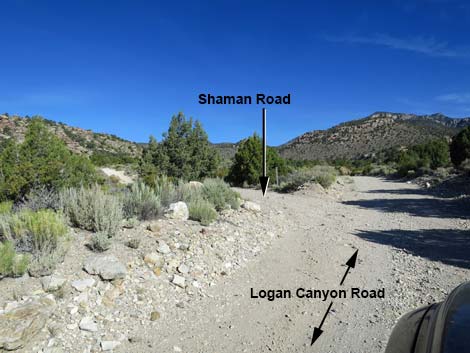 Logan Canyon Road at Shaman Road (view NW) |
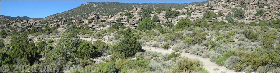
Overview Shaman Road is a dirt, 0.2-mile (350 yards) spur road that connects Logan Canyon Road with the Shaman Hill and Shaman Knob trailheads. The road once was maintained to be suitable for 2WD vehicles, assuming Logan Canyon Road is also suitable for 2WD, but now it is rougher (merely a 2-track road) and may require 4WD to cross two washes. In both cases, the road exiting the wash is steep, and driver of 2WD vehicles spin their tires and dig out the stop, making conditions worse. Shaman Road provides access to Shaman Hill and Shaman Knob, two archeological sites with large numbers of petroglyphs and a few pictographs. |
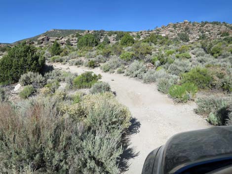
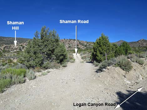 Shaman Road (view W from Logan Canyon Road) |
Watch Out Other than the standard warnings about driving in the desert, ...this road is pretty safe, but be sure that your vehicle is in good working condition and suitable for crossing the washes, carry plenty of water (radiator and drinking), and pack a lunch. Always drive carefully; even though the road is maintained, there are occasional hazards such as errant washouts. While out, please respect the land and the other people out there, and try to Leave No Trace of your passage. This road goes into remote areas, so be sure to bring the 10 Essentials. Cell phones don't work. |
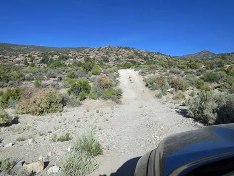 Shaman Road entering the first wash (view W) |
Getting to the Road Logan Townsite Road is located in the southern part of Basin and Range National Monument, about 2 hours northeast of Las Vegas. From Las Vegas, drive out to Basin and Range National Monument. From the intersection of Highway 93 and Highway 318, drive north on Highway 318 for 3.2 miles to Logan Canyon Road on the left. The intersection is not marked, but watch for a wire gate on the left. Drive west on Logan Canyon Road, past the two Archeological District signs, for a total of 8.9 miles to Shaman Road, which forks off to the left. |
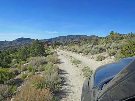
 Shaman Road on the high point between the two washes (view W) |
The Road From Logan Canyon Road (Table 1, Site 1135), Shaman Road forks left and runs west as it descends to cross a gravel wash. In 2WD vehicles, drivers should consider parking here (or along Logan Canyon Road); it is only 300 yards to the second trailhead. Continuing, the road climbs steeply out of the wash, runs over a low ridge, and drops into a second wash. Depending on conditions, this second crossing can be worse than the first. Continuing, the road climbs steeply out of the wash, runs onto gentle hillside parallel to the base of Shaman Hill, on the right. Quickly, Shaman Knob comes into view on the left. The road passes trailhead parking (Site 1136) for Shaman Hill as it bends around Shaman Knob and arrives at a wide area that serves as trailhead parking for Shaman Knob (Site 1137). The two trailheads are so close together that it doesn't matter where people park. Shortly, the road ends (0.2 miles out) at the end of the wide parking area. |
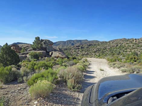
 Shaman Road approaching the second wash (view WS) |
 Shaman Road (view S) |
 Shaman Road approaching Shaman Knob (view S) |
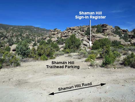 Shaman Road at Shaman Hill trailhead (view W) |
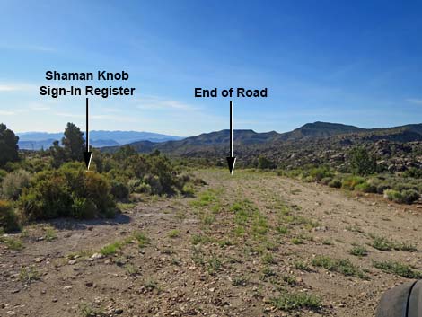 Shaman Road at Shaman Knob trailhead (view SE) |
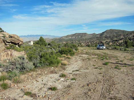 Sedans could make it to the end of the road during 2015 (view SE) |
 Shaman Knob parking (view NW) |
 Shaman Knob parking (view NE) |
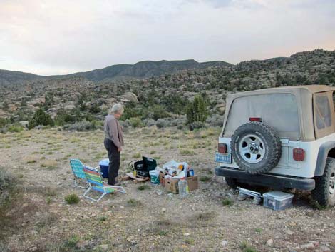 Camping at Shaman Knob (view S; evening) |
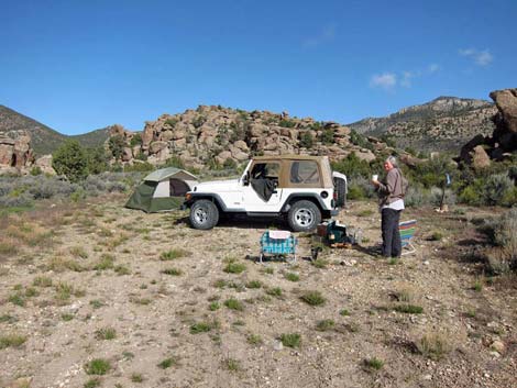 Camping at Shaman Knob (view W; morning) |
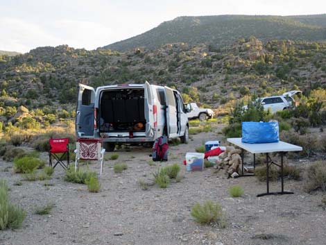 Camping at Shaman Knob (view S; evening) |
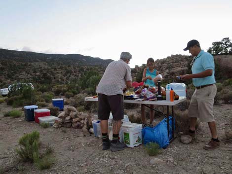 Camping at Shaman Knob (view SW; evening) |
Table 1. Highway Coordinates and Distances based on GPS Data (NAD27). Download Highway GPS Waypoints (gpx) file.
| Wpt. | Location | Latitude (N) | Longitude (W) | Elevation (ft) | Point-to-Point Distance (mi) | Cumulative Distance (mi) |
|---|---|---|---|---|---|---|
| 1135 | Logan Canyon Road at Shaman Road | 37.60820 | 115.37670 | 5,746 | 0.00 | 0.00 |
| 1136 | Shaman Rd at Shaman Hill | 37.60688 | 115.37767 | 5,769 | 0.15 | 0.15 |
| 1137 | Shaman Rd @ Shaman Knob | 37.60656 | 115.37755 | 5,734 | 0.03 | 0.17 |
Happy Hiking! All distances, elevations, and other facts are approximate.
![]() ; Last updated 240324
; Last updated 240324
| Basin and Range | Backroads | Hiking Around Las Vegas | Glossary | Copyright, Conditions, Disclaimer | Home |