Backroads Around Las Vegas, Basin and Range National Monument
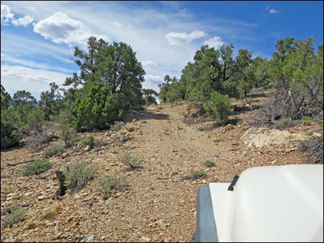
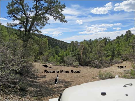
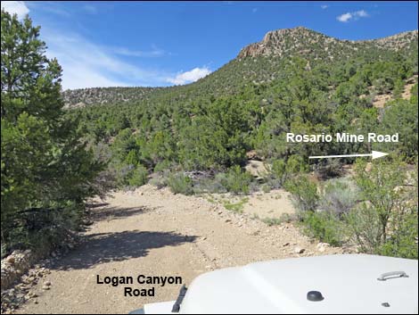 Logan Canyon Road at east end of Rosario Mine Road (view NW) |
Overview Rosario Mine Road is an unmaintained, 0.3-mile dirt road that forms a short loop off the north side of Logan Canyon Road (west of Logan Pass). Logan Canyon Road normally is suitable for 2WD medium-clearance vehicles, but Rosario Mine Road is better in an AWD or 4WD vehicle, so walk the road if unsure. This short road provides access to Rosario Mine, one of the oldest mines in southern Nevada. Little remains except the shell of an old workshop, one long adit, several short adits, and a few junked odd-and-ends. |
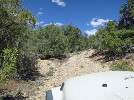 Rosario Mine Road climbs somewhat steeply (view NE) |
Watch Out Other than the standard warnings about driving in the desert, ...this road is pretty safe if driven slowly. The road is narrow and steep in places, but there should be no clearance issues after getting over the grader-berm along Logan Canyon Road. At the mine site, keep in mind that holes in the ground are never safe to enter, which for most of these is obvious. The area is remote and without cell service, so be sure that your vehicle is in good working condition, carry plenty of water (radiator and drinking), and pack a lunch. Always drive carefully and watch for occasional hazards such as errant boulders and washouts in the roadway. While out, please respect the land and the other people out there, and try to Leave No Trace of your passage. This road goes into remote areas, so be sure to bring the 10 Essentials. Cell phones don't work. |
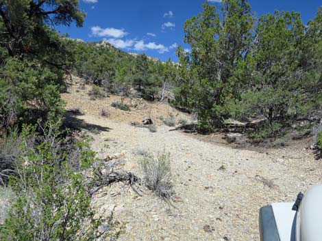 Rosario Mine Road makes a steep, tight bend left (view N) |
Getting to the Road Rosario Mine Road is located in the southwest corner of Basin and Range National Monument, about 2-1/2 hours northeast of Las Vegas driving directly, or about 1 hour west of the intersection of Highway 93 and Highway 318. From Las Vegas, drive north to Basin and Range National Monument, but remember that gasoline is available in Alamo, Ash Springs, Rachael, and Lund. Turn left onto Highway 318 and drive west then north for 3.2 miles to Logan Canyon Road on the left. The intersection is not marked, but watch for a wire gate on the left. Drive west on Logan Canyon Road, up over Logan Pass, for 12.3 miles to the east end of Rosario Mine Road, or 12.4 miles to the west end. In case you miss the road, Rosie's Cabin is 12.5 miles out. |
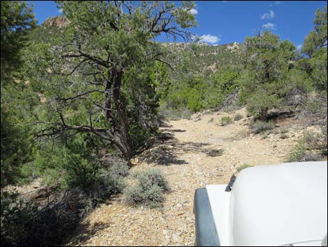
 Rosario Mine Road becomes more gentle (view NW) |
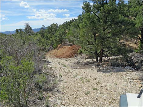
The Road From the intersection of Logan Canyon Road and Rosario Mine Road (Table 1, Site 1824), Rosario Mine Road runs northeast up a fairly steep slope until curving steeply and sharply left (70 yards out). From there, the narrow road becomes more gentle as it climbs northwest across the slope. The road curves right and arrives atop the tailings pile (240 yards out) for the main mine, an adit on the right. Ahead, what remains of the workshop sits on the right edge of the road. Continuing past the workshop, the road curves sharply left and begins to descend past a small tailings pile on the right (310 yards out; more adits) and then along the base of the main tailings pile (370 yards out; on the left). Shortly (440 yards out), the main road passes a 60-yard-long spur road right to a small adit. The turn-around at the end is tight. From the spur, Rosario Mine Road continues southwest until bending sharply right and merging into Logan Canyon Road (530 yards out; Site 1825). |
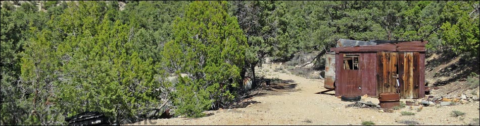
 Rosario Mine Road approaching the mine site (view NW) |
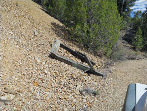
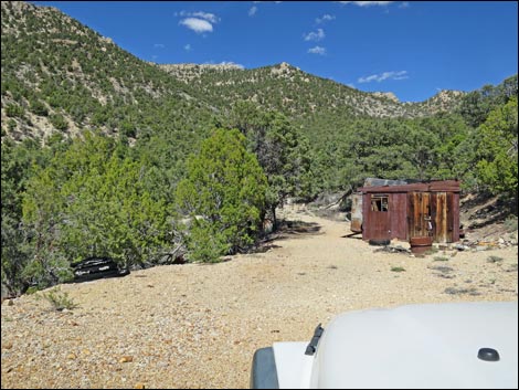 Rosario Mine Road at the workshed (view NE) |
 Descending beyond the workshop, adits on the right (view W) |
 Circling below the main tailings pile (view S) |
 Rosario Mine Road at spur to adits (view SW) |
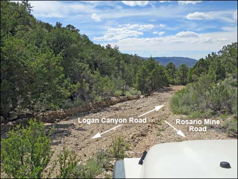 Rosario Mine Road at Logan Pass Road (view SW) |
Table 1. Highway Coordinates and Distances based on GPS Data (NAD27). Download highway GPS waypoints (gpx) file.
| Site | Location | UTM Easting | UTM Northing | Latitude (N) | Longitude (W) | Elevation (ft) |
|---|---|---|---|---|---|---|
| 1824 | Logan Canyon Road at Rosario Mine Road East | 639634 | 4165677 | 37.62946 | 115.41761 | 6,874 |
| 1825 | Logan Canyon Road at Rosario Mine Road West | 639527 | 4165739 | 37.63004 | 115.41880 | 6,851 |
Happy Hiking! All distances, elevations, and other facts are approximate.
![]() ; Last updated 240324
; Last updated 240324
| Basin and Range | Backroads | Hiking Around Las Vegas | Glossary | Copyright, Conditions, Disclaimer | Home |