Backroads Around Las Vegas, Basin and Range National Monument
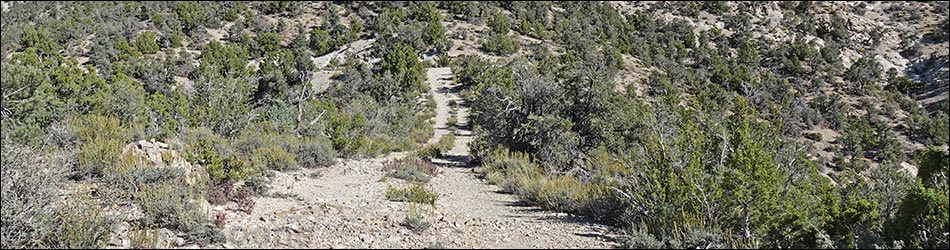
 Logan Canyon Road atop Logan Pass (view S) |
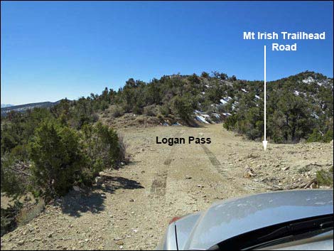
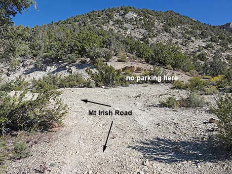
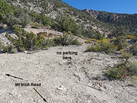
Overview Mt. Irish Road is a narrow two-track suitable for 2WD-HC vehicles if they can get to this point using Logan Canyon Road. The east half of Logan Canyon Road, however, has a reputation for being steep and rough, so 4WD vehicles are be preferred if coming up from Highway 318. Mt. Irish Road is short, only 0.1 miles, and provides access to a campsite and the Mt. Irish Peak Trailhead. Scenery from the end of the road is spectacular, but little different from the scenery seen from Logan Pass, so other than camping or climbing the peak, there is little reason to use this road. The end of the road is narrow with a T-type turn-around, so don't park in the "parking" spur because that might force the next vehicle to back all the way down Logan Canyon Road. |
 Logan Canyon Road atop Logan Pass (view N) |
Watch Out Other than the standard warnings about driving in the desert, ...this road is pretty safe, but be sure that your vehicle is in good working condition, carry plenty of water (radiator and drinking), and pack a lunch. Always drive carefully; the road is not maintained and there are occasional hazards such as errant boulders in the roadway. While out, please respect the land and the other people out there, and try to Leave No Trace of your passage. This road goes into remote areas, so be sure to bring the 10 Essentials. Cell phones work at the end of the road and atop Logan Pass. |
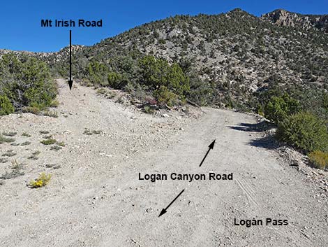
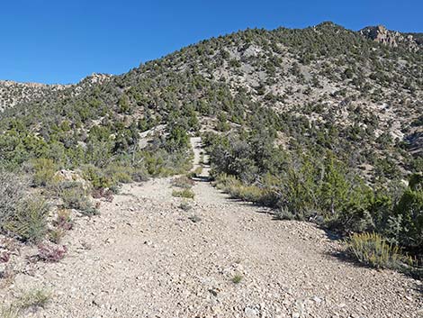
 Mt Irish Road (view NW from Logan Canyon Road) |
Getting to the Road Mt. Irish Road is located in the east-central part of Basin and Range National Monument, about 2 hours northeast of Las Vegas. From Las Vegas, drive north on Interstate-15 for 21 miles to Highway 93. Turn left onto Great Basin Highway (Hwy 93) and top off the gas tank if necessary. Drive north through the towns of Alamo (95 miles from Las Vegas) and Ash Springs (102 miles) to the intersection of Highway 93 and Highway 318 (107 miles). Gasoline is available in Alamo, Ash Springs, Rachael, and Lund. Turn left onto Highway 318 and drive west then north on Highway 318 for 3.2 miles to Logan Canyon Road, on the left. The intersection is not marked, but watch for a dirt road with a wire-fence gate. Turn left onto Logan Canyon Road and drive west, 11.6 miles, to Logan Pass on the crest of the mountains. Atop the pass, Mt. Irish Road forks hard to the right. |
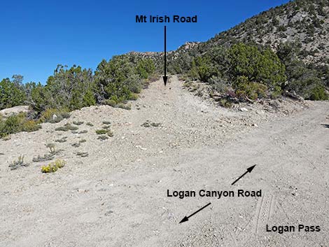
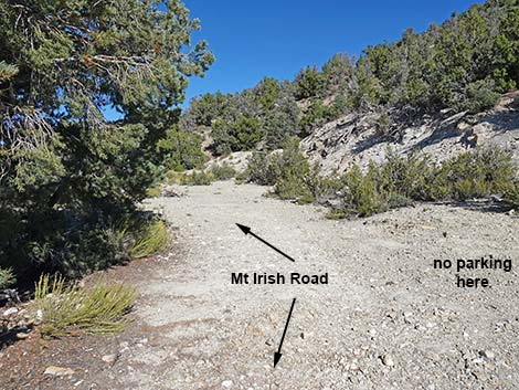
 Start of Mt Irish Road (view NW) |
The Road From Logan Canyon Road (Table 1, Site 1590), Mt. Irish Road runs northwest as it climbs at a moderate grade towards Mt. Irish. The road is short, so drivers quickly arrive at a sharp bend to the left with what appears to be a "parking spot" on the right. Don't park on the right, but continue around the curve to the left and the flat end of the road. There is nowhere to turn around a long vehicle here, so back into the "parking spot," turn your vehicle around, and back up to the end of the road (Site 1986). Park here, facing out. This is the Mt Irish Peak Trailhead. Turning around when arriving ensures that if someone else, perhaps less thoughtful, parks in the turn-around spot and blocks your exit. |
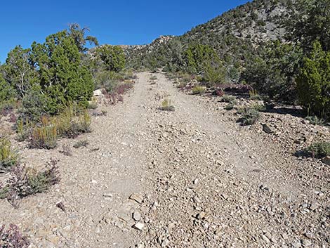
 Mt Irish Road (view NW) |
 Mt Irish Road (view NW) |
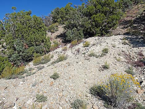
 Mt Irish Road approaching parking area (view NW) |
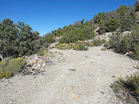
 This is the back-in and turn-around spot -- don't park here (view N) |
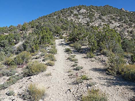
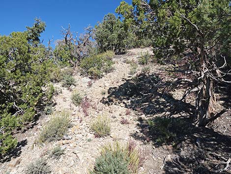
 Approaching end of Mt Irish Road (view NW) |
 End of Mt Irish Road with nowhere to turn around (view NW) |
Mt. Irish Trailhead
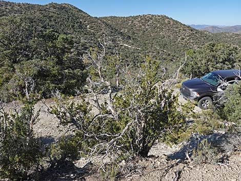 Trailhead parking at narrow road end (view SW) |
 Mt Irish Trailhead at end of narrow road (view NW) |
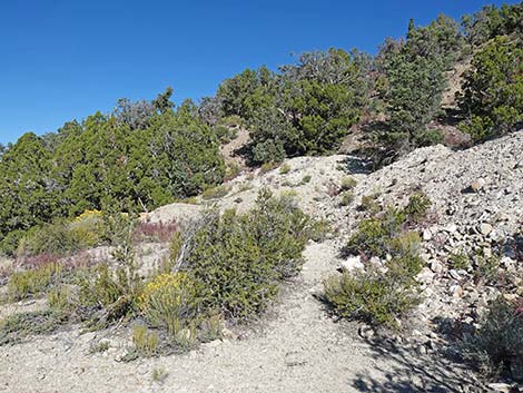
 Start of Mt Irish Route (view NW) |
 Mt Irish Route: faint tracks fan out up the ridgeline (view NW) |
Table 1. Highway Coordinates and Distances based on GPS Data (NAD27). Download highway GPS waypoints (gpx) file.
| Wpt. | Location | Latitude (N) | Longitude (W) | Elevation (ft) | Point-to-Point Distance (mi) | Cumulative Distance (mi) |
|---|---|---|---|---|---|---|
| 1590 | Logan Cyn Rd at Logan Pass | 37.62682 | -115.40805 | 7,196 | 0.00 | 0.00 |
| 1986 | Mt Irish Trailhead | 37.62811 | -115.40839 | 7,295 | 0.00 | 0.09 |
Happy Hiking! All distances, elevations, and other facts are approximate.
![]() ; Last updated 240324
; Last updated 240324
| Basin and Range | Backroads | Hiking Around Las Vegas | Glossary | Copyright, Conditions, Disclaimer | Home |