Backroads Around Las Vegas, Basin and Range National Monument
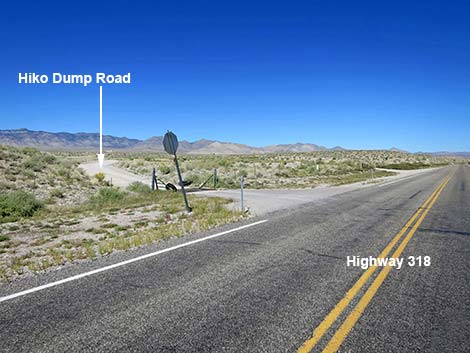 Highway 318 approaching Hiko Dump Road (view NW) |
Overview Hiko Dump Road is a well-maintained dirt road that normally is suitable for 2WD-HC vehicles. The road starts along Highway 318 in Hiko and runs northwest up the desert bajada to the waste transfer station. At the waste transfer station, the road bends left to head south, parallel to Highway 318, until it ends at an intersection with Logan Canyon Road. This road is described here only because it offers an alternative start to Logan Canyon Road that bypasses the wire fence gate at the edge of the highway. For people who don't want to open and close the gate, this is a good alternative. This alternative is also good so that groups of vehicles don't end up parked on the pavement -- risking an accident -- while the first driver opens the gate. Link to Area Map or Road Map. |
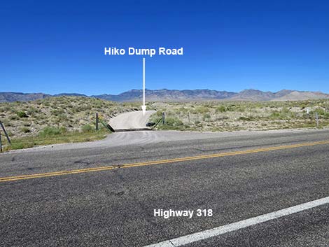 Hiko Dump Road (view NW from Highway 318) |
Watch Out Other than the standard warnings about driving in the desert, ...this road is pretty safe, but be sure that your vehicle is in good working condition, carry plenty of water (radiator and drinking), and pack a lunch. Always drive carefully; even though the road is maintained, there are occasional hazards such as errant boulders in the roadway. While out, please respect the land and the other people out there, and try to Leave No Trace of your passage. This road goes into remote areas, so be sure to bring the 10 Essentials. Cell phones work along parts of this road, including atop Logan Pass. |
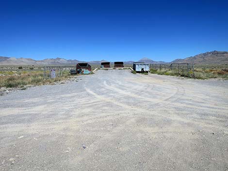
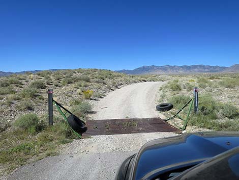 Hiko Dump Road starts at cattle guard (view NW) |
Getting to the Road Hiko Dump Road is located just outside the east-central part of Basin and Range National Monument, about 1-1/2 hours (110 miles) northeast of Las Vegas driving directly, or about 4 minutes (3.2 miles) north of the intersection of Highway 93 and Highway 318. From Las Vegas, drive north on Interstate-15 for 21 miles to Highway 93. Turn left onto Great Basin Highway (Hwy 93) and top off the gas tank if necessary. Drive north through the towns of Alamo (95 miles from Las Vegas) and Ash Springs (102 miles) to the intersection of Highway 93 and Highway 318 (107 miles). Gasoline is available in Alamo, Ash Springs, Rachael, and Lund. Turn left onto Highway 318 and drive west then north on Highway 318 for 3.2 miles to Logan Canyon Road on the left. Continue another 0.6 miles (3.8 miles from Highway 93) to Hiko Dump Road, on the left. The intersection is not marked, but watch for a dirt road with a stop sign and a cattle guard in the highway fence. |
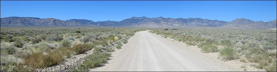
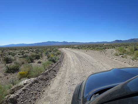
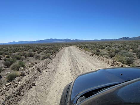
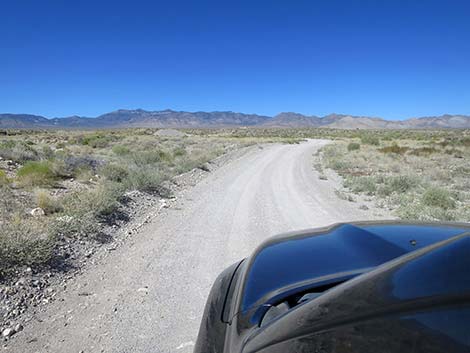 Hiko Dump Road winds up the desert bajada (view NW) |
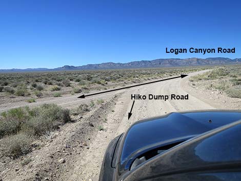
The Road From the pavement (Table 1, Site 1982), Hiko Dump Road runs northwest as it gently winds up the desert bajada towards Mt. Irish in the distance. At about 0.6 miles out, Hiko Dump Road reaches the transfer station, on the right. At this point, Hiko Dump Road bends left to run southwest. The road runs another 0.5 miles until reaching a triangular intersection with Logan Canyon Road (Wpt. 1983). Here, drivers can bend right to join Logan Canyon Road westbound towards Mt. Irish, or they can bend left and return to Highway 318. |
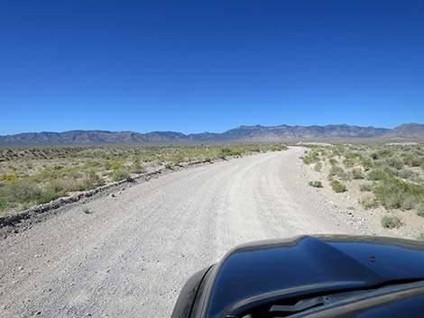 Hiko Dump Road (view NW) |
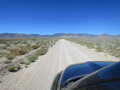 Hiko Dump Road (view NW) |
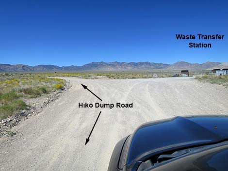 Hiko Dump Road approaching the waste transfer station (view NW) |
 Hiko waste transfer station (view N from Hiko Dump Road) |
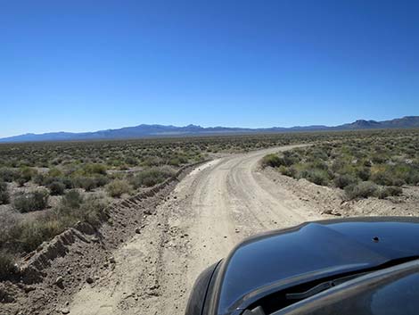
 Hiko Dump Road curves left (view SW) |
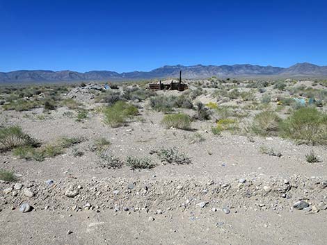 Old debris field (view W from Hiko Dump Road) |
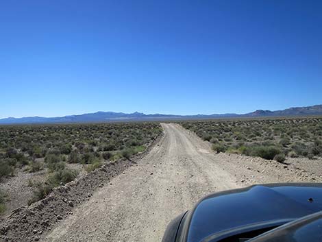 Hiko Dump Road (view SW) |
 Hiko Dump Road (view SW) |
 Hiko Dump Road approaching Logan Canyon Road (view SW) |
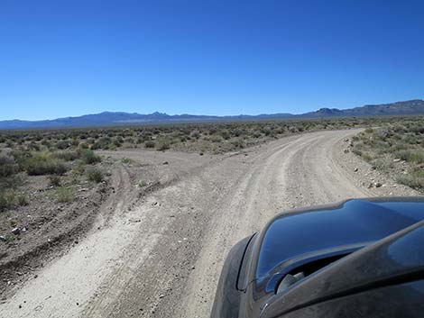 Hiko Dump Road at start of triangular intersection (view SW) |
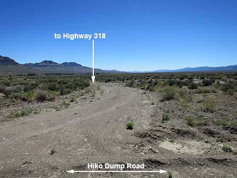 Left side of triangular intersection (return to Hwy 318, view S) |
 Right side of triangular intersection (merge onto Logan Canyon Road) |
Table 1. Highway Coordinates and Distances based on GPS Data (NAD27). Download highway GPS waypoints (gpx) file.
| Wpt. | Location | Latitude (N) | Longitude (W) | Elevation (ft) | Point-to-Point Distance (mi) | Cumulative Distance (mi) |
|---|---|---|---|---|---|---|
| 1982 | Highway 318 at Hiko Dump Road | 37.57614 | 115.22890 | 3,871 | 0.00 | 0.00 |
| 1983 | Logan Canyon Rd at Hiko Dump Rd | 37.57416 | 115.24381 | 3,976 | 1.13 | 1.13 |
Happy Hiking! All distances, elevations, and other facts are approximate.
![]() ; Last updated 240324
; Last updated 240324
| Basin and Range | Backroads | Hiking Around Las Vegas | Glossary | Copyright, Conditions, Disclaimer | Home |