Backroads Around Las Vegas, Avi Kwa Ame National Monument
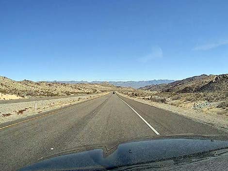 Highway 163 descending over the Newberry Mountains (view E) |
Overview Hiko Canyon Road is a short, sandy road that runs down a desert wash into a fairly narrow canyon. The upper part of the road, down to Hiko Spring, is a typical desert two-track in a wash where the sand can be soft or firm depending on conditions, but usually it is passable in any medium-clearance vehicle. The lower part of the road, past Hiko Spring, is a typical desert two-track in a wash where the sand can be soft or firm depending on conditions. But here, general conditions are more suitable for an ATV than a big truck. The road runs down a beautiful canyon with several springs, lots of desert vegetation, petroglyphs, and towering rock walls. This is an in-and-out road, and it is not possible to drive all the way through. For photos of the canyon, see Hiko Spring Hike. Link to map. |
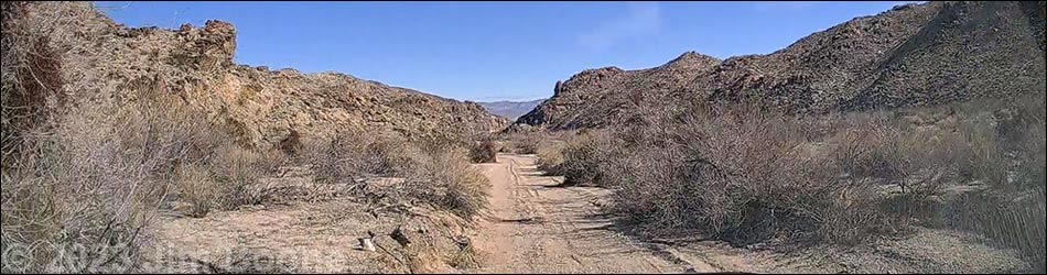
 Hiko Canyon begins to narrow |
Watch Out Other than the standard warnings about driving in the desert, ...this road is pretty safe when the weather is cool. If the weather is hot, this place can be unbelievably hot. The sand in the road can be soft, and the canyon is subject to flash floods. While out, please respect the land and the other people out there, and please try to Leave No Trace of your passage. This road is short, but bring what you need of the 10 Essentials. |
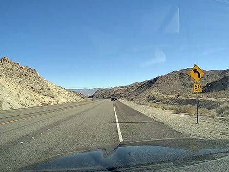 Just past the curve sign, turn off onto Hiko Canyon Road (view E) |
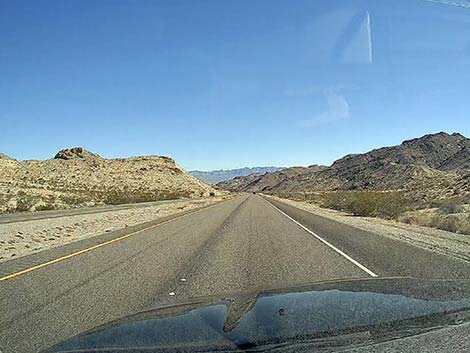
Getting to the Roadhead This road is located near Laughlin, Nevada, about 1-1/4 hours south of Las Vegas. From town, drive south on Highway 95 through Henderson and Searchlight (58 miles out) to Highway 163 (77 miles out). Turn left onto Highway 163 and drive east another 9.7 miles (87 miles total). Highway 163 runs generally long and straight as it heads up and over a low pass in the Newberry Mountains. Heading more-or-less straight down the other side, the canyon begins to narrow (this is now Hiko Canyon). Just before Highway 163 bends hard to the left for the first time, hikers can turn off the pavement (just past the caution sign for the curve) into a broad dirt parking area on the right. For those not happy with driving on sandy roads, stop here. The parking area is the start of Hiko Canyon Road. |
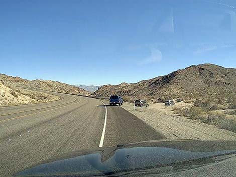 Drivers turning off Highway 163 (view E) |
The Road From the pavement (Table 1, Site 1969), Hiko Canyon Road runs down Hiko Canyon where road conditions depend on how long it's been since the last flash flood. The sand can be soft or firm, depending on conditions, so drivers without 4WD should check the road before starting down. Keep in mind that it is easier to drive downhill on a sandy road than it is to drive uphill. The road is two parts. The first is a fairly easy drive down the wash to Hiko Spring (watch for the cottonwood tree), where drivers will find a large parking area and turn-around loop (Site 1970). Beyond the turn-around loop, Hiko Canyon Road continues as more of an ATV trail for another 1.2 miles. When drivers encounter a jumble of boulders in the wash, the road ends. Some have tried to drive farther, but they don't get far. |
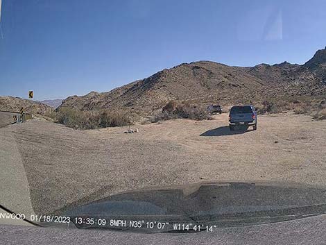 Parking area at the edge of the pavement (view SE) |
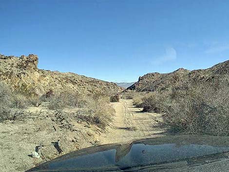
 Starting down Hiko Canyon Road (view E) |
 Hiko Canyon Road follows a narrow, sandy track (view E) |
 Vehicles might get a bit of "desert pin-striping" courtesy of the bushes |
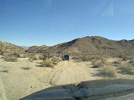
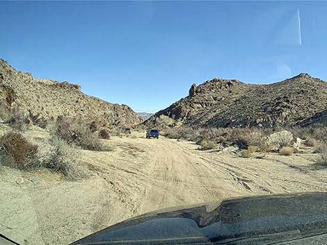 Vehicle approaching the turn-around loop (view E) |
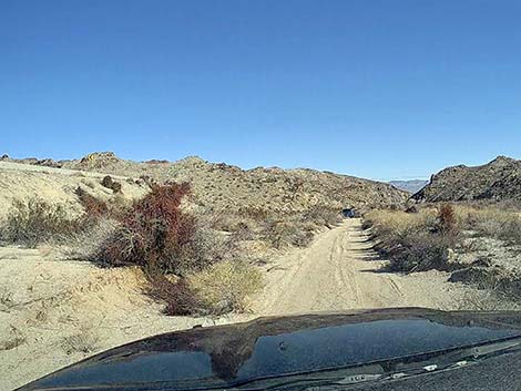
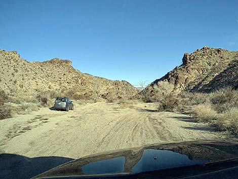
 Vehicles parked at the start of the turn-around loop (view E) |
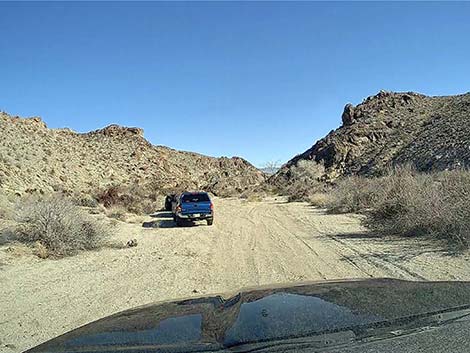
 Vehicle` parked on the turn-around loop (view E) |
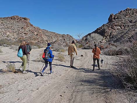 Hikers departing railhead (cottonwood tree in the distance; view E) |
Table 1. Hiking Coordinates Based on GPS Data (NAD27, UTM Zone 11S). Download Hiking GPS Waypoints (*.gpx) file.
| Site | Location | UTM Easting | UTM Northing | Latitude (N) | Longitude (W) | Elevation (ft) |
|---|---|---|---|---|---|---|
| 1969 | Hiko Road at Pavement | 710714 | 3893992 | 35.16858 | 114.68635 | 1,937 |
| 1970 | Hiko Spring Parking | 711354 | 3894048 | 35.16896 | 114.67932 | 1,849 |
Happy Hiking! All distances, elevations, and other facts are approximate.
![]() ; Last updated 240323
; Last updated 240323
| Avi Kwa Ame | Backroads Around Las Vegas | Glossary | Copyright, Conditions, Disclaimer | Home |