Hiking Around Las Vegas, Avi Kwa Ame National Monument
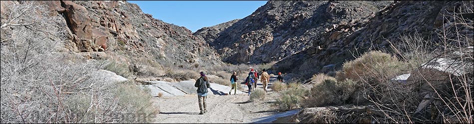
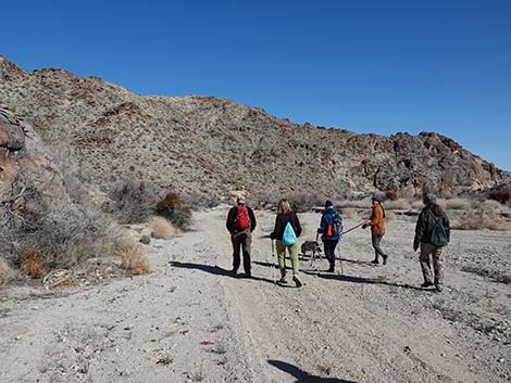
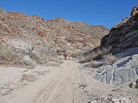
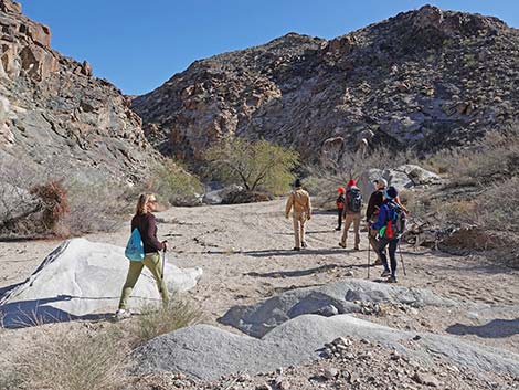
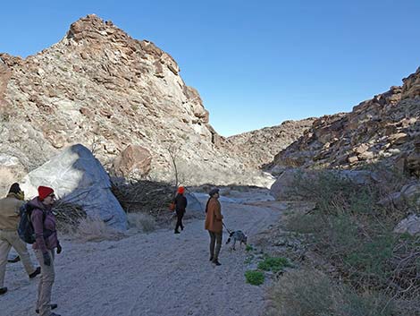
 Hikers departing the trailhead (view E) |
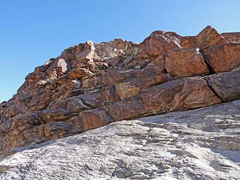
Overview Hiko Canyon is a deep, beautiful desert canyon with several springs (including Hiko Spring) that provide for patches of verdant vegetation separated by stretches of more typical desert-wash vegetation. Above the wash, some of the towering cliffs are inscribed with messages from the ancients. The route follows a gravel road down the wash, which makes for easy walking, and the towering cliffs keep people and pets in the bottom of the canyon, so there is no chance of really getting lost. Past the end of the road, the hike ends atop a high pour-over, so even the end of the route helps keep people from getting lost. This in-and-out hike makes for a short hike to an interesting place that is suited to travelers without much time for hiking. Hikers can also combine this route with the short trail to nearby petroglyphs in Grapevine Canyon for a longer day. Link to map. |
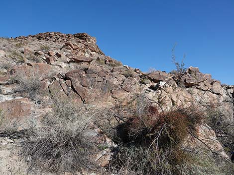
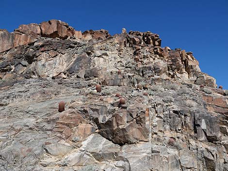
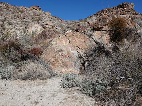 Stone outcrops near Hiko Spring |
Watch Out Other than the standard warnings about hiking in the desert, ...this hike is pretty safe when the weather is cool. If the weather is hot, this place can be unbelievably hot. The canyon is subject to flash floods. Also, the fact that the trail is almost entirely smooth and nearly level creates a tripping hazard because hikers forget to watch where they are walking. Be careful atop the pour-over at the end of trail. While hiking, please respect the land and the other people out there, and please try to Leave No Trace of your passage. This walk is short, but bring what you need of the 10 Essentials. |
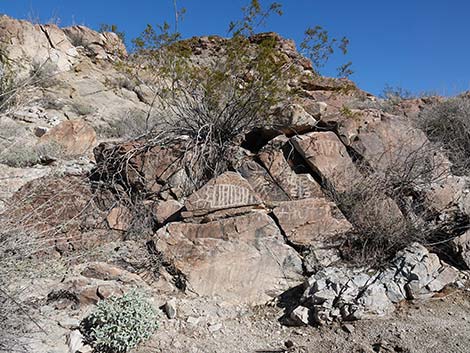
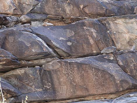
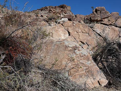 Stone outcrops are marked with ancient stories |
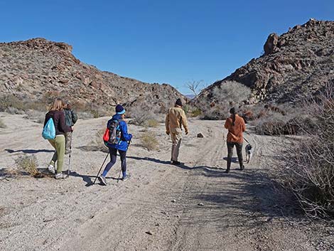
Getting to the Trailhead This hike is located near Laughlin, Nevada, about 1.5 hours south of Las Vegas. From town, drive south on Highway 95 through Henderson and Searchlight (58 miles out) to Highway 163 (77 miles out). Turn left onto Highway 163 and drive east another 9.7 miles (87 miles total). Highway 163 runs generally long and straight as it heads up and over a low pass in the Newberry Mountains. Heading more-or-less straight down the other side, the canyon begins to narrow (this is now Hiko Canyon). Just before Highway 163 bends hard to the left for the first time, hikers can turn off the pavement (just past the caution sign for the curve) into a broad dirt parking area on the right. For those not happy with driving on sandy roads, stop here. Otherwise, continue down the wash following Hiko Canyon Road for 0.43 miles to a turn-around loop at Hiko Spring. The single Fremont's Cottonwood Tree is a good landmark for the end of the road. Park here; this is the trailhead. Note that an ATV track continues. |
 Stone outcrops are marked with ancient stories |
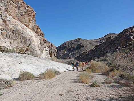
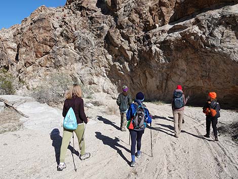
The Hike From the trailhead (Table 1, Waypoint 01), hikers quickly approach the cottonwood tree at Hiko Spring (Wpt. 02). From the tree, the narrow road presses through the vegetation (lots of Arrowweed) and continues down the wash. Before continuing, however, look north (left) and take a few minutes to read the rock stories. We don't know what the authors were saying, but petroglyphs are always fascinating. It is interesting too that although these stories might be thousands of years old, the descendants of these ancients live just down the canyon along the Colorado River. Continuing past Hiko Spring, hikers follow the road (now essentially an ATV trail) down the canyon. The sounds of the highway can be heard from the trailhead, but they soon fade away and hikers are left with the silence of the desert. Hiking down the canyon, some parts are narrower, and some parts are wider, but the canyon always is fairly narrow with cliffs towering above. |
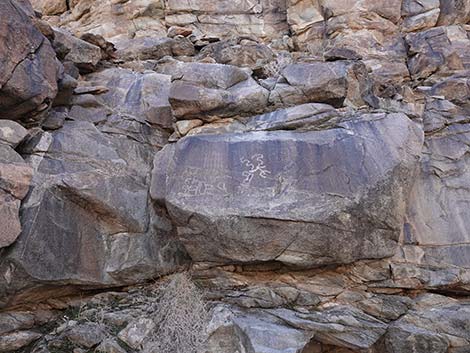
 Stone outcrops are marked with ancient stories |
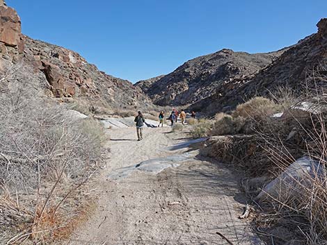
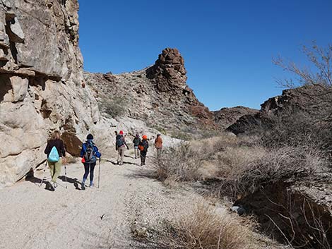
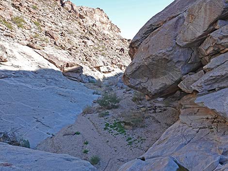
Heading down the canyon, hikers will encounter interesting geology, a variety of desert plant species (notice California Barrel Cactus clinging to rock walls), and more rock stories. Always keep an eye out for interesting things along the way and underfoot. Eventually the sandy wash gives way to granite slickrock and then jumbled boulders (Wpt. 03). The boulder-filled wash marks the end of the road, but hikers can continue another 200 yards to the top of a high pour-over (Wpt. 04). The smooth, water polished rock at the top of the pour-over makes for a nice place to stop, rest, and listen to the sounds of birds and the wind in the canyon. When ready, follow your footprints in the sand back up the canyon to the trailhead (Wpt. 01). |
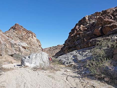
 Hikers in Hiko Wash below the cottonwood tree (view E) |
 Big boulders fell from high in the cliffs (view E) |
 Hikers in Hiko Wash (view E) |
 Walls tower above Hiko Wash (view E) |
 Parts of Hiko Wash are narrow (view E) |
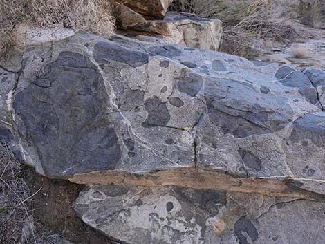 Curious inclusions in the rocks (view SW) |
 Parts of Hiko Wash are wide (view E) |
 Towering cliffs with Barrel Cactus (view NE) |
 Hikers approaching a bend in the wash (view E) |
 Interesting crags (view E) |
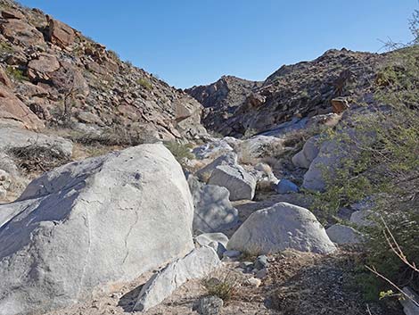
 Huge boulder in the wash (view E) |
 Be sure to scan the walls above the wash (view S) |
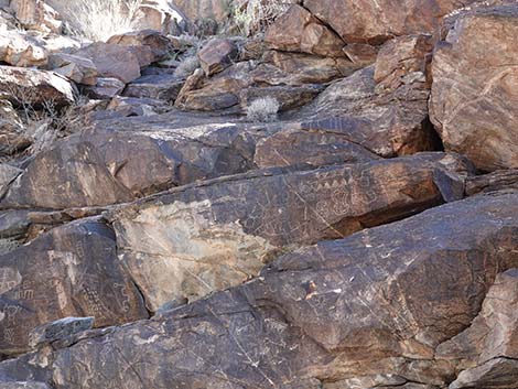 More rock stories (view S) |
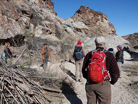 Hikers listening to local stories (view E) |
 More rock stories (view S) |
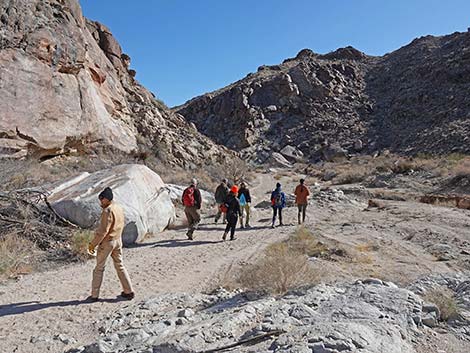
 Hikers continuing down the canyon (view E) |
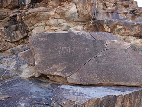
 More rock stories (view S) |
 Even more rock stories (view S) |
 Evidence of a recent rain storm (view E) |
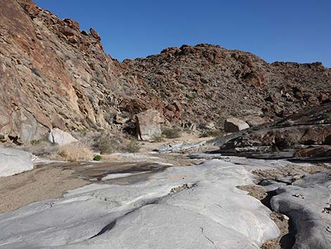 A bit of granite slickrock in the canyon bottom (view E) |
 The road ends, but hikers can continue on foot (view SE) |
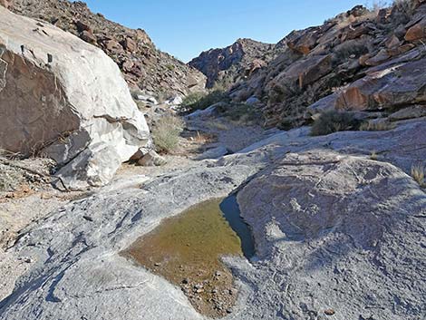
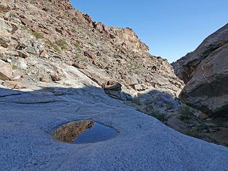 Reflecting pond on the rocks (view SE) |
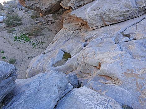 The hike ends atop a high pour-over (view SE) |
 Down the canyon (view E from atop the pour-over) |
Table 1. Hiking Coordinates Based on GPS Data (NAD27, UTM Zone 11S). Download Hiking GPS Waypoints (*.gpx) file.
| Wpt. | Location | UTM Easting | UTM Northing | Elevation (ft) | Point-to-Point Distance (mi) | Cumulative Distance (mi) |
|---|---|---|---|---|---|---|
| 01 | Hiko Canyon Trailhead | 711356 | 3894045 | 1,847 | 0.00 | 0.00 |
| 02 | Hiko Spring | 711434 | 3894052 | 1,839 | 0.05 | 0.05 |
| 03 | End of Road | 713035 | 3894238 | 1,559 | 1.19 | 1.24 |
| 04 | Pour-Over | 713148 | 3894100 | 1,514 | 0.12 | 1.36 |
| 01 | Hiko Canyon Trailhead | 711356 | 3894045 | 1,847 | 1.36 | 2.72 |
Happy Hiking! All distances, elevations, and other facts are approximate.
![]() ; Last updated 240323
; Last updated 240323
| Avi Kwa Ame | Hiking Around Las Vegas | Glossary | Copyright, Conditions, Disclaimer | Home |