Hiking Around Las Vegas, Red Rock Canyon National Conservation Area
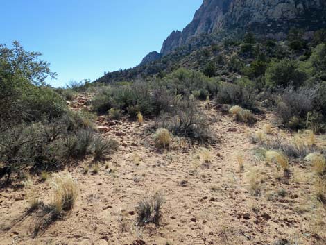
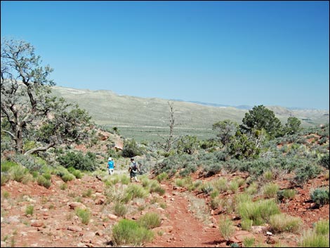
 Willow Springs Loop Trail trailhead (view SW) |
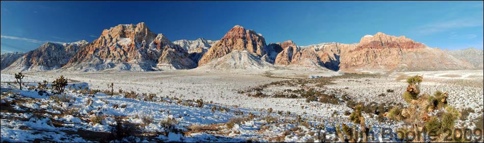
Overview The Escarpment Trail runs 8.3-miles along the base of the Wilson Cliffs (i.e., the escarpment) from Willow Springs Picnic Area at the north end to the old Oak Creek Campground at the south end. The trail uses several named trails (Willow Springs Loop, SMYC, Dales, Pine Creek, Knoll, and South Oak Creek, plus a bit of use-trail, to traverse the escarpment. The scenery is grand, and the vegetation is relatively lush for the desert. This is a one-way hike that requires shuttling vehicles or arranging a pickup at the end of the day. The hike can be done in either direction in its entirety or in part by starting and stopping at any of the several trailheads along the way. Here, the trail is described from north to south, the downhill direction, but most details are left to descriptions of the individual trails along the way. For the other direction, see Escarpment Trail - Northbound. Link to map. For detailed maps, follow links to the named trails. |
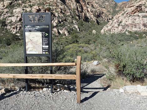 Small Willow Springs Loop Trail trailhead sign (view SW) |
Watch Out Other than the standard warnings about hiking in the desert, ...this generally is a safe trail. In some places, there are so many rocks in the trail that the chance of twisting an ankle is unusually high. While hiking, please respect the land and the other people out there, and try to Leave No Trace of your passage. Also, this is a long hike, so be sure to bring the 10 Essentials. |
 |
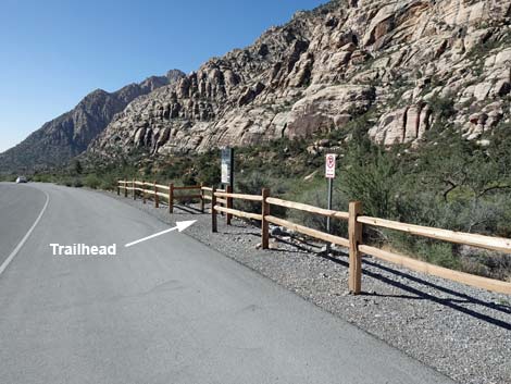
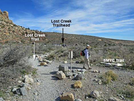
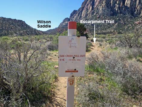
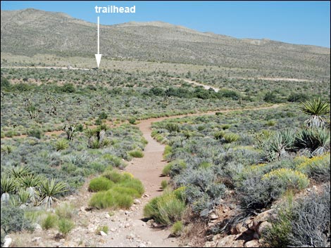
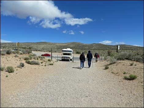
Getting to the Trailhead This hike is located along the Scenic Loop Road in Red Rock Canyon National Conservation Area, about 45 minutes west of Las Vegas. Drive out to Red Rocks, pay the fee, and then drive about half-way around the Scenic Loop Road to Willow Spring Road. Turn right and drive north 0.6 miles to the Willow Springs Trailhead. Park here; this is the trailhead. The trail ends at the old South Oak Creek Trailhead, which is located on Charleston Blvd south of the exit from the Scenic Loop Road in the no-fee area. Alternate trailheads for shortening the route are (from north to south) Lost Creek Trailhead, Ice Box Canyon Trailhead, Pine Creek Trailhead, and Oak Creek Road Trailhead. |
 Trail drops to merge with Children's Discovery (view S) |
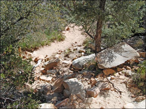
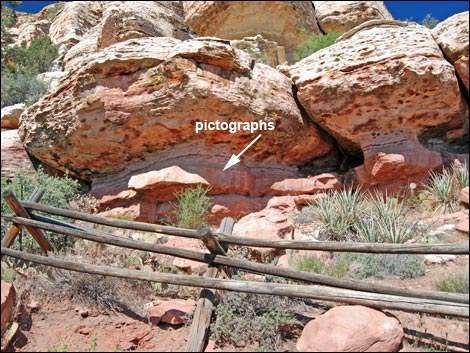
The Hike From the Willow Spring Loop trailhead (Table 1, Waypoint 01), which is marked by a small trail sign at the southwest corner of the Willow Spring Picnic Area parking lot (about 50 feet south of the end of the pavement), the Escarpment Trail runs southwest, downstream, for about 0.08 miles to Red Rock Wash. The trail crosses the wash (Wpt. 02) and climbs the hillside to run along a bench on the hillside. The trail runs south, winding along the hillside to a T-intersection with the Children's Discovery Trail (Wpt. 03). The Escarpment Trail turns right and continues south along the west side of Red Rock Wash. The trail shortly passes an archeological site (marked by a wooden fence). After considering the lives of the people who did the painting, continue south for a short way to a T-intersection with the Lost Creek Falls Trail (Wpt. 04). |
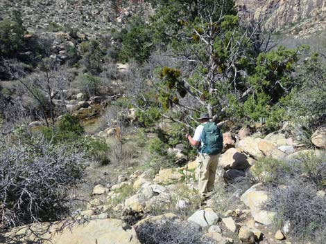
 Rock art site along Children's Discovery Trail (view W) |
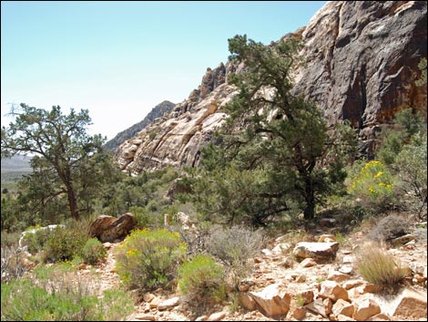
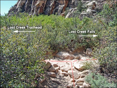
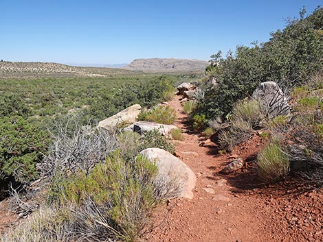
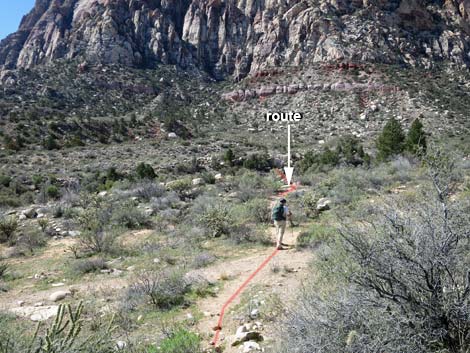
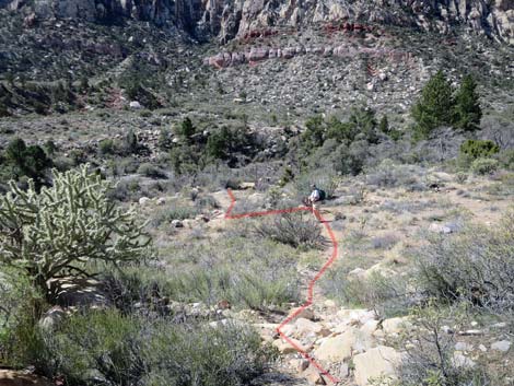
Consider turning right and hiking west for the short distance to Lower Lost Creek Falls if the stream is running, or turn left and continue east on the Escarpment Trail. About 20 yards past the intersection, the trail crosses a wet willow thicket area on a wooden boardwalk, then drops to cross Red Rock Wash, and runs east towards the Lost Creek Trailhead. About 80 yards before getting to the parking area, the trail reaches an intersection with the SMYC Trail (Wpt. 05). The Escarpment Trail turns right onto the SMYC Trail and runs southwest to cross back to the west side of Red Rock Wash. The SMYC Trail runs south through spectacular open desert along the base of the Wilson Cliffs. This is a pleasant trail with relatively little overall elevation change. The grade generally is gentle, but there are two short, steep sections associated with nice viewpoints. The Escarpment Trail runs south on the SMYC Trail for 1.1 miles to an intersection with the Ice Box Canyon Trail (Wpt. 06). For details of this segment of the Escarpment Trail, see the description of the SMYC Trail. |
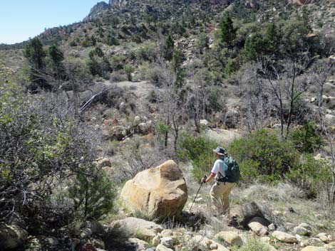
 Unmarked junction with Lower Lost Creek Falls Trail (view S) |
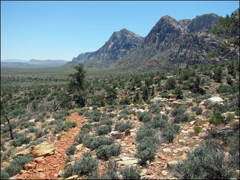
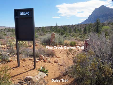
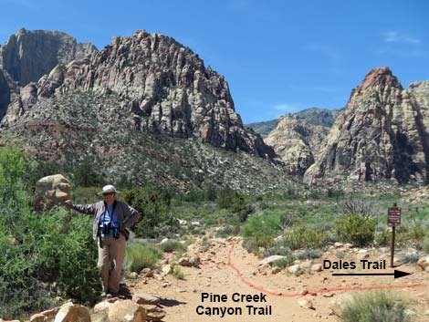
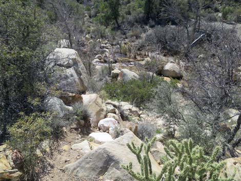
From the Ice Box Canyon Trail (Wpt. 06) intersection, the Escarpment Trail continues south on Dales Trail. Dales Trail runs at a fairly gentle grade most of the way, but it has several short, steep sections; it is quite rocky and hard to walk on; and it seems to twist and jog back and forth far more than is necessary. The south end of Dales Trail cuts across a number of ravines that come down from the cliffs, but rather than contour around the ravines, the trail drops into each one and climbs back up the other side. In general, this trail is poorly laid out and is not among my favorites. Fortunately, park benches along the trail encourage you to stop, relax, and enjoy the splendid views. The Escarpment Trail runs south on Dales Trail for 2.1 miles to a T-intersection with the Pine Creek Canyon Trail (Wpt. 07). For details of this segment of the trail, see the description of Dales Trail. |
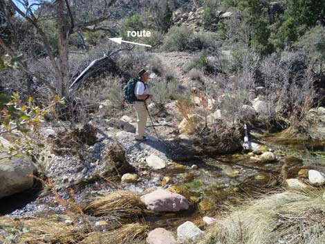
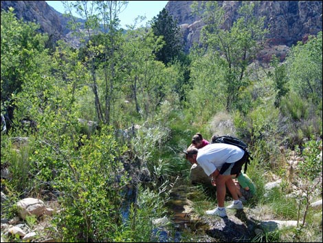
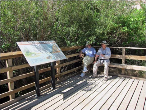 Hikers resting shade on boardwalk at Lost Creek Spring |
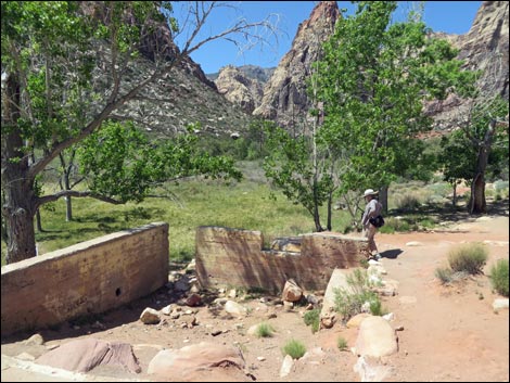
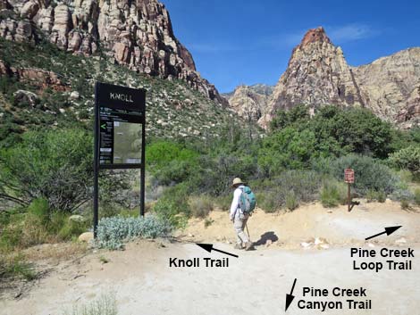
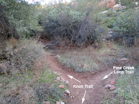
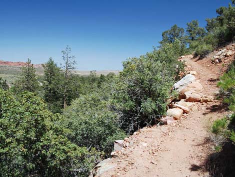
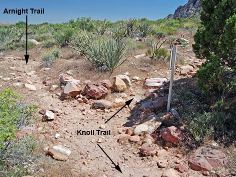
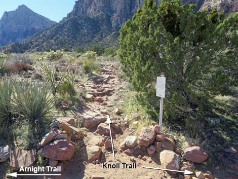
From the T-intersection with the Pine Creek Canyon Trail (Wpt. 07), the Escarpment Trail turns right and runs west on the Pine Creek Canyon Trail for 0.37 miles to the historical Wilson homestead. Just past the building foundations, the Pine Creek Canyon Trail forks (Wpt. 08). The Escarpment Trail turns left onto the Knoll Trail, runs southwest through Mr. Wilson's orchard and across his garden, crosses Pine Creek, and continues west along the south side of the creek. About 0.12 miles past Pine Creek, hikers reach a T-intersection where the Knoll Trail (Wpt. 09) turns left. The Escarpment Trail turns left with the Knoll Trail and climbs somewhat steeply out of Pine Creek Canyon. Back on desert flats, the trail runs through open desert along the base of the Wilson Cliffs. This is a pleasant trail with relatively little elevation change (after climbing out of Pine Creek) that runs through some spectacular desert country. Stay on the main trail at unmarked trail junctions. The Escarpment Trail runs south on the Knoll Trail for 0.5 miles to an intersection with the Arnight Trail (Wpt. 10). |
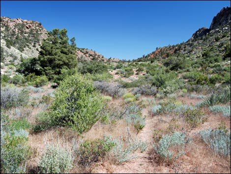
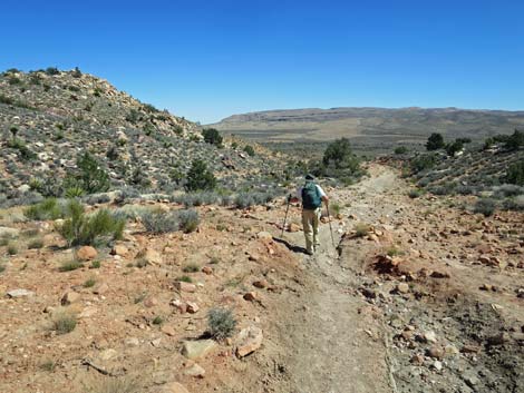
 Hiker turning onto SMYC Trail (view SE) |
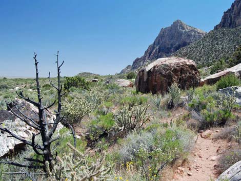
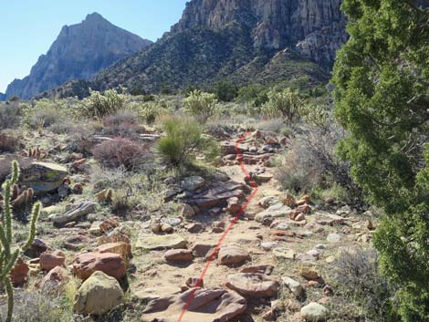
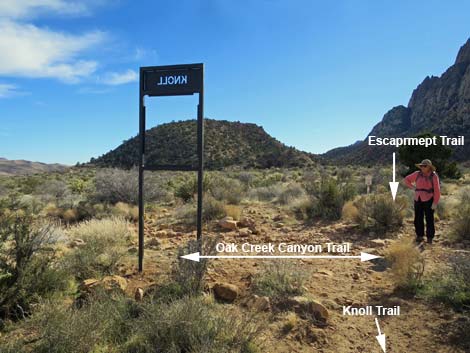
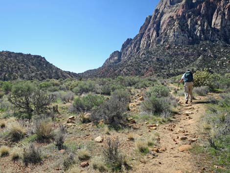
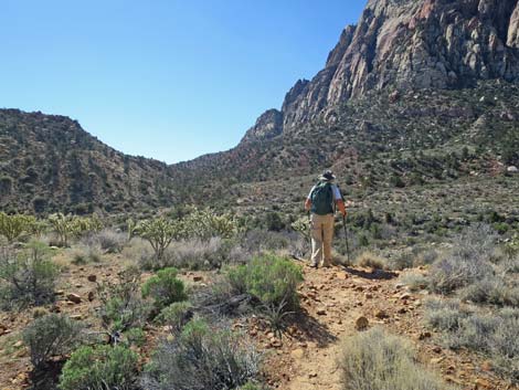
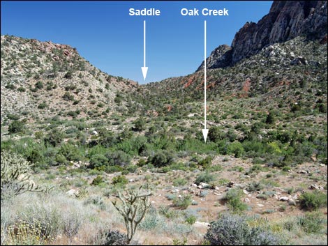
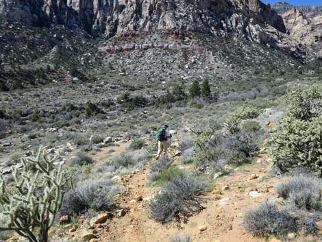
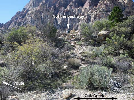
From the intersection with the Arnight Trail (Wpt 10), the Escarpment Trail turns right, staying on the Knoll Trail, which runs south on gentle grades across open desert with little elevation gain. In total, the Escarpment Trail runs south on the Knoll Trail for 1.80 miles from the Wilson Homestead to an intersection with the Oak Creek Canyon Trail (Wpt. 11). For details on this segment of the trail, see the description of the Knoll Trail. From the intersection with the Oak Creek Canyon Trail (Wpt. 11), the goal is to get across Oak Creek Wash and hike up to the saddle between the face of Mt. Wilson and Wilson Pimple, the odd hill below the face of Mt. Wilson that can be seen ahead. Unfortunately, there are no good trails to get across Oak Creek (updated March 2019), but there are myriad use-trails and old roads throughout the Oak Creek Canyon area that run up and down the canyon. |
 SMYC Trail (view S) |
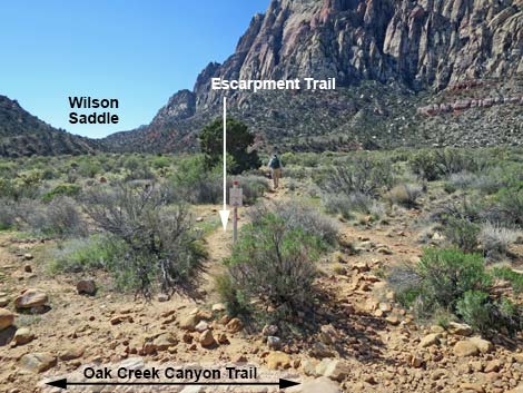
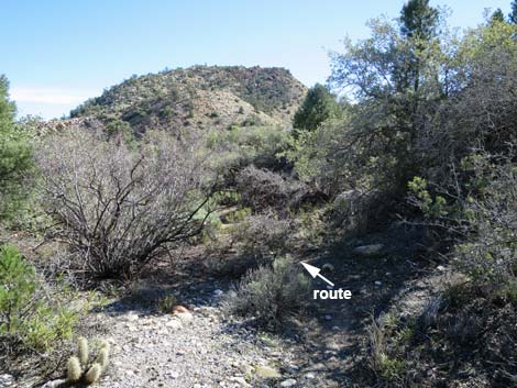
The shortest route across Oak Creek is to continue south from the intersection (Wpt. 11) on use-trails that run down and right (southwest) to Oak Creek (Wpt. 12). Across the wash, stay left on use-trails along the stream and avoid the shrub live oak thickets. Heading southeast, use-trails eventually join with South Oak Creek Trail, a well-used trail. Now turning right, the route heads south on the old road and hike up to Wilson Saddle (Wpt. 13). From Wilson Saddle (Wpt 13), the Escarpment Trail continues on the South Oak Creek Trail, staying on the main old road as it runs east and down out of the hills onto the desert flats. The old road runs east then southeast until crossing Red Rocks Wash and entering the old campground area. From the wash crossing, the route runs east on the campground entrance road to a gate and the South Oak Creek Trailhead (Wpt 14). For details on this segment of the trail, see the description of South Oak Creek Trail. |
 Escarpment Trail crossing Ice Box Canyon Trail |
 Dales Trail (view S towards Rainbow and Wilson peaks) |
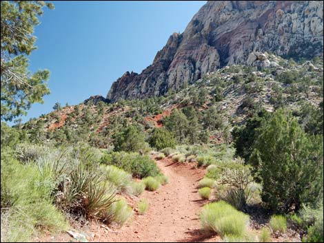
 Escarpment Trail at Pine Creek Canyon Trail (view S) |
 Dales Trail at Pine Creek Canyon Trail (view W) |
 Pine Creek Canyon Trail at Wilson Homestead (view W) |
 Escarpment Trail turns left onto Knoll Trail past homestead (view W) |
 Escarpment Trail stays left on Knoll Trail (view S) |
 Knoll Trail climbs out of Pine Creek Canyon (view E) |
 Knoll Trail runs south along the base of the escarpment (view S) |
 Knoll Trail at Arnight Trail (view S) |
 Knoll Trail (view SW from Knoll-Arnight trail junction) |
 Knoll Trail runs south as a very rocky path (view SW) |
 Knoll Trail (view S towards Wilson Pimple) |
 Knoll Trail at Oak Creek Trail (view S) |
 Escarpment Trail crossing Oak Cr Canyon Trail onto use-trail (view S) |
 Trail sign at Oak Creek Canyon Trail crossing (view S) |
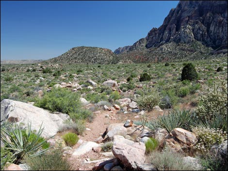
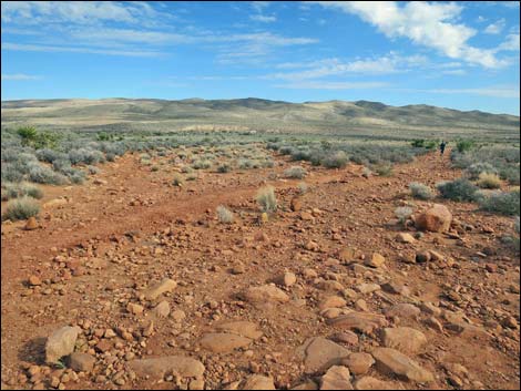
 Hiker crossing desert flats (view s) |
 Hiker at edge of bluff overlooking Oak Creek (view S) |
 Bluff overlooking Oak Creek; Wilson Saddle in the distance (view S) |
 Hiker contouring down across bluff towards Oak Creek (view SW) |
 Crossing one of several east-west trending use-trails (view SW) |
 Escarpment Trail continues towards Oak Creek (view SW) |
 Trail forks: left fork descent (view S; not the best) |
 Trail forks: right fork descent past juniper tree (view S) |
 Escarpment Trail arriving at Oak Creek (view S) |
 Hiker across Oak Creek (view S) |
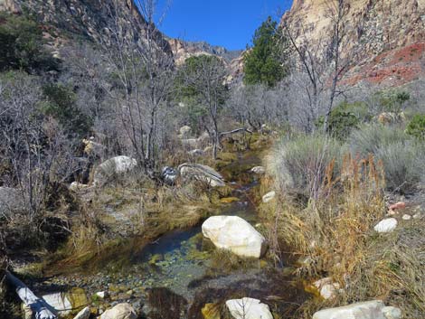 Oak Creek during winter (view W; upstream) |
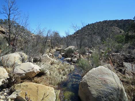 Oak Creek during winter (view E, downstream) |
 Oak Creek during summer (view E, downstream) |
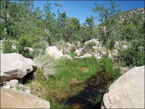
 Catching Baja California Treefrogs in Oak Creek (view W; upstream) |
 Escarpment Trail climbs gravel bank out of creek bed (view S) |
 Escarpment Trail angles down along creek (view S) |
 Escarpment Trail angles down along creek ... (view SE) |
 ... then climbs up the bank of the wash (view SE) |
 Route continues past the tall pine tree (view S) |
 Passing through a sandy area (view S) |
 One of several use-trails climbing towards Wilson Saddle (view SE) |
 South Oak Creek Trail below Wilson Saddle (view S) |
 South Oak Creek Trail approaching Wilson Saddle (view SE) |
 South Oak Creek Trail just past saddle (view SE) |
 Descending towards desert flats (view E) |
 South Oak Creek Trail runs across desert flats (view SE) |
 South Oak Creek Trail approaching the trailhead (view SE) |
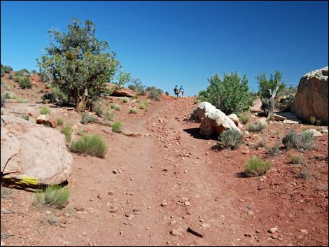
 Hikers Approaching the South Oak Creek Trailhead (view E) |
Table 1. Hiking Coordinates and Distances based on GPS Data (NAD27; UTM Zone 11S). Download Hiking GPS Waypoints (*.gpx) file.
| Wpt. | Location | UTM Easting | UTM Northing | Elevation (ft) | Point-to-Point Distance (mi) | Cumulative Distance (mi) |
|---|---|---|---|---|---|---|
| 01 | Willow Springs Trailhead | 635138 | 4002610 | 4,564 | 0.00 | 0.00 |
| 02 | Crossing Red Rock Wash | 635110 | 4002496 | 4,540 | 0.08 | 0.08 |
| 03 | Willow Spring-Children's Trail Jct | 635234 | 4002262 | 4,532 | 0.23 | 0.31 |
| 04 | Willow Spring-Lost Creek Trail Jct | 635274 | 4002118 | 4,521 | 0.15 | 0.46 |
| 05 | Lost Creek-SMYC Trail Jct | 635496 | 4002239 | 4,474 | 0.17 | 0.63 |
| 06 | SMYC-Icebox-Dale Trail Jct | 636233 | 4001218 | 4,307 | 1.04 | 1.67 |
| 07 | Dale-Pine Creek Canyon Trail Jct | 636965 | 3998718 | 3,980 | 2.13 | 3.80 |
| 08 | Fork Past Homestead | 636477 | 3998548 | 4,029 | 0.35 | 4.15 |
| 09 | Knoll-Pine Creek Loop Trail Jct | 636349 | 3998464 | 4,063 | 0.11 | 4.26 |
| 10 | Knoll-Arnight Trail Jct | 636701 | 3997957 | 4,138 | 0.45 | 4.71 |
| 11 | Knoll-Oak Creek Trail Jct | 637160 | 3996333 | 4,104 | 1.26 | 5.97 |
| 12 | Oak Creek Wash | 637060 | 3996117 | 4,055 | 0.17 | 6.14 |
| 13 | Wilson Saddle | 637473 | 3995556 | 4,137 | 0.49 | 6.63 |
| 14 | South Oak Creek Trailhead | 639689 | 3994796 | 3,756 | 1.67 | 8.30 |
Happy Hiking! All distances, elevations, and other facts are approximate.
![]() ; Last updated 256022
; Last updated 256022
| Hiking Around Red Rocks | Hiking Around Las Vegas | Glossary | Copyright, Conditions, Disclaimer | Home |