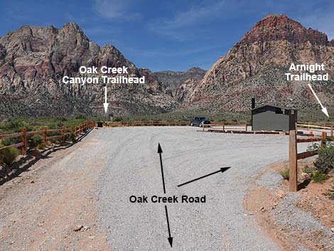
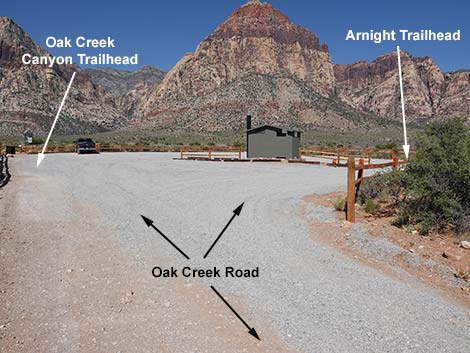
(Oak Creek Canyon Trailhead and Arnight Trailhead)
Hiking Around Las Vegas, Red Rock Canyon National Conservation Area
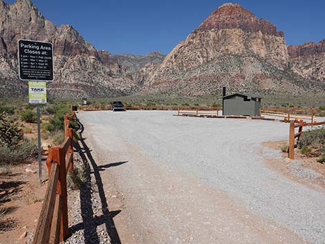
 Oak Creek Road approaching Oak Creek Trailhead sign (view SW) |
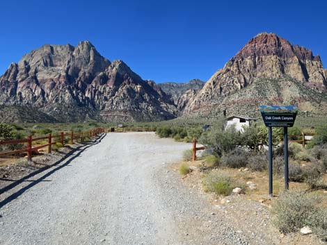
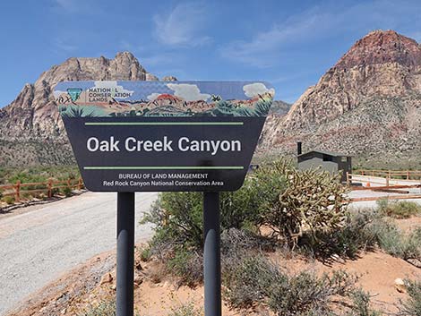
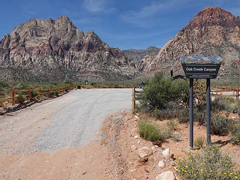
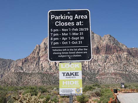
The Oak Creek Canyon Trailhead, sometimes referred to as North Oak Creek Trailhead or Oak Creek Road Trailhead, is located in Red Rock Canyon National Conservation Area, about 50 minutes west of Las Vegas, in the Scenic Loop Road fee area. From town, drive out to Red Rocks. From West Charleston Blvd at Scenic Loop Road (Table 1, Site 0519), turn right and drive north for 0.2 miles to the entrance station (Site 0855). Pay the fee, then drive around the one-way Scenic Loop Road to Oak Creek Canyon Road (Site 0530), which is at Mile Marker 12.15 (0.15 miles past Mile Marker 12). Turn right onto Oak Creek Canyon Road and drive west for 0.7 miles to the parking lot at the end of the road (Site 0531). Park here; this is the trailhead. Link to trailhead map. |
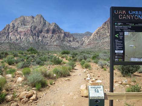
 Oak Creek Canyon Trailhead sign (view SW) |
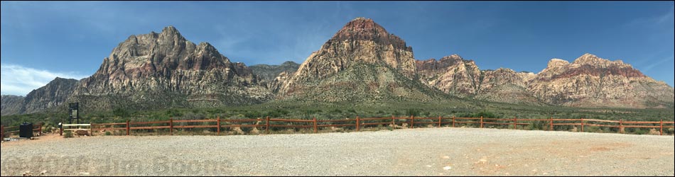
The Oak Creek Canyon Trailhead provides access to hikes in the Oak Creek Canyon area, including access to the Escarpment and many miles of easy to strenuous hiking on the flats and in the canyons. There are two trailheads here: the Oak Creek Canyon Trailhead and the Arnight Trailhead. The Oak Creek Trailhead is located at the southwest corner of the parking area, and the Arnight Trailhead is located at the northeast corner of the parking area. Trails: Middle Oak Creek Trail, Oak Creek Canyon Trail, South Oak Creek Trail, Escarpment Trail, Arnight Trail, Rainbow Mountain Loop Trail, Knoll Trail. |
Oak Creek Canyon Trailhead
 Approaching Oak Creek Canyon Trailhead (view SW) |
 Oak Creek Road forks to form a loop (view SW) |
 |
 |
 Staying left entering the parking area (view SW) |
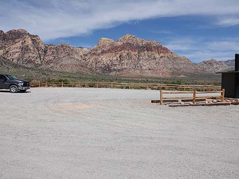
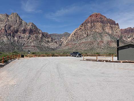 Oak Creek Canyon Trailhead parking (view SW) |
 Parking on the right by the vault toilet (view NW) |
Approaching Oak Creek Canyon Trailhead parking (view SW) |
 Oak Creek Trailhead parking area (view SW) |
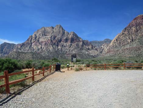
 Oak Creek Trailhead (view SW) |
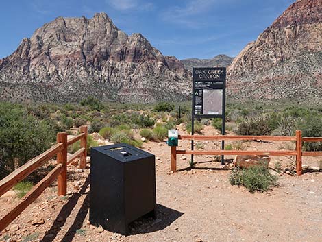 Oak Creek Canyon Trailhead (view SW) |
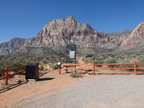
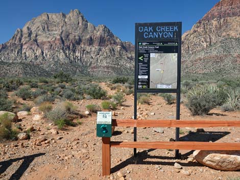 Oak Creek Canyon Trailhead sign (view SW) |
 Oak Creek Canyon Trailhead sign (view SW) |
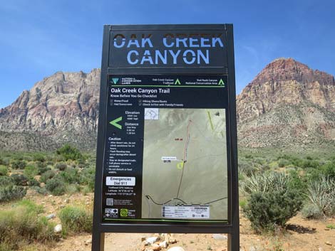
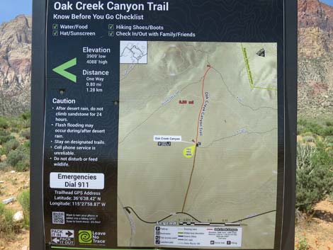 Oak Creek Canyon Trailhead map (view SW) |
 Start of Oak Creek Canyon Trail (view SW) |
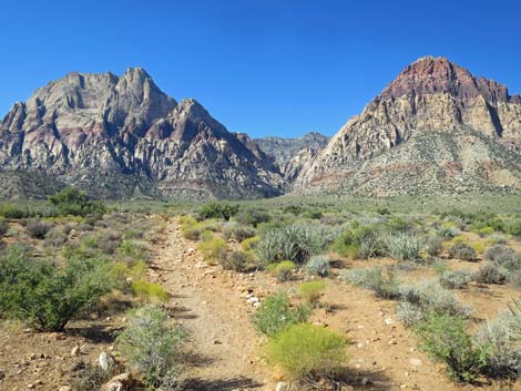 Start of Oak Creek Canyon Trail (view SW) |
 Lots of parking on the turn-around loop (view N) |
 Lots of parking on the turn-around loop (view NE) |
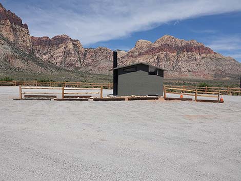
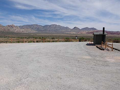
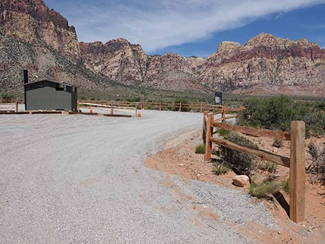
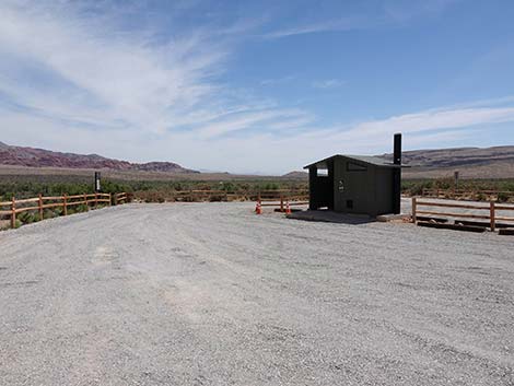 Vault toilet in the middle of the parking lot (view W) |
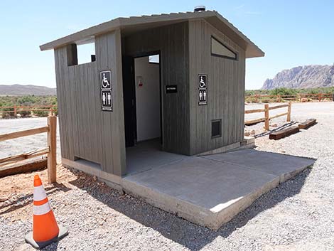 Oak Creek vault toilet (view S) |
Arnight Trailhead
 Oak Creek Road forks to form a loop (view SW) |
 Staying right towards Arnight Trailhead parking (view NW) |
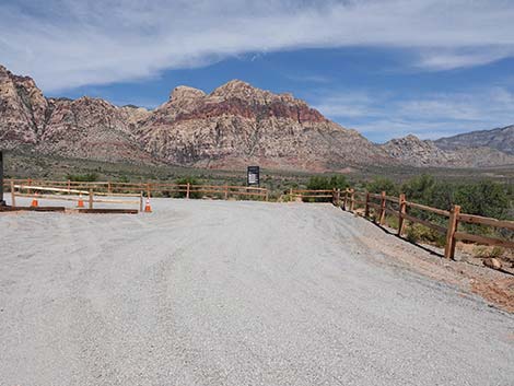 Approaching Arnight Trail parking (view NW) |
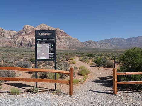 Arnight Trailhead (view N) |
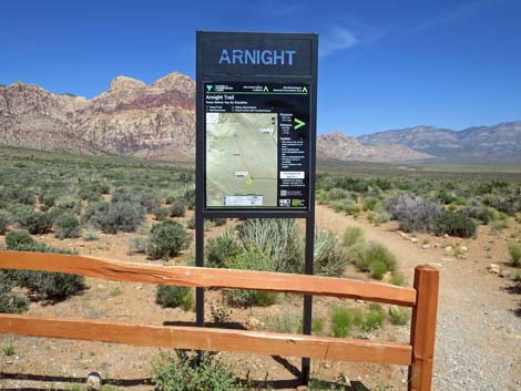 Arnight Trailhead sign (view N) |
 Arnight Trailhead sign (view N) |
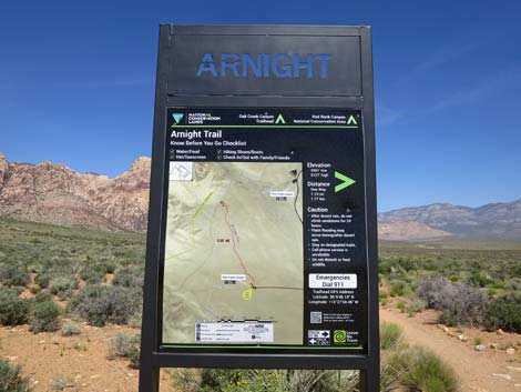
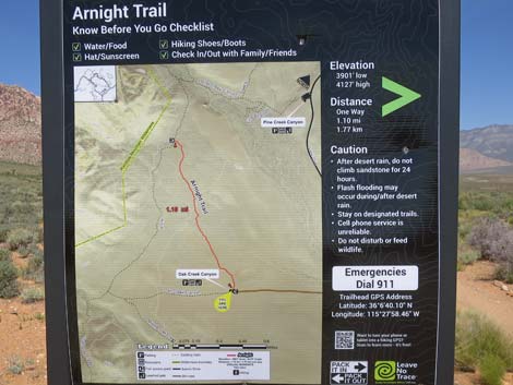 Arnight Trailhead map (view N) |
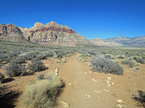 Start of the Arnight Trail (view N) |
Table 1. Highway Coordinates (NAD27; UTM Zone 11S). Download Highway GPS Waypoints (*.gpx) file.
| Site # | Location | Latitude (N) | Longitude (W) | UTM Easting | UTM Northing | Elevation (feet) | Verified |
|---|---|---|---|---|---|---|---|
| 0519 | Charleston at Scenic Loop Entrance | 36.13161 | 115.42048 | 642131 | 3999501 | 3,681 | Yes |
| 0530 | Scenic Loop Rd at Oak Creek Rd | 36.11673 | 115.45622 | 638940 | 3997798 | 3,804 | Yes |
| 0531 | Oak Creek Trailhead | 36.11081 | 115.46549 | 638116 | 3997128 | 3,905 | Yes |
| 0855 | Scenic Loop Entrance Station | 36.13252 | 115.42282 | 641918 | 3999598 | 3,682 | Yes |
Happy Hiking! All distances, elevations, and other facts are approximate.
![]() ; Last updated 240330
; Last updated 240330
| Hiking Around Red Rocks | Hiking Around Las Vegas | Glossary | Copyright, Conditions, Disclaimer | Home |