Backroads Around Las Vegas
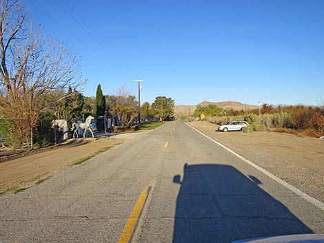
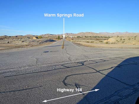 Warm Springs Road (view SW from Highway 168) |
Overview Warm Springs Road is a paved, rural road that provides access to Moapa Valley National Wildlife Refuge, Warm Springs Natural Area, and farms, homes, and businesses in Warm Springs Valley. Birdwatchers might enjoy driving slowly and looking for birds in the open fields and scattered mesquite thickets. Link to Map. Watch Out Other than the standard warnings about hiking in the desert, ...this road is pretty safe, but be sure that your vehicle is in good working condition, carry plenty of water (radiator and drinking), and pack a lunch. Always drive carefully; even though the road is paved, there are occasional hazards such as flood damage, errant rocks, and potholes in the roadway. |
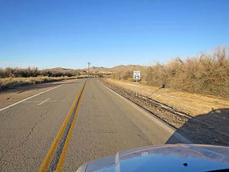
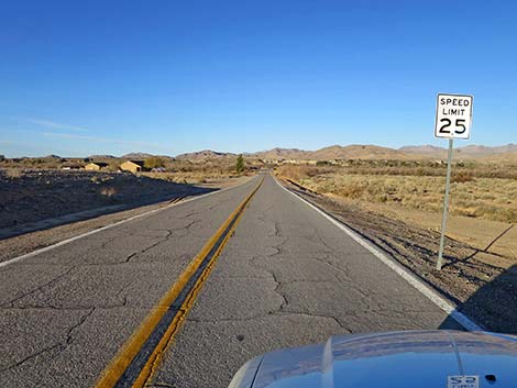 Slow speed limit on this rural road (view SE) |
While out, please respect the public and private lands out there, and try to Leave No Trace of your passage. This road is not remote, but be sure to bring what you need of the 10 Essentials. Getting to the Road Warm Springs Road is located northeast of Las Vegas, about 50 minutes out Interstate-15 Northbound. From town, drive north on I-15 for 40 minutes to Exit 90, Watch for signs to State Route 168, Glendale, and Moapa. The interstate offramp loops to the right and circles back under the highway. At the stop sign, continue straight (northwest) onto Highway 168. Following Highway 168 through Moapa, the road passes rural homes, businesses, and government buildings before heading into the desert. The road passes through the corner of the Moapa Valley Indian Reservation, and at about 7.1 miles out, reaches an intersection with Warm Springs Road, on the left. |
 Warm Springs Road bends right (view SW) |
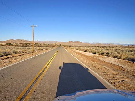
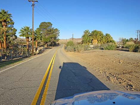
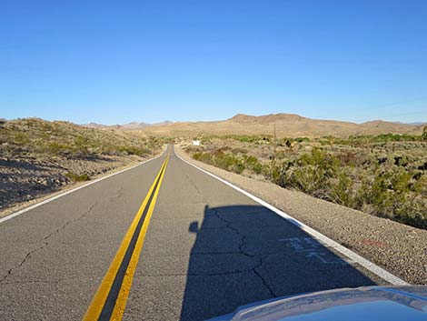
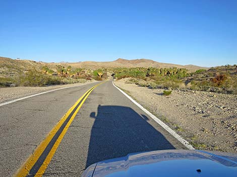
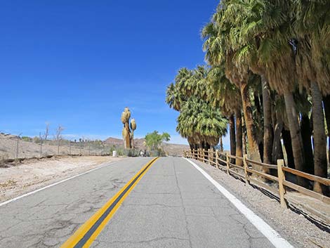
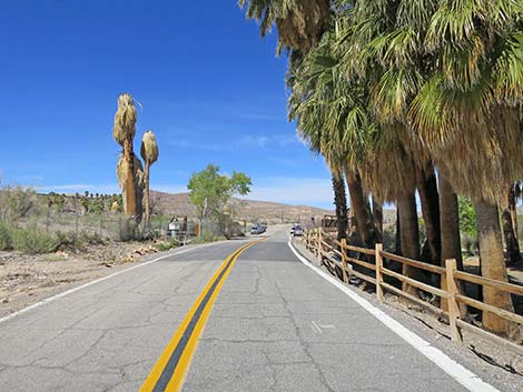
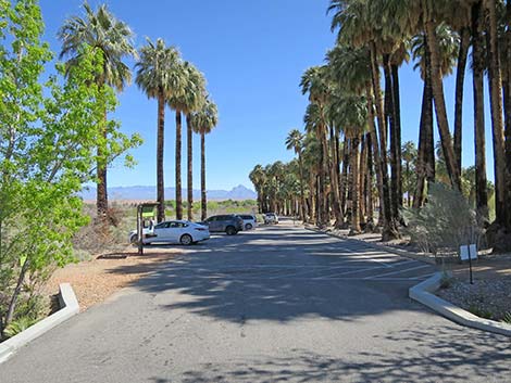
The Road From Highway 168, Warm Springs Road (Table 1, Site 0898) runs southwest with a 25-mph speed limit. At about 0.27 miles out, the road bends right to run due west. At about 0.79 miles out, Warm Springs Road passes Palm Creek Ranch, a private enterprise with camping and access to the warm water of the Muddy River. Watch for the concrete horse statue that marks the entrance. At the far edge of the property (0.90 miles out), the road dips to cross a bridge over the river. The road runs across fallowed farm fields and bends a bit left and right as it runs through rolling country below a flat-topped mesa on the left. Shortly, at about 1.63 miles out, Warm Springs Road crests a low rise and drops back into the valley bottom and an oasis of palm and other trees. |
 Warm Springs Road traversing fallow fields (view W) |
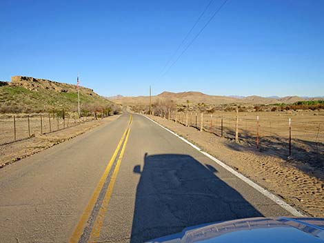
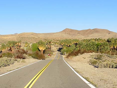
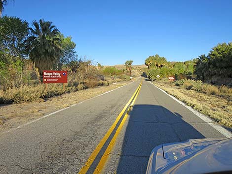
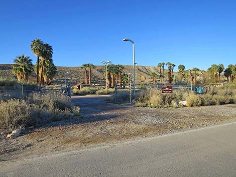
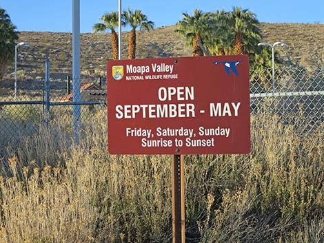
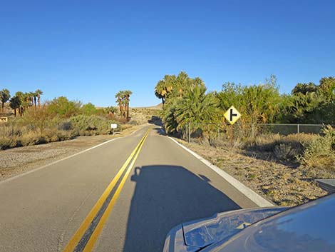
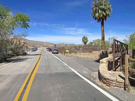
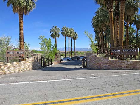
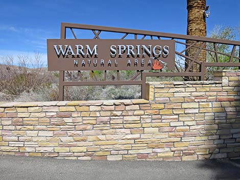
At about 1.75 miles out, Warm Springs Road passes a brown sign on the left announcing entrance into Moapa Valley National Wildlife Refuge . At this point, the wildlife refuge includes a sliver of land on the right side of the road, but the vast majority of the refuge lies to the left of the road behind chain-link fencing. The entrance to the refuge is just ahead (Site 0449; 1.78 miles out) on the left. Signs provide information about open hours. Continuing, a highway sign warns of a highway intersection ahead on the right. The chain-link fence on the right gives way to a wooden split-rail fence, and drivers arrive at the entrance to Warm Springs Natural Area (Site 1169; 1.91 miles out). Signs here announce the area and provide information about open hours. Note that the turn into Warm Springs is on a curve with limited sight distances. |
 Warm Springs Road approaching Palm Creek Ranch (view W) |
Continuing, Warm Springs Road passes the entrance (2.42 miles out) to the Muddy Spring area, an LDS swimming and recreation area. From there, the road winds about and climbs onto the mesa-top mountains providing grand views out across Warm Springs Valley. Warm Springs Road eventually bends northward and drops steeply back onto the valley floor. At about 3.95 miles out, the road splits. The main fork continues straight, while the other fork curves to the left. According to maps, both forks are named Warm Springs Road. The main fork continues straight and soon bends a bit right to end at an intersection with Highway 168 (Site 1169). The left fork also bends around and ends at an intersection with Highway 168. |
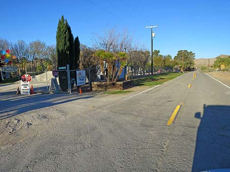 Warm Springs Road at Palm Creek Ranch (view SW) |
 Warm Springs Road approaching the Muddy River (view W) |
 Warm Springs Road traversing fallow fields (view W) |
 Warm Springs Road traversing rolling hills (view W) |
 Warm Springs Road cresting a hill (view W) |
 Warm Springs Road dropping into an oasis (view W) |
 Warm Springs Road approaching the Moapa Valley NWR (view W) |
 Entrance to Moapa Valley NWR (view SW from Warm Springs Road) |
 Moapa Valley NWR sign (view S) |
 Warm Springs Road continuing past Moapa Valley NWR (view W) |
 Warm Springs Road bends right (view NW) |
 Warm Springs Road at split-rail fence (view NW) |
 Warm Springs Rd approaching entrance to Warm Springs Nat Area |
 Warm Springs Rd at entrance to Warm Springs Natural Area (view NW) |
 Entrance to Warm Springs Natural Area (view NE) |
 Warm Springs Natural Area sign (view N) |
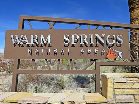 Warm Springs Natural Area sign (view N) |
 Entering Warm Springs Natural Area (view NE) |
Table 1. Highway Coordinates and Distances based on GPS Data (NAD27). Download Highway GPS Waypoints (gpx) file.
| Wpt. | Location | Latitude (N) | Longitude (W) | Elevation (ft) | Point-to-Point Distance (mi) | Cumulative Distance (mi) |
|---|---|---|---|---|---|---|
| 0879 | I-15 at Hwy 168 (Glendale) | 36.66059 | 114.57340 | 1,542 | . | . |
| 0898 | Hwy 168 at Warm Springs Rd (S) | 36.71347 | 114.67964 | 1,716 | 0.00 | 0.00 |
| 0449 | Moapa NWR | 36.71078 | 114.71063 | 1,772 | 1.78 | 1.78 |
| 1909 | Warm Springs Natural Area | 36.71163 | 114.71251 | 1,778 | 0.13 | 1.91 |
| 1169 | Hwy 168 at Warm Springs Rd (E) | 36.73501 | 114.72836 | 1,816 | 2.32 | 4.23 |
Happy Hiking! All distances, elevations, and other facts are approximate.
![]() ; Last updated 240331
; Last updated 240331
| Backroads | Hiking Around Las Vegas | Glossary | Copyright, Conditions, Disclaimer | Home |