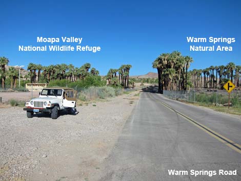
 Warm Springs Road approaching Moapa NWR, on the left (view NW) |
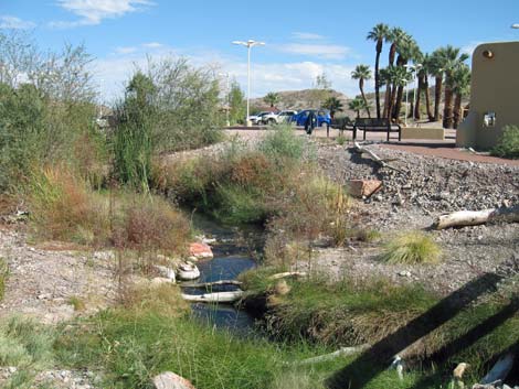
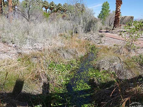
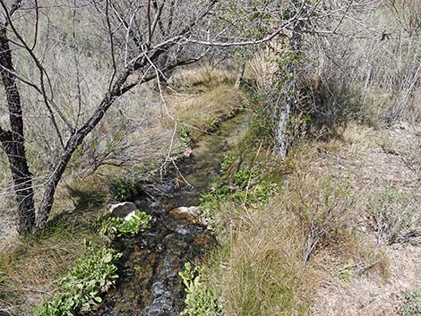
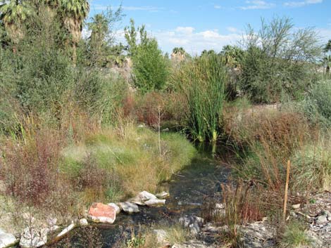
Description Moapa Valley National Wildlife Refuge protects 116 acres of habitat for the endangered Moapa Dace, a small endemic fish that lives only in the headwaters of the Muddy River system. Dace populations were in peril due to habitat destruction and stream modification, plus competition with non-native mosquitofish, shortfin molly, and tilapia. As stream channels have been restored and the non-native species removed, Dace numbers have begun to rebound. Recent population surveys revealed about 1,500 Dace. While established to protect the fish, the refuge protects bird habitat too. Trees, shrubs, and water attract desert birds from a wide area and migratory birds in season, making the refuge a good place for birdwatchers. Warm Springs Natural Area, across the street from the refuge, protects another 1220 acres of riparian habitat for fish and birds. This is also a good place for watching dragonflies. Link to map. |
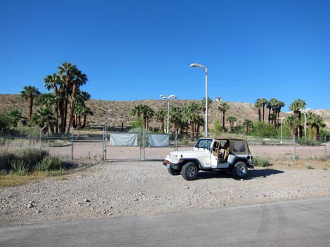 Moapa Valley NWR entrance along Warm Springs Road (view SW) |
Beyond the refuge, the Upper Moapa Valley is a broad, flat area set in dry Mojave Desert Scrub between two limestone mountains ranges. Water emerges from several springs, including warm springs at about 90°F, in the upper Moapa Valley to create a fairly large riparian area. Water from the springs converges downstream to form the Muddy River. Because of the water, people have lived and farmed the area for thousands of years, and much of the land is now used for farms or pasture. Much of the rest of the valley is thickets of fan palms, date palms, and honey mesquite. The Upper Moapa Valley suffered a huge fire in 2010 that killed many of the palms and cleared out many of the shrub thickets. The area is now more open, so it is easier to bird from the road. Bird the refuge by walking the short trails, and also by walking the road between the refuge and Warm Springs Natural Area, being careful of the traffic. The road is posted at 25 mph, but don't bet your life that people drive the speed limit. The shoulders are narrow, so pay attention to the traffic. Traffic generally is light, so you can bird the rest of the valley by driving slowly and stopping to investigate interesting spots from the road. |
 Moapa Valley NWR (view S from Warm Springs Road) |
Location The Moapa National Wildlife Refuge is located northwest of Moapa, about 1 hour from Las Vegas. To get there from Las Vegas, drive north on Highway I-15 to the Moapa-Glendale exit (Exit 90; Table 1, Site 0879). Exit the Interstate and drive northwest on Highway 168 for 7.0 miles to Warm Springs Road (Site 0898). Turn left (southwest), and drive for about 2 more miles. When you see the chain link fence capped with barbed wire on both sides of the road, you are there (Site 0449). Park on either side of the road, or if the refuge is open, turn left into the parking lot. For some variety on the way home, continue driving northwest on Warm Springs Road until it intersects Highway 168 again. Turn left (northwest) and drive 14 miles to Highway 93. Turn left (south) and head back to Interstate-15. These roads traverse beautiful desert landscapes. The land south of Highway 168 and east of Highway 93 is the Arrow Canyon Wilderness Area. |
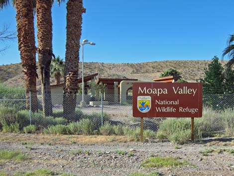
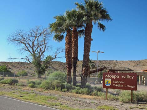 Moapa Valley National Wildlife Refuge |
Hours Due to its small size, fragile habitats, and on-going restoration work, the wildlife refuge is only open Friday, Saturday, and Sunday, sunrise to sunset, from September through May. The refuge is closed during June, July, and August. The road is always open for birders, but it probably should be considered day-use only. Warm Springs Natural Area, across the street from the refuge, is also open to the public (link to open hours). Fees None. |
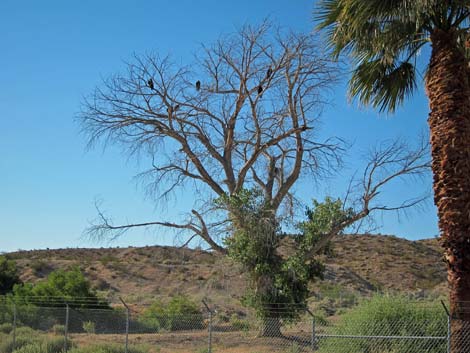 Turkey Vultures roosting in dead cottonwood tree inside the refuge |
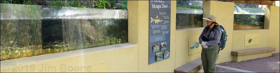
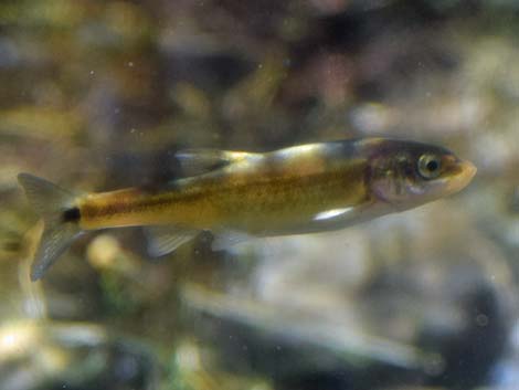
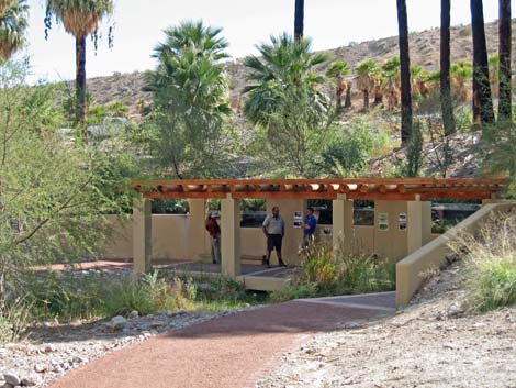
Specialties The area is good for desert species such as Phainopepla, Abert's Towhee, Verdin, Black Phoebe, Gambel's Quail, and Lucy's Warbler, and migrants such as Red-shouldered Hawk, Killdeer, Hooded Oriole, sparrows, and warblers. Watch for the endemic fish (Moapa Dace, Moapa White River Springfish) and snails (Moapa Pebblesnails) too. This is also a good place to see dragonflies. If you are lucky enough to get into the Wildlife Refuge, the new fish viewing exhibit is excellent, providing a side-view of a stream. Looking into the water, visitors can see the endemic fish and snails close-up. For More Information Visit the Moapa Valley NWR website. |
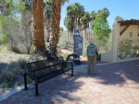
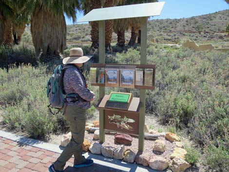 Visitor sign-in and information kiosk (view SE) |
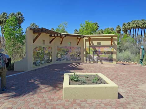 Entrance plaza (view W) |
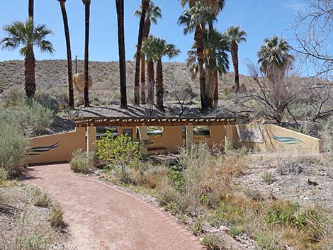
 Entrance to short trail system (view W) |
 Approaching the fish-viewing station |
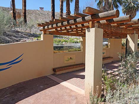 Entering the fish-viewing station |
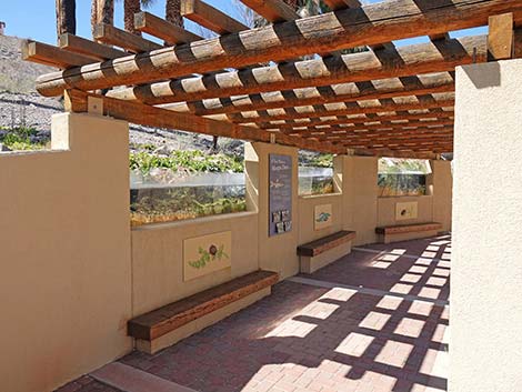 Fish-viewing station |
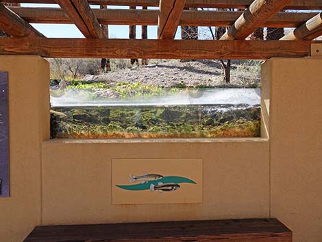
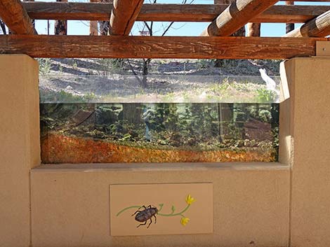
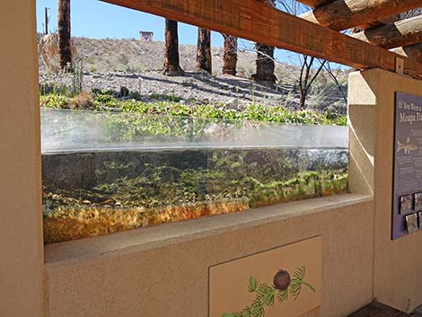 Plexiglas wall allows viewing into the stream |
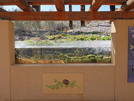 Plexiglas wall allows viewing into the stream |
 |
 |
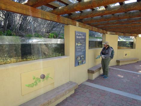 Visitor at the fish-viewing exhibit |
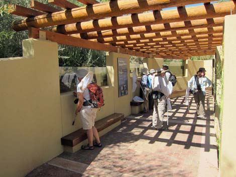 Visitors at the fish-viewing exhibit |
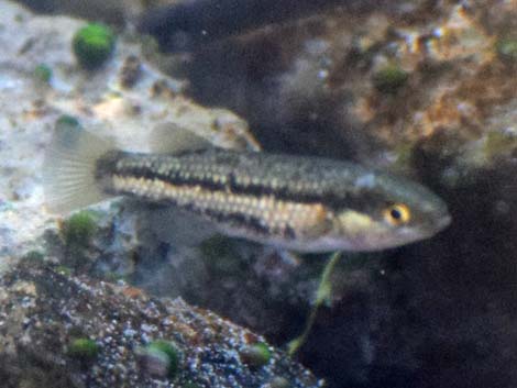
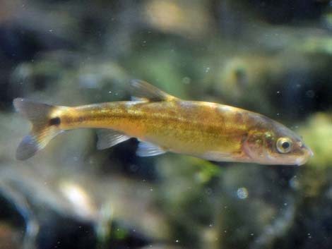 Moapa dace (Moapa coriacea) |
 Moapa dace (Moapa coriacea) |
 Moapa White River Springfish (Crenichthys baileyi moapae) |
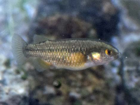 Moapa White River Springfish (Crenichthys baileyi moapae) |
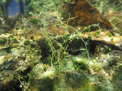 Snails and algae in the stream |
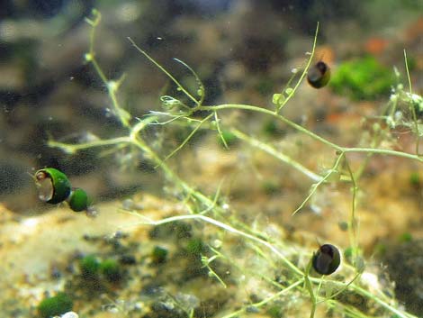 Snails and algae in the stream |
 Steam inside Moapa NWR |
 Steam inside Moapa NWR |
 Steam inside Moapa NWR |
 Steam inside Moapa NWR |
 Keep an eye out for other species, such as muskrat |
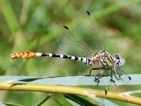 Keep an eye out for other species, such as dragonflies |
 Stream viewing area (view SE) |
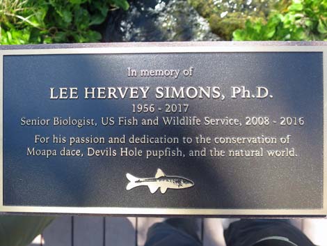 In memory of Lee Simons, friend of mine (plaque on bridge railing) |
Table 1. GPS Coordinates for Highway Locations (NAD27; UTM Zone 11S). Download Highway GPS Waypoints (*.gpx) file.
| Site | Location | UTM Easting | UTM Northing | Latitude (N) | Longitude (W) | Elevation (ft) |
|---|---|---|---|---|---|---|
| 0449 | Moapa NWR | 704440 | 4064990 | 36.71044 | 114.71119 | 1,772 |
| 0879 | I-15 at Hwy 168 (Glendale) | 716892 | 4059769 | 36.66065 | 114.57337 | 1,542 |
| 0898 | Hwy 168 at Warm Springs Rd (S) | 707249 | 4065385 | 36.71338 | 114.67965 | 1,716 |
| 1909 | Warm Springs Natural Area | 704319 | 4065120 | 36.71163 | 114.71251 | 1,778 |
Happy birding! All distances, elevations, and other facts are approximate.
![]() ; Last updated 240322
; Last updated 240322
| Birding Around Las Vegas | Southern Nevada Birds | Guide Service | Copyright, Conditions, Disclaimer | Home |