Backroads Around Las Vegas, Red Rock Canyon NCA
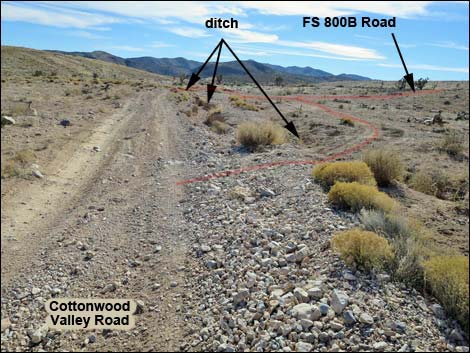 Cottonwood Valley Road at Road FR-800B (view SW) |
Overview Forest Road FR-800B is a short side-road off Cottonwood Valley Road that runs 0.6 miles to connect with Forest Road FR-800C, which then leads to the Dawn Mine, 99 Mine, and the trailhead for the hike to the Carol Lombard Crash Site. Road FR-800B is rough, rocky, and requires a 4WD vehicle. The road is so badly washed out that it has, more or less, been abandoned. It is now faster and easier to drive 0.7 miles farther south on Cottonwood Valley Road to Road FR-800C, which leads to the mines and trailhead. Link to map. |
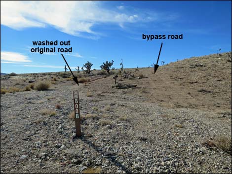 Forest Road 800B (Ninetynine Mine Road) highway sign (view SW) |
Watch Out Other than the standard warnings about driving in the desert, ...this road is pretty rough, requires a 4WD vehicle, and it has been abandoned. While out, please respect the land and the other people out there, and try to Leave No Trace of your passage. Also, be sure to bring what you need of the 10 Essentials. Getting to the Roadhead From Las Vegas, drive west on Highway 160 (Pahrump Highway) to the Cottonwood Valley Trailhead, then drive south on Cottonwood Valley Road for 4.6 miles to Road FR-800B (Table 1, Site 0488) on the right. Note that Cottonwood Valley Road and Road FR-800B require a 4WD vehicle. |
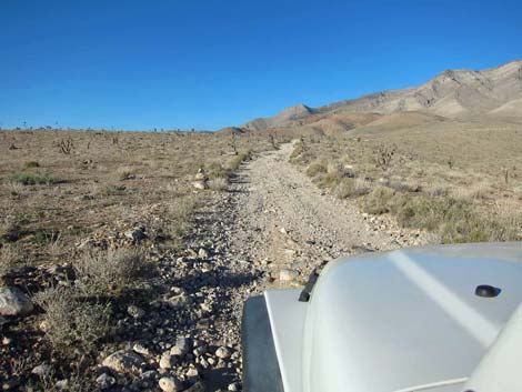
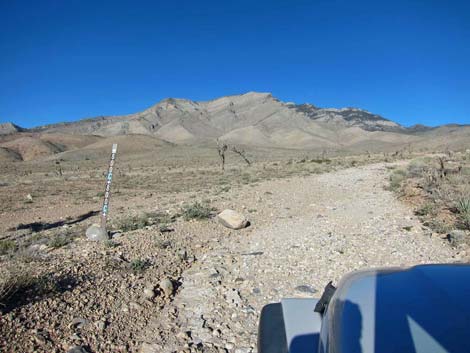
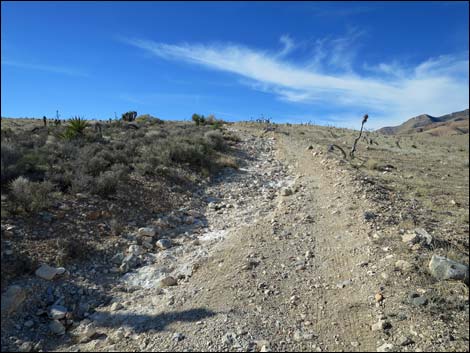 Starting into 4WD section (view SW) |
The Road From Cottonwood Valley Road, the road intersection onto Road FR-800B is washed out and blocked by a deep erosion gully, requiring drivers to cross the gully a fair ways north or south of the actual road. From Cottonwood Valley Road at Road FR-800B (Site 0488), Road FR-800B runs southwest. The start of the road is a long, deep rut, and drivers have been making a new road to the side of the original. After joining the original road, the road begins to climb a hillside. The road looks bad, as it is rutted with lots of loose rock and requires 4WD-low range. At about 0.66 miles out, Road FR-800B merges left into FR-800C (Site 1125). |
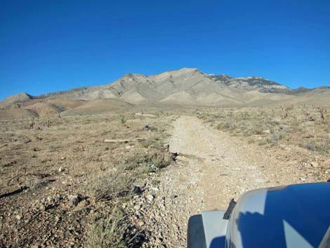
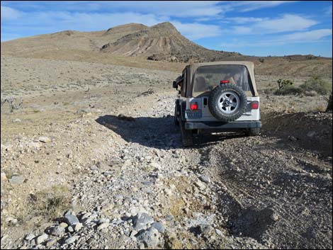
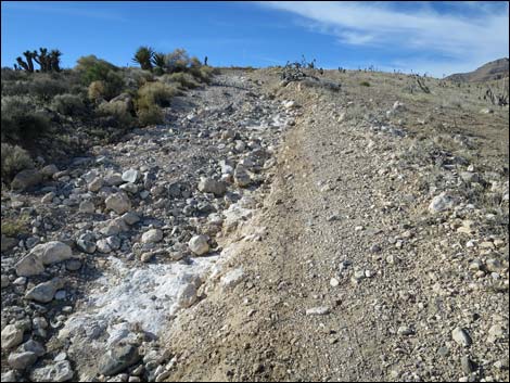 4WD section (view SW) |
 4WD section (view SW) |
 4WD section (view SW) |
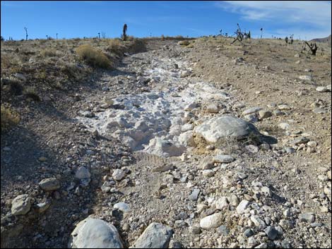
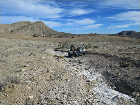
 Even this section is now washed out (view SW) |
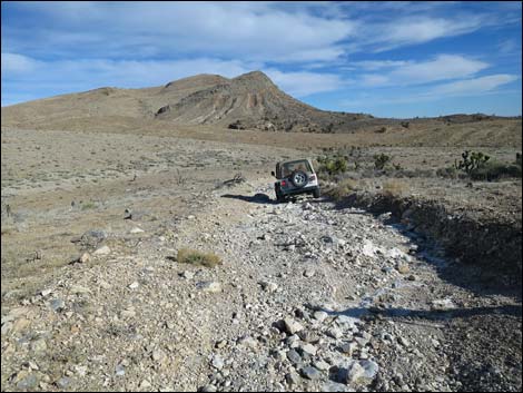
 This section is now washed out (view SW) |
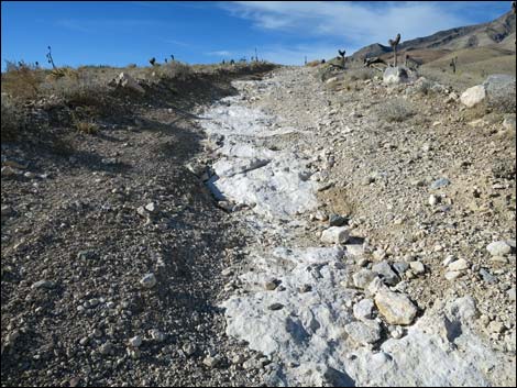
 This section is now washed out; FR-800B at Road FR-800C |
Returning Down the Worst of the Road
 |
 |
 |
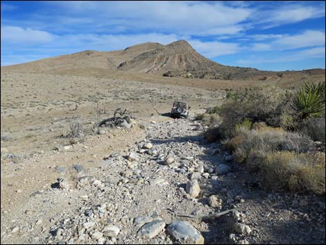 |
Table 1. Highway Coordinates based on GPS Data (NAD27; UTM Zone 11S). Download Highway GPS Waypoints (*.gpx) file.
| Site | Location | UTM Easting | UTM Northing | Latitude (N) | Longitude (W) | Elevation (ft) |
|---|---|---|---|---|---|---|
| 488 | Cottonwood Rd at 99 Mine Rd | 641404 | 3978040 | 35.93830 | 115.43239 | 4697 |
| 1125 | FR800B at FR800C | 640480 | 3977749 | 35.93581 | 115.44268 | 4903 |
| 1931 | Cottonwood Valley Road at Road FR-800C | 641701 | 3976569 | 35.92500 | 115.42935 | 4518 |
Happy Hiking! All distances, elevations, and other facts are approximate.
![]() ; Last updated 200720
; Last updated 200720
| Backroads | Hiking Around Las Vegas | Glossary | Copyright, Conditions, Disclaimer | Home |