Backroads Around Las Vegas, Red Rock Canyon NCA
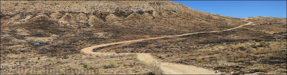
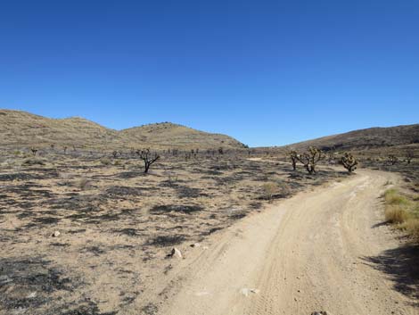
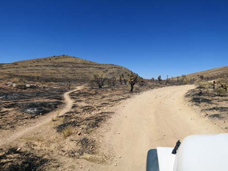
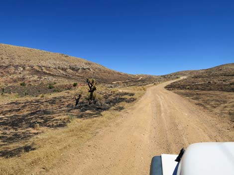
 Cottonwood Valley Road approaching Birdspring Road (view E) |
Overview Birdspring Road, a spur road off Cottonwood Valley Road, runs northeast about 0.8 miles and ends at an overlook on the crest of the Birdspring Mountain Range. The road runs up to a saddle that serves as the trailhead for the hike to Birdspring Peak, then continues a few yards to the overlook that provides grand views out across the landscape and southern parts of Las Vegas. The area burned during the 2005 Goodsprings fire, and then again during the 2020 Cottonwood Fire. Link to map. Watch Out Other than the standard warnings about driving in the desert, ...this road is getting to be a rough ride, but it isn't too bad. Cell phones work in some areas. This is a major mountain biking area, so keep an eye out for inattentive bikers careening across the road. Slow down when approaching the saddle so as not to fly over the crest and down the other side. |
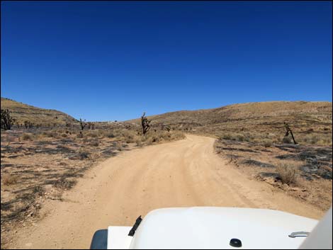
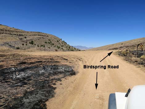
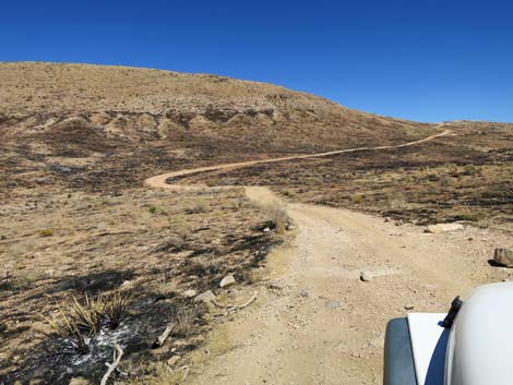
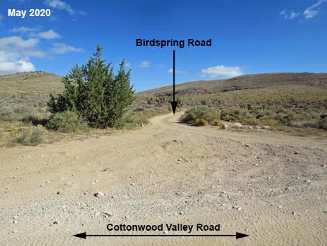 Birdspring Road May 2020 (view N from Cottonwood Valley Rd) |
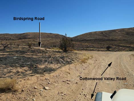
While out, please respect the land and the other people out there, and try to Leave No Trace of your passage. Also, be sure to bring what you need of the 10 Essentials. Getting to the Roadhead Birdspring Road is located in Cottonwood Valley, about 45 minutes southwest of Las Vegas on the east side of Mt. Potosi. From Las Vegas, drive west on Highway 160 (Pahrump Highway) to the Cottonwood Valley Trailhead, which is about 200 yards down Cottonwood Valley Road. From there, continue south on Cottonwood Valley Road for a rough 3.2 miles to Cottonwood Pass. From the top of the pass, continue south another 0.3 miles to a T-intersection where Birdspring Road branches to the left. |
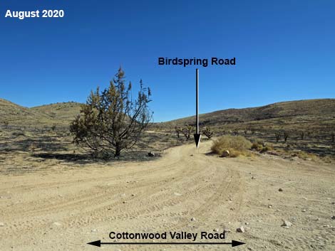 Birdspring Road August 2020 (view N from Cottonwood Valley Rd) |
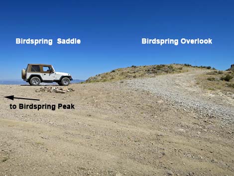
The Road From Cottonwood Valley Road (Table 1, Site 0851), Birdspring Road runs north-northeast over fairly gentle terrain. At about 300 yards out, a bike trail merges onto the road from the right, runs on the road for about 40 yards, and then exits to the left. The road continues north until about 0.4 miles out, then bends right and begins to climb into the mountains. From this point, the road runs considerably steeper. In another 0.1 miles, the road curves left to dip and cross a shallow wash. Climbing out of the wash, the road resumes climbing steeply over fairly rocky terrain that makes for a bumpy, but not a rock-hopping, experience. At about 0.8 miles out, the road reaches Birdspring Saddle (Site 0852), which is the trailhead for Birdspring Peak. The road continues a few yards farther, bending south and climbing onto Birdspring Overlook. For most people, stopping at the saddle and walking to the Overlook is a good chance to stretch the legs. |
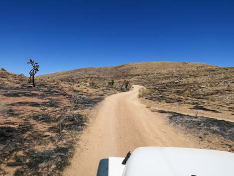
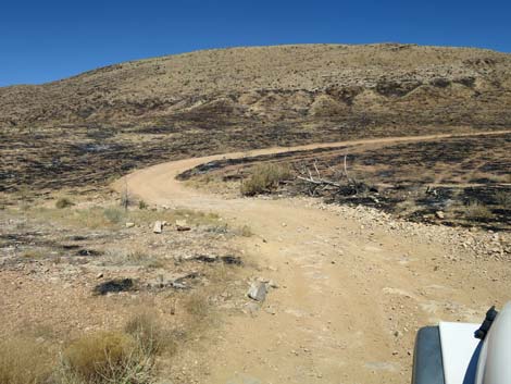
 All of Birdspring Road burned in 2020 (view N) |
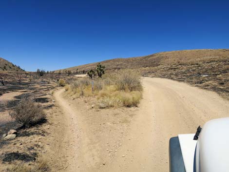
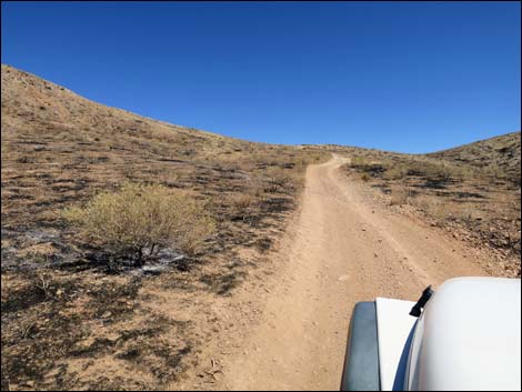
 Much of lower Birdspring Road is easy (view N) |
 Mountain bike trail entering Birdspring Road from the right (view N) |
 Mountain bike trail exiting Birdspring Road to the left (view N) |
 Mountain bike trail parallels Birdspring Road (view N) |
 Birdspring Road approaching a low saddle (view N) |
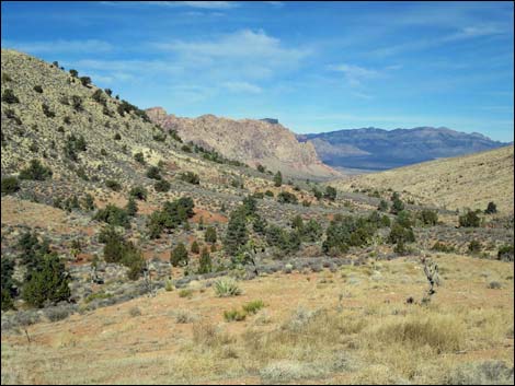 Looking out from the saddle towards Red Rock Cliffs, May 2020 |
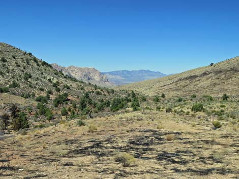 Looking out from the saddle towards Red Rock Cliffs, August 2020 |
 From saddle, road bends right and starts climbing (view NE) |
 Birdspring Road crosses the canyon (view NE) |
 Birdspring Road crossing the wash (view NE) |
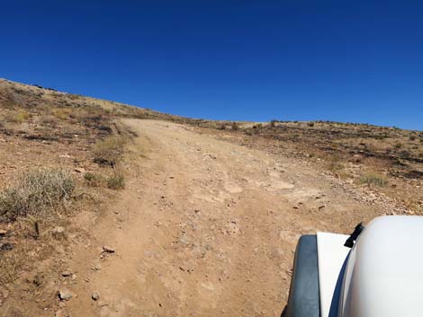
 Parts of steep upper Birdspring Road are smooth (view SE) |
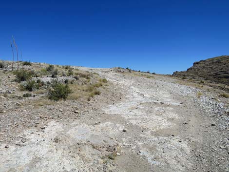
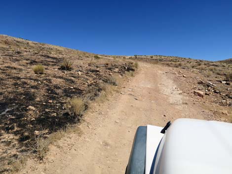 Birdspring Road climbing steeply (view SE) |
 Parts of steep upper Birdspring Road are a bit rocky (view SE) |
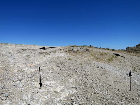
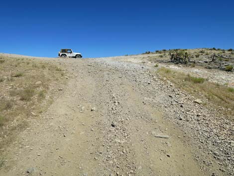 Birdspring Road approaching Birdspring Saddle (view SE) |
 Birdspring Road approaching Birdspring Saddle (view SE) |
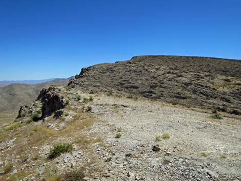
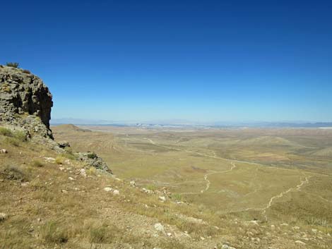 Birdspring Saddle (view NE towards Las Vegas) |
 Birdspring Saddle (view NE towards Las Vegas) |
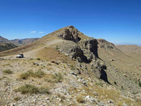
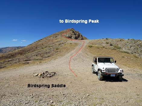 Birdspring Peak trailhead (view N) |
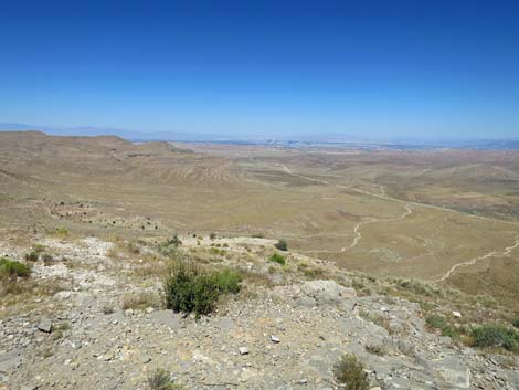
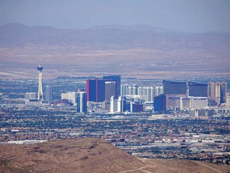 Las Vegas (view NE from Birdspring Saddle) |
Continuing to Birdspring Overlook
Birdspring Road approaching Birdspring Saddle (view SE) |
 Birdspring Overlook is a few yards south of the saddle (view SE) |
 Turn-around loop at Birdspring Overlook (view SE) |
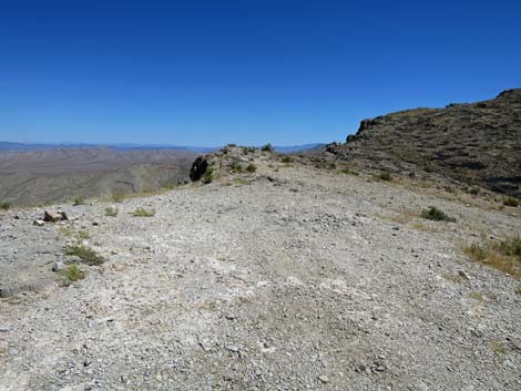 Turn-around loop at Birdspring Overlook (view SE) |
 Turn-around loop at Birdspring Overlook (view SE) |
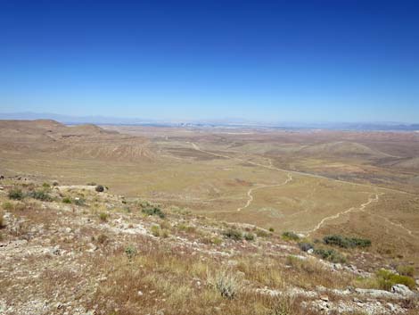
 Birdspring Overlook (view NE towards Las Vegas) |
 Birdspring Overlook (view NE towards Las Vegas) |
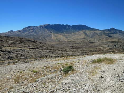
 Birdspring Overlook (view N towards Birdspring Peak) |
Table 1. Highway Coordinates based on GPS Data (NAD27; UTM Zone 11S). Download Highway GPS Waypoints (*.gpx) file.
| Wpt. | Location | Latitude (N) | Longitude (W) | Elevation (ft) | Point-to-Point Distance (mi) | Cumulative Distance (mi) |
|---|---|---|---|---|---|---|
| 0851 | Cottonwood Road at Birdspring Road | 35.95387 | 115.43718 | 4,733 | 0.00 | 0.00 |
| 0852 | Birdspring Saddle | 35.95659 | 115.42808 | 4,933 | 0.85 | 0.85 |
Happy Hiking! All distances, elevations, and other facts are approximate.
![]() ; Last updated 240330
; Last updated 240330
| Backroads | Hiking Around Las Vegas | Glossary | Copyright, Conditions, Disclaimer | Home |