Hiking Around Las Vegas, Mojave National Preserve
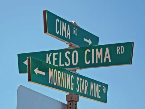 Street signs at Cima |
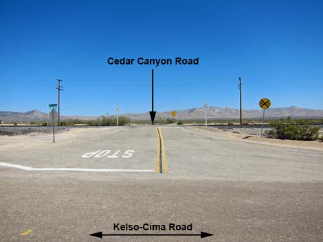
Overview Kelso-Cima Road is a paved road and a main highway through the central part of Mojave National Preserve, connecting the "towns" of Kelso and Cima. The road generally is fine for sedans, but sections of the road are badly pot-holed and bumpy from years of throwing patch. The speed limit is 55 mph, partly because the bumps tend to throw cars from one side to the other, especially on curves and in dips. This road provides access to hikes, homes, ranches, primitive camping areas, and the Kelso Visitor Center. This is also a main road used for travel between southern California (e.g., Palm Springs, 29 Palms) and Las Vegas. Link to map. |
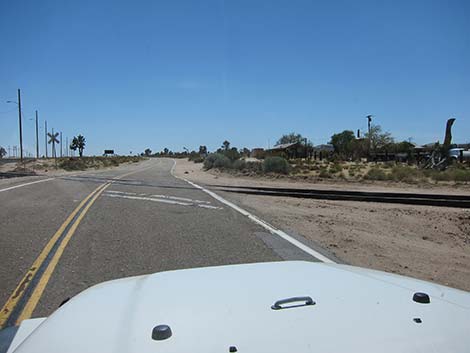 Crossing uncontrolled railroad tracks into Cima |
Watch Out Other than the standard warnings about the desert, ... the road is fine for sedans. Use your own good judgment about the road conditions, as the road is subject to washouts. The road is posted at 55 mph, but pay attention to curve-ahead signs, especially on rough sections of the highway. While out in the desert, please respect the land and the other people out there, and try to Leave No Trace of your passage. Also, the area is remote, so be sure to bring the 10 Essentials. |
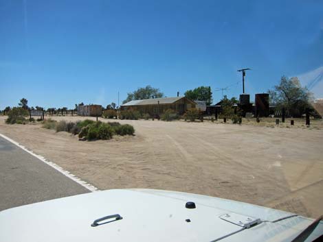 Cima Store (view W) |
Getting to the Road This road is located in Mojave National Preserve, about 2 hours south of Las Vegas. From town, drive south on Interstate-15 to Mojave National Preserve. On the interstate, either exit onto Nipton Road or continue and exit onto Cima Road. If exiting onto Nipton Road, turn right onto Ivanpah Road and then right onto Morningstar Mine Road, which ends in Cima. If exiting onto Cima Road, turn left onto Cima Road and drive south to Cima. |
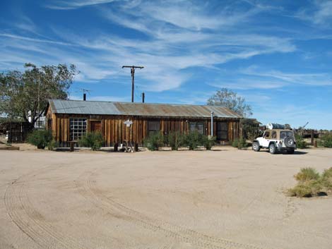 Cima Store (view N) |
The Road From the 3-way intersection of Morningstar Mine Road and Cima Road (Site 0831), Kelso-Cima Road runs southwest across railroad tracks. These tracks are little used, but they are unguarded, so look carefully both ways before proceeding. The road passes Cima, which was founded in the 1900s as a railroad siding, but it grew to serve the area as a commercial center for ranching and mining. Cima is essentially a ghost town now, with the remaining central feature being the Cima Store. The sign on the door suggests the store is open weekends, but don't count on it. Railroad cars often are parked on the tracks in this area, and there are some interesting old buildings, but always keep an eye out for rattlesnakes and open mine shafts. A recent (May 2013) 40-acre wildfire will be interesting to watch as plants grow back in the coming decades. |
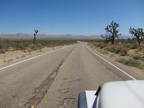
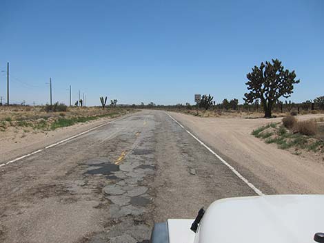 Rough road with lots of patch (view SW) |
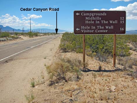
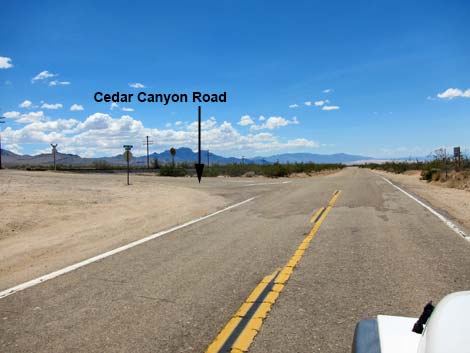
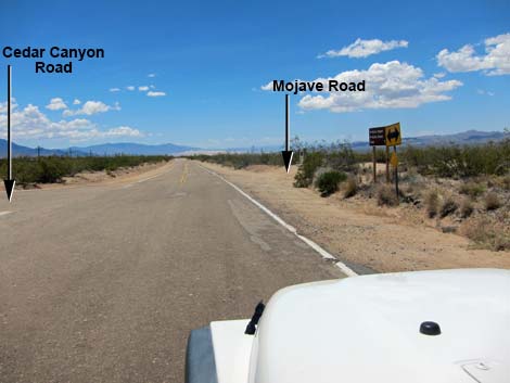
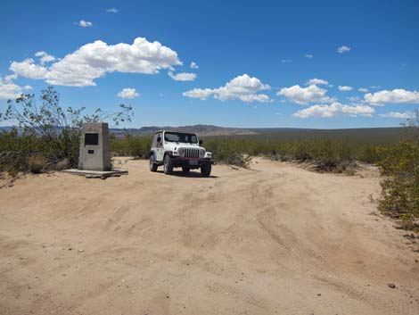
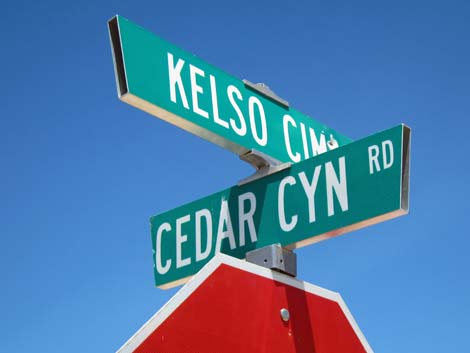
South of Cima, the road winds through a gap in the hills and descends quickly onto the desert flats below. The rough road and sharp curves here will get your attention, especially at night as the road drops out of view and the bumps throw vehicles to the outside of the curve. Fortunately, the road surface improves farther out. At 4.6 miles out, Kelso-Cima Road passes a 4-way intersection. To the left, the paved Cedar Canyon Road runs east towards campgrounds and the Hole-in-the-Wall Visitor Center (pavement ends 2.3 miles out). To the right, a monument marks the historic Mojave Road. This was the original road used by travelers, traders, and the army during early days of western expansion and white settlement of the wild west. Continuing, the road runs south-southwest heading down gently sloping desert flats with grand views in all directions. To the left are the rugged Panamint Mountains, and far to the south, the white patch is the Kelso Dune complex. |
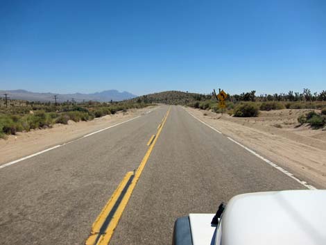 Smooth road (view SW; note curve-ahead sign) |
At 10.3 miles south of Cima, the road passes a side road to the left that runs under the railroad tracks and heads up Macedonia Canyon to the Hole-in-the-Wall area. This short cut requires, at the least, a 2WD-HC vehicle, and I'm not sure I would do it without 4WD because of deep sand high in the canyon. The Kelso-Cima Road continues, angling more to the southwest, as the road surface improves greatly. Eventually the trees and old buildings of Kelso come into view, and at 18.7 miles south of Cima, the road passes the Kelso Depot Visitor Center (Site 1269). This is the main Visitor Center in the Preserve with exhibits, movies, and information about the area. In another 0.1 miles, Kelso-Cima Road ends at a T-intersection with Kelbaker Road (Site 0837). The road right leads to Baker on Interstate 15, and the road south leads to Interstate 40. |
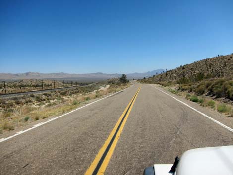 Kelso-Cima Road runs parallel to the railroad (view S) |
 Pay particular attention to this curve-sign |
 Desert flats with pretty good pavement (view SW) |
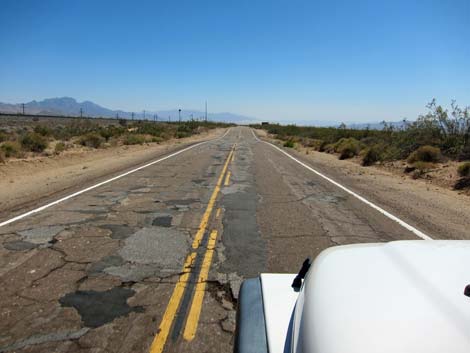 Desert flats with pretty bad pavement (view SW) |
 Distances to recreational points of interest (view SE) |
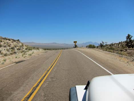
 Approaching Cedar Canyon Road - Mojave Road intersection (view S) |
 Cedar Canyon Road - Mojave Road intersection (view S) |
 Cedar Canyon Road (view E from Kelso-Cima Road) |
 Monument and historic Mojave Road (view W) |
 Kelso-Cima Road - Cedar Canyon Road street sign |
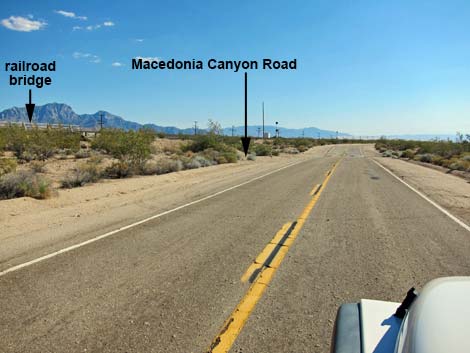 Approaching Macedonia Canyon Road (view SW) |
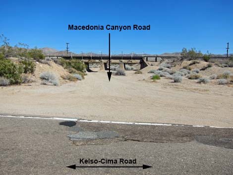 Macedonia Canyon Road (view E from Kelso-Cima Road) |
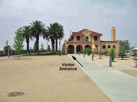 Kelso Depot Visitor Center (view SW) |
 More to come ... |
Table 1. Highway Coordinates Based on GPS Data (NAD27; UTM Zone 11S). Download Highway GPS Waypoints (*.gpx) file.
| Site | Location | UTM Easting | UTM Northing | Latitude (N) | Longitude (W) | Elevation (ft) | Verified |
|---|---|---|---|---|---|---|---|
| 0831 | Kelso Rd at Cima | 636500 | 3900110 | 35.23656 | 115.49990 | 4,176 | Yes |
| 0832 | Cima-Kelso Rd at Cedar Cyn Rd | 635848 | 3893416 | 35.17631 | 115.50817 | 3,727 | Yes |
| 0837 | Kelbaker Rd at Kelso-Cima Rd | 622882 | 3875002 | 35.01197 | 115.65325 | 2,119 | Yes |
| 1269 | Mojave Natl. Preserve, Kelso Visitor Center | 623051 | 3875074 | 35.01260 | 115.65139 | 2,133 | Yes |
| 1476 | Kelso-Cima Rd at Macedonia Canyon Rd | 632168 | 3885015 | 35.10107 | 115.54991 | 3,103 | Yes |
Happy Hiking! All distances, elevations, and other facts are approximate.
![]() ; Last updated 240329
; Last updated 240329
| Backroads | Hiking Around Mojave Preserve | Hiking Around Las Vegas | Glossary | Copyright, Conditions, Disclaimer | Home |