Hiking Around Las Vegas, Lake Mead National Recreation Area
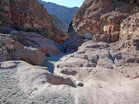
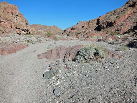
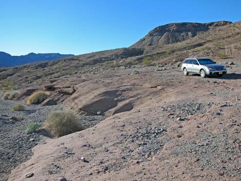 2WD-HC Trailhead above pour-over |
Overview This hike runs about 1.6 miles down Cranes Nest Canyon to the Colorado River at Cranes Nest Rapids, which given the water levels, looks a lot like Lake Mohave. The first mile is a fairly open canyon, but the last 0.6 miles is deep, narrow, and sinuous. Hikers in 4WD vehicles can drive an extra 0.8 miles down the canyon, but those in 2WD-HC vehicles should park early. Camping is permitted on the beach, so this hike provides a short backpack through a scenic canyon to the shore of Lake Mohave. Campsites are set back in the saltcedar trees, which provides privacy, but also blocks the view of the water. Link to map. |
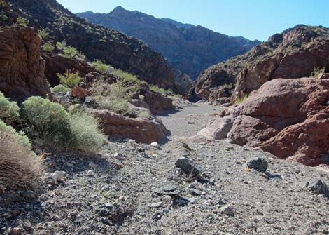
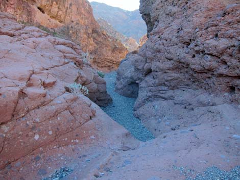
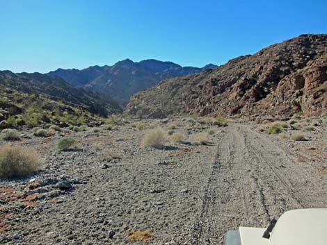 Continuing down the 4WD road (view SW) |
Watch Out Other than the standard warnings about hiking in the desert, ...this hike is pretty safe, as there are no unusual hazards. However, don't camp too close to the water because levels fluctuate depending on how much is being released from the dam. While hiking, please respect the land and the other people out there, and try to Leave No Trace of your passage. This area is remote, so be sure to bring the 10 Essentials. |
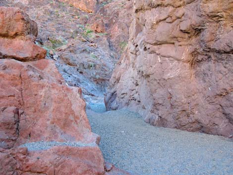
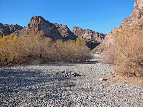
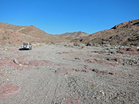
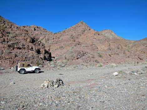 4WD trailhead Cranes Nest Campground (view N) |
Getting to the Trailhead This hike is located in Lake Mead National Recreation Area, about 1-1/4 hours southeast of Las Vegas. From town, drive out towards Hoover Dam, then continue south on Hwy 93 to just past Mile Marker 8 and Cranes Nest Canyon Road. Drive southwest on Cranes Nest Road for about 3.25 miles to a low pour-over. Drivers in 2WD-HC vehicles should park here; this is the 2WD trailhead. In a 4WD, hikers can drive over the pour-over, but the gravel quickly becomes deeper and softer. At about 4.1 miles out, the road ends where rocks naturally block the wash at Cranes Nest Campground. It is possible to drive 0.2 miles past this point, but it appears to be illegal and hardly worth the risk of getting a ticket. Park here; this is the 4WD trailhead. |
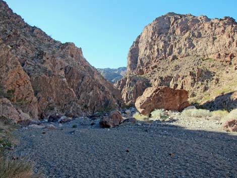
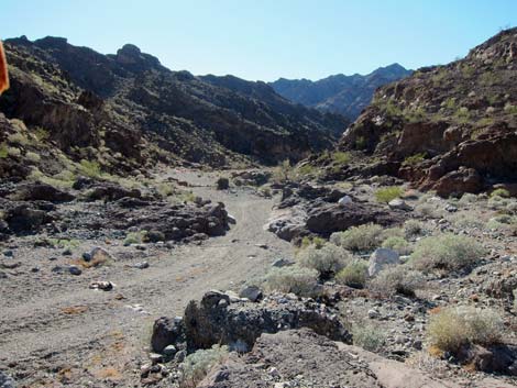 4WD trailhead (view SE down canyon) |
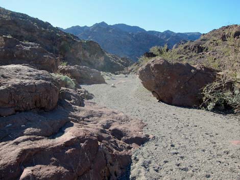
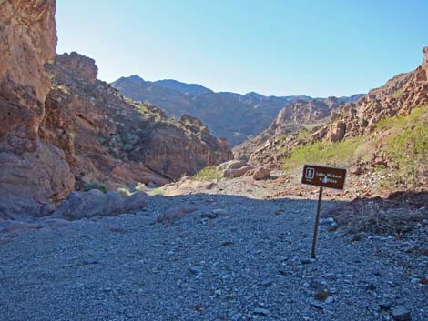
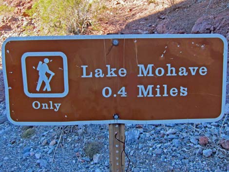
The Hike From the 2WD trailhead (Table 1, Waypoint 01), the route continues down the canyon, which is wide and open to start. Eventually the canyon deepens and begins to narrow, and the legal road ends at Cranes Nest Campground (Wpt. 02). The canyon continues, and in about 0.2 miles (Wpt. 03), a sign announces "Lake Mohave 0.4 miles". Someone in the sign shop was overly optimistic, as the water is still 0.6 miles away. Even so, the walking is easy and interesting, and soon enough hikers arrive at the mouth of the canyon. Wandering through the saltcedar trees and campsites, hikers arrive at the edge of the lake (Wpt. 04). Return to the trailhead by following your footprints in the wash. |
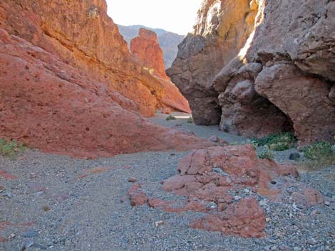
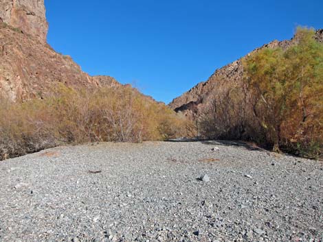
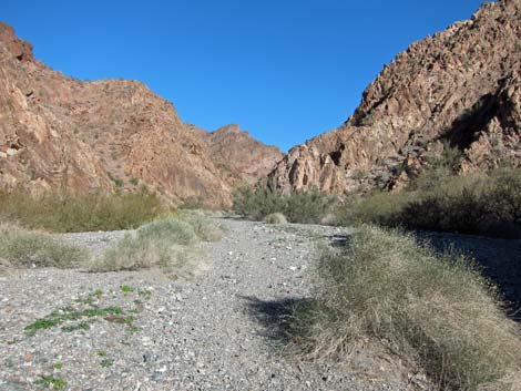
 Cranes Nest Wash (view SW) |
 End of what once was the road (view W) |
 Foot traffic only sign (view SW) |
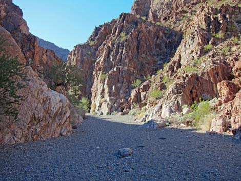
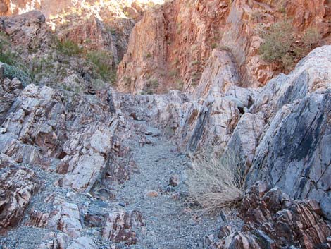
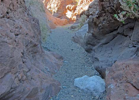 Narrow canyon (view SW) |
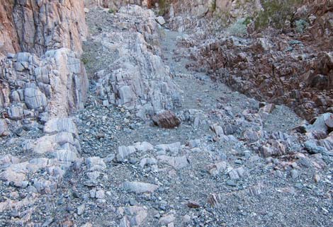
 Sinuous wash (view SW) |
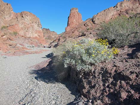
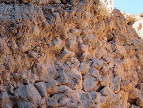 Interesting geology (view SW) |
 |
 |
 |
 |
 |
 |
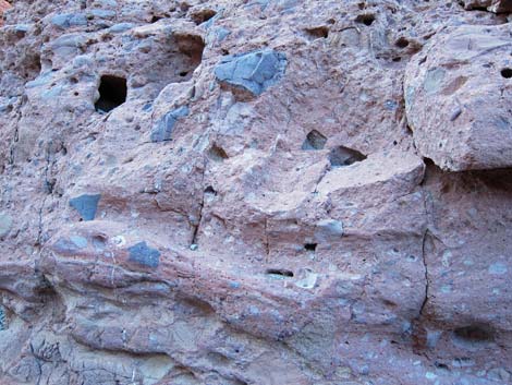
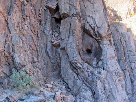 Unusual metamorphic rock formation |
 High canyon walls |
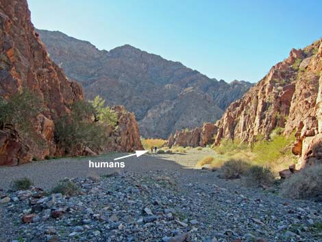 Humans at the mouth of the canyon |
 Campsites among saltcedar trees |
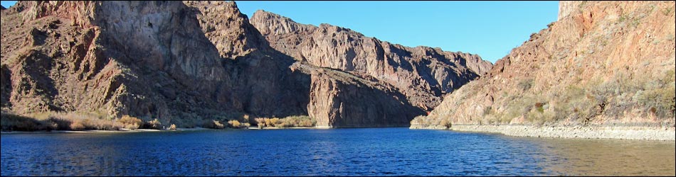
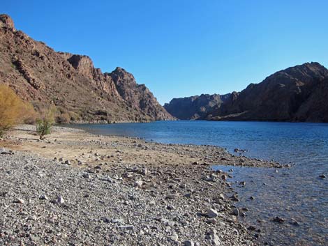 Lake Mohave (view S; downstream) |
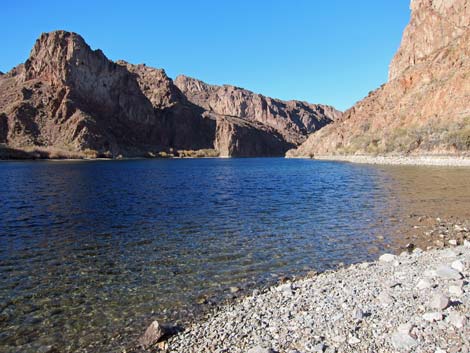 Lake Mohave (view S; upstream) |
 Departing the beach |
 Starting up the canyon |
 Returning: Interesting metamorphic rock |
 Returning: Interesting metamorphic rock |
 Returning: Interesting volcanic rock |
 Returning: Blooming brittlebush along the wash |
 Returning: canyon begins to open |
 Returning: arriving at 4WD trailhead (view E) |
Table 1. Hiking Coordinates Based on GPS Data (NAD27; UTM Zone 11S). Download Hiking GPS Waypoints (*.gpx) file.
| Wpt. | Location | UTM Easting | UTM Northing | Elevation (ft) | Point-to-Point Distance (mi) |
Cumulative Distance (mi) |
Verified |
|---|---|---|---|---|---|---|---|
| 01 | 2WD Trailhead | 708915 | 3977309 | 1,152 | 0.00 | 0.00 | GPS |
| 02 | 4WD Trailhead | 707958 | 3976748 | 913 | 0.80 | 0.80 | GPS |
| 03 | Foot Trail Only Sign | 707801 | 3976543 | 850 | 0.18 | 0.98 | GPS |
| 04 | Cranes Nest Beach | 707016 | 3976232 | 631 | 0.62 | 1.60 | GPS |
| 01 | 2WD Trailhead | 708915 | 3977309 | 1,152 | 1.60 | 3.20 | GPS |
Happy Hiking! All distances, elevations, and other facts are approximate.
![]() ; Last updated 240326
; Last updated 240326
| Hiking Around Lake Mead | Hiking Around Las Vegas | Glossary | Copyright, Conditions, Disclaimer | Home |