Backroads Around Las Vegas, Lake Mead National Recreation Area
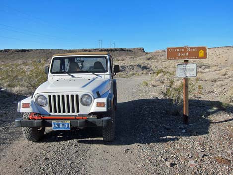
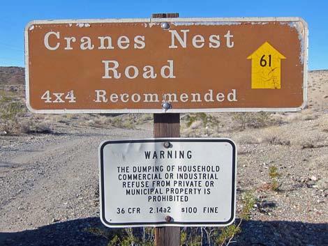 Sign: Cranes Nest Road (NPS Road 61) |
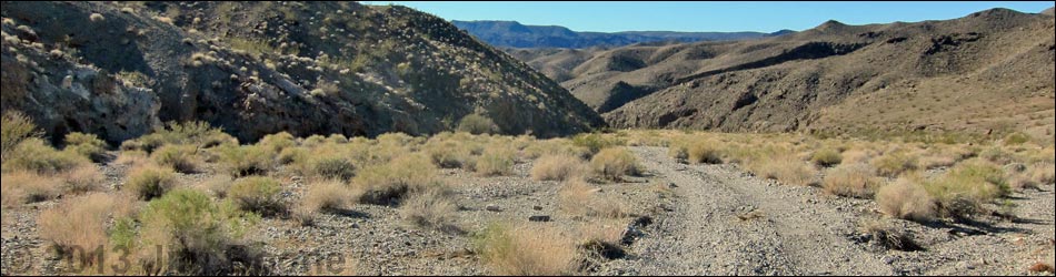
Overview Cranes Nest Road (NPS Road 61) is a backcountry road off Highway 93 south of Hoover Dam in Arizona. The road follows the bed of Cranes Nest Wash through the wild backcountry of Lake Mead National Recreation Area down towards the Colorado River (no vehicle access to the river). The road dead-ends about 4 miles out where boulders restrict travel in the wash, but drivers in 2WD-HC vehicles should stop before a drop-off 3.25 miles out. This road provides hiker access to Cranes Nest Canyon and the edge of the Colorado River at Cranes Nest Rapids, and it provides 4WD vehicle access to Cranes Nest Campground. Link to map. |
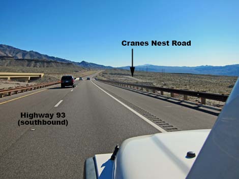 Hwy 93 approaching Cranes Nest Road (view S) |
Watch Out Other than the standard warnings about hiking in the desert, ...this is a bumpy but easy drive for the first 3.25 miles. Beyond there, the gravel becomes deeper and looser, and although my jeep handled it in 2WD (in and out), drivers would be foolish to do so without 4WD. Check with NPS rangers on road conditions before driving into the backcountry. Maps of approved backcountry roads are available online and at the Alan Bible Visitor Center. While out, please respect the land and the other people out there, and try to Leave No Trace of your passage. Also, even though this road is short, be sure to bring what you need of the 10 Essentials. Be aware of the weather report and stay out of this area if rain is expected; you don’t want to get caught in a flash flood. |
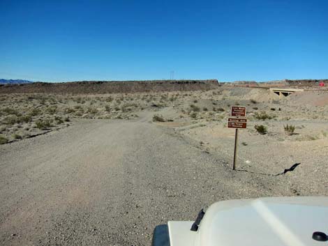
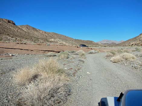
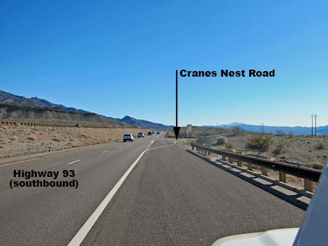 Cranes Nest Road turnoff (view S) |
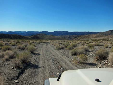
Getting to the Roadhead This road is located in Lake Mead National Recreation Area, about 45 minutes southeast of Las Vegas. From town, drive out to Hoover Dam, then continue south on Hwy 93 for 7.4 miles (just past Mile Marker 8). Watch for a paved turnoff marked by a "right turn only" symbol sign. A designated right-turn lane is marked with white paint on the pavement. After the turnoff, watch for a brown backcountry road sign giving the name of the road and a numbered yellow arrow. Approved roads are signed with yellow arrows and a number, which is the road number. Driving on roads or trails not marked with the yellow arrow is prohibited. Driving off roads, in washes, or cross country damages the fragile desert soil and is prohibited by National Park Service regulations. |
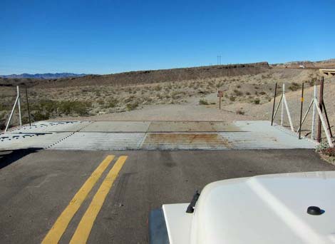 Edge of the pavement at cattle guard (view N) |
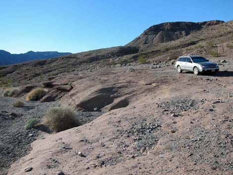
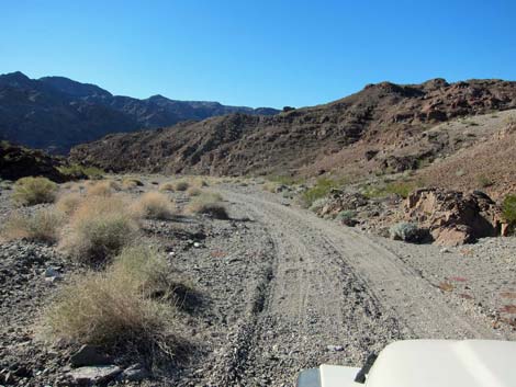
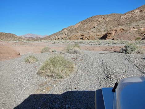
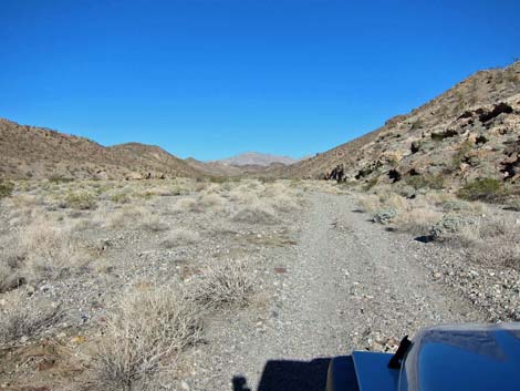
The Road From the turnoff (Table 1, Site 1392), the paved road curves back to the north, crosses a cattle guard, and goes onto graded gravel. In only a few yards, signs indicate the Lake Mead National Recreation Area boundary and that this is a hunting area, so target practice is illegal here. In about 150 yards, the road passes the "Cranes Nest Road (Road 61)" sign. Beyond the sign, the road turns left and drops into Cranes Nest Wash. Initially the road runs across broad, open country, but soon it passes a cliff capped by a basalt (volcanic lava) flow where the lava cooled forming columnar patterns similar to those at Devil's Postpile in California. |
 Signs: Lake Mead boundary; no target shooting |
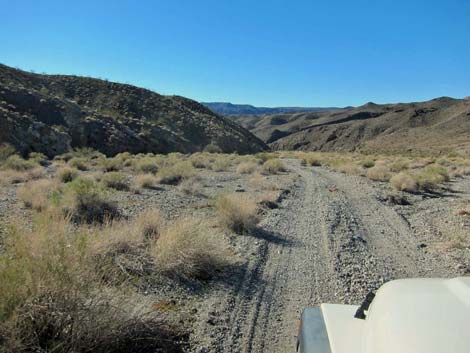
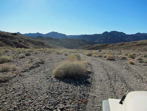
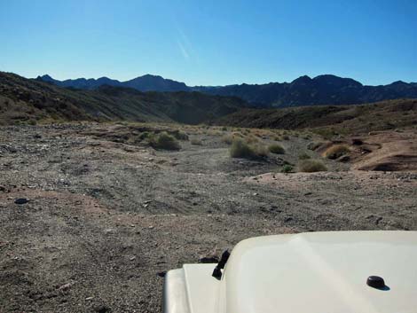
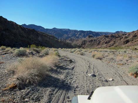
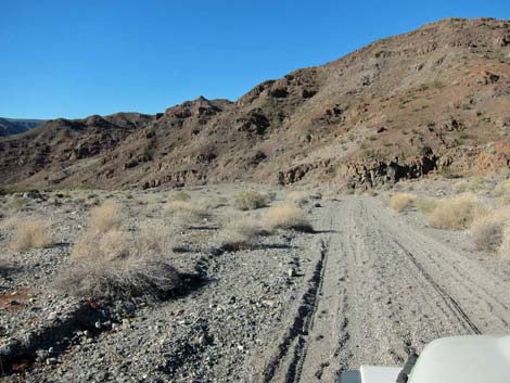
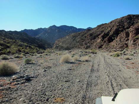
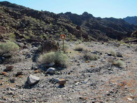
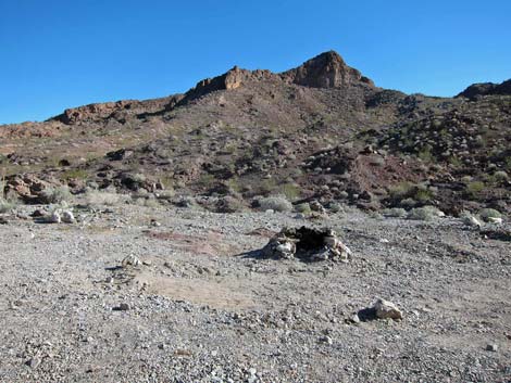
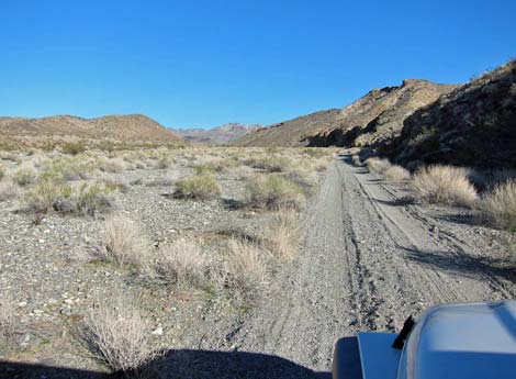
Beyond the "postpile" cliffs, the road continues downhill, eventually running down a wide canyon. At about 3.25 miles out, the road runs across several sills that act like speed bumps and arrives at a low and smooth pour-over (Site 1405). Drivers in 2WD-HC vehicles should park here. Driving over the low pour-over, the gravel in the bed of the wash quickly becomes deeper and softer. Eventually the canyon narrows a bit, and the walls get higher, and at about 4.1 miles out, the road ends where rocks naturally block the wash. This is Cranes Nest Campground (Site 1406), which is marked with a single symbol sign and campfire rings. It is possible to drive 0.2 miles past this point, but it appears to be illegal and hardly worth the risk of getting a ticket. Hikers can walk another 0.8 miles to the river. |
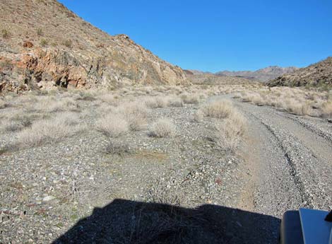
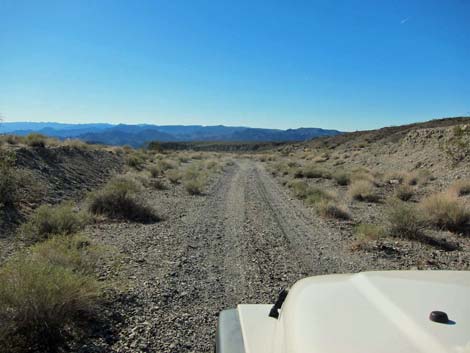 Cranes Nest Road (view SW) |
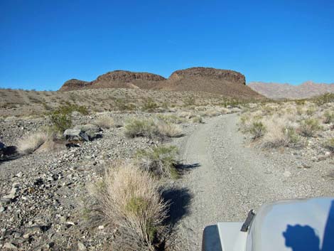
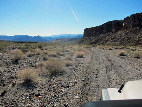 Cranes Nest Road approaching "devils postpile" (view SW) |
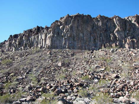 "Devils postpile" (view N) |
 Cranes Nest Road (view SW) |
 |
 |
 2WD parking atop pour-over |
 Cranes Nest Road approaching pour-over (view SW) |
 Deeper gravel below pour-over (view SW) |
 Canyon begins to narrow |
 |
 |
 Cranes Nest Campground sign (notice sign; view SW) |
 Cranes Nest Campground (view S) |
 Returning up the road, approaching the pour-over (view NE) |
 Returning up the road, approaching the pour-over (view NE) |
 Returning up the road (view NE) |
 Returning up the road (view NE) |
 Returning up the road (view NE) |
 Returning up the road (view NE) |
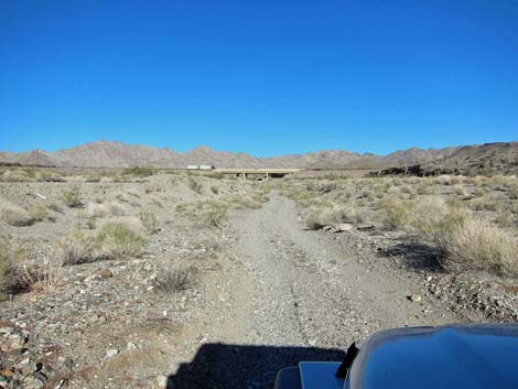 Returning up the road, highway bridge in background (view NE) |
 Returning up the road; road sign (view N) |
Table 1. Highway Coordinates Based on GPS Data (NAD27; UTM Zone 11S). Download Highway GPS Waypoints (*.gpx) file.
| Site | Location | UTM Easting | UTM Northing | Latitude (N) | Longitude (W) | Elevation (ft) | Verified |
|---|---|---|---|---|---|---|---|
| 1392 | Hwy 93 at Cranes Nest Rapid Rd | 712519 | 3980223 | 35.94508 | 114.64392 | 2,174 | GPS |
| 1405 | Cranes Nest 2WD Parking | 708916 | 3977316 | 35.91967 | 114.68459 | 1,152 | GPS |
| 1406 | Cranes Nest Campground | 707978 | 3976773 | 35.91498 | 114.69513 | 912 | GPS |
Happy Hiking! All distances, elevations, and other facts are approximate.
![]() ; Last updated 240326
; Last updated 240326
| Backroads Around Lake Mead | Hiking Around Las Vegas | Glossary | Copyright, Conditions, Disclaimer | Home |