Hiking Around Las Vegas, Gold Butte National Monument
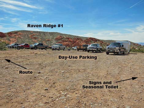 Whitney Pocket day-use parking (view SW) Whitney Pocket day-use parking (view SW) |
Overview Raven Ridge is a complex of low, alluvial ridges that run west from Whitney Pocket nearly to Black Butte. The ridge is fairly easy to climb onto, and from the top hikers are exposed to surprisingly grand views out across Gold Butte and far into the surrounding region. Raven Ridge #1 is the east-most of the ridges that make up the Raven Ridge complex. Raven Ridge #1 Route is a 2.60 mile in-and-out hike that runs out to two grand overlooks, the second of which sits right above the heart of Amber Cat Canyon. From the second overlook, hikers can wander where they will, but descending into Amber Cat Canyon and returning over the Doodlebug Arch Loop route makes a nice loop. This is a convenient hike because it is near Whitney Pocket (a popular camping and picnic area) and because it is accessible in 2WD vehicles. Link to map. |
 Route starts in the day-use parking lot (view S) |
Watch Out Other than the standard warnings about hiking in the desert, ... this is a relatively safe hike for those who stay on the ridgetop and don't stray too far out onto the edge at the overlooks. This is, however, a wild and remote area without services of any kind (no restrooms, no water, no gas, no food). Bring what you need to survive. Be prepared and be self-reliant. Nobody will find you if you get lost in this area. Some cell phones work at points along the ridgeline. While visiting the area, please respect the land and the other people out there, and try to Leave No Trace of your passage. Also, this is a fairly remote area, so be sure to bring what you need of the 10 Essentials. |
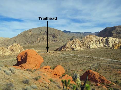
 Trailhead: old road exits the day-use parking lot (view S) |
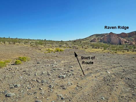
Getting to the Trailhead Raven Ridge is located at Whitney Pocket out in Gold Butte National Monument at the northeast end of Lake Mead, about 2 hours northeast of Las Vegas in a wild, remote, and scenic area. From town, drive out to Gold Butte National Monument. Drive east on Interstate-15 to Highway 170. Take Exit 112 south towards Riverside and Bunkerville. Drive south across the Virgin River, then quickly turn right onto the paved Gold Butte Road. Follow the pavement (there are no paved side roads) for 21 miles until the pavement ends at Whitney Pocket. Continue south on the unpaved Gold Butte Road for about 120 yards to a graded spur road to the right. Turn right onto the Whitney Pocket Day-Use Parking Lot, drivers will see information signs on the right; the trail starts on the opposite end of the parking area. Park here; this is the trailhead. |
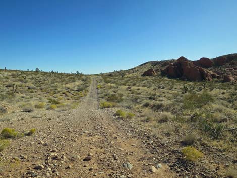 Route follows the old road towards the skyline ridge (view S) |
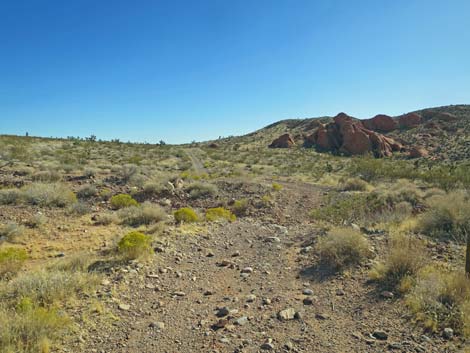
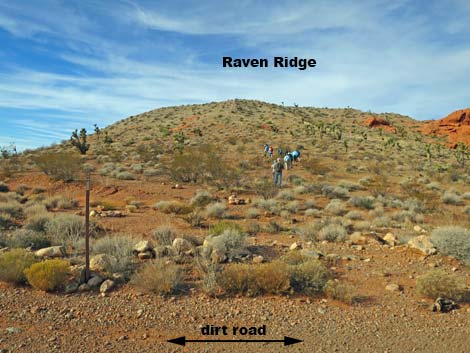
The Hike From the Trailhead (Table 1, Waypoint 01), the route heads south on a little used dirt road that runs parallel to Gold Butte Road. The dirt road dips through two washed and climbs towards the apparent skyline, which is off the toe of Raven Ridge. Approaching the apparent skyline (Wpt. 02), the route turns right and heads west and straight up the toe of Raven Ridge. This is the steepest part of the hike, but it is only about 0.1 miles to the top of the ridge (Wpt. 03). At this point, the top of the ridge is small and fairly narrow, so when hikers stop for a few minutes to catch their breath, they are treated to grand views back towards the trailhead (seems a long way down!) and the rest of the Whitney Pocket area. Views in the other directions are pretty good too. |
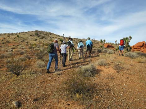
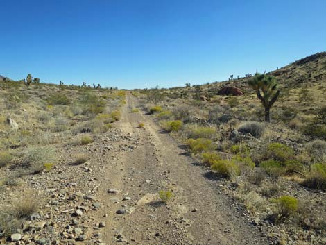 Route follows the old road to the skyline ridge (view S) |
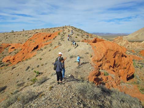
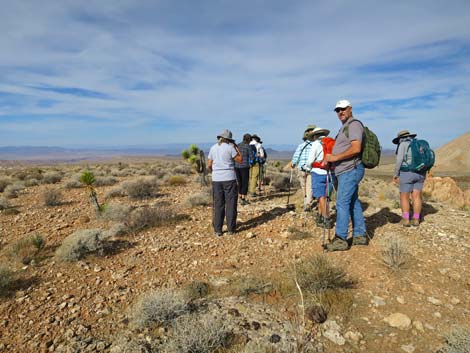
From the top of the ridge (Wpt. 03), the route runs northwest along the narrow crest of the ridge. The route dips into a saddle where the ridge is narrow enough that hikers must watch their step carefully. Beyond the saddle, the route climbs towards the highpoint (Wpt. 04) of the hike. After crossing the saddle, hikers will find the grand view welcome because they provide another reason to stop and rest for a few minutes. From the highpoint (Wpt. 04), the route continues west following the top of the broad, flat ridgetop, and hikers will find the walking open and easy. The route stays atop the broad ridge heading generally west, staying more-or-less along the north edge of the ridge overlooking sandstone crags and the broad desert valley to the north. At about 0.8 miles out, the ridge bends a bit to the left, such that the route begins to run towards the southwest. |
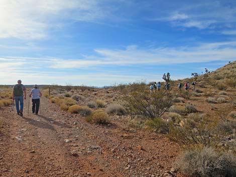 Hikers departing dirt road (view S) |
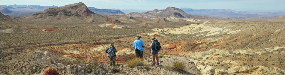
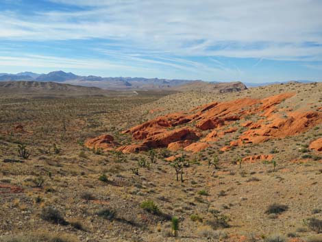
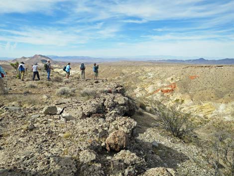
Staying atop the broad ridge, now running southwest, the route stays to the right as it runs out onto a finger of ridgeline that gets narrower and narrower. Hikers are soon stopped by cliffs, but from atop the cliffs (Upper Amber Cat Canyon Overlook; Wpt. 05), grand views open below into upper Amber Cat Canyon. After enjoying the view, the route backtracks up the finger about 20 yards to where it is relatively easy to turn southeast and hike 100 yards (across the nearest gully) to the next ridgeline to the south. Turning southwest onto that ridgetop, the route again stays right atop steep cliffs and runs out to Amber Cat Canyon Overlook (Wpt. 06), with stunning views down into Amber Cat Canyon. From Amber Cat Canyon Overlook (Wpt. 06), this route ends. Hikers can return over the same route to the trailhead, or consider backtracking and then dropping into the canyon to the south. Following that canyon leads hikers into the bottom of Amber Cat Canyon, and then Amber Cat Canyon can be followed back to the trailhead, making a nice loop. |
 Hikers starting up toe of Raven Ridge (view W) |
 Hikers heading up toe of Raven Ridge (view W) |
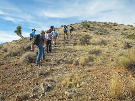 Steep approach to the top of the ridge (view W) |
 Hikers arriving at the top of the ridge (view W) |
 Hikers on the narrow crest of the ridge (view W) |
 Grand views back towards the trailhead (view N) |
 Hikers traversing the narrow crest of the ridge (view W) |
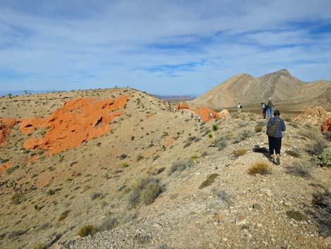
 Grand views across the length of Gold Butte (view S) |
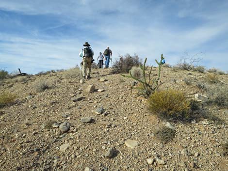
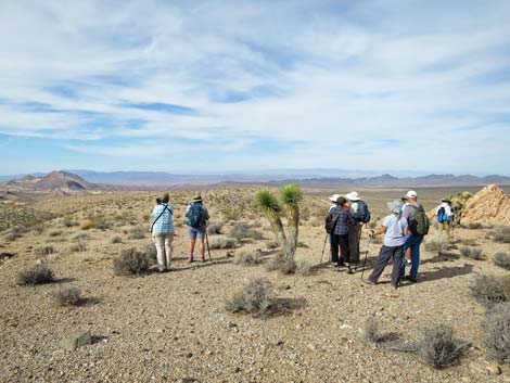
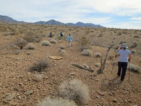
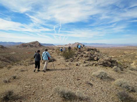
 Hikers on the broad crest of Raven Ridge (view W) |
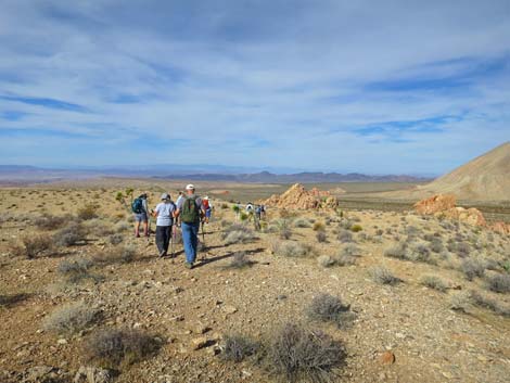 Hikers on the broad crest of Raven Ridge (view W) |
 Another grand view back towards Whitney Pocket (view N) |
 Hikers on the broad crest of Raven Ridge (view W) |
 Hikers on the broad crest of Raven Ridge (view W) |
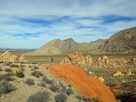 Hiker on an outcrop of red sandstone (view NW) |
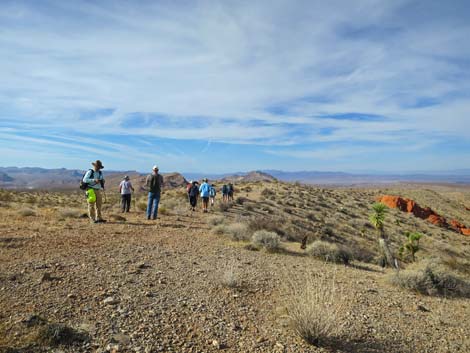
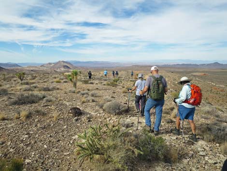
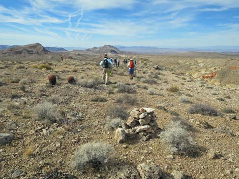
 Hikers resting on the broad crest of Raven Ridge (view W) |
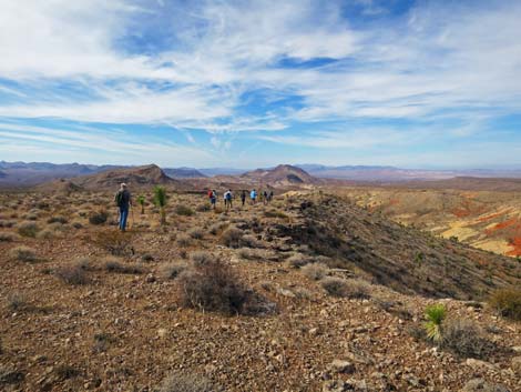
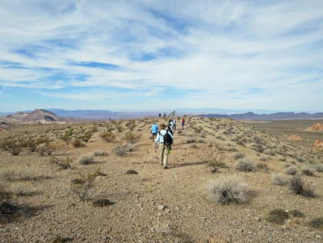 Hikers continuing out the broad crest of Raven Ridge (view W) |
 Hikers continuing along the broad crest of Raven Ridge (view W) |
 Hikers along the edge of Raven Ridge (view W) |
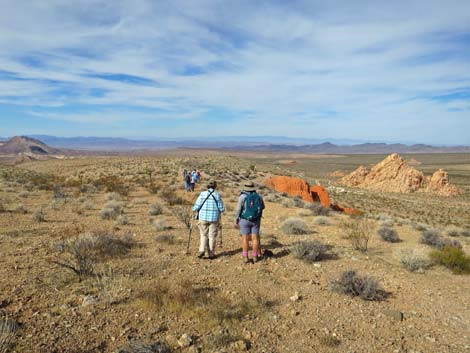
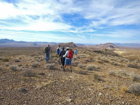
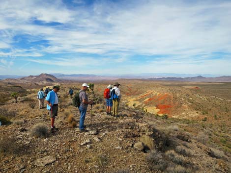 Hikers approaching Amber Cat Canyon Overlook #1 (view W) |
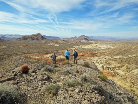
 Hikers at Amber Cat Canyon Overlook #1 (view W) |
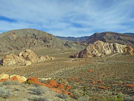
 Amber Cat Canyon Overlook #1 (view W) |
 Hikers cutting back to main finger of Raven Ridge (view SE) |
 Hikers on main finger of Raven Ridge (view W) |
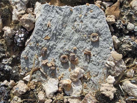 Crinoid fossils in limestone rock |
 Hikers on main finger of Raven Ridge (view W) |
 Historical mining claim marker -- what did they find here? (view W) |
 Hikers on main finger of Raven Ridge (view W) |
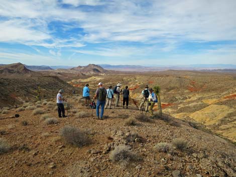
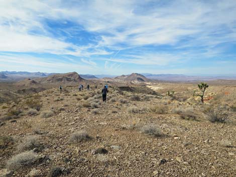
 Hikers approaching Amber Cat Canyon Overlook #2 (view W) |
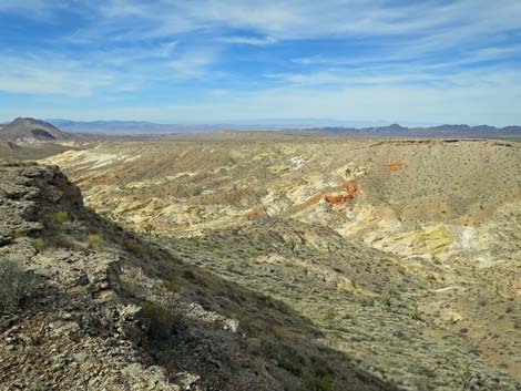 Amber Cat Canyon Overlook #2 (view W) |
 Amber Cat Canyon Overlook #2 (view W) |
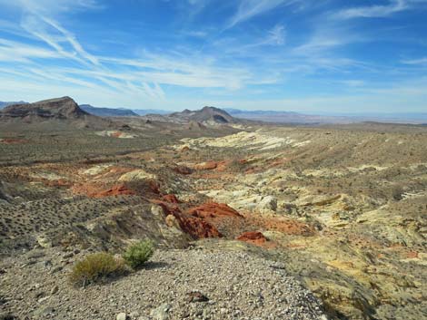 Amber Cat Canyon Overlook #2 (view W) |
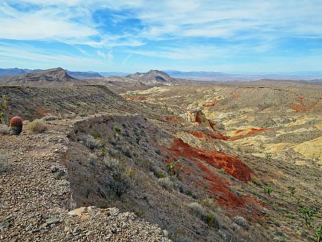
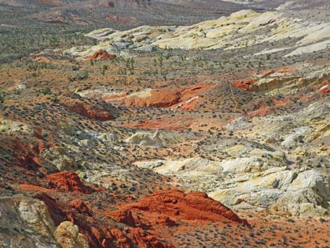 Amber Cat Canyon (view W) |
Table 1. Hiking Coordinates and Distances based on GPS Data (NAD27; UTM Zone 11S). Download Hiking GPS Waypoints (gpx) file.
| Wpt. | Location | UTM Easting | UTM Northing | Elevation (ft) | Point-to-Point Distance (mi) | Cumulative Distance (mi) |
|---|---|---|---|---|---|---|
| 01 | Raven Ridge #1 Trailhead | 756138 | 4045523 | 2,996 | 0.00 | 0.00 |
| 02 | Depart Dirt Road | 756270 | 4045236 | 3,012 | 0.20 | 0.20 |
| 03 | Crest of Raven Ridge | 756149 | 4045163 | 3,102 | 0.10 | 0.30 |
| 04 | Open, flat ridgetop | 756025 | 4045227 | 3,112 | 0.09 | 0.39 |
| 05 | Upper Amber Cat Overlook | 755217 | 4045141 | 2,990 | 0.57 | 0.96 |
| 06 | Amber Cat Overlook | 754909 | 4044847 | 2,920 | 0.37 | 1.33 |
| 01 | Raven Ridge #1 Trailhead | 756138 | 4045523 | 2,996 | 1.27 | 2.60 |
Happy Hiking! All distances, elevations, and other facts are approximate.
![]() ; Last updated 240326
; Last updated 240326
| Hiking Around Gold Butte | Hiking Around Las Vegas | Glossary | Copyright, Conditions, Disclaimer | Home |