Ruby Canyon to Quartz Canyon
Hiking Around Las Vegas, Grand Canyon National Park
Overview | Previous Segment | Next Segment
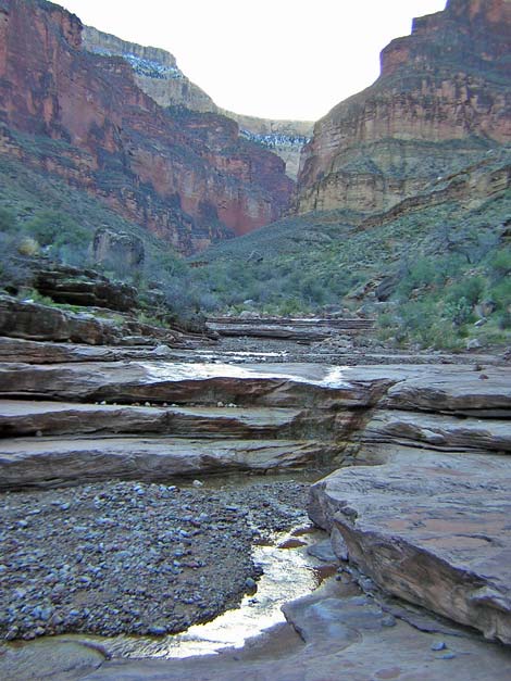 Ruby Creek upstream from the crossing (view SW) |
Overview This description of the Tonto West Trail is divided into two parts: (1) an overview of the entire trail, trailheads, and other general information, and (2) individual canyon-to-canyon segments. From the wash in Ruby Canyon, it is about 1.8 miles and 1 hour to the wash in Quartz Canyon. Seasonal water is available in Ruby Wash. This short segment runs northeast out of Ruby Canyon, around a point on a ridge below Havasupai Point, and back northwest into Quarts Canyon. The trail is always faint, but it is fairly easy to follow. This segment of trail is in Backcountry Use Zone BP9 (at-large camping). Link to map of this segment. Watch Out Other than the standard warnings about hiking in the desert, ...be sure to read the Watch Out section on the Tonto West Overview page, which discusses things such as cell phones and signal mirrors. While hiking, please respect the land and the other people out there, and please try to Leave No Trace of your passage. |
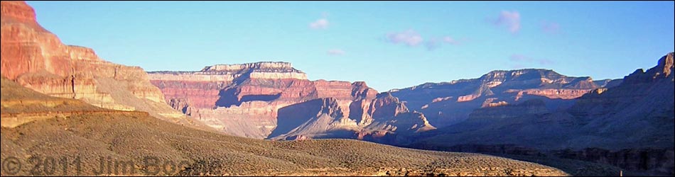
 Ruby Canyon (view SW) |
Getting to the Trailhead Trailhead information is presented on the Tonto West Overview page. The Hike 17. Ruby Canyon to Quartz Canyon -- 1.8 miles and 1 hour The trail exits Ruby Wash just downstream from the enormous boulder in the wash (Table 17, Waypoint 096). The route starts by scrambling 20-30 vertical feet up through a break in the cliffs to the top of the Tapeats cliffs; watch for cairns. The trail then turns north, quickly runs southwest around a deep, narrow side canyon, and continues out on the contour along the edge of the Ruby Canyon gorge. |
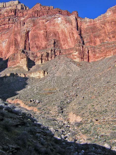
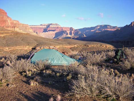 Ridge between Ruby and Quartz canyons (view NE) |
The trail runs across a steep hillside to pass a side ridge, then turns into the third major side canyon. In the back of the side canyon, the trail continues up the gully and onto the hillside above; it does not follow the contour (Wpt. 097). From there, the very faint trail runs pretty steeply up the gully and hillside to a low saddle on a side ridge with a marginal campsite. This bit of trail runs to the east of the trail marked on USGS topo maps. From the low saddle, the grade eases as the trail runs across the hillside towards the main ridgeline. The trail approaches the ridgeline, but runs out towards the river staying just on the southeast side of the ridgeline until the trail turns abruptly turns and crosses the ridge (Wpt. 098) at a campsite. |
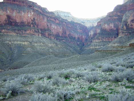
 Quartz Canyon (view NW) |
From the ridge crossing (Wpt. 098), trail does not follow the trail marked on USGS topo maps; rather it drops at a moderate grade straight down the hillside towards cliffs at the edge of Quartz Canyon for about 6 minutes, then turns into the canyon on the original trail. The trail runs across flats, then cuts around gullies and rocky spots, and follows below a line of short cliffs (not on top), the top of which are at eye level. After the trail rounds the last gully, it drops steeply through the cliffs on a narrow, precipitous trail. The trail then runs down and across a rocky hillside and into Quartz Wash. The trail continues up the wash for a short distance (staying on the same line that it came in on) to the actual crossing point (Wpt. 099). There are no campsites or water here. |
Table 17. Hiking Coordinates Based on GPS Data (NAD27; UTM Zone 12). Download Entire Route Waypoint (gpx) file.
| Wpt. | Location | Time | Easting | Northing | Elevation (ft) | Verified |
|---|---|---|---|---|---|---|
| 096 | Ruby Wash (67) | 1500 | 380066 | 4004203 | 3,087 | GPS |
| 097 | Moderate run up the hillside (68) | 1524 | 380652 | 4004816 | 3,203 | GPS |
| 098 | Crossing ridge (69) | 1535-0810 | 380774 | 4005195 | 3,396 | GPS |
| 099 | Quartz Wash (70) | 0835 | 380178 | 4005396 | 3,252 | GPS |
Happy Hiking! All distances, elevations, and other facts are approximate.
![]() ; Last updated 240326
; Last updated 240326
| Hiking Around Grand Canyon | Hiking Around Las Vegas | Glossary | Copyright, Conditions, Disclaimer | Home |