 |
| Home | Wilderness | Hiking | Backroads | Desert NWR | Gass Road |
Gass Peak Road Map - Overview
Hiking Around Las Vegas,
Desert National Wildlife Refuge
Overview | Western Section | Southeast Section |
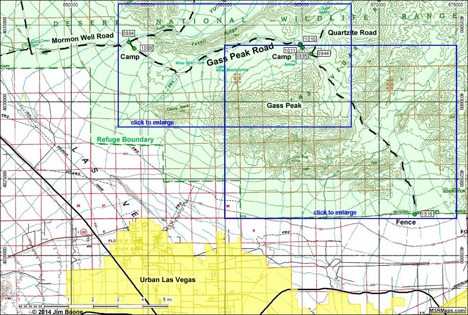 |
| Note: Roads are black (solid = paved; dashed = unpaved). Trails and routes are red (solid = main; dashed = adjacent or alternate). Map based on USGS 15-minute topo map, which may have red grid lines and various numbers. North is at the top. Grid is UTM NAD27 CONUS. National Wildlife Refuge Area (boundaries dashed green, fill light green) based on USFWS data. Urban areas (yellow) based on Google Earth (2/2014). BLM areas (white) based on BLM data. Download waypoint coordinates from route description page. |
Happy Hiking! All distances, elevations, and other facts are approximate.
 ; Last updated 140224 ; Last updated 140224 |
|