Southern Nevada Wilderness Areas
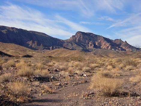 |
Area Description Link to Wilderness Area Map Access The wilderness area can be accessed from dirt roads that run along the northern and southern borders, from a dirt road that runs up to the western border, from the paved road near Nelson, and from the river. On the north side, the Burro Wash Road runs along a powerline corridor, and (assuming dry roads) driving to the crest of the mountains only requires a high-clearance, 2-WD vehicle. To get to Burro Wash from Boulder City, turn south at the intersection of Highway 93 and Buchanan Blvd. Buchanan intersects Highway 93 at the stoplight where Highway 93 jogs north in downtown Boulder City (driving east, if you turn left at the stoplight, you will go to Hoover Dam; but if you turn right, you will be on Buchanan). |
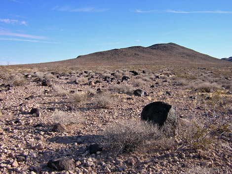 |
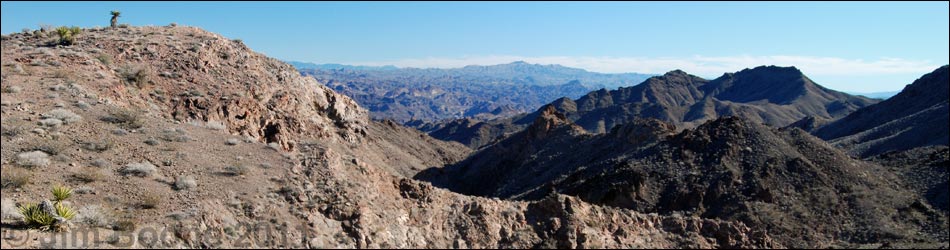
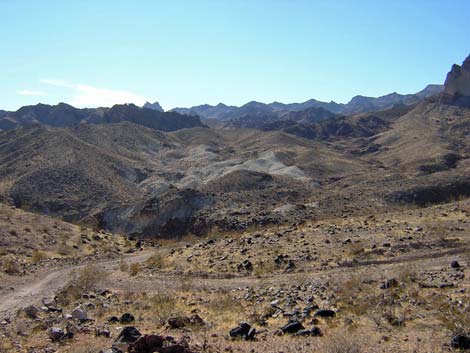
From Highway 93, drive south on Buchanan for 2.9 miles to a paved road (no street name) just before a large power substation. Turn east (left) on the paved road and drive for 0.5 miles to the north entrance gate of the power substation. At the gate, continue east on the dirt road that runs parallel to the chain-link fence. Beyond the substation fence, curve southeast on a wide, graded dirt road that follows a line of high-tension powerlines running out towards a saddle on the mountains to the southeast. The road passes under other high-tension powerlines. Drive 1.8 miles across the flats to the edge of the hills, which is also the edge of Lake Mead National Recreation Area (marked with fencing and signs). Continue southeast for another 4.3 miles on a graded, but rocky road to an overlook at the head of Burro Wash. At this point, which is the end of the easy 2-WD road, there is a parking area and a great view east into Arizona. At this point, you first connect with the boundary of the wilderness area. |
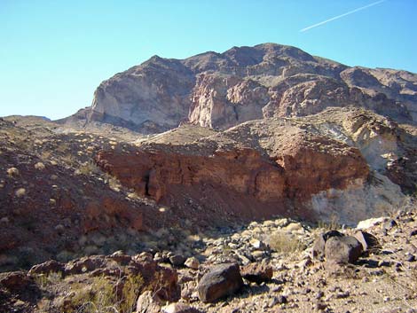 |
From the overlook, you can drive to the river in a 2-WD vehicle, but it would be hard, if not impossible, to get back out; and the worst spot is near the end of the road. From the overlook, the road runs steeply down rocky switchbacks to the bottom of the canyon (Burro Wash). At a fork in the bottom of the canyon, stay left and stay in the bottom of the wash. The road continues down the wash as a fairly good gravel road, but there are a few large rocks and some deep, loose gravel. From the overlook, it is 4.8 miles to the end of the road in the canyon (blocked by water-polished narrows). |
 |
Just before the narrows, the main road cuts up and out of the canyon on the south side of the wash. The road runs up to a saddle and forks. The main road stays right and runs steeply down the other side of the saddle into a ravine. There is a rough section down this road that requires 4WD to get back up on the way out. If you drive down to look at the rough spot, it will be hard to back out if you decide not to do it. From the wash before crossing the saddle, it is about 1.5 miles to the river, so it is about 1 mile to the river from the saddle. The last bit of road runs down a narrow, rocky canyon, and a spring in a side canyon puts water on a short section of road. |
Note: All distances, elevations, and other facts are approximate.
![]() ; Last updated 230909
; Last updated 230909
| El Dorado Wilderness Area | Southern Nevada Wilderness Areas | Hiking Around Las Vegas | Copyright, Conditions, Disclaimer | Home |