Backroads Around Las Vegas
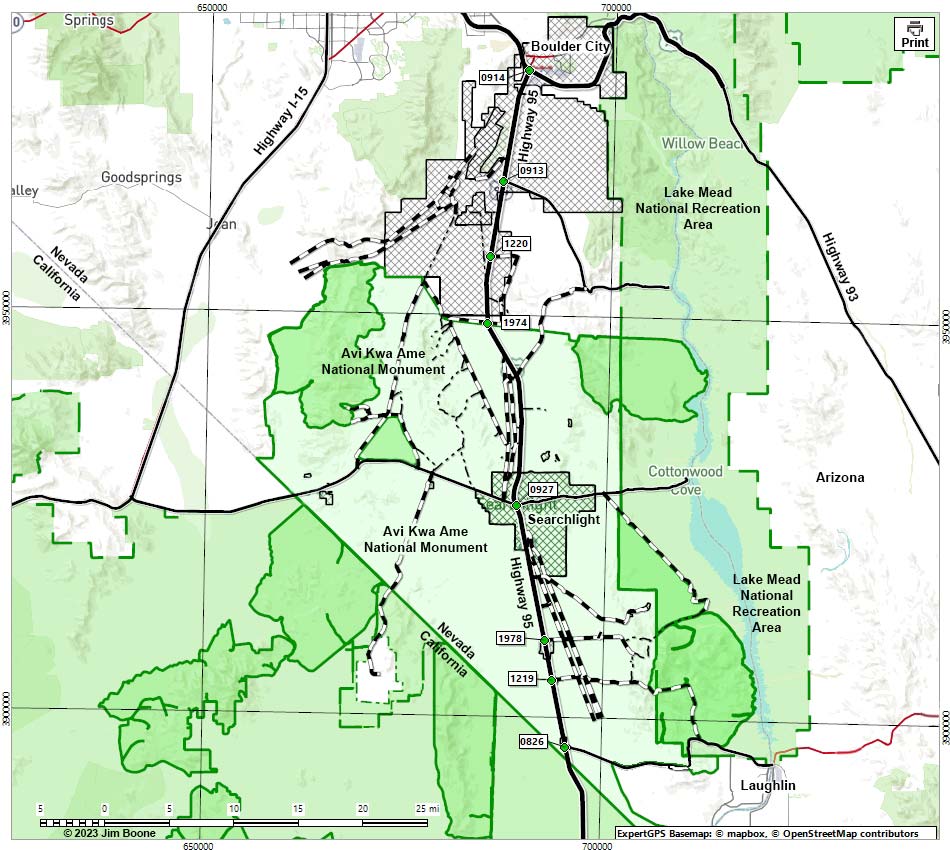
Note: Map based on OpenStreetMap. North is at the top. Grid is UTM NAD27 CONUS. Roads are black (solid = paved; dashed = unpaved; width implies quality). Trails and routes are red (solid = main; dashed = adjacent or alternate). Washes, streams, and lakes are blue (solid = permanent; dashed = intermittent). National Monument Areas (boundaries solid green, fill light green) based on BLM data. Wilderness Areas (boundaries solid green, fill dark green) based on BLM data. National Park areas (boundaries dashed green, fill light green) based on NPS data. Private lands (boundaries solid gray, fill crosshatch gray) based on NPS data. BLM areas (no color overlay) based on BLM data. Download waypoint coordinates from route description page.
Happy Hiking! All distances, elevations, and other facts are approximate.
![]() ; Last updated 231103
; Last updated 231103
| Highway 95 Southbound | Backroads | Glossary | Copyright, Conditions, Disclaimer | Home |