Southern Nevada Wilderness Areas, Hiking the Wilderness Areas
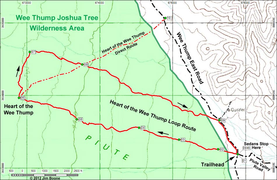
Note: Roads are black (solid = paved; dashed = unpaved). Trails and routes are red (solid = main; dashed = adjacent or alternate). Map based on USGS 7.5-minute topo map. North is at the top. Grid is UTM NAD27 CONUS. Wilderness Area boundaries (solid green) based on BLM data.
Note: Sedans can get to the loop trailhead, but high-clearance vehicles are required for the direct trailhead.
tags: Wee Thump Joshua Tree Wilderness Area
Happy Hiking! All distances, elevations, and other facts are approximate.
![]() ; Last updated 121018
; Last updated 121018
| Heart of the Wee Thump | Hiking Around Wilderness Areas | Glossary | Copyright, Conditions, Disclaimer | Home |