Hiking Around Las Vegas, Mojave National Preserve
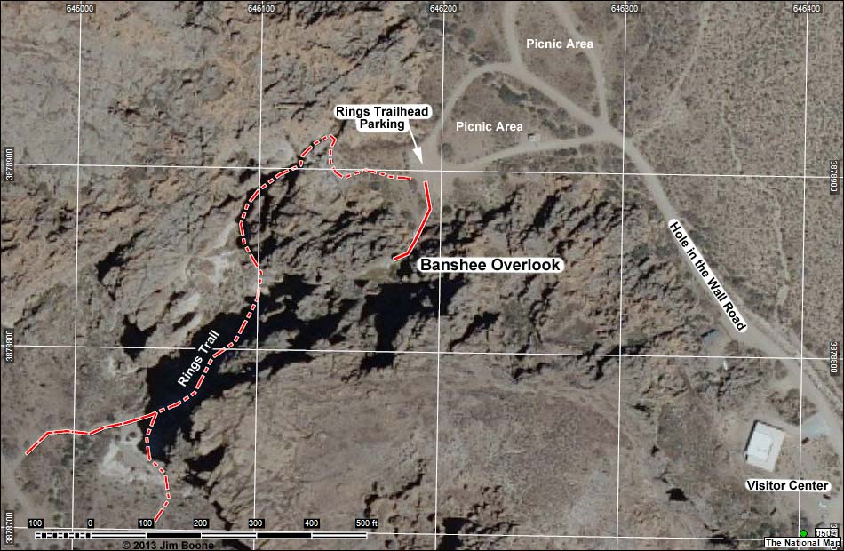
Note: Map based on natural color aerial photo. Trails and routes are red (solid = main; dashed = adjacent or alternate). North is at the top. Grid is UTM NAD27 CONUS.
Happy Hiking! All distances, elevations, and other facts are approximate.
![]() ; Last updated 130311
; Last updated 130311
| Banshee Overlook | Hiking Around Mojave Preserve | Glossary | Copyright, Conditions, Disclaimer | Home |