Backroads Around Las Vegas, Lake Mead National Recreation Area
Overview Map | Mormon Mesa Road Map | Double Negative Road Map
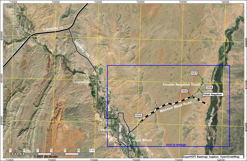
Note: Roads are black (solid = paved; dashed = unpaved). Trails and routes are red (solid = main; dashed = adjacent or alternate). Map based on true-color aerial photograph. North is at the top. Grid is UTM NAD27 CONUS. Download waypoint coordinates from route description page. Click inside blue rectangles to enlarge those sections of the map.
Happy Hiking! All distances, elevations, and other facts are approximate.
![]() ; Last updated 230104
; Last updated 230104
| Double Negative Road | Hiking Around Lake Mead | Glossary | Copyright, Conditions, Disclaimer | Home |