 |
| Home | Wilderness | Backroads | Hiking | Gold Butte | Billy Goat Peak Road |
Billy Goat Peak Road Map
Backroads Around Las Vegas,
Gold Butte National Monument |
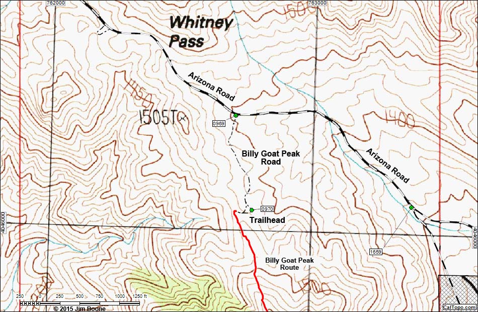 |
| Note: Roads are black (solid = paved; dashed = unpaved; width implies quality). Trails and routes are red (solid = main; dashed = adjacent or alternate). Map based on USGS 7.5-minute topo map, which may have red grid lines and various numbers. North is at the top. Grid is UTM NAD27 CONUS. Private land (crosshatch gray) based on NPS data. BLM areas (no overlay) based on BLM data. Download waypoint coordinates from route description page. |
Happy Hiking! All distances, elevations, and other facts are approximate.
 ; Last updated 151104 ; Last updated 151104 |
|