Hiking Around Las Vegas, Gold Butte National Monument
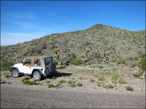 Trailhead parking along Gold Butte Road (view W) |
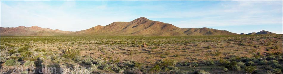
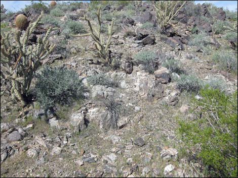
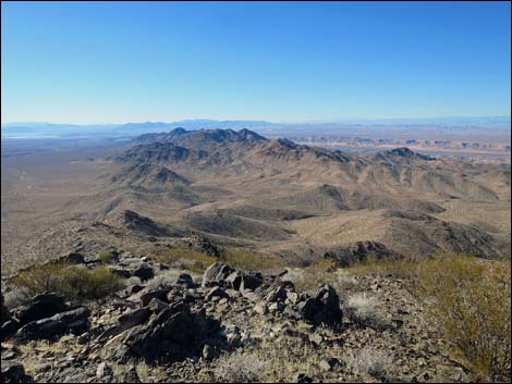
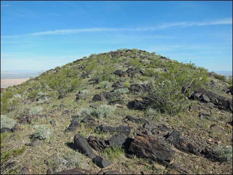
Overview Little Virgin Peak (3,514 ft) is a nice little peak that stands in the morning shadow of "big" Virgin Peak. For residents of Mesquite, this peak makes a nice morning hike, but for others, it is too short for a destination hike. In that case, however, it makes a nice add-on hike for visitors to Gold Butte National Monument. Even though the peak is low, easy, and only 2-miles round-trip, the peak stands high above the surrounding terrain and the 360-degree views from the summit are surprisingly grand. The hike also runs through a rocky cactus garden in the Mojave Desert Scrub, with nice examples of several species of southern Nevada cactus. Link to hiking map. |
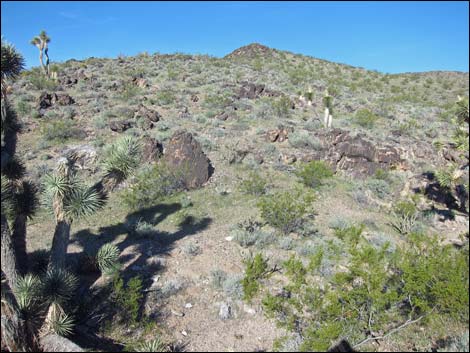 Starting up the ridge between Joshua trees (view W) |
Watch Out Other than the standard warnings about hiking in the desert, ...this is a safe and easy hike, but the area is wild and remote, so be careful because even a twisted ankle could be a serious problem when help is far away. Make no mistake; going out to Gold Butte National Monument is going to wild and remote country. This is not a walk in the park; this is an adventure. Be prepared. Take food and water (lots of it during warm weather), make sure your spare tire is in good shape, and take everything that you might need to survive a night stranded with your vehicle. Law enforcement occasionally patrols the area. Cell phones get out from some places, but don't count on it. While hiking, please respect the land and the other people out there, and try to Leave No Trace of your passage. Also, even though the hike is short, the area is remote, so be sure to bring the 10 Essentials. |
 Much of the ridge has white quartz rock (pegmatite) |
Getting to the Trailhead Little Virgin Peak is located out in Gold Butte National Monument at the northeast end of Lake Mead, about 1.5 hours northeast of Las Vegas in a wild, remote, and scenic area. From Las Vegas, drive out to Gold Butte National Monument and head south on the paved Gold Butte Road. From Highway 170 at Gold Butte Road, drive south for 13.8 miles. As the road crosses the saddle between Big and Little Virgin peaks, watch for a wide spot on the right shoulder of the road adjacent to the toe of Little Virgin Ridge. Park here; this is the trailhead. |
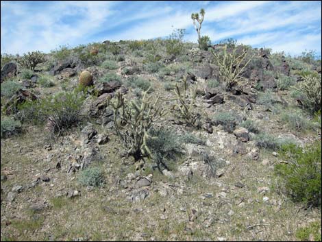
 Buckhorn cholla and pegmatite rock on the ridgeline |
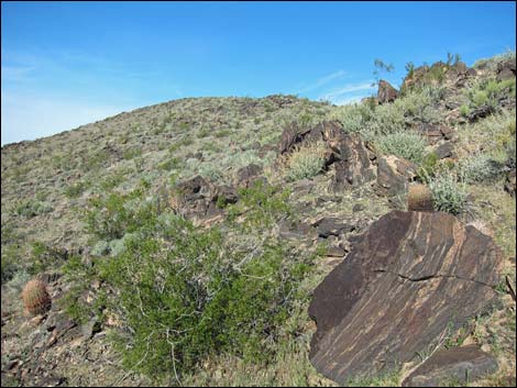
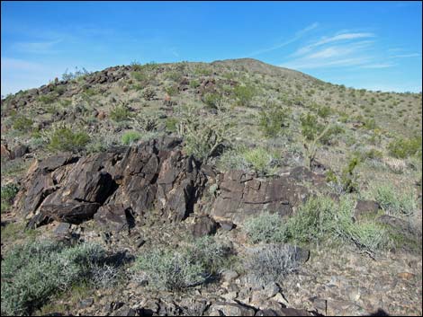
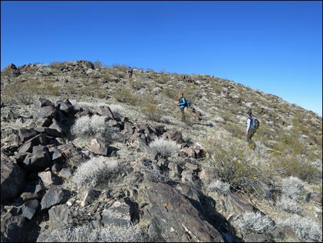
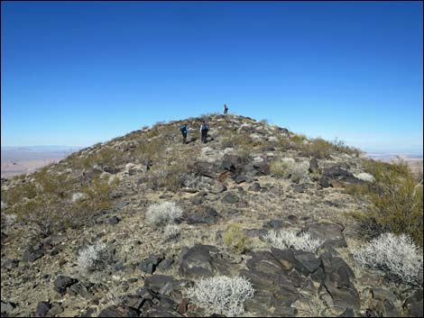
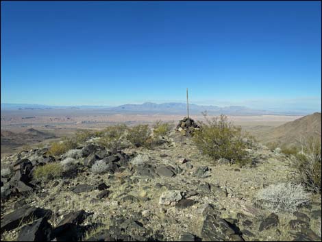
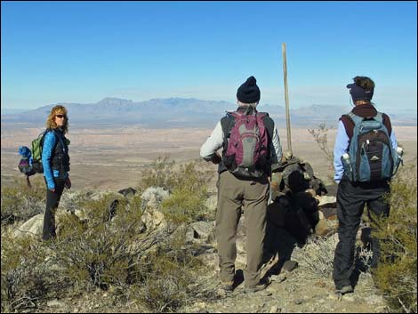
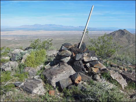
Hiking Guide From the trailhead (Table 1, Waypoint 01), the route starts up the ridge adjacent to the road. Winding among Joshua Trees, rocky outcrops, and myriad cactus, the route climbs onto a highpoint (Wpt. 02). Dropping slightly and following the ridge westward, the route runs through a low point on the ridge (Wpt. 03) with a large cairn marking some old mining claim. Continuing up the ridgeline, the route again winds among rocky outcrops and cactus until gaining the summit, which has a large cairn but no summit register. Views from the summit (photos from the summit) include Mt. Charleston, the Sheep Range, the Muddy Mountains, the Mormon Mountains, Big Virgin Peak, and high peaks to the south. Between these are glimpses of mountains far off in Utah and Arizona, and maybe even California. Return to the trailhead (photos of the descent) by following your footprints back down the ridge. |
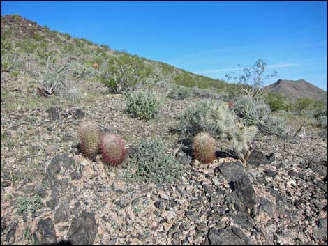 Pineapple Cactus and Pricklypear Cactus |
 Banded metamorphic rock on ridge |
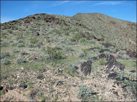
 Rocks and cactus approaching highpoint (view W) |
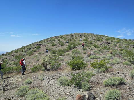 Hikers approaching the first highpoint (view W) |
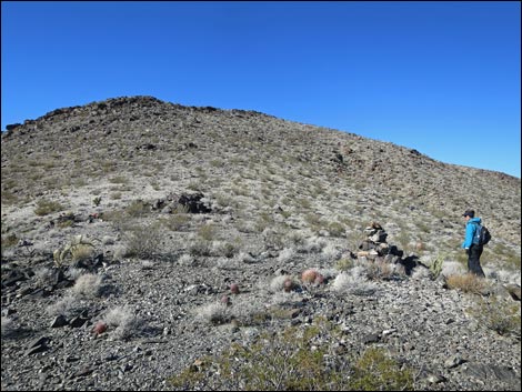
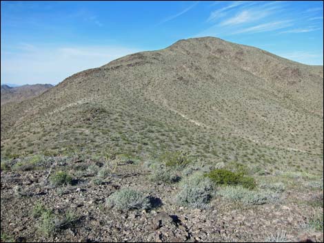 Highpoint (view W along ridge to summit) |
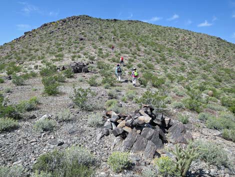
 Hikers continuing past the first highpoint (view W) |
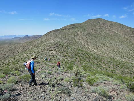
 Hikers on ridgeline past highpoint (view W) |
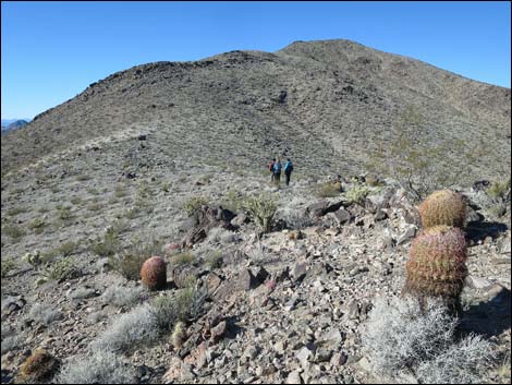 Cactus and hikers on ridgeline past highpoint (view W) |
 Hiker at large mining claim marker cairn on saddle (view W) |
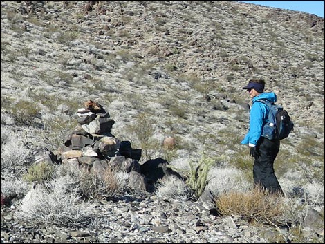 Hiker at large mining claim marker cairn (view W; 12/2015) |
 Hikers departing damaged mine marker cairn (view W; 04/2017) |
 Ridgeline (view W) |
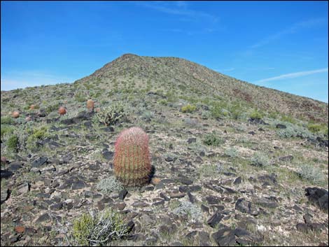 California Barrel Cactus on ridgeline (view W) |
 Ridgeline (view W) |
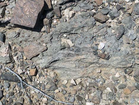 Garnets in the bedrock |
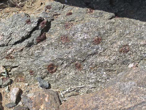 Garnets in the bedrock (zoom) |
 Steep final ridgeline (view NW) |
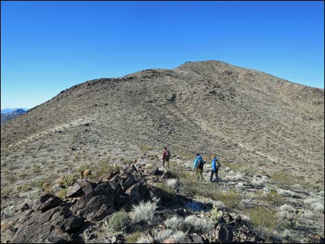
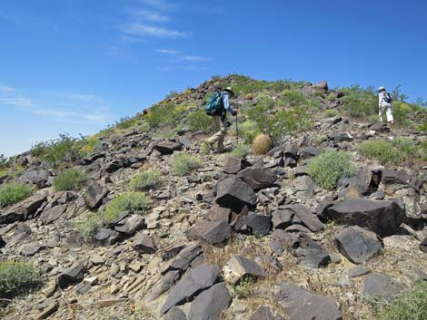 Hikers on the ridge (view NW) |
 Hikers on the ridge (view NW) |
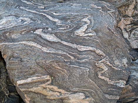 Crazy banding in the layered metamorphic rock |
 Hikers on the ridge (view NW) |
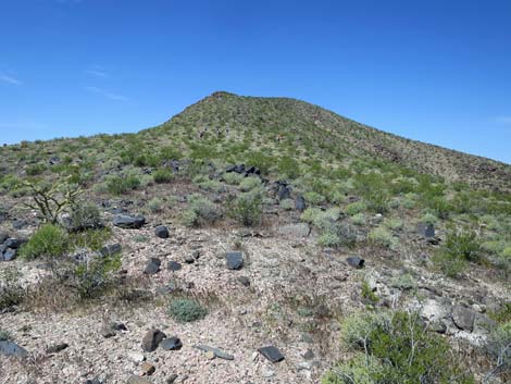
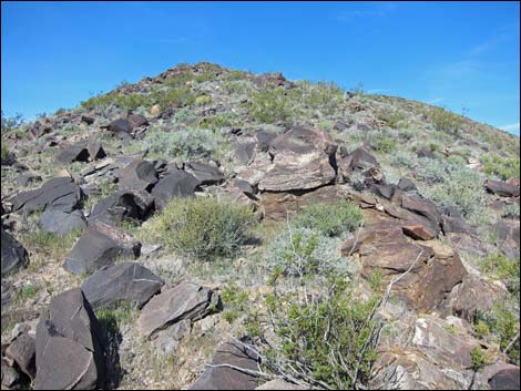
 Black Ridge (first view west over summit ridge) |
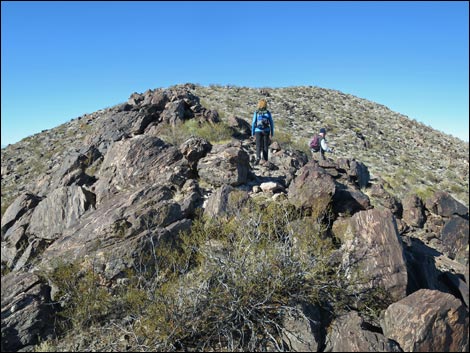
 Hikers approaching the summit (view N) |
 Approaching the summit (view N) |
 Arriving at the summit (view N) |
 Hikers on the summit (view N) |
 Summit views are grand (view N) |
 Hiker descending off the summit (view S) |
Table 1. Hiking Coordinates Based on GPS Data (NAD27; UTM Zone 11S). Download Hiking GPS Waypoints (*.gpx) file.
| Wpt. | Location | UTM Easting | UTM Northing | Elevation (ft) | Point-to-Point Distance (mi) | Cumulative Distance (mi) | Verified |
|---|---|---|---|---|---|---|---|
| 01 | Trailhead | 749650 | 4054224 | 2,777 | 0.00 | 0.00 | GPS |
| 02 | Highpoint on Ridge | 749283 | 4054199 | 3,013 | 0.28 | 0.28 | GPS |
| 03 | Saddle with Cairn | 749076 | 4054105 | 2,968 | 0.15 | 0.43 | GPS |
| 04 | Little Virgin Peak | 748388 | 4054225 | 3,514 | 0.53 | 0.96 | GPS |
| 01 | Trailhead | 749650 | 4054224 | 2,777 | 0.96 | 1.92 | GPS |
Note: All distances, elevations, and other facts are approximate.
![]() ; Last updated 240325
; Last updated 240325
| Hiking Around Gold Butte | Hiking Around Las Vegas | Glossary | Copyright, Conditions, Disclaimer | Home |